|
Borgetinde
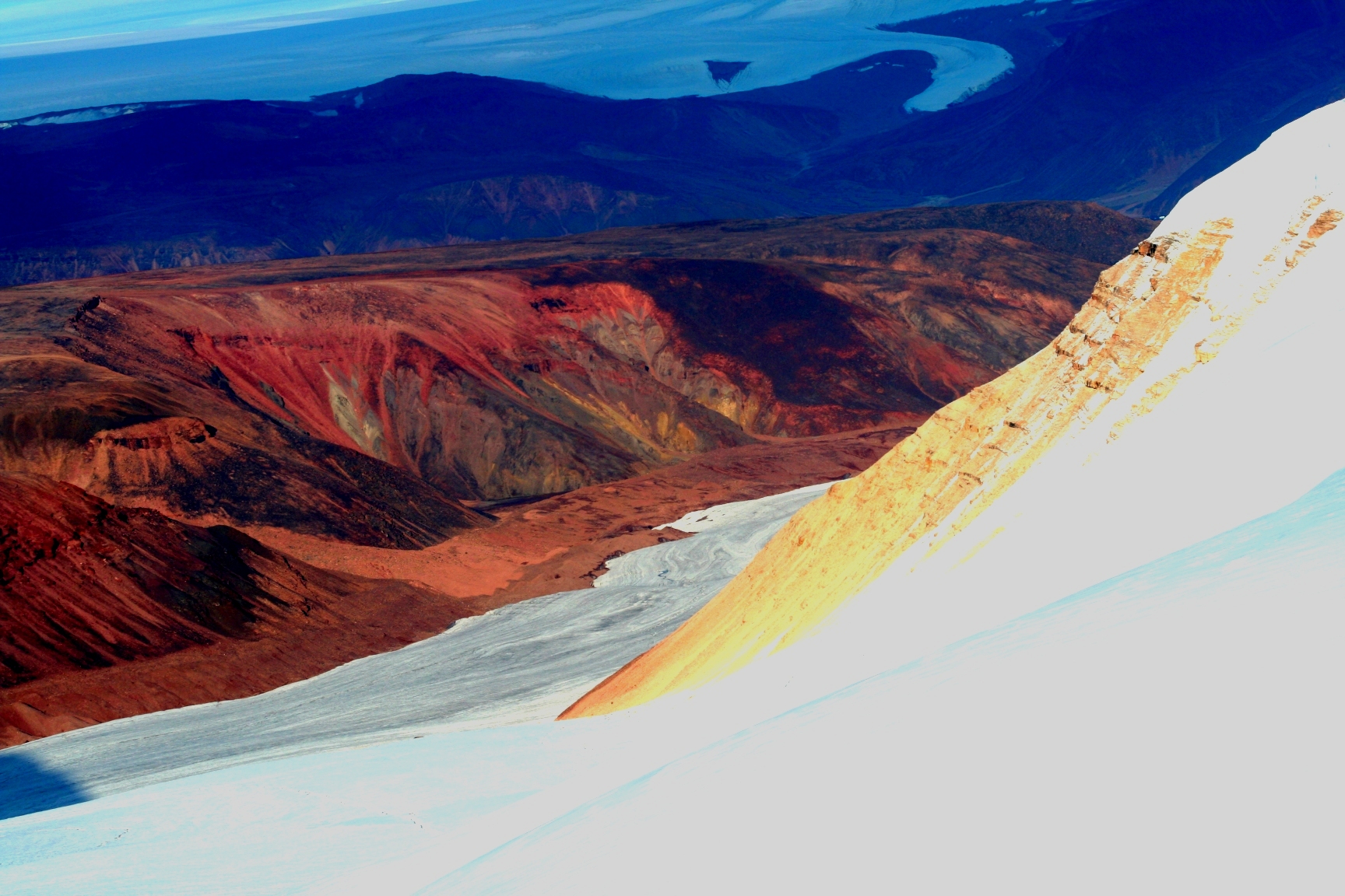
Borgtinderne, meaning 'Castle Pinnacles' in the Danish language, is a mountain range in King Christian IX Land, eastern Greenland. Administratively this range is part of the Sermersooq Municipality. Geography The Borgtinderne is a long nunatak with high mountains. It is located east of the Ejnar Mikkelsen Range, between the Borggraven Glacier on its eastern and the Kronborg Glacier on its western side. The southern end of the range reaches the coast. The area of the Borgtinderne is uninhabited.Google Earth Mountains The highest point is Borgetinde, a mountain which has a wide reputation among alpinists and which is the easternmost summit of Greenland and greater North America. * Borgetinde (3,265 m); highest peak at * Tall peak further north (3,197 m) at * Peak SW of the tallest (2,909 m) at * Northern end peak (2,389 m) at Climate Tundra climate prevails in the region. The average annual temperature in the area of the range is -12 °C. The warmest month is July wh ... [...More Info...] [...Related Items...] OR: [Wikipedia] [Google] [Baidu] |
List Of Mountains In Greenland
This is a list of mountains in Greenland. List For each mountain, the municipality in which it is located is given, along with coordinates indicating the approximate centre of the mountain (follow the link to see satellite images of the location). Above 3000 m Above 2000 m Above 1000 m Other relevant mountains See also *List of mountain peaks of Greenland *List of mountain ranges of Greenland This is a list of mountain ranges of Greenland. List by alphabetical order *Alángup Qáqai, located in SW Disko Island *Albert Heim Range ''(Albert Heim Bjerge)'', located in northern Hudson Land, north of Promenadedal. *Alexandrine Range ' ... * List of nunataks of Greenland * List of Ultras of Greenland References Bibliography''Gazetteer of Greenland''Compiled by Per Ivar Haug. UBiT, Universitetsbiblioteket i Trondheim, August 2005, {{ISBN, 82-7113-114-1.Exploration and place names in Northeastern Greenland ... [...More Info...] [...Related Items...] OR: [Wikipedia] [Google] [Baidu] |
List Of Mountain Ranges Of Greenland
This is a list of mountain ranges of Greenland. List by alphabetical order * Alángup Qáqai, located in SW Disko Island * Albert Heim Range ''(Albert Heim Bjerge)'', located in northern Hudson Land, north of Promenadedal. * Alexandrine Range ''(Alexandrine Bjerge)'', rising above the southeastern shore of Denmark Fjord. * Amitsorssûp Qulâ, located south of the Ameralik Fjord in West Greenland. * Barth Range ''(Barth Bjerge)'', located in Queen Margrethe II Land. *Borgtinderne, a long nunatak with multiple peaks east of the Ejnar Mikkelsen Range. Highest peak Borgetinde. * Brages Range ''(Brages Bjerge)'', located at the western end of Odinland in a nunatak between the Fimbul and Sleipner glaciers at the head of the Bernstorff Fjord. *Crown Prince Frederick Range ''(Kronprins Frederik Bjerge)'', very long range of nunataks stretching southwest of Kangerlussuaq Fjord, East Greenland. *Daly Range ''(Daly Bjerge)'', a subrange of the Roosevelt Range located in Peary Land. * ... [...More Info...] [...Related Items...] OR: [Wikipedia] [Google] [Baidu] |
Defense Mapping Agency
The National Geospatial-Intelligence Agency (NGA) is a combat support agency within the United States Department of Defense whose primary mission is collecting, analyzing, and distributing geospatial intelligence (GEOINT) in support of national security. Initially known as the National Imagery and Mapping Agency (NIMA) from 1996 to 2003, it is a member of the United States Intelligence Community. NGA headquarters, also known as NGA Campus East or NCE, is located at Fort Belvoir North Area in Springfield, Virginia. The agency also operates major facilities in the Greater St. Louis, St. Louis, Missouri area (referred to as NGA Campus West or NCW), as well as support and liaison offices worldwide. The NGA headquarters, at , is the third-largest government building in the Washington metropolitan area after The Pentagon and the Ronald Reagan Building and International Trade Center, Ronald Reagan Building. In addition to using GEOINT for U.S. military and intelligence efforts, NGA pr ... [...More Info...] [...Related Items...] OR: [Wikipedia] [Google] [Baidu] |
Google Earth
Google Earth is a computer program that renders a 3D computer graphics, 3D representation of Earth based primarily on satellite imagery. The program maps the Earth by superimposition, superimposing satellite images, aerial photography, and geographic information system, GIS data onto a 3D globe, allowing users to see cities and landscapes from various angles. Users can explore the globe by entering addresses and coordinates, or by using a Computer keyboard, keyboard or computer mouse, mouse. The program can also be downloaded on a smartphone or Tablet computer, tablet, using a touch screen or stylus to navigate. Users may use the program to add their own data using Keyhole Markup Language and upload them through various sources, such as forums or blogs. Google Earth is able to show various kinds of images overlaid on the surface of the earth and is also a Web Map Service client. In 2019, Google has revealed that Google Earth now covers more than 97 percent of the world, and has c ... [...More Info...] [...Related Items...] OR: [Wikipedia] [Google] [Baidu] |
Mountain Ranges Of Greenland
A mountain is an elevated portion of the Earth's crust, generally with steep sides that show significant exposed bedrock. Although definitions vary, a mountain may differ from a plateau in having a limited summit area, and is usually higher than a hill, typically rising at least 300 metres (1,000 feet) above the surrounding land. A few mountains are isolated summits, but most occur in mountain ranges. Mountains are formed through tectonic forces, erosion, or volcanism, which act on time scales of up to tens of millions of years. Once mountain building ceases, mountains are slowly leveled through the action of weathering, through slumping and other forms of mass wasting, as well as through erosion by rivers and glaciers. High elevations on mountains produce colder climates than at sea level at similar latitude. These colder climates strongly affect the ecosystems of mountains: different elevations have different plants and animals. Because of the less hospitable terrain and ... [...More Info...] [...Related Items...] OR: [Wikipedia] [Google] [Baidu] |
Syenite
Syenite is a coarse-grained intrusive igneous rock with a general composition similar to that of granite, but deficient in quartz, which, if present at all, occurs in relatively small concentrations (< 5%). Some syenites contain larger proportions of components and smaller amounts of felsic material than most granites; those are classed as being of . The equivalent of syenite is |
Tundra Climate
The tundra climate is a polar climate sub-type located in high latitudes and high mountains. undra climate https://www.britannica.com/science/tundra-climateThe Editors of Encyclopaedia Britannica, 2019 It is classified as ET according to Köppen climate classification. It is a climate which at least one month has an average temperature high enough to melt snow (), but no month with an average temperature in excess of . Despite the potential diversity of climates in the ''ET'' category involving precipitation, extreme temperatures, and relative wet and dry seasons, this category is rarely subdivided. Rainfall and snowfall are generally slight due to the low vapor pressure of water in the chilly atmosphere, but as a rule potential evapotranspiration is extremely low, allowing soggy terrain of swamps and bogs even in places that get precipitation typical of deserts of lower and middle latitudes. The amount of native tundra biomass depends more on the local temperature than the amoun ... [...More Info...] [...Related Items...] OR: [Wikipedia] [Google] [Baidu] |
Kronborg Glacier
Kronborg Glacier ( da, Kronborg Gletscher) is a glacier on the east coast of the Greenland ice sheet. It is named after Kronborg Castle in Denmark. Administratively this glacier is part of the Sermersooq Municipality.Google Earth The area surrounding the Kronborg Glacier is remote and uninhabited. History In 1962, a VP-5 Lockheed P-2 Neptune on a routine patrol mission crashed into the slope of the Kronborg Glacier in unknown circumstances, killing all twelve men aboard. The place where the plane had crashed was finally discovered in 1966 when four geologists found the remains, but it was not until 2004 that the US Navy recovered all the crew remains and memorialized the deceased at the crash site. Geography The Kronborg Glacier is a non-surge type valley glacier that does not drain the Greenland ice sheet directly, but flows partly from it across mountainous areas in a roughly north–south direction. It separates the Ejnar Mikkelsen Range in the west from the Borgtinderne in t ... [...More Info...] [...Related Items...] OR: [Wikipedia] [Google] [Baidu] |


