|
Boldmere
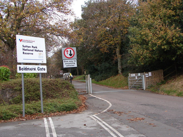
Boldmere is a suburban village and residential area of Sutton Coldfield, near Birmingham, England. It is bordered by New Oscott, Sutton Park, Wylde Green and Erdington, and is in the ward of Sutton Vesey. History Toponymy "Boldmere" is a corruption of the word "Baldmoor", coming from the Middle English ''bald'' (meaning ''" a white patch"'') and the Anglo-Saxon ''moor'' (meaning ''" boggy land"''). Therefore, Boldmere literally means a "bald moor"; a treeless patch. ''Bald'' (meaning ''" bold"'') was also a personal name used by the Anglo-Saxons. Name history At the time of John Speed's 1610 atlas ''The Theatre of the Empire of Great Britaine'', Boldmere was known as Cofield Wast. The area was described as "an open, wild and windy expanse, covered with gorse". The United Kingdom Census of 1841 refers to the area as Baldmoor Lake, which was once a body of water south of the Chester Road. The lake has also been known as Bowen Pool, Baldmoor, and Bolemore Lake, t ... [...More Info...] [...Related Items...] OR: [Wikipedia] [Google] [Baidu] |
Sutton Park, West Midlands
Sutton Park is a large urban park located in Sutton Coldfield, Birmingham, West Midlands, England. Most of the park is a national nature reserve; large parts are also a scheduled monument. Sutton Park is one of the largest urban parks in the United Kingdom. The park covers more than according to one source, or according to another. It consists of a mix of heathland, wetlands and marshes, seven lakes, extensive ancient woodlands (covering approximately a quarter of the park), several restaurants, a private 18-hole golf course on its western edge and a municipal golf course to the south, a donkey sanctuary, children's playgrounds and a visitors' centre. There is no entrance charge to the Park, however there is a parking charge for cars on Saturdays and Sundays during the summer. A wide range of leisure activities are undertaken in the park including dog walking, pony trekking, bike riding and kite flying and there are areas to fly model aeroplanes and helicopters. Additionally ... [...More Info...] [...Related Items...] OR: [Wikipedia] [Google] [Baidu] |
Sutton Coldfield
Sutton Coldfield or the Royal Town of Sutton Coldfield, known locally as Sutton ( ), is a town and civil parish in the City of Birmingham, West Midlands, England. The town lies around 8 miles northeast of Birmingham city centre, 9 miles south of Lichfield, 7 miles southwest of Tamworth and 7 miles east of Walsall. Sutton Coldfield and its surrounding suburbs are governed under Birmingham City Council for local government purposes but the town has its own town council which governs the town and its surrounding areas by running local services and electing a mayor to the council. It is in the Historic county of Warwickshire, and in 1974 it became part of Birmingham and the West Midlands metropolitan county under the Local Government Act 1972. History Etymology The etymology of the name Sutton appears to be from "South Town". The name "Sutton Coldfield" appears to come from this time, being the "south town" (i.e. south of Tamworth and/or Lichfield) on the edge of the "col f ... [...More Info...] [...Related Items...] OR: [Wikipedia] [Google] [Baidu] |
Sutton Vesey
Sutton Vesey is one of the 69 electoral wards in Birmingham, England. Sutton Vesey is one of the four wards that make up the Parliamentary Constituency and council constituency of Sutton Coldfield. The ward lies to the south of Sutton Coldfield town centre and Sutton Park and includes the neighbourhoods of Boldmere, Banners Gate and parts of New Oscott and Wylde Green. It covers an area of . The area is served bBoldmere Library Population According to the 2001 Population Census there were 22,879 people living in 9,391 households in Sutton Vesey. 6.5% (1,483) of the ward's population consists of ethnic minorities compared with 29.6% for Birmingham in general. The population at the 2011 Census had increased to 23,360 in 9,635 households at the 2011 Census. Politics The two councillors presently representing Sutton Vesey on Birmingham City Council are Rob Pocock (Local Campaigner and Labour Party) and Kath Scott (Labour). Sutton Vesey has adopted a Ward Support Officer. Furt ... [...More Info...] [...Related Items...] OR: [Wikipedia] [Google] [Baidu] |
Wylde Green Railway Station
Wylde Green railway station is a railway station serving northern Wylde Green and Boldmere in Sutton Coldfield, Birmingham, West Midlands, England. It is on the Redditch-Birmingham New Street-Lichfield Cross-City Line north east of Birmingham New Street, and is in Centro fare zone 4. The station was opened on 2 June 1862, when the LNWR Birmingham to Sutton Coldfield railway line was completed and later operated by the LMS. The station has a car park. Pedestrian and vehicular access is via Station Road, with pedestrian access also available from Highbridge Road. The platforms are above the former road, but below the latter. Despite the station name, Chester Road railway station is located closer to Wylde Green's shopping centre, The Lanes. Service Monday to Saturdays there is a 10-minute frequency southbound with three trains per hour to Longbridge and three to Redditch. Northbound there are six trains per hour to Four Oaks, four trains per hour continuing to Lichfield Ci ... [...More Info...] [...Related Items...] OR: [Wikipedia] [Google] [Baidu] |
Erdington
Erdington is a suburb and ward of Birmingham in the West Midlands County, England. Historically part of Warwickshire and located northeast of central Birmingham, bordering Sutton Coldfield. It was also a council constituency, managed by its own district committee. The former council district consisted of the ward of Erdington, and Tyburn, (formerly Kingsbury), Stockland Green and Kingstanding, although all of Kingstanding and most of both Tyburn and Stockland Green wards lie outside the historical boundaries of Erdington. Stockland Green was formerly part of Aston, Kingstanding part of Perry Barr and Tyburn (Tyburn Road South & Birches Green) partially split between Aston and Hodge Hill ( Castle Vale). Erdington (ward) was part of the Sutton Coldfield constituency before 1974. History Erdington Manor Erdington had its own manor house, Erdington Hall, which was protected on three sides by a double moat and on the fourth by the River Tame. It had developed from a small forti ... [...More Info...] [...Related Items...] OR: [Wikipedia] [Google] [Baidu] |
Porter (carrier)
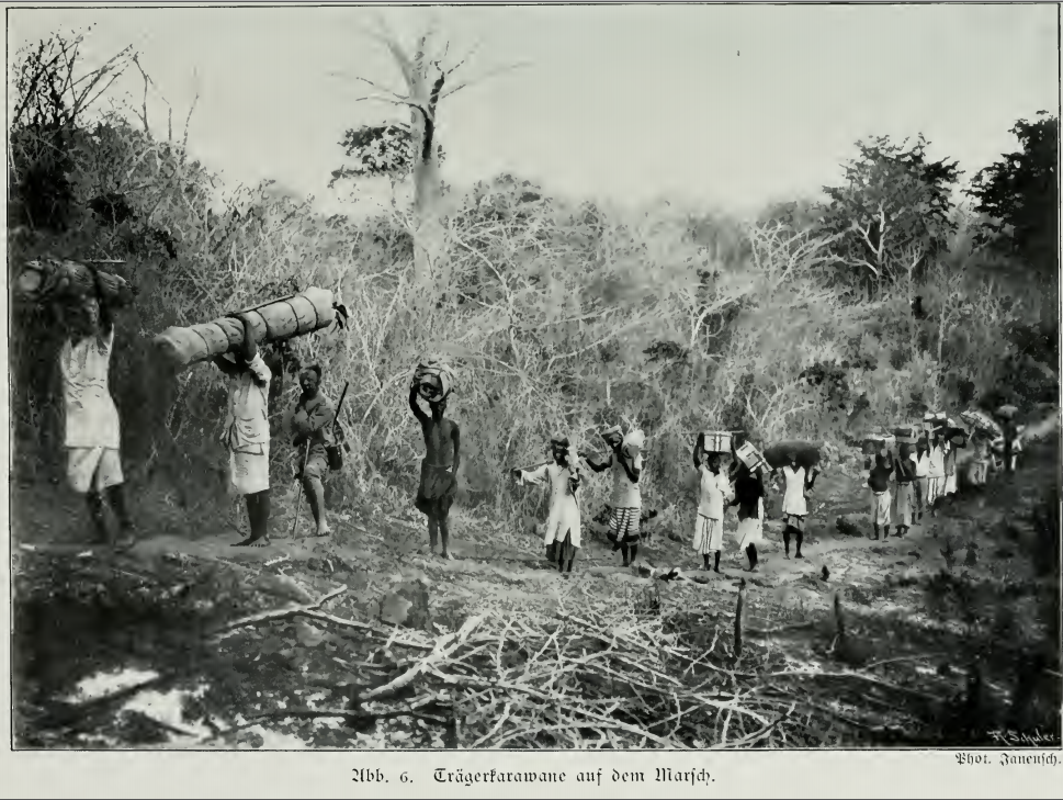
A porter, also called a bearer, is a person who carries objects or cargo for others. The range of services conducted by porters is extensive, from shuttling luggage aboard a train (a railroad porter) to bearing heavy burdens at altitude in inclement weather on multi-month mountaineering expeditions. They can carry items on their backs (backpack) or on their heads. The word "porter" derives from the Latin ''portare'' (to carry). The use of humans to transport cargo dates to the ancient world, prior to domesticating animals and development of the wheel. Historically it remained prevalent in areas where slavery was permitted, and exists today where modern forms of mechanical conveyance are impractical or impossible, such as in mountainous terrain, or thick jungle or forest cover. Over time slavery diminished and technology advanced, but the role of porter for specialized transporting services remains strong in the 21st century. Examples include bellhops at hotels, redcaps at ... [...More Info...] [...Related Items...] OR: [Wikipedia] [Google] [Baidu] |
Birmingham Mail
The ''Birmingham Mail'' (branded the ''Black Country Mail'' in the Black Country) is a tabloid newspaper based in Birmingham, England but distributed around Birmingham, the Black Country, and Solihull and parts of Warwickshire, Worcestershire and Staffordshire. Background The newspaper was founded as the ''Birmingham Daily Mail'' in 1870, in April 1963 it became known as the ''Birmingham Evening Mail and Despatch'' after merging with the ''Birmingham Evening Despatch'' and was titled the ''Birmingham Evening Mail'' from 1967 until October 2005. The ''Mail'' is published Monday to Saturday. The '' Sunday Mercury'' is a sister paper published on a Sunday. The newspaper is owned by Reach plc, who also own the ''Daily Mirror The ''Daily Mirror'' is a British national daily tabloid. Founded in 1903, it is owned by parent company Reach plc. From 1985 to 1987, and from 1997 to 2002, the title on its masthead was simply ''The Mirror''. It had an average daily print ...'' ... [...More Info...] [...Related Items...] OR: [Wikipedia] [Google] [Baidu] |
Inclosure Act
The Inclosure Acts, which use an archaic spelling of the word now usually spelt "enclosure", cover enclosure of open fields and common land in England and Wales, creating legal property rights to land previously held in common. Between 1604 and 1914, over 5,200 individual enclosure acts were passed, affecting 28,000 km2. History Before the enclosures in England, a portion of the land was categorized as "common" or "waste". "Common" land was under the control of the lord of the manor, but certain rights on the land such as pasture, pannage, or estovers were held variously by certain nearby properties, or (occasionally) ''in gross'' by all manorial tenants. "Waste" was land without value as a farm strip – often very narrow areas (typically less than a yard wide) in awkward locations (such as cliff edges, or inconveniently shaped manorial borders), but also bare rock, and so forth. "Waste" was not officially used by anyone, and so was often farmed by landless peasants. The r ... [...More Info...] [...Related Items...] OR: [Wikipedia] [Google] [Baidu] |
Common Land
Common land is land owned by a person or collectively by a number of persons, over which other persons have certain common rights, such as to allow their livestock to graze upon it, to collect Wood fuel, wood, or to cut turf for fuel. A person who has a right in, or over, common land jointly with another or others is usually called a commoner. In the New Forest, the New Forest Commoner is recognised as a minority cultural identity as well as an agricultural vocation, and members of this community are referred to as Commoners. In Great Britain, common land or former common land is usually referred to as a common; for instance, Clapham Common and Mungrisdale Common. Due to enclosure, the extent of common land is now much reduced from the millions of acres that existed until the 17th century, but a considerable amount of common land still exists, particularly in upland areas. There are over 8,000 registered commons in England alone. Origins Originally in medieval England the co ... [...More Info...] [...Related Items...] OR: [Wikipedia] [Google] [Baidu] |
Penns Hall
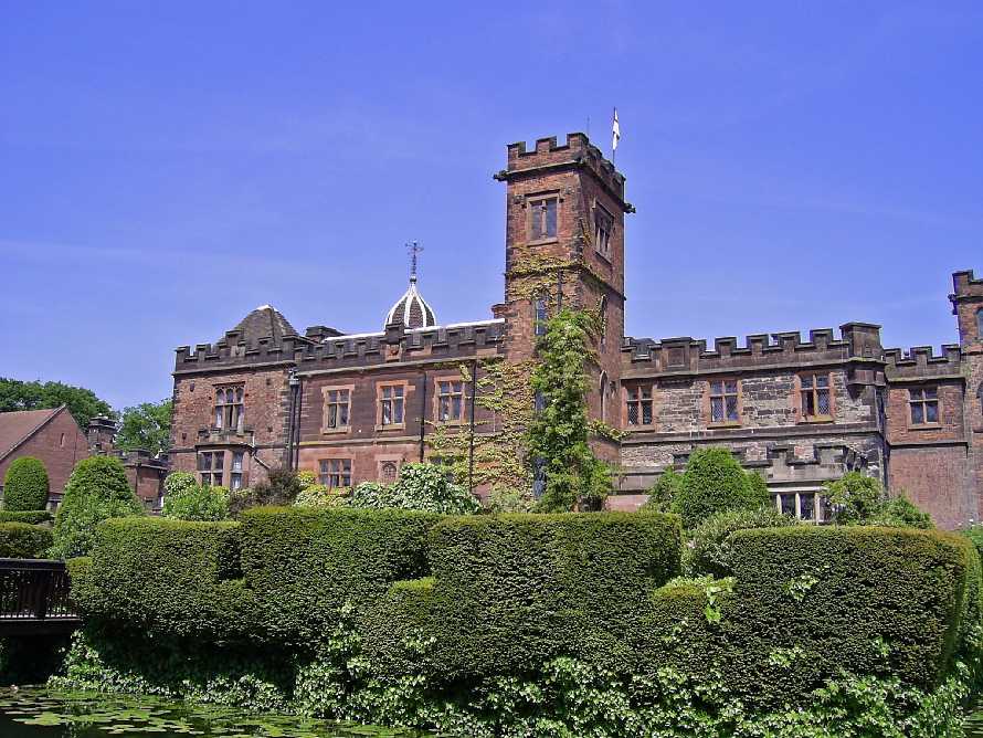
Penns Hall is a building on Penns Lane, Walmley, Sutton Coldfield, Birmingham, England, operated as a hotel and country club by Ramada International. It is a Grade B locally listed building, and is licensed as a venue for civil marriages and civil partnerships. Plants Brook, a tributary of the River Tame, flows through its grounds. A long pool formed by the damming of Plants Brook named Penns Lake is also part of the hotel grounds. This is today used as a carp fishing lake operated by Fosters Fisheries. History In 1618, John Penn was operating two water mills for corn milling and for blade sharpening in Sutton Coldfield. The Websters, a Presbyterian family, operated a blade mill at Perry Barr, Birmingham and in about 1750, Joseph Webster acquired the additional lease of the Penns Mills which property in 1776 comprised a house and two dwellings adjoining a wire mill and a fulling mill, called Penns Mills. He and his son Joseph Webster developed a wire drawing business and ... [...More Info...] [...Related Items...] OR: [Wikipedia] [Google] [Baidu] |
Wire Drawing
Wire drawing is a metalworking process used to reduce the cross-section of a wire by pulling the wire through a single, or series of, drawing die(s). There are many applications for wire drawing, including electrical wiring, cables, tension-loaded structural components, springs, paper clips, spokes for wheels, and stringed musical instruments. Although similar in process, drawing is different from extrusion, because in drawing the wire is pulled, rather than pushed, through the die. Drawing is usually performed at room temperature, thus classified as a cold working process, but it may be performed at elevated temperatures for large wires to reduce forces. Process The wire drawing process is quite simple in concept. The wire is prepared by shrinking the beginning of it, by hammering, filing, rolling or swaging, so that it will fit through the die; the wire is then pulled through the die. As the wire is pulled through the die, its volume remains the same, so as the diameter de ... [...More Info...] [...Related Items...] OR: [Wikipedia] [Google] [Baidu] |


