|
Bohle River
The Bohle River is a river located in North Queensland, Australia. Course and features The headwaters of the river rise in the Hervey Range south of and flows north along the coastal plain west of Lake Ross and then north, parallel with Ross River. The Hervey Range Developmental Road crosses the river east of Thuringowa and then the Ingham Connection Road crosses the river west of Townsville. It then enters the Bohle River Fish Habitat Area and the Townsville Town Common Conservation Park and discharges into the Halifax Bay near Bushland Beach, and then empties into the Coral Sea. Tributaries include Middle Creek, Stony Creek (), Stag Creek, the Little Bohle River and Garner Creek. The river descends over its course. The catchment area of the river occupies an of which an area of is composed of estuarine wetlands. The river drains most of the coastal plain west of Townsville. The river supports recreational fishing, particularly of barramundi. The Bohle is located appr ... [...More Info...] [...Related Items...] OR: [Wikipedia] [Google] [Baidu] |
Drover (Australian)
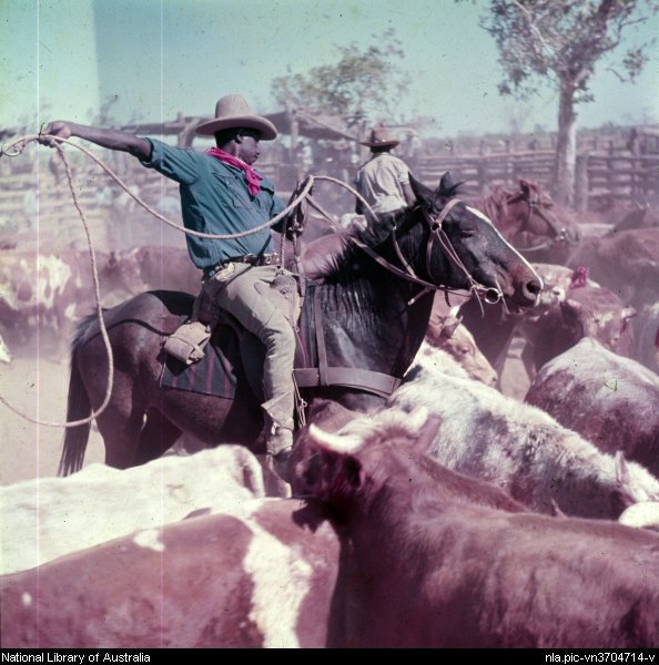
A drover in Australia is a person, typically an experienced stockman, who moves livestock, usually sheep, cattle, and horses "on the hoof" over long distances. Reasons for droving may include: delivering animals to a new owner's property, taking animals to market, or moving animals during a drought in search of better feed and/or water or in search of a yard to work on the livestock. The drovers who covered very long distances to open up new country were known as " overlanders". Method Moving a small mob of quiet cattle is relatively easy, but moving several hundreds or thousands head of wild station cattle over long distances is a very different matter. Long-distance moving large mobs of stock was traditionally carried out by contract drovers. A drover had to be independent and tough, an excellent horseman, able to manage stock as well as men. The boss drover who had a plant (horses, dogs, cooking gear and other requisites) contracted to move the mob at a predetermined rat ... [...More Info...] [...Related Items...] OR: [Wikipedia] [Google] [Baidu] |
Hervey Range Developmental Road
Hervey Range Developmental Road (alternate spellings: "Herveys", "Hervey's") is a continuous road route in the Townsville and Charters Towers local government areas of Queensland, Australia. It is designated as State Route 72. It is a state-controlled regional road (number 83A). Route description The road commences as Hervey Range Road (State Route 72) at an intersection with Garbutt–Upper Ross Road (Thuringowa Drive / Riverway Drive) and Ross River Road (see below), on a mid-point of and . State Route 72 continues east on Ross River Road. The road proceeds west through Thuringowa Central, passing between Kirwan and , and crossing the Bohle River as it enters . Here it runs under the Bruce Highway at an incomplete diamond interchange. From the start to this point the road has a four-lane divided carriageway, which reverts to two lanes undivided just west of the Bruce Highway. Continuing west the road passes between and , and then crosses the Alice River, a tributary of t ... [...More Info...] [...Related Items...] OR: [Wikipedia] [Google] [Baidu] |
Cleveland Bay (Queensland)
Cleveland Bay is a bay located on the north-eastern coast of Queensland, Australia. It is part of the Coral Sea and, administratively, is within the City of Townsville. Entrance to the bay is marked by the Cape Cleveland Light and in earlier years by the Bay Rock Light on Magnetic Island. History Cleveland Bay was named by Lieutenant (later Captain) James Cook on HM Bark Endeavour on 6 June 1770, probably in honour of John Clevland, Secretary to the Admiralty 1751-1763. However, Cook may have named the bay after the Cleveland Hills near his birthplace of Marton in Yorkshire Yorkshire ( ; abbreviated Yorks), formally known as the County of York, is a Historic counties of England, historic county in northern England and by far the largest in the United Kingdom. Because of its large area in comparison with other Eng ..., England. References {{Authority control Bays of Queensland North Queensland ... [...More Info...] [...Related Items...] OR: [Wikipedia] [Google] [Baidu] |
Overlanding
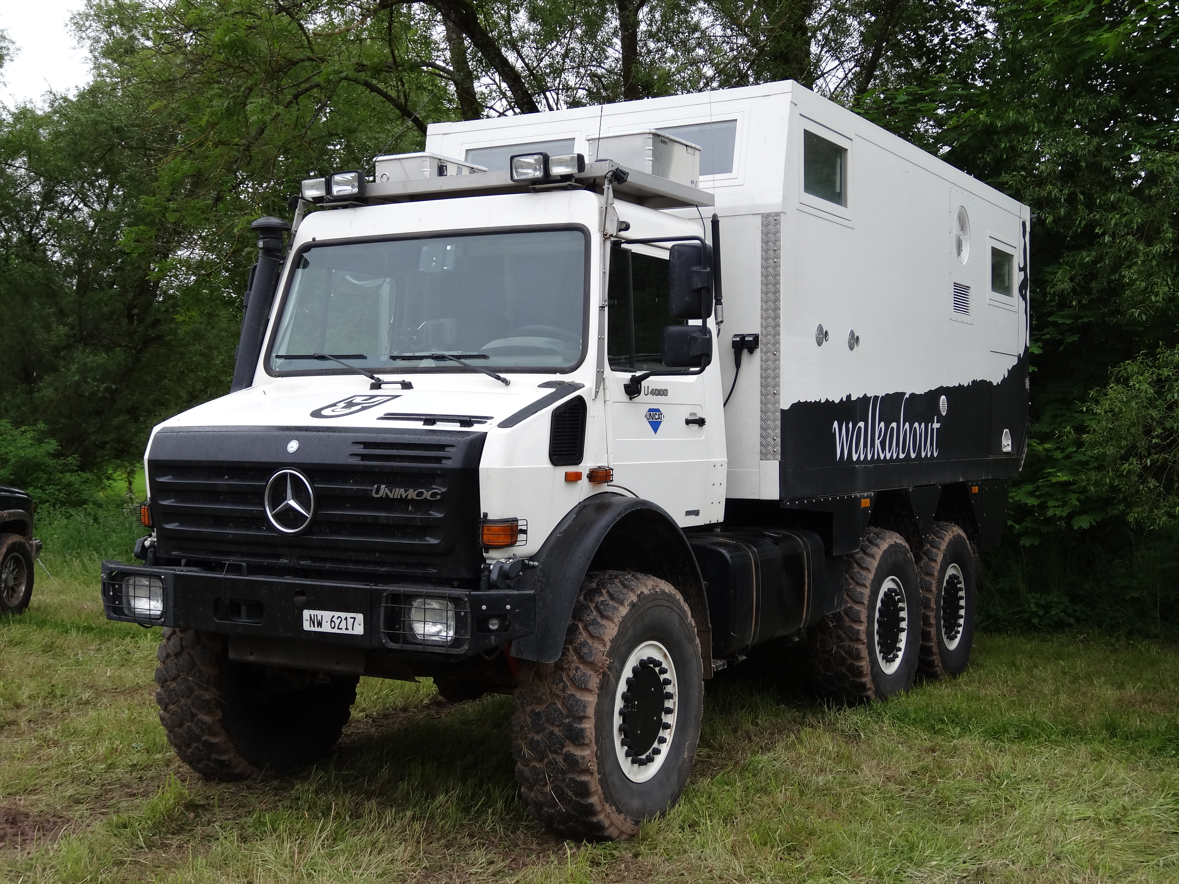
Overlanding is self-reliant overland travel to remote destinations where the journey is the principal goal. Typically, but not exclusively, it is accomplished with mechanized off-road capable transport (from bicycles to trucks) where the principal form of lodging is camping, often lasting for extended lengths of time (months to years) and spanning international boundaries. History Historically, "overlanding" is an Australian term to denote the droving of livestock over very long distances to open up new country or to take livestock to market far from grazing grounds. Between 1906 and 1910 Alfred Canning opened up the Canning Stock Route. In Australia overlanding was inspired to a large degree by Len Beadell who, in the 1940s and 1950s, constructed many of the roads that opened up the Australian Outback to colonizers. Those roads are still used today by Australian overlanders and still hold the names Len gave them; the Gunbarrel Highway, the Connie Sue Highway (named after his da ... [...More Info...] [...Related Items...] OR: [Wikipedia] [Google] [Baidu] |
John Melton Black
John Melton Black (1830–1919) was a pioneer of Townsville, Queensland, Australia. Black ordered the expedition of Cleveland Bay to find a suitable site for a port and then established the Port of Townsville and the associated town of Townsville. He served for two terms as Mayor of Townsville. Early life Black was born in Edinburgh, Scotland in 1830, the son of a physician. Black become a merchant and moved to London. It was there that he heard of the Australian goldfields. Victoria Black immigrated to Melbourne where he made his fortune, not by mining gold but by establishing a business as a carrier. In 1855 he established the first Theatre Royal in Melbourne on the north side of Bourke Street, able to hold more than 3000 people. The opening production was ''The School for Scandal''. He also upgraded Astley's Amphitheatre, which re-opened on 16 April 1857 as Princess's Theatre and Opera House, and was its first manager. Although described as a "magnificent theatre", the £60 ... [...More Info...] [...Related Items...] OR: [Wikipedia] [Google] [Baidu] |
Grunter
Grunters or tigerperches are ray-finned fishes in the family Terapontidae (also spelled Teraponidae, Theraponidae or Therapontidae). This family is part of the superfamily Percoidea of the order Perciformes. Characteristics The Terapontidae is a large family of small to medium-sized perciform fishes which occur in marine, brackish and fresh waters in the Indo-Pacific region. They are characterised by a single long-based dorsal fin which has a notch marking the boundary between the spiny and soft-rayed portions. They have small to moderate-sized scales, a continuous lateral line reaching the caudal fin, and most species lack teeth on the roof of the mouth. The marine species are found in inshore sea and brackish waters, some species are able to enter extremely saline and fresh waters. In Australia and New Guinea there are a number of species restricted to fresh water. Classification The following genera are classified within the family Terpontidae: * '' Amniataba'' Whitley ... [...More Info...] [...Related Items...] OR: [Wikipedia] [Google] [Baidu] |
Mangrove Jack
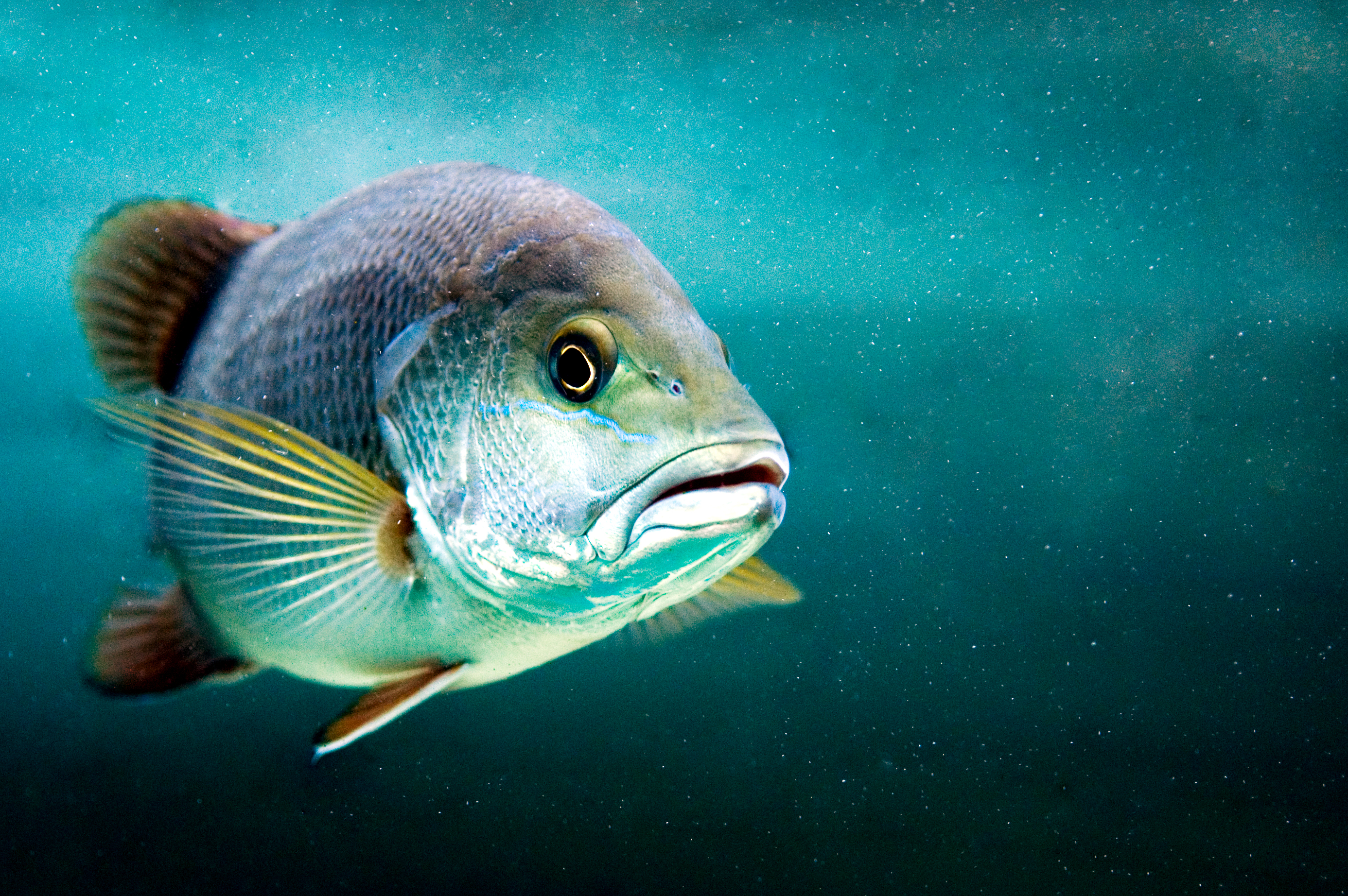
The mangrove red snapper (''Lutjanus argentimaculatus''), also known as mangrove jack, grey snapper, creek red bream, Stuart evader, dog bream, purple sea perch, red bream, red perch, red reef bream, river roman, or rock barramundi, is a species of marine ray-finned fish, a snapper belonging to the family Lutjanidae. It has a wide Indo-Pacific range and has recently been recorded in the eastern Mediterranean Sea. Taxonomy The mangrove red snapper was first formally described in 1775 as ''Sciaena argentimaculata'' by the Swedish speaking Finnish born explorer and naturalist Peter Forsskål with the type locality given as the Red Sea. The specific name is a compound of ''argentum'' meaning “silver” and ''maculatus'' meaning “spots”, a possible reference to the white edging to each of the scales on this species. Description Coloration of the mangrove red snapper ranges from burnt orange, to copper, to bronze and dark reddish-brown, depending on its age and environment. ... [...More Info...] [...Related Items...] OR: [Wikipedia] [Google] [Baidu] |
Australasian Snapper
The Australasian snapper (''Chrysophrys auratus'') or silver seabream is a species of porgie found in coastal waters of Australia, Philippines, Indonesia, mainland China, Taiwan, Japan and New Zealand. Its distribution areas in the Northern and Southern Hemispheres are disjunct. Although it is almost universally known in Australia and New Zealand as snapper, it does not belong to the snapper family, Lutjanidae. It is highly prized as an edible fish, with a sweet sea taste and a firm texture. The species name is ''Chrysophrys auratus'', but previously referred to as ''Pagrus auratus''. Regional variation in naming Australia: cocknies (young smaller than legal size), red bream or pinkies (legal size), squire or squirefish (when bigger), snapper (at full size) Western Australia: "pink snapper" to distinguish it from unrelated species Victoria: also schnapper (ref: Schnapper Point, Mornington) South Australia: the name "ruggers" is often used for smaller fish of legal size Abo ... [...More Info...] [...Related Items...] OR: [Wikipedia] [Google] [Baidu] |
Barramundi
The barramundi (''Lates calcarifer'') or Asian sea bass, is a species of catadromous fish in the family Latidae of the order Perciformes. The species is widely distributed in the Indo-West Pacific, spanning the waters of the Middle East, South Asia, Southeast Asia, East Asia, and Oceania. Origin of name Barramundi is a loanword from an Australian Aboriginal language of the Rockhampton area in Queensland meaning "large-scaled river fish". Originally, the name barramundi referred to ''Scleropages leichardti'' and ''Scleropages jardinii''. However, the name was appropriated for marketing reasons during the 1980s, a decision that has aided in raising the profile of this fish significantly. ''L. calcarifer'' is broadly referred to as Asian seabass by the international scientific community, but is also known as Australian seabass. Description This species has an elongated body form with a large, slightly oblique mouth and an upper jaw extending behind the eye. The lower edge of th ... [...More Info...] [...Related Items...] OR: [Wikipedia] [Google] [Baidu] |
Queensland Government
The Queensland Government is the democratic administrative authority of the Australian state of Queensland. The Government of Queensland, a parliamentary constitutional monarchy was formed in 1859 as prescribed in its Constitution, as amended from time to time. Since the Federation of Australia in 1901, Queensland has been a State of Australia, with the Constitution of Australia regulating the relationships between all state and territory governments and the Australian Government. Under the Australian Constitution, all states and territories (including Queensland) ceded powers relating to certain matters to the federal government. The government is influenced by the Westminster system and Australia's federal system of government. The Governor of Queensland, as the representative of Charles III, King of Australia, holds nominal executive power, although in practice only performs ceremonial duties. In practice executive power lies with the Premier and Cabinet. The Cabinet of ... [...More Info...] [...Related Items...] OR: [Wikipedia] [Google] [Baidu] |
Estuarine
An estuary is a partially enclosed coastal body of brackish water with one or more rivers or streams flowing into it, and with a free connection to the open sea. Estuaries form a transition zone between river environments and maritime environments and are an example of an ecotone. Estuaries are subject both to marine influences such as tides, waves, and the influx of saline water, and to fluvial influences such as flows of freshwater and sediment. The mixing of seawater and freshwater provides high levels of nutrients both in the water column and in sediment, making estuaries among the most productive natural habitats in the world. Most existing estuaries formed during the Holocene epoch with the flooding of river-eroded or glacially scoured valleys when the sea level began to rise about 10,000–12,000 years ago. Estuaries are typically classified according to their geomorphological features or to water-circulation patterns. They can have many different names, such as bays, harb ... [...More Info...] [...Related Items...] OR: [Wikipedia] [Google] [Baidu] |
Watercourse
A stream is a continuous body of surface water flowing within the bed and banks of a channel. Depending on its location or certain characteristics, a stream may be referred to by a variety of local or regional names. Long large streams are usually called rivers, while smaller, less voluminous and more intermittent streams are known as streamlets, brooks or creeks. The flow of a stream is controlled by three inputs – surface runoff (from precipitation or meltwater), daylighted subterranean water, and surfaced groundwater (spring water). The surface and subterranean water are highly variable between periods of rainfall. Groundwater, on the other hand, has a relatively constant input and is controlled more by long-term patterns of precipitation. The stream encompasses surface, subsurface and groundwater fluxes that respond to geological, geomorphological, hydrological and biotic controls. Streams are important as conduits in the water cycle, instruments in groundwater ... [...More Info...] [...Related Items...] OR: [Wikipedia] [Google] [Baidu] |


_nahe_dem_Weiherdamm_in_Wildbergerhütte.jpg)