|
Blackdyke
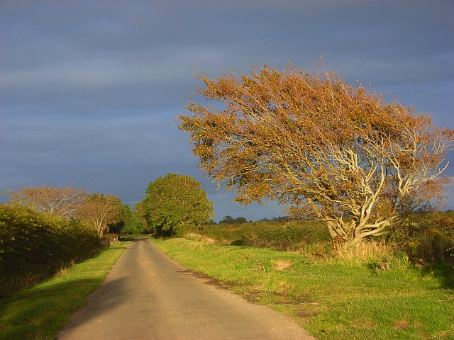
Blackdyke is a hamlet in the civil parish of Holme Low in Cumbria, United Kingdom. It is located by road to the east of Silloth. A railway station existed at Black Dyke Halt railway station, Blackdyke Halt on the line to Silloth until 1964. See also *Listed buildings in Holme Low *List of places in Cumbria References Hamlets in Cumbria Allerdale {{Cumbria-geo-stub ... [...More Info...] [...Related Items...] OR: [Wikipedia] [Google] [Baidu] |
Black Dyke Halt Railway Station
Black Dyke Halt or Blackdyke was a train station, railway station near Blackdyke, Cumbria on the Silloth railway station, Silloth branch, serving the small hamlet of Black Dyke and its rural district. In its early days trains called on Saturdays only (Market Day), being upgraded some years later. The station closed on 7 September 1964.Cumbria Railways Retrieved : 2012-08-21 The line to Silloth closed on 7 September 1964 as part of the Beeching cuts. History The North British Railway leased the line from 1862, it was absorbed by them in 1880, and then taken over by the London and North Eastern Railway in 1923.Cumbria RailwayRetrieved : 2012-08-21 The ... [...More Info...] [...Related Items...] OR: [Wikipedia] [Google] [Baidu] |
Listed Buildings In Holme Low
Holme Low is a civil parish in the Allerdale, Borough of Allerdale in Cumbria, England. It contains eight Listed building#England and Wales, listed buildings that are recorded in the National Heritage List for England. All the listed buildings are designated at Grade II, the lowest of the three grades, which is applied to "buildings of national importance and special interest." The parish contains small settlements and is otherwise rural. The listed buildings are houses with associated structures, or farmhouses and farm buildings, and a war memorial. __NOTOC__ Buildings References Citations Sources * * * * * * * * {{DEFAULTSORT:Holme Low Lists of listed buildings in Cumbria ... [...More Info...] [...Related Items...] OR: [Wikipedia] [Google] [Baidu] |
Holme Low
Holme Low is a civil parish in the Allerdale borough of Cumbria, United Kingdom. It borders the parishes of Holme St. Cuthbert and Holme Abbey to the south, the town of Silloth-on-Solway to the north-west, and has a short stretch of coastline on the Solway Firth to the west. To the north, it is bordered by lands common to Holme St. Cuthbert, Holme Low, and Holme Abbey, which is an unpopulated area. Holme Low had a population of 373 in 137 households at the 2001 census, reducing slightly in the 2011 Census to a population of 362 in 162 households. The parish is entirely rural, and the population is scattered in small hamlets. Holme Low includes the hamlets of Barracks Bridge, Blackdyke, Blitterlees, Calvo, Causewayhead, Greenrow, Seaville and Wolsty. There are bus services available in the parish, with several Silloth-bound routes passing through or close by. The number 60 from Silloth runs every two hours to Maryport along the B5300 coast road, and stops at Blitterlees, Beck ... [...More Info...] [...Related Items...] OR: [Wikipedia] [Google] [Baidu] |
List Of Places In Cumbria
This is a list of cities, towns and villages in the county of Cumbria, England. A *Abbeytown, Ackenthwaite, Adgarley, Aglionby * Aiketgate, Aikhead, Aikshaw, Aikton, Ainstable, Aisgill * Albyfield, Aldingham, Aldoth, Allenwood * Allhallows, Allithwaite, Allonby * Alston, Alston Moor *Ambleside * Angerton, Allerdale, Angerton, South Lakeland, Annaside, Anthorn *Appleby-in-Westmorland, Applethwaite *Arkleby, Arlecdon, Armaside, Armathwaite * Arnaby, Arnside, Arrad Foot, Arthuret, Asby *Ashgill, Askam-in-Furness, Askham, Askerton *Aspatria, Aughertree, Ayside B *Backbarrow, Baggrow, Baldwinholme, Bampton, Bampton Grange * Bandrake Head, Banks, Barber Green, Barbon * Barclose, Bardsea, Barepot, Barras *Barrow Island, Barrow-in-Furness * Barrows Green, Barton *Bassenthwaite *Baycliff, Bayles, Beanthwaite, Beaumont * Beck Bottom, Beck Foot, Beck Head, Beck Side * Beckces, Beckermet, Beckfoot, Beckside *Beetham, Belah, Belle Vue, B ... [...More Info...] [...Related Items...] OR: [Wikipedia] [Google] [Baidu] |
Allerdale
Allerdale is a non-metropolitan district of Cumbria, England, with borough status. Its council is based in Workington and the borough has a population of 93,492 according to the 2001 census, increasing to 96,422 at the 2011 Census. The Borough of Allerdale was formed under the Local Government Act 1972, on 1 April 1974 by the merger of the municipal borough of Workington, the urban districts of Maryport, Cockermouth and Keswick; and the rural districts of Cockermouth and Wigton, all of which were within the administrative county of Cumberland. In 1995 Allerdale was granted borough status. The name derives from the ancient region of Allerdale, represented latterly by the two wards of Cumberland, called Allerdale-above-Derwent and Allerdale-below-Derwent, the present borough corresponding largely to the latter with parts of the former. Much of the area during the medieval period was a royal forest subject to forest law. In July 2021 the Ministry of Housing, Communities an ... [...More Info...] [...Related Items...] OR: [Wikipedia] [Google] [Baidu] |
Cumbria
Cumbria ( ) is a ceremonial and non-metropolitan county in North West England, bordering Scotland. The county and Cumbria County Council, its local government, came into existence in 1974 after the passage of the Local Government Act 1972. Cumbria's county town is Carlisle, in the north of the county. Other major settlements include Barrow-in-Furness, Kendal, Whitehaven and Workington. The administrative county of Cumbria consists of six districts ( Allerdale, Barrow-in-Furness, Carlisle, Copeland, Eden and South Lakeland) and, in 2019, had a population of 500,012. Cumbria is one of the most sparsely populated counties in England, with 73.4 people per km2 (190/sq mi). On 1 April 2023, the administrative county of Cumbria will be abolished and replaced with two new unitary authorities: Westmorland and Furness (Barrow-in-Furness, Eden, South Lakeland) and Cumberland ( Allerdale, Carlisle, Copeland). Cumbria is the third largest ceremonial county in England by area. It i ... [...More Info...] [...Related Items...] OR: [Wikipedia] [Google] [Baidu] |
Workington (UK Parliament Constituency)
Workington is a Constituencies of the Parliament of the United Kingdom, constituency in Cumbria represented in the House of Commons of the United Kingdom, House of Commons of the Parliament of the United Kingdom, UK Parliament since 2019 United Kingdom general election, 2019 by Mark Jenkinson, a Conservative Party (UK), Conservative. Boundaries The constituency covers much of the north-west of Cumbria, corresponding largely to the Allerdale borough, except for the areas around Wigton and Keswick, Cumbria, Keswick. As well as Workington itself, the constituency contains the towns of Cockermouth, Maryport, Aspatria and Silloth. Boundary review 1918–1950: The Municipal Borough of Workington, the Urban Districts of Arlecdon and Frizington, Aspatria, Harrington, and Maryport, and parts of the Rural Districts of Cockermouth, Whitehaven, and Wigton. 1950–1983: The Municipal Borough of Workington, the Urban Districts of Cockermouth, Keswick, and Maryport, and the Rural District of ... [...More Info...] [...Related Items...] OR: [Wikipedia] [Google] [Baidu] |
Silloth
Silloth (sometimes known as Silloth-on-Solway) is a port town and civil parish in the Allerdale borough of Cumbria, England. Historically in the county of Cumberland, the town is an example of a Victorian seaside resort in the North of England. Silloth had a population of 2,932 at the 2001 Census, falling slightly to 2,906 at the 2011 Census. Location It sits on the shoreline of the Solway Firth, north of Workington and west of Carlisle. The town of Maryport lies south, down the B5300 coast road which also passes through the villages of Blitterlees, Beckfoot, Mawbray, and Allonby. Wigton is east, along the B5302 road, which also passes through the village of Abbeytown, southeast. History Silloth developed in the 1860s onwards around the terminus of the railway from Carlisle and associated docks which had begun construction in 1855 to replace Port Carlisle as the deep-water port for Carlisle. Workers from the factories of Carlisle were presented with access to t ... [...More Info...] [...Related Items...] OR: [Wikipedia] [Google] [Baidu] |
Google Maps
Google Maps is a web mapping platform and consumer application offered by Google. It offers satellite imagery, aerial photography, street maps, 360° interactive panoramic views of streets ( Street View), real-time traffic conditions, and route planning for traveling by foot, car, bike, air (in beta) and public transportation. , Google Maps was being used by over 1 billion people every month around the world. Google Maps began as a C++ desktop program developed by brothers Lars and Jens Rasmussen at Where 2 Technologies. In October 2004, the company was acquired by Google, which converted it into a web application. After additional acquisitions of a geospatial data visualization company and a real-time traffic analyzer, Google Maps was launched in February 2005. The service's front end utilizes JavaScript, XML, and Ajax. Google Maps offers an API that allows maps to be embedded on third-party websites, and offers a locator for businesses and other organizations in numero ... [...More Info...] [...Related Items...] OR: [Wikipedia] [Google] [Baidu] |
Hamlets In Cumbria
A hamlet is a human settlement that is smaller than a town or village. Its size relative to a parish can depend on the administration and region. A hamlet may be considered to be a smaller settlement or subdivision or satellite entity to a larger settlement. The word and concept of a hamlet has roots in the Anglo-Norman settlement of England, where the old French ' came to apply to small human settlements. Etymology The word comes from Anglo-Norman ', corresponding to Old French ', the diminutive of Old French ' meaning a little village. This, in turn, is a diminutive of Old French ', possibly borrowed from (West Germanic) Franconian languages. Compare with modern French ', Dutch ', Frisian ', German ', Old English ' and Modern English ''home''. By country Afghanistan In Afghanistan, the counterpart of the hamlet is the qala (Dari: قلعه, Pashto: کلي) meaning "fort" or "hamlet". The Afghan ''qala'' is a fortified group of houses, generally with its own commu ... [...More Info...] [...Related Items...] OR: [Wikipedia] [Google] [Baidu] |


