|
Blackdown, Sussex
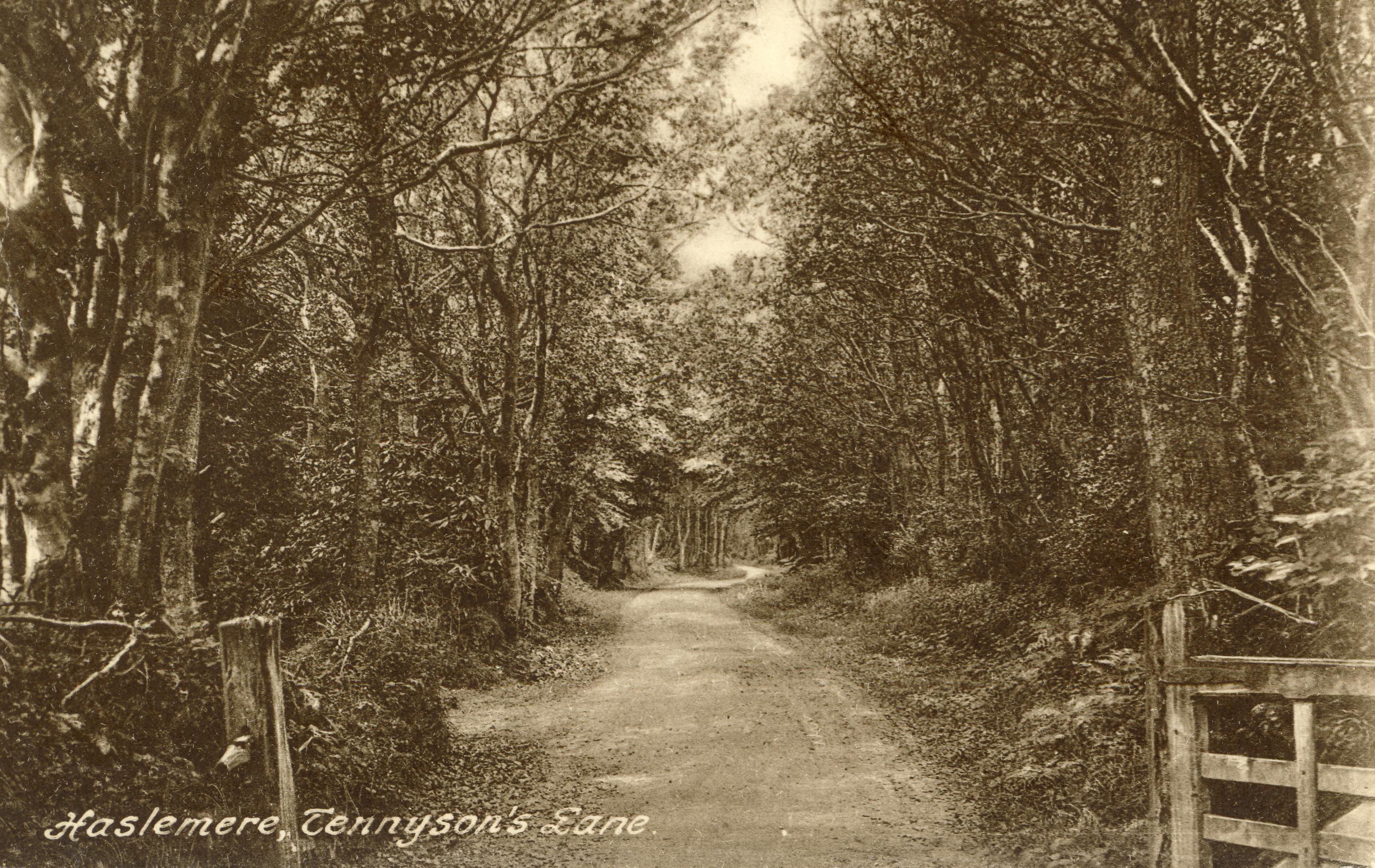
Blackdown, or Black Down, summit elevation AMSL, is the highest point in both the historic county of Sussex and the South Downs National Park. It is one of the highest points in the south east of England, exceeded by Walbury Hill, Leith Hill and Pilot Hill. Blackdown is protected as part of the South Downs National Park. Location Blackdown is in the far northwest of West Sussex. The hill presents as a dark-sided mass that towers over the western parts of the Low Weald and south-west Surrey. There is no village or hamlet on Blackdown although it lies approximately equidistant from the railway town of Haslemere to the northwest, Fernhurst to the southwest, and Lurgashall to the southeast.Ordnance Survey There are three National Trust car parks on Tennyson's Lane, which runs up Haste Hill from Haslemere. There are numerous footpaths from the surrounding villages, including a steep walk up the southern escarpment from Lurgashall. Blackdown is crossed by the Sussex Border ... [...More Info...] [...Related Items...] OR: [Wikipedia] [Google] [Baidu] |
Helen Allingham
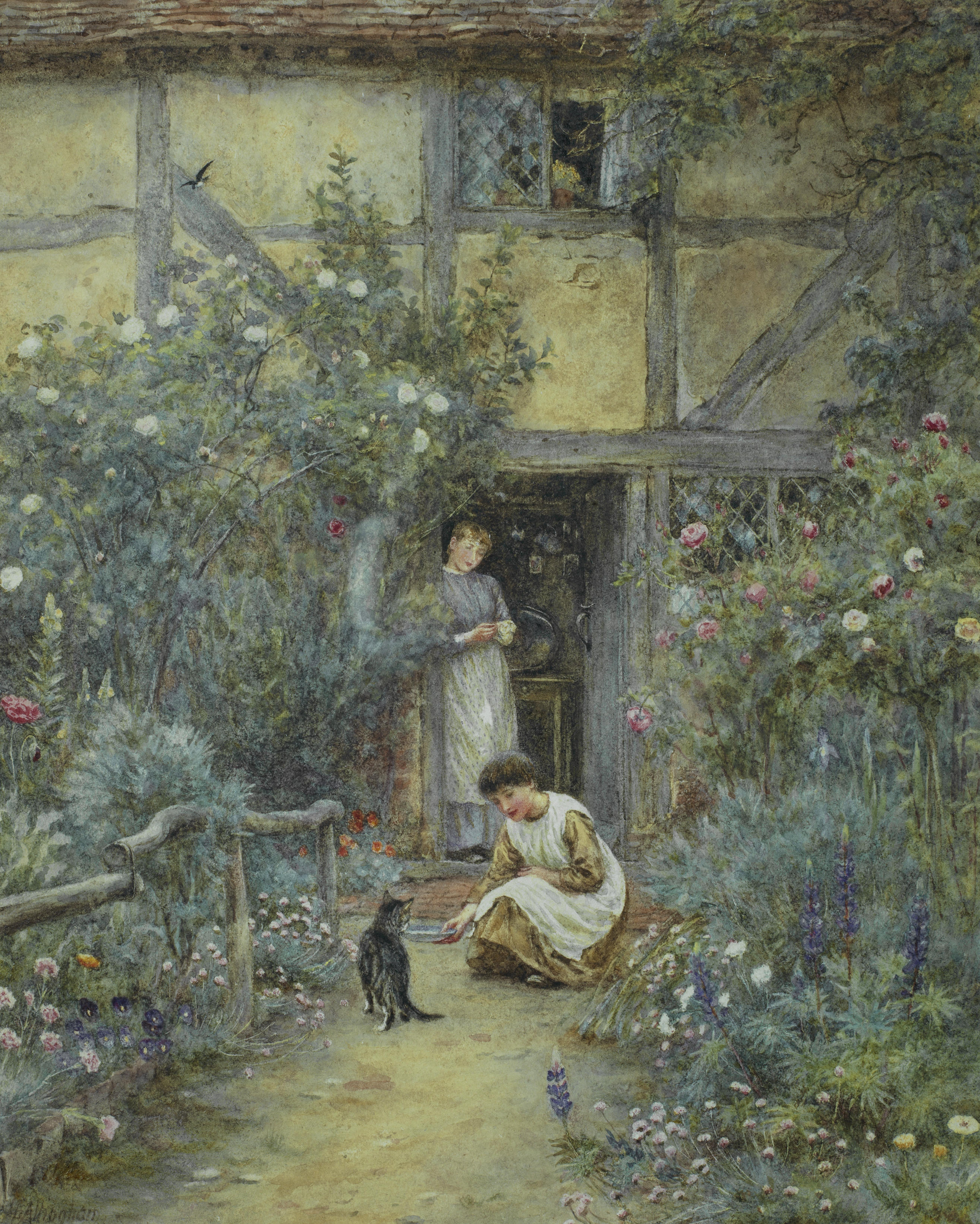
Helen Allingham (Birth name, née Paterson; 26 September 1848 – 28 September 1926) was a British watercolourist and illustrator of the Victorian era. Biography Helen Mary Elizabeth Paterson was born on 26 September 1848, at Swadlincote in Derbyshire, the daughter of Alexander Henry Paterson, a medical doctor, and Mary Herford Paterson. Helen was the eldest of seven children. The year after her birth the family moved to Altrincham in Cheshire. In 1862 her father and her three-year-old sister Isabel died of diphtheria during an epidemic. The remaining family then moved to Birmingham, where some of Alexander Paterson's family lived. Paterson showed a talent for art from an early age, drawing some of her inspiration from her maternal grandmother Sarah Smith Herford and aunt Laura Herford, both accomplished artists of their day. Her younger sister Caroline Paterson (artist), Caroline Paterson also became a noted artist. She initially studied art for three years at the Birmingham ... [...More Info...] [...Related Items...] OR: [Wikipedia] [Google] [Baidu] |
Fernhurst
Fernhurst is a village and civil parish in the Chichester District of West Sussex, England, on the A286 Milford, Surrey, to Chichester road, south of Haslemere and north of Midhurst. The parish includes the settlements of Henley Common, Kingsley Green and Bell Vale, lies within the boundaries of the South Downs National Park and is surrounded by hills. The area of the parish is . In the 2001 census there were 1,158 households with a total population of 2,765 of whom 1,244 were economically active. The population had increased to 2,942 at the 2011 Census. Geography Fernhurst lies in the valley of the River Lod whose feeder streams, known as ghyls, rise in the surrounding hills, that include Telegraph Hill at , Marley Heights at , Bexley Hill at , Fridays Hill at and the highest hill in Sussex, Blackdown at , which rises to the northeast. The valley soil is predominantly clay with greensand outcrops on Blackdown summit. There are dense wooded areas punctuated by miles of ... [...More Info...] [...Related Items...] OR: [Wikipedia] [Google] [Baidu] |
Upper Roundhurst Farm, West Sussex
Upper may refer to: * Shoe upper or ''vamp'', the part of a shoe on the top of the foot * Stimulant, drugs which induce temporary improvements in either mental or physical function or both * ''Upper'', the original film title for the 2013 found footage film ''The Upper Footage'' * Dmitri Upper Dmitri Sergeyevich Upper (; born July 27, 1978) is a Kazakhstani former professional ice hockey center. He also holds Russian citizenship. Career Upper was selected by the New York Islanders in the 5th round (136th overall) of the 2000 NHL ... (born 1978), Kazakhstani ice hockey player See also * Uppers (video game), a video game by Marvelous {{Disambiguation ... [...More Info...] [...Related Items...] OR: [Wikipedia] [Google] [Baidu] |
Haslemere Educational Museum
Haslemere Educational Museum was founded in 1888 by the eminent surgeon Sir Jonathan Hutchinson to display his growing collection of natural history specimens. After two moves it found in 1926 a permanent home in Haslemere High Street, in the town of Haslemere, Surrey, England. The museum won a national award in 2012 and is an independent charity. It contains nearly half a million specimens, artefacts, papers and images. History Already a successful surgeon with homes in London and Haslemere, Sir Jonathan Hutchinson was also keenly interested in the full spectrum of science and nature. At the farm that was his home in Haslemere he had already amassed a large collection of specimens and fossils collected on his travels, and in 1888 he opened a museum in the outbuildings, encouraging a then-revolutionary 'hands-on' approach. By 1895 the expanding collection needed larger premises, and was moved to what is now Museum Hill. Hutchinson himself lectured at the museum and before he di ... [...More Info...] [...Related Items...] OR: [Wikipedia] [Google] [Baidu] |
Surrey
Surrey () is a Ceremonial counties of England, ceremonial county in South East England. It is bordered by Greater London to the northeast, Kent to the east, East Sussex, East and West Sussex to the south, and Hampshire and Berkshire to the west. The largest settlement is Woking. The county has an area of and a population of 1,214,540. Much of the north of the county forms part of the Greater London Built-up Area, which includes the Suburb, suburbs within the M25 motorway as well as Woking (103,900), Guildford (77,057), and Leatherhead (32,522). The west of the county contains part of Farnborough/Aldershot built-up area, built-up area which includes Camberley, Farnham, and Frimley and which extends into Hampshire and Berkshire. The south of the county is rural, and its largest settlements are Horley (22,693) and Godalming (22,689). For Local government in England, local government purposes Surrey is a non-metropolitan county with eleven districts. The county historically includ ... [...More Info...] [...Related Items...] OR: [Wikipedia] [Google] [Baidu] |
National Trust For Places Of Historic Interest Or Natural Beauty
The National Trust () is a heritage and nature conservation charity and membership organisation in England, Wales and Northern Ireland. The Trust was founded in 1895 by Octavia Hill, Sir Robert Hunter and Hardwicke Rawnsley to "promote the permanent preservation for the benefit of the Nation of lands and tenements (including buildings) of beauty or historic interest". It has since been given statutory powers, starting with the National Trust Act 1907. Historically, the Trust acquired land by gift and sometimes by public subscription and appeal, but after World War II the loss of country houses resulted in many such properties being acquired either by gift from the former owners or through the National Land Fund. One of the largest landowners in the United Kingdom, the Trust owns almost of land and of coast. Its properties include more than 500 historic houses, castles, archaeological and industrial monuments, gardens, parks, and nature reserves. Most properties are open ... [...More Info...] [...Related Items...] OR: [Wikipedia] [Google] [Baidu] |
Conservation Grazing
Conservation grazing or targeted grazing is the use of semi- feral or domesticated grazing livestock to maintain and increase the biodiversity of natural or semi-natural grasslands, heathlands, wood pasture, wetlands and many other habitats. Conservation Grazing Peninsula Open Space Trust, California, US, 2009. (cited 2009 Mar 11)What is Conservation Grazing? Grazing Advice Partnership, UK, 2009. Conservation grazing is generally less intensive than practices such as [...More Info...] [...Related Items...] OR: [Wikipedia] [Google] [Baidu] |
Pinus Sylvestris
''Pinus sylvestris'', the Scots pine (UK), Scotch pine (US), Baltic pine, or European red pine is a species of tree in the pine family Pinaceae that is native plant, native to Eurasia. It can readily be identified by its combination of fairly short, blue-green leaves and orange-red bark. Description ''Pinus sylvestris'' is an evergreen coniferous tree growing up to in height and in trunk diameter when mature, exceptionally over tall and in trunk diameter on very productive sites. The tallest on record is a tree over 210 years old growing in Estonia which stands at . The lifespan is normally 150–300 years, with the oldest recorded specimens in Lapland (Finland), Lapland, Northern Finland over 760 years. The Bark (botany), bark is thick, flaky and orange-red when young to scaly and gray-brown in maturity, sometimes retaining the former on the upper portion. The habit of the mature tree is distinctive due to its long, bare and straight trunk topped by a rounded or flat- ... [...More Info...] [...Related Items...] OR: [Wikipedia] [Google] [Baidu] |
Panorama At Temple Of The Winds, Blackdown Hill, West Sussex Looking South
A panorama (formed from Greek πᾶν "all" + ὅραμα "view") is any wide-angle view or representation of a physical space, whether in painting, drawing, photography (panoramic photography), film, seismic images, or 3D modeling. The word was coined in the 18th century by the English ( Irish descent) painter Robert Barker to describe his panoramic paintings of Edinburgh and London. The motion-picture term ''panning'' is derived from ''panorama''. A panoramic view is also purposed for multimedia, cross-scale applications to an outline overview (from a distance) along and across repositories. This so-called "cognitive panorama" is a panoramic view over, and a combination of, cognitive spaces used to capture the larger scale. History The device of the panorama existed in painting, particularly in murals, as early as 20 A.D., in those found in Pompeii, as a means of generating an immersive " panoptic" experience of a vista. Cartographic experiments during the Enlighte ... [...More Info...] [...Related Items...] OR: [Wikipedia] [Google] [Baidu] |
Blackdown Jan 3 09 004
Blackdown or Black Down may refer to: Places Australia * Blackdown, Queensland, a locality in the Central Highlands Region *Blackdown Tableland National Park in Queensland. Canada * Blackdown Cadet Training Centre, a Canadian Cadet training centre (Tri-Force) located at CFB Borden, Ontario. England * Blackdown, Dorset, a village near Chard * Black Down, Dorset, a hill near Portesham * Blackdown, Hampshire, a village near Winchester * Black Down, Somerset, a hill in the Mendip Hills * Blackdown, Warwickshire, a village near Leamington Spa * Blackdown, West Sussex, a hill also spelt Black Down * Blackdown Hill, Dorset, one of Dorset's highest points * Blackdown Hills, a range of hills in Somerset and Devon * Princess Royal Barracks, Deepcut (Blackdown Camp), a World War II army camp near Aldershot, Hampshire Computing * Blackdown Java, a port of Sun's Java virtual machine to Linux. Popular culture * "Blackdown", a song by Patrick Wolf from '' The Bachelor'' * "Bla ... [...More Info...] [...Related Items...] OR: [Wikipedia] [Google] [Baidu] |
Sunken Lane
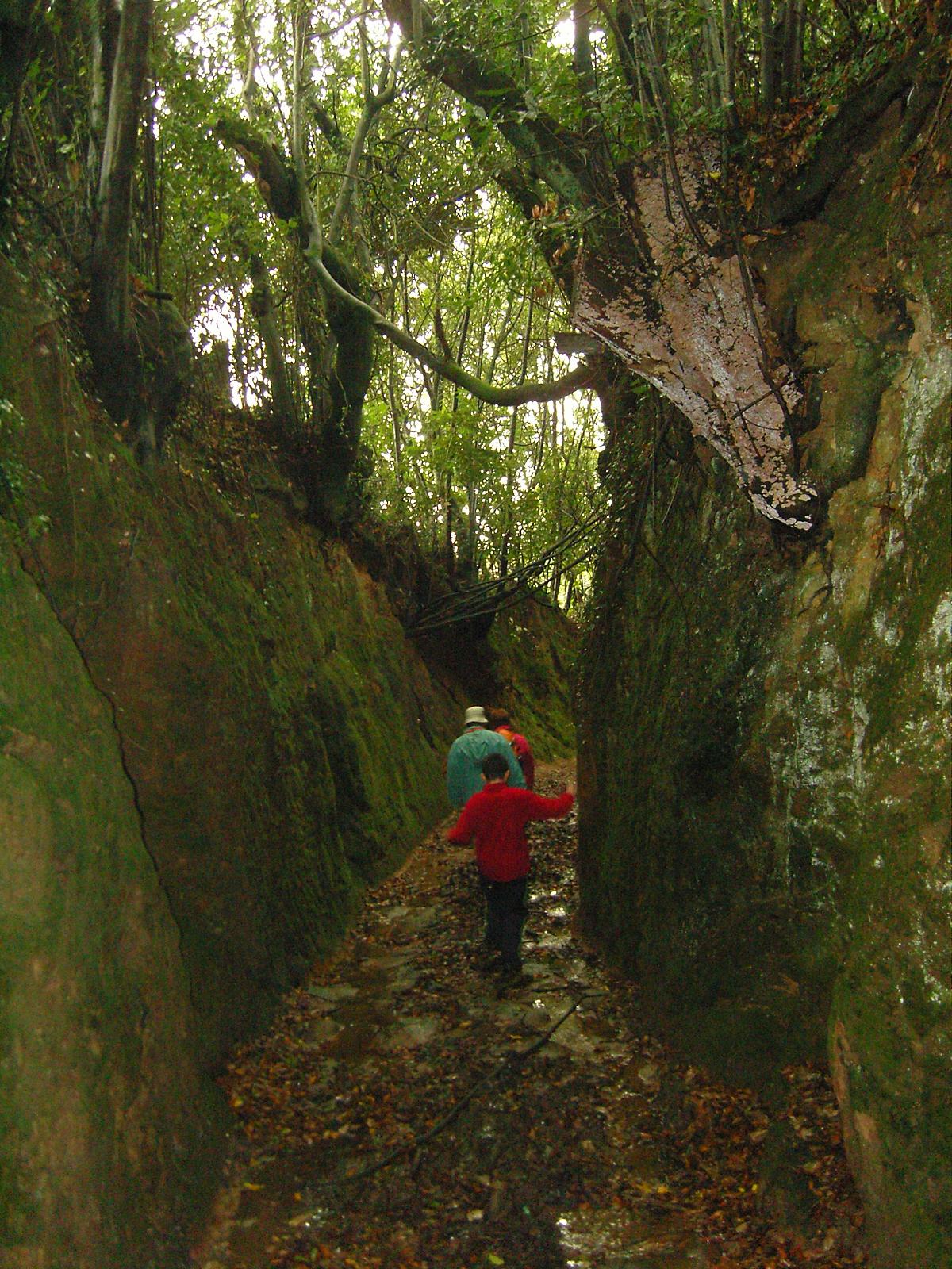
A sunken lane (also hollow way or holloway) is a road or track that is significantly lower than the land on either side, not formed by the (recent) engineering of a road cutting but possibly of much greater age. Holloways may have been formed in various ways, including erosion by water or traffic; the digging of embankments to assist with the herding of livestock; and the digging of double banks to mark the boundaries of estates. Means of formation A variety of theories have been proposed for the origins of holloways. Different mechanisms may well apply in different cases. Erosion Some sunken lanes are created incrementally by erosion, by water and traffic. Some are ancient, with evidence of Roman or Iron Age origins, but others such as the Deep Hill Ruts in the old Oregon Trail at Guernsey, Wyoming, developed in the space of a decade or two. Where ancient trackways have lapsed from use, the overgrown and shallow marks of hollow ways through forest may be the sole evidence ... [...More Info...] [...Related Items...] OR: [Wikipedia] [Google] [Baidu] |
Alfred, Lord Tennyson
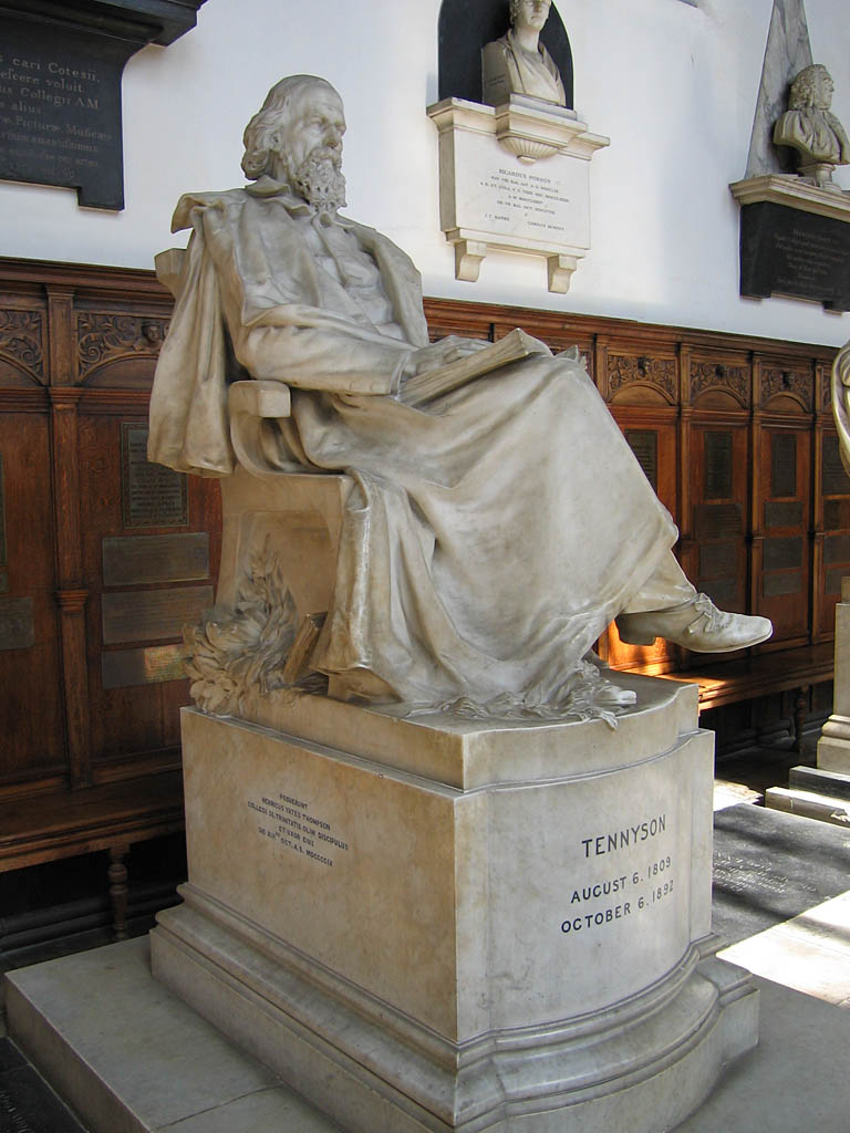
Alfred Tennyson, 1st Baron Tennyson (; 6 August 1809 – 6 October 1892) was an English poet. He was the Poet Laureate during much of Queen Victoria's reign. In 1829, Tennyson was awarded the Chancellor's Gold Medal at Cambridge for one of his first pieces, "Timbuktu". He published his first solo collection of poems, '' Poems, Chiefly Lyrical'', in 1830. " Claribel" and " Mariana", which remain some of Tennyson's most celebrated poems, were included in this volume. Although described by some critics as overly sentimental, his poems ultimately proved popular and brought Tennyson to the attention of well-known writers of the day, including Samuel Taylor Coleridge. Tennyson's early poetry, with its medievalism and powerful visual imagery, was a major influence on the Pre-Raphaelite Brotherhood. Tennyson also focused on short lyrics, such as " Break, Break, Break", " The Charge of the Light Brigade", " Tears, Idle Tears", and " Crossing the Bar". Much of his verse was based on ... [...More Info...] [...Related Items...] OR: [Wikipedia] [Google] [Baidu] |


