|
Bistrița-Năsăud County
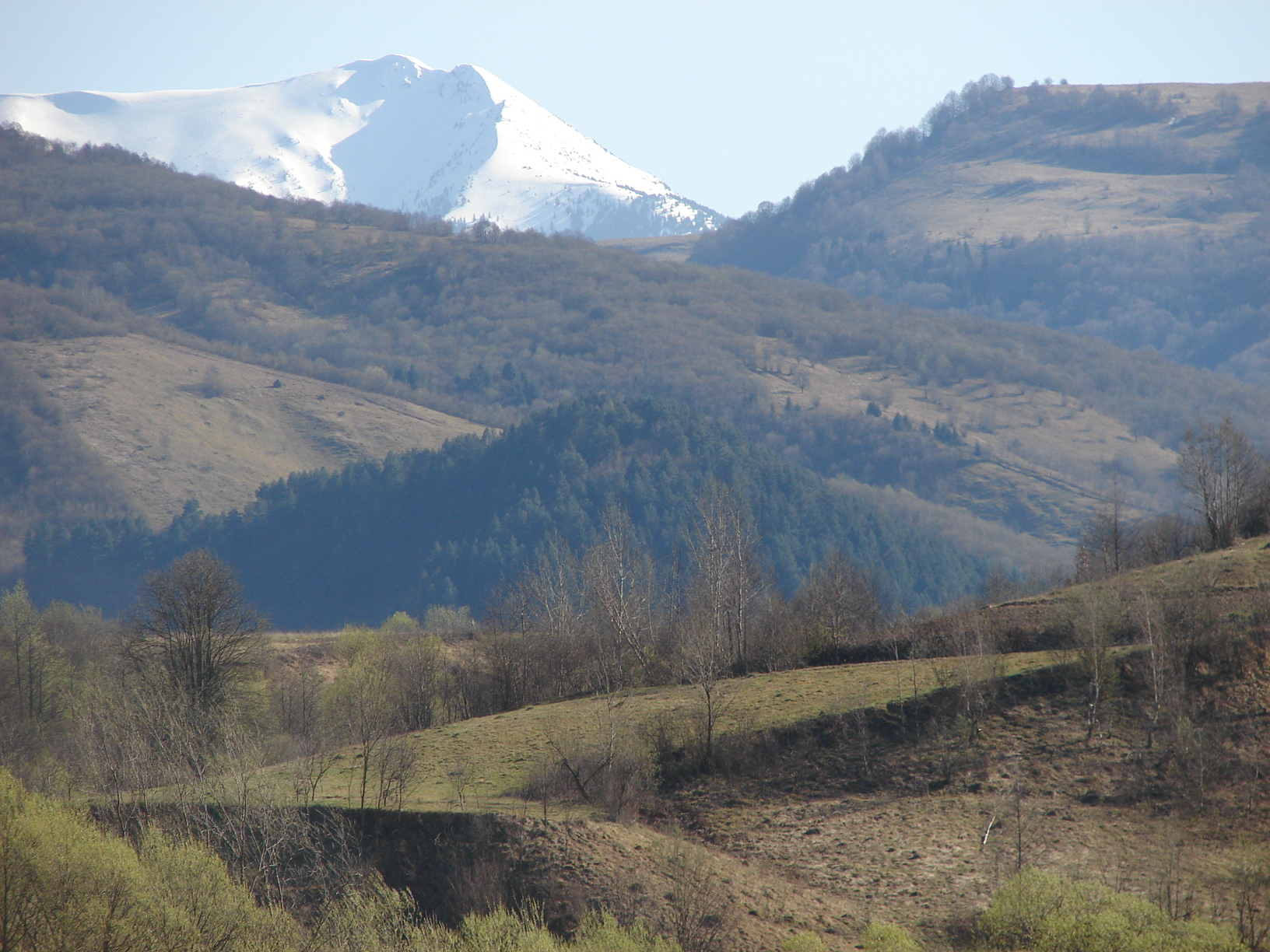
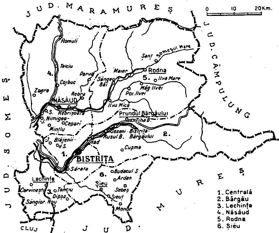
Bistrița-Năsăud () is a county (județ) of Romania, in Transylvania, with its capital city at Bistrița. Name In Hungarian language, Hungarian, it is known as ''Beszterce-Naszód megye'', and in German language, German as ''Kreis Bistritz-Nassod''. The name is identical with the county created in 1876, Beszterce-Naszód County () in the Kingdom of Hungary (the county was recreated in 1940 after the Second Vienna Award, as it became part of Hungary again until 1944). Except these, as part of Romania, until 1925 the former administrative organizations were kept when a new county system was introduced. Between 1925–1940 and 1945–1950, most of its territory belonged to the Năsăud County, with smaller parts belonging to the Mureș County, Mureș, Cluj County, Cluj, and Someș County, Someș counties. Geography The county has a total area of . One third of this surface represents the mountains from the Divisions of the Carpathians, Eastern Carpathians group: the Țibleș Mo ... [...More Info...] [...Related Items...] OR: [Wikipedia] [Google] [Baidu] |
Counties Of Romania
A total of 41 counties (), along with the municipality of Bucharest, constitute the official administrative divisions of Romania. They represent the country's NUTS-3 (Nomenclature of Territorial Units for Statistics – Level 3) statistical subdivisions within the European Union and each of them serves as the local level of government within its borders. Most counties are named after a major river, while some are named after notable cities within them, such as the county seat. The earliest organization into ''județe'' of the Principalities of Wallachia and Moldavia (where they were termed ''ținuturi'') dates back to at least the late 14th century. For most of the time since modern Romania was formed in 1859, the administrative division system has been similar to that of the French departments. The system has since changed several times and the number of counties has varied over time, from the 71 ''județe'' that existed before World War II to only 39 after 1968. The curr ... [...More Info...] [...Related Items...] OR: [Wikipedia] [Google] [Baidu] |
Hungarian Language
Hungarian, or Magyar (, ), is an Ugric language of the Uralic language family spoken in Hungary and parts of several neighboring countries. It is the official language of Hungary and one of the 24 official languages of the European Union. Outside Hungary, it is also spoken by Hungarians, Hungarian communities in southern Slovakia, western Ukraine (Zakarpattia Oblast, Transcarpathia), central and western Romania (Transylvania), northern Serbia (Vojvodina), northern Croatia, northeastern Slovenia (Prekmurje), and eastern Austria (Burgenland). It is also spoken by Hungarian diaspora communities worldwide, especially in North America (particularly the Hungarian Americans, United States and Canada) and Israel. With 14 million speakers, it is the Uralic family's most widely spoken language. Classification Hungarian is a member of the Uralic language family. Linguistic connections between Hungarian and other Uralic languages were noticed in the 1670s, and the family's existenc ... [...More Info...] [...Related Items...] OR: [Wikipedia] [Google] [Baidu] |
Călimani Mountains
The Călimani Mountains (, ) are the largest volcanic complex of the Carpathian Mountains in Transylvania, Romania. Geologically they belong to the Căliman-Harghita Mountains group of the Inner Eastern Carpathians. Maximum height is reached in Pietrosul Călimanilor Peak, at 2,102 m. Other significant peaks include: Bistriciorul (1,990 m), Stuniorul (1,885 m), Gruiului (1,913 m), Negoiul Unguresc (2,084 m), Rețițiș (2,021 m), Bradul Ciont (1,899 m), Iezerul Călimanilor (2,023 m). The volcanic crater with a diameter of 10 km is bordered by the highest peaks, and to north is split by Valea Neagră, a tributary of Dorna River. Inside the crater there are several secondary volcanic funnels (Pietricelui, Vârful Haitei, Negoiul Românesc), the last one being a exploitation of sulfur until 1997. Among the major tourist attractions include odd shapes of volcanic rocks on Tihul, Rusca and Rețițiș Mountains, but especially on Tămău and Lucaciu Mountains. In the last sector ... [...More Info...] [...Related Items...] OR: [Wikipedia] [Google] [Baidu] |
Bârgău Mountains
The Bârgău Mountains () are a mountain range in the Carpathian Mountains, part of the Căliman-Harghita Mountains in the Bistrița-Năsăud County, in the north of Romania Romania is a country located at the crossroads of Central Europe, Central, Eastern Europe, Eastern and Southeast Europe. It borders Ukraine to the north and east, Hungary to the west, Serbia to the southwest, Bulgaria to the south, Moldova to .... The highest point is Heniu Mare at . References Mountain ranges of Romania Mountain ranges of the Eastern Carpathians {{Romania-geo-stub ... [...More Info...] [...Related Items...] OR: [Wikipedia] [Google] [Baidu] |
Rodna Mountains
Rodna Mountains (, ) are a subdivision of the Inner Eastern Carpathians in northern Romania. The name comes from the nearby Rodna Veche village. At , is the highest peak in all of the Eastern Carpathians. The main ridge of the Rodna Mountains constitutes the natural border between Bistrița-Năsăud and Maramureș counties. From an administrative point of view, 80% of the massif's surface is in Bistrița-Năsăud and 20% in Maramureș. Geography The Rodna Mountains have one of the longest continuous ridges in Romania, with over from west to east and a width of over . The massif covers an area of about . The highest points are Pietrosul Rodnei at 2,303 m, Ineu Peak at , Ineuț Peak at , Gârgalău Peak at , and Omu Peak at . The mountains are most suited for hiking in summer and skiing in winter, and are especially famous for having snow late into the summer months (skiing is possible well into June, sometimes even July). While the ridge itself poses no difficulti ... [...More Info...] [...Related Items...] OR: [Wikipedia] [Google] [Baidu] |
Țibleș Mountains
The Țibleș Mountains (, or ''Széples'') are a volcanic mountain range located in Maramureș County, in northern Romania. They belong to the Vihorlat-Gutin Area of the Inner Eastern Carpathians. They are located at the southern border of historical Maramureș region and they cut off the Maramureș valleys from the rest of Romania. The range's highest peak is Bran Peak, at . The closest town is Dragomirești. See also * Romanian Carpathians The Romanian Carpathians () are a section of the Carpathian Mountains, within the borders of modern Romania. The Carpathians are a "subsystem" of the Alps-Himalaya System and are further divided into "provinces" and "subprovinces". This is an ... References Sources * External links Țibleș Mountains on the geographical map of Maramureș County Mountain ranges of Romania Mountain ranges of the Eastern Carpathians {{Romania-geo-stub ... [...More Info...] [...Related Items...] OR: [Wikipedia] [Google] [Baidu] |
Divisions Of The Carpathians
Divisions of the Carpathians are a categorization of the Carpathian mountains system. Below is a detailed overview of the major subdivisions and ranges of the Carpathian Mountains. The Carpathians are a "subsystem" of a bigger Alps-Himalaya System that stretches from western Europe all the way to southern Asia, and are further divided into "provinces" and "subprovinces". The last level of the division, i.e. the actual mountain ranges and basins, is usually classified as "units". The main divisions are shown in the map on the right. To generalize, there are three major provinces (regions): Western Carpathians, Eastern Carpathians, and the Southern Carpathians. Naming conventions The division is largely (with many exceptions) undisputed at the lowest level (except for the Ukrainian part), but various divisions are given for the higher levels, especially for the penultimate level. A geomorphological division has been used as much as the data was available; other new physioge ... [...More Info...] [...Related Items...] OR: [Wikipedia] [Google] [Baidu] |
Someș County
Someș County is one of the historic counties of Transylvania, Romania. The county seat was Dej. In 1938, the county was disestablished and incorporated into the newly formed Ținutul Crișuri, but it was re-established in 1940 after the fall of King Carol II's regime, only to be abolished 10 years later by the Communist regime. Geography Someș County covered and was located in Transylvania. The territory that comprised Someș County is now located in the Bistrița-Năsăud, Maramureș, Cluj Cluj-Napoca ( ; ), or simply Cluj ( , ), is a city in northwestern Romania. It is the second-most populous city in the country and the seat of Cluj County. Geographically, it is roughly equidistant from Bucharest (), Budapest () and Belgrade ( ..., and Sălaj County, Sălaj counties. It neighbored Satu Mare County, Satu Mare and Maramureș counties to the north, Năsăud County to the east, Cluj County to the south, and Sălaj County to the west. Historical County Prior to World ... [...More Info...] [...Related Items...] OR: [Wikipedia] [Google] [Baidu] |
Cluj County
Cluj County () is a county () of Romania, in Transylvania. Its seat is Cluj-Napoca. Name In Hungarian language, Hungarian it is known as ''Kolozs megye''. Under the Kingdom of Hungary, a county with an identical name (Kolozs County, ) existed since the 11th century. Geography Cluj County lies in the northwestern half of the country, between parallels 47°28' in north and 46°24' in south, meridians 23°39' in west and 24°13' in east, respectively. It covers an area of unfolded in the contact zone of three representative natural units: the Apuseni Mountains, the Transylvanian Plateau, Someș Plateau, and the Transylvanian Plain. Cluj County is the 12th largest in the country and occupies 2.8% of Romania's area. It is bordered to the northeast with Maramureș County, Maramureș and Bistrița-Năsăud County, Bistrița-Năsăud counties, to the east with Mureș County, to the south with Alba County, and to the west with Bihor County, Bihor and Sălaj County, Sălaj counties. ... [...More Info...] [...Related Items...] OR: [Wikipedia] [Google] [Baidu] |
Mureș County
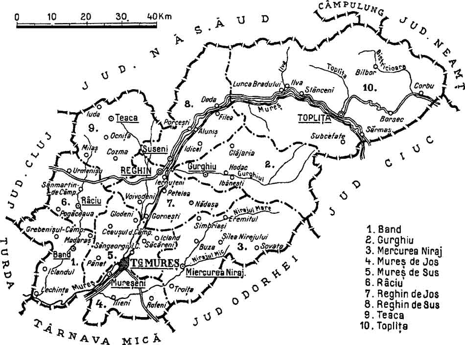
Mureș County (, , ) is a county (''județ'') of Romania, in the Historical regions of Romania, historical region of Transylvania, with the administrative centre in Târgu Mureș. The county was established in 1968, after the administrative reorganization that re-introduced the historical ''județ'' (Counties of Romania, county) system, still used today. This reform eliminated the previous Magyar Autonomous Region, Mureș-Magyar Autonomous Region, which had been created in 1952 within the People's Republic of Romania. Mureș County has a vibrant multicultural fabric that includes Székely Land, Hungarian-speaking Székelys and Transylvanian Saxons, with a rich heritage of Villages with fortified churches in Transylvania, fortified churches and towns. Name In Hungarian language, Hungarian, it is known as ''Maros megye'' (), and in German language, German as ''Kreis Mieresch''. Under Kingdom of Hungary, a county with a similar name (Maros-Torda County, ) was created in 1876. There ... [...More Info...] [...Related Items...] OR: [Wikipedia] [Google] [Baidu] |
Năsăud County
Năsăud County is one of the historic counties of Transylvania, Romania. The county seat was Bistrița. Geography Năsăud County was located in the north-central part of Greater Romania, in the north of Transylvania, covering . Currently, the territory that comprised Năsăud County is mostly included in the Bistrița-Năsăud County, while its eastern part belongs now to Suceava County. In the interwar period, the county was bordered on the south by Mureș County and a small part of Cluj County, to the west by Someș County, to the north by Maramureș County, and to the east by the counties of Câmpulung and Neamț. History The territory of Năsăud County was ceded to Romania by Hungary, as successor state to Austria-Hungary in the Treaty of Trianon (1920). Prior to then, the territory formed Beszterce-Naszód County in the Kingdom of Hungary. Romanian authorities established the county in 1925. In 1938, the county was disestablished and incorporated into the newly formed ... [...More Info...] [...Related Items...] OR: [Wikipedia] [Google] [Baidu] |
Second Vienna Award
The Second Vienna Award was the second of two territorial disputes that were arbitrated by Nazi Germany and the Kingdom of Italy. On 30 August 1940, they assigned the territory of Northern Transylvania, including all of Maramureș and part of Crișana, from the Kingdom of Romania to the Kingdom of Hungary (1920–46), Kingdom of Hungary. Background After World War I, the multiethnic Lands of the Crown of Saint Stephen, Kingdom of Hungary was divided by the 1920 Treaty of Trianon to form several new nation states, but Hungary noted that the new state borders did not follow ethnic boundaries. The new nation state of Hungary was about a third the size of prewar Hungary, and millions of ethnic Hungarians were left outside the new Hungarian borders. Many historically-important areas of Hungary were assigned to other countries, and the distribution of natural resources was uneven. The various non-Hungarian populations generally saw the treaty as justice for their historically-margina ... [...More Info...] [...Related Items...] OR: [Wikipedia] [Google] [Baidu] |


