|
Birtavarre
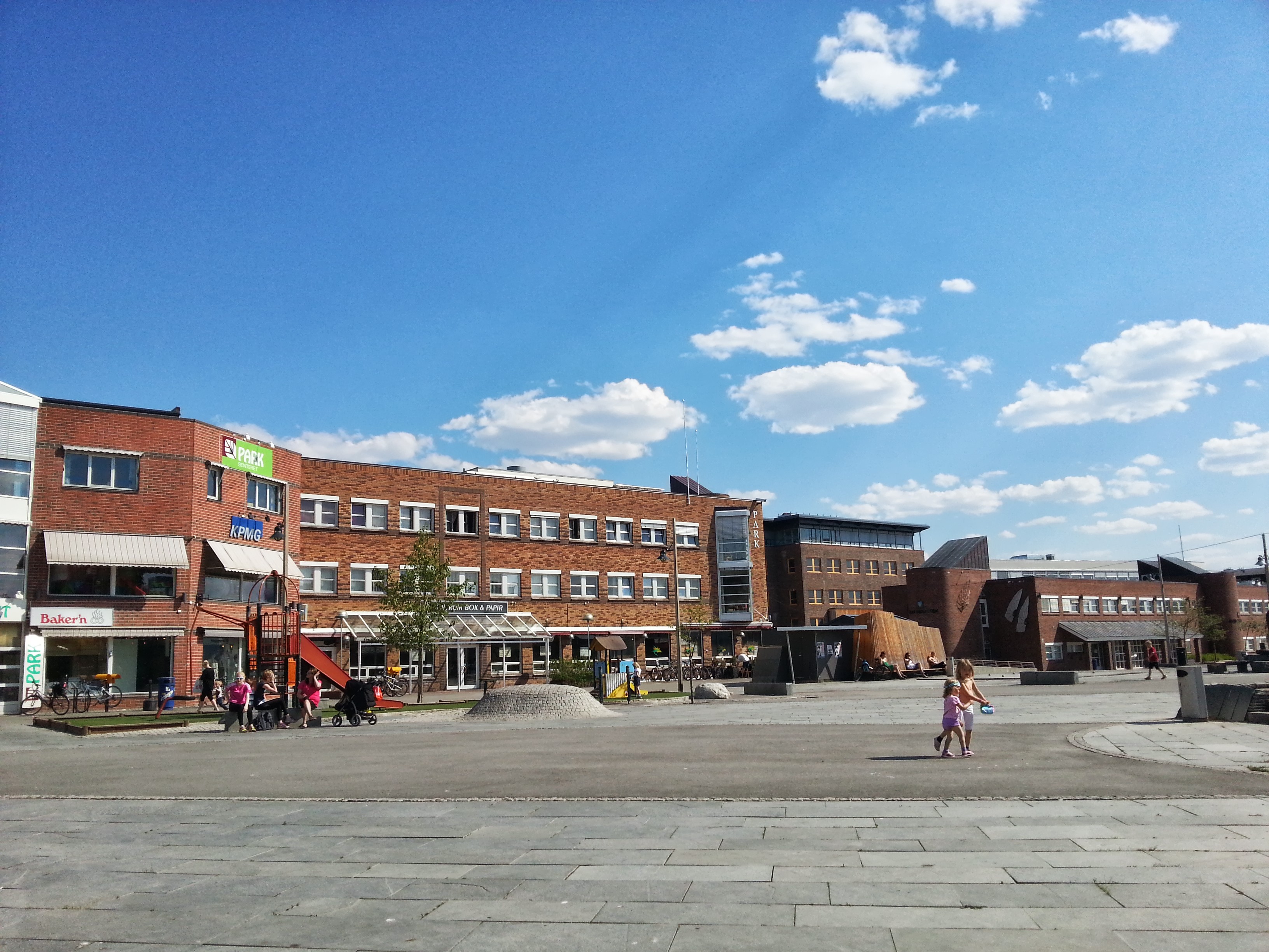
Birtavarre ( sme, Gáivuonbahta; fkv, Pirttivaara) is a village in the municipality of Gáivuotna-Kåfjord-Kaivuono in Troms og Finnmark county, Norway. The village is located along the Kåfjordelva river ( sme, Gáivuoneatu) at the end of the Kåfjorden in the Kåfjorddalen valley in an area called ''Kåfjordbotn'' ( sme, Gaivuonbahta). The village has a population (2017) of 214 which gives the village a population density of . Birtavarre is located along European route E6 about southeast of the municipal centre of Olderdalen (on the north side of the fjord) and about southeast of Samuelsberg and Manndalen (on the south side of the fjord). Birtavarre Chapel is also located in the village. Name Birtavarre is a former mining town with smelters in Ankerlia that are preserved by the Nord-Troms Museum. It was during the mining period that the village adopted the name ''Birtavarre''. Up until that time the area had been called ''Kåfjordbotn'', meaning the end of the Kå ... [...More Info...] [...Related Items...] OR: [Wikipedia] [Google] [Baidu] |
Birtavarre Chapel
Birtavarre ( sme, Gáivuonbahta; fkv, Pirttivaara) is a village in the municipality of Gáivuotna-Kåfjord-Kaivuono in Troms og Finnmark county, Norway. The village is located along the Kåfjordelva river ( sme, Gáivuoneatu) at the end of the Kåfjorden in the Kåfjorddalen valley in an area called ''Kåfjordbotn'' ( sme, Gaivuonbahta). The village has a population (2017) of 214 which gives the village a population density of . Birtavarre is located along European route E6 about southeast of the municipal centre of Olderdalen (on the north side of the fjord) and about southeast of Samuelsberg and Manndalen (on the south side of the fjord). Birtavarre Chapel is also located in the village. Name Birtavarre is a former mining town with smelters in Ankerlia that are preserved by the Nord-Troms Museum. It was during the mining period that the village adopted the name ''Birtavarre''. Up until that time the area had been called ''Kåfjordbotn'', meaning the end of the Kå ... [...More Info...] [...Related Items...] OR: [Wikipedia] [Google] [Baidu] |
Kåfjorden (Troms)
Kåfjorden, Gáivuotna or Kaivuono is a fjord in the municipality of Gáivuotna-Kåfjord-Kaivuono in Troms og Finnmark county, Norway. The long fjord is a branch off the main Lyngen fjord stretching further inland to the village of Birtavarre. The European route E06 highway runs around the entire fjord. See also * List of Norwegian fjords This list of Norwegian fjords shows many of the fjords in Norway. In total, there are about 1,190 fjords in Norway and the Svalbard islands. The sortable list includes the lengths and locations of those fjords. Fjords See also * List of gla ... References Fjords of Troms og Finnmark Gáivuotna–Kåfjord {{Norway-fjord-stub ... [...More Info...] [...Related Items...] OR: [Wikipedia] [Google] [Baidu] |
Olderdalen
Olderdalen ( se, Dálošvággi; fkv, Junttaniemi) is the administrative centre of the municipality of Gáivuotna – Kåfjord – Kaivuono in Troms og Finnmark county, Norway. Olderdalen is located in the Olderdalen valley along the Kåfjorden with a view of the Lyngen Alps. The village has a ferry connection to Lyngseidet, the administrative centre of Lyngen Municipality, across the fjord. The European route E6 highway passes through this village also. Olderdalen is located about to the northwest of the village of Birtavarre and it is about to the east of the city of Tromsø. Kåfjord Church is located in this village. The village has a population (2017) of 322 which gives the village a population density of . Economy The Olderdalen area is home to mainly farming and fishing. Raising sheep and dairy cattle are two of the most prominent types of agriculture in the area. There is also grocery services as well as public and private services. History During World Wa ... [...More Info...] [...Related Items...] OR: [Wikipedia] [Google] [Baidu] |
Population Density
Population density (in agriculture: standing stock or plant density) is a measurement of population per unit land area. It is mostly applied to humans, but sometimes to other living organisms too. It is a key geographical term.Matt RosenberPopulation Density Geography.about.com. March 2, 2011. Retrieved on December 10, 2011. In simple terms, population density refers to the number of people living in an area per square kilometre, or other unit of land area. Biological population densities Population density is population divided by total land area, sometimes including seas and oceans, as appropriate. Low densities may cause an extinction vortex and further reduce fertility. This is called the Allee effect after the scientist who identified it. Examples of the causes of reduced fertility in low population densities are * Increased problems with locating sexual mates * Increased inbreeding Human densities Population density is the number of people per unit of area, usuall ... [...More Info...] [...Related Items...] OR: [Wikipedia] [Google] [Baidu] |
Kven Language
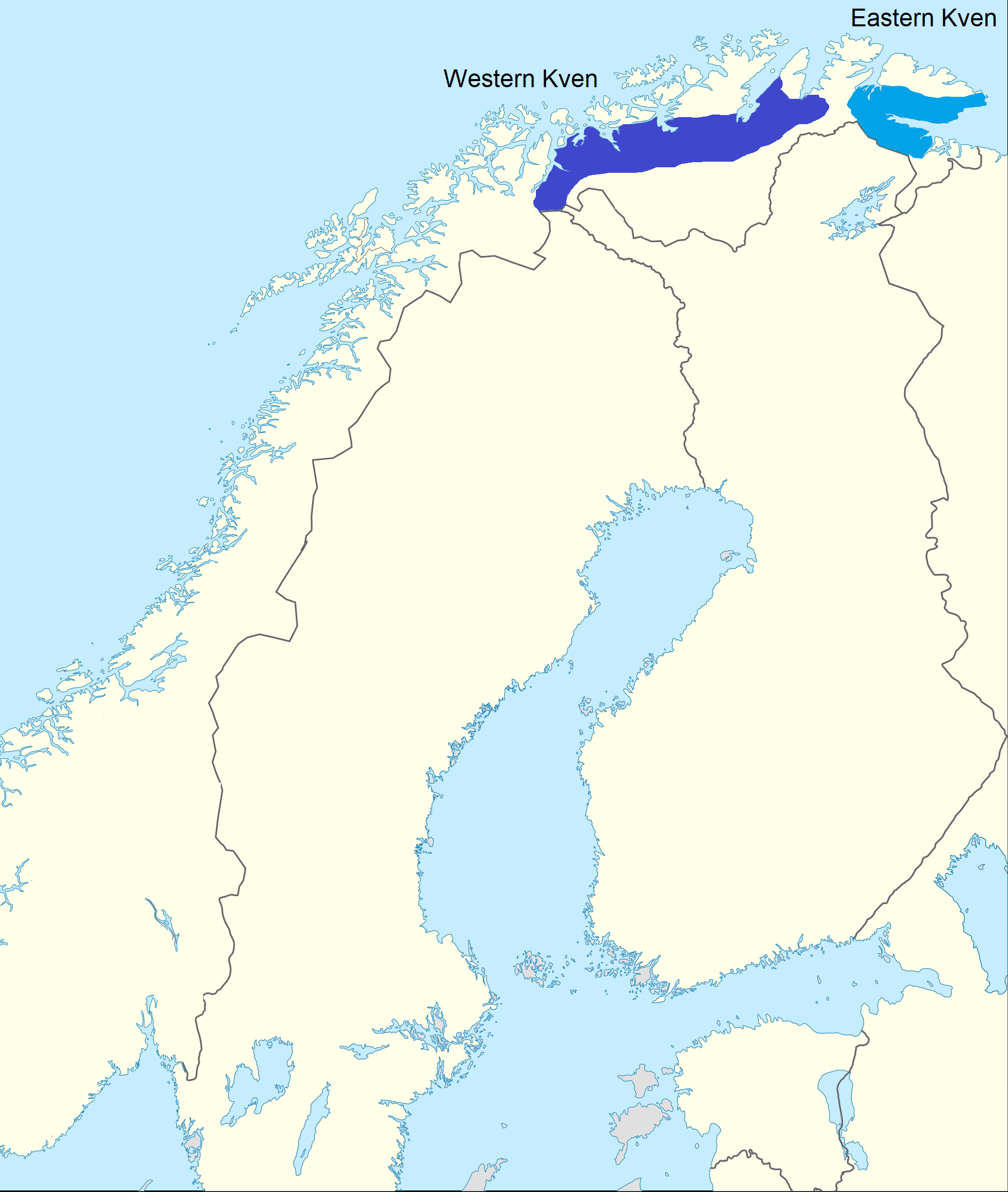
The Kven language ( or ; or ; fi, kveeni or ; no, kvensk) is a Finnic language or a group of Finnish dialects spoken in the northernmost parts of Norway by the Kven people. For political and historical reasons, it received the status of a minority language in 2005 within the framework of the European Charter for Regional or Minority Languages. Linguistically, however, it is seen as a mutually intelligible dialect of the Finnish language, and grouped together with the Peräpohjola dialects such as Meänkieli, spoken in Torne Valley in Sweden. While it is often considered a dialect in Finland, it is officially recognized as a minority language in Norway and some Kven people consider it a separate language. There are about 1,500 to 10,000 known native speakers of this language, most of whom are over the age of 60. Middle aged speakers tend to have a passing knowledge of the language. They use it occasionally, but not frequently enough to keep it off the endangered list. People un ... [...More Info...] [...Related Items...] OR: [Wikipedia] [Google] [Baidu] |
Alta Municipality
( se, Áltá ; fkv, Alattio; fi, Alattio) is the most populated municipality in Finnmark in Troms og Finnmark county, Norway. The administrative centre of the municipality is the town of Alta. Some of the main villages in the municipality include Kåfjord, Komagfjord, Kvenvik, Langfjordbotn, Leirbotn, Rafsbotn, Talvik, and Tverrelvdalen. Downtown Alta is located just below the 70th latitude and is closer to the North Pole than it is to much of Central Europe and the British Isles. The town is the northernmost settlement of urban significance in the European Economic Area, with municipalities north of it being sparsely populated. In spite of its high latitude the local climate is seldom severy cold thanks to Gulf Stream moderation in the prevailing wind. As a result of its shielded position leading to mild summers, the coastal areas of the municipality are warm enough to enable forestation. Due to Norway curving above its Nordic neighbours, Alta is located further e ... [...More Info...] [...Related Items...] OR: [Wikipedia] [Google] [Baidu] |
Kåfjord, Alta
Kåfjord is a village in Alta Municipality in Troms og Finnmark county, Norway. The village is located along the Kåfjorden, about west of the town of Alta along the European route E6 highway. The village of Kvenvik lies about to the east, also along the E6 highway. At the summit of Mount Haldde, about by a track from Kåfjord, is a restored Northern Lights Observatory, established by Kristian Birkeland in 1899 and operational until 1926, when it was transferred to Tromsø. History Copper ore was mined at Kåfjord between 1826 and 1909. A mining company, Alten Copper Mines, was founded by two Englishmen in 1826. By the 1840s, the village had grown to become the largest settlement in Finnmark county, with over 1,000 inhabitants, including Englishmen from Cornwall. The copper works are now closed and derelict. In 1837, the British built Kåfjord Church, which was restored in 1969. During the Second World War, the German battleship ''Tirpitz'' used Kåfjord as a har ... [...More Info...] [...Related Items...] OR: [Wikipedia] [Google] [Baidu] |
European Route E6
European route E6 ( no, Europavei 6, sv, Europaväg 6, or simply E6) is the main north-south thoroughfare through Norway as well as the west coast of Sweden. It is long and runs from the southern tip of Sweden at Trelleborg, into Norway and through almost all of the country north to the Arctic Circle and Nordkapp. The route ends in Kirkenes close to the Russian border. Route From south to north, E6 runs through Trelleborg, Malmö, Helsingborg, Halmstad, Gothenburg, Svinesund in Sweden, before crossing the border at the Svinesund Bridge into Norway. It then passes Halden, Sarpsborg, Moss to the capital Oslo. North of this, it passes by Gardermoen, Hamar, Lillehammer, Dombås, Oppdal, Melhus to Trondheim. Beyond Trondheim, the E6 meets Stjørdal, Verdal, Steinkjer, Grong, Mosjøen, Mo i Rana, Saltdal, Fauske and Hamarøy towards Bognes, where there is a ferry crossing over the Tysfjorden to Skarberget. It then runs through on via Narvik, Setermoen, Nordkjosbotn, Skib ... [...More Info...] [...Related Items...] OR: [Wikipedia] [Google] [Baidu] |
Norway
Norway, officially the Kingdom of Norway, is a Nordic country in Northern Europe, the mainland territory of which comprises the western and northernmost portion of the Scandinavian Peninsula. The remote Arctic island of Jan Mayen and the archipelago of Svalbard also form part of Norway. Bouvet Island, located in the Subantarctic, is a dependency of Norway; it also lays claims to the Antarctic territories of Peter I Island and Queen Maud Land. The capital and largest city in Norway is Oslo. Norway has a total area of and had a population of 5,425,270 in January 2022. The country shares a long eastern border with Sweden at a length of . It is bordered by Finland and Russia to the northeast and the Skagerrak strait to the south, on the other side of which are Denmark and the United Kingdom. Norway has an extensive coastline, facing the North Atlantic Ocean and the Barents Sea. The maritime influence dominates Norway's climate, with mild lowland temperatures on the se ... [...More Info...] [...Related Items...] OR: [Wikipedia] [Google] [Baidu] |
List Of Regions Of Norway
Norway is commonly divided into five major geographical regions (''landsdeler''). These regions are purely geographical, and have no administrative purpose. However, in 2017 the government decided to abolish the current counties of Norway (''fylker'') and to replace them with fewer, larger administrative regions (''regioner''). The first of these new areas came into existence on 1 January 2018, when Nord-Trøndelag and Sør-Trøndelag merged to form Trøndelag. According to most definitions, the counties of Norway are divided into the following regions (these groupings are approximate): * Northern Norway (''Nord-Norge''/''Nord-Noreg'') **Troms og Finnmark ** Nordland *Trøndelag (alt. ''Midt-Norge''/''Midt-Noreg'') **Trøndelag *Western Norway (''Vestlandet'') ** Møre og Romsdal **Vestland ** Rogaland *Southern Norway (''Sørlandet'' or ''Agder'') **Agder *Eastern Norway (''Østlandet''/''Austlandet'') **Vestfold og Telemark **Viken **Innlandet **Oslo The division into region ... [...More Info...] [...Related Items...] OR: [Wikipedia] [Google] [Baidu] |


