|
Bichtenberg
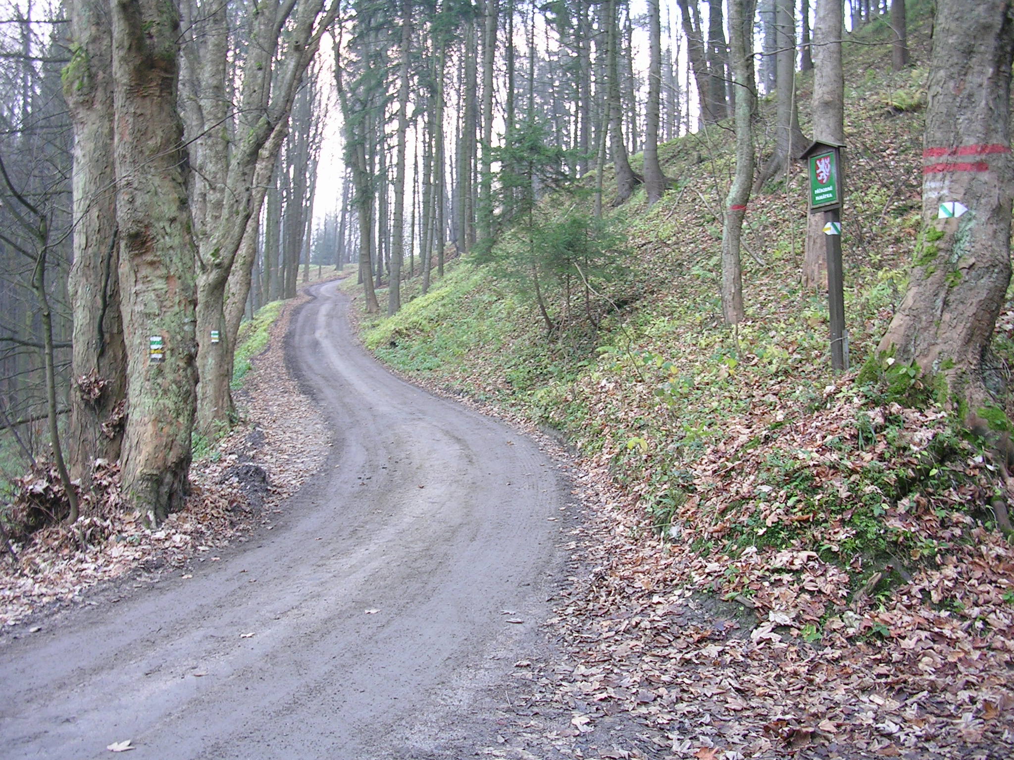
The Bichtenberg is a 400-metre-high hill in the western Wasgau, a region on the Franco-German border that includes the southern part of the Palatine Forest and the northern part of the Vosges. Its northwestern flank is in the parish of Lemberg, its southwestern flank in the parish of Dahn. To the north is the Lemberg hamlet of Salzwoog. Three kilometres west lies the Salzwoog Devil's Table. The Bichteberg, which is made of bunter sandstone is entirely covered in mixed forest crossed by several tracks and forest roads. One route to the summit is also suitable for mountain bike A mountain bike (MTB) or mountain bicycle is a bicycle designed for off-road cycling. Mountain bikes share some similarities with other bicycles, but incorporate features designed to enhance durability and performance in rough terrain, which ...s.{{Cite web, url=http://www.gps-tour.info/de/touren/detail.11655.html, title = Mountainbike: 14. Wasgau Mountainbike Marathon 110km 2200Hm References ... [...More Info...] [...Related Items...] OR: [Wikipedia] [Google] [Baidu] |
Devil's Table (Lemberg)
The Devil's Table (german: Teufelstisch or ''Salzwooger Teufelstisch'') of Salzwoog, in the municipality of Lemberg, is a striking mushroom rock in the German part of the Wasgau that covers the southern part of the Palatinate Forest in the state of Rhineland-Palatinate. The rock formation lies 5 km southwest of the largest and far better known Devil's Table of Hinterweidenthal, which also has a more impressive "table shape". Geography The rock is located at an elevation of on the northwest slopes of the wooded western spur of the Bichtenberg hill (400 m). To the north are the water meadows of the Salzbach stream, which flows from west to east here and is a right-hand tributary of the Wieslauter. Also to the north is the state road, the '' Landesstraße'' 486, which runs from Lemberg via Salzwoog to Hinterweidenthal. The Salzwoog Devil's Table is accessible from the valley of Salzwoog on a narrow footpath which branches off the trail to Dahn and climbs thro ... [...More Info...] [...Related Items...] OR: [Wikipedia] [Google] [Baidu] |
Rhineland-Palatinate
Rhineland-Palatinate ( , ; german: link=no, Rheinland-Pfalz ; lb, Rheinland-Pfalz ; pfl, Rhoilond-Palz) is a western state of Germany. It covers and has about 4.05 million residents. It is the ninth largest and sixth most populous of the sixteen states. Mainz is the capital and largest city. Other cities are Ludwigshafen am Rhein, Koblenz, Trier, Kaiserslautern, Worms and Neuwied. It is bordered by North Rhine-Westphalia, Saarland, Baden-Württemberg and Hesse and by the countries France, Luxembourg and Belgium. Rhineland-Palatinate was established in 1946 after World War II, from parts of the former states of Prussia (part of its Rhineland and Nassau provinces), Hesse (Rhenish Hesse) and Bavaria (its former outlying Palatinate kreis or district), by the French military administration in Allied-occupied Germany. Rhineland-Palatinate became part of the Federal Republic of Germany in 1949 and shared the country's only border with the Saar Protectorate until the latter wa ... [...More Info...] [...Related Items...] OR: [Wikipedia] [Google] [Baidu] |
Germany
Germany,, officially the Federal Republic of Germany, is a country in Central Europe. It is the second most populous country in Europe after Russia, and the most populous member state of the European Union. Germany is situated between the Baltic and North seas to the north, and the Alps to the south; it covers an area of , with a population of almost 84 million within its 16 constituent states. Germany borders Denmark to the north, Poland and the Czech Republic to the east, Austria and Switzerland to the south, and France, Luxembourg, Belgium, and the Netherlands to the west. The nation's capital and most populous city is Berlin and its financial centre is Frankfurt; the largest urban area is the Ruhr. Various Germanic tribes have inhabited the northern parts of modern Germany since classical antiquity. A region named Germania was documented before AD 100. In 962, the Kingdom of Germany formed the bulk of the Holy Roman Empire. During the 16th ce ... [...More Info...] [...Related Items...] OR: [Wikipedia] [Google] [Baidu] |
Bunter Sandstone
The Buntsandstein (German for ''coloured'' or ''colourful sandstone'') or Bunter sandstone is a lithostratigraphic and allostratigraphic unit (a sequence of rock strata) in the subsurface of large parts of west and central Europe. The Buntsandstein predominantly consists of sandstone layers of the Lower Triassic series and is one of three characteristic Triassic units, together with the Muschelkalk and Keuper that form the Germanic Trias Supergroup. The Buntsandstein is similar in age, facies and lithology with the Bunter of the British Isles. It is normally lying on top of the Permian Zechstein and below the Muschelkalk. In the past the name Buntsandstein was in Europe also used in a chronostratigraphic sense, as a subdivision of the Triassic system. Among reasons to abandon this use was the discovery that its base lies actually in the latest Permian. Origin The Buntsandstein was deposited in the Germanic Basin, a large sedimentary basin that was the successor of the smal ... [...More Info...] [...Related Items...] OR: [Wikipedia] [Google] [Baidu] |
Wasgau
The Wasgau (german: Wasgau, french: Vasgovie) is a Franco-German hill range in the German state of Rhineland-Palatinate and the French departments of Bas-Rhin and Moselle. It is formed from the southern part of the Palatine Forest and the northern part of the Vosges mountains, and extends from the River Queich in the north over the French border to the Col de Saverne in the south. The highest hill in the entire Wasgau is the Grand Wintersberg (581 m above NHN) near Niederbronn-les-Bains in northern Alsace. Next, at 577 m is the only slightly lower Rehberg near Annweiler in the South Palatinate, which is the highest summit on German soil in the Wasgau. The Wasgau forms the southern part of the Palatine Forest-North Vosges Biosphere Reserve. Geography Location The Wasgau runs from a line between Pirmasens and Landau in the north that, from Wilgartswiesen coincides with the course of the River Queich, to the Col de Saverne and a line between Phalsbourg to Sa ... [...More Info...] [...Related Items...] OR: [Wikipedia] [Google] [Baidu] |
Vosges Mountains
The Vosges ( , ; german: Vogesen ; Franconian and gsw, Vogese) are a range of low mountains in Eastern France, near its border with Germany. Together with the Palatine Forest to the north on the German side of the border, they form a single geomorphological unit and low mountain range of around in area. It runs in a north-northeast direction from the Burgundian Gate (the Belfort–Ronchamp– Lure line) to the Börrstadt Basin (the Winnweiler– Börrstadt–Göllheim line), and forms the western boundary of the Upper Rhine Plain. The Grand Ballon is the highest peak at , followed by the Storkenkopf (), and the Hohneck ().IGN maps available oGéoportail/ref> Geography Geographically, the Vosges Mountains are wholly in France, far above the Col de Saverne separating them from the Palatinate Forest in Germany. The latter area logically continues the same Vosges geologic structure but traditionally receives this different name for historical and political reasons. From ... [...More Info...] [...Related Items...] OR: [Wikipedia] [Google] [Baidu] |
Lemberg (Pfalz)
Lemberg is a municipality in Südwestpfalz district, in Rhineland-Palatinate, western Germany and belongs to the municipal association Pirmasens-Land Pirmasens-Land is a ''Verbandsgemeinde'' ("collective municipality") in the Südwestpfalz district, in Rhineland-Palatinate, Germany. It is situated on the southwestern edge of the Palatinate forest, around Pirmasens. The seat of the municipality i .... References Municipalities in Rhineland-Palatinate Südwestpfalz {{Südwestpfalz-geo-stub ... [...More Info...] [...Related Items...] OR: [Wikipedia] [Google] [Baidu] |
Dahn
Dahn is a municipality in the Südwestpfalz district, in Rhineland-Palatinate, Germany. It is situated in the Palatinate Forest, approximately 15 km southeast of Pirmasens, and 25 km west of Landau. It is part of the ''Verbandsgemeinde'' ("collective municipality") of Dahner Felsenland. Geography Dahn is located 210 m above sea level in a valley of the Dahner Felsenland, a part of the Wasgau, which is itself a part of the Palatinate Forest. A small creek, the Lauter, flows through Dahn, and here, in the area of its headwaters, is called the ''Wieslauter''. The border with Alsace (France) is located 10 km south of Dahn. History Coat of arms In 1952 the coat of arms was recreated as a result of historical research. The new shield, parted per chevron, has on its dexter chief: azure (blue), a cross argent (silver); on its sinister chief: gules (red), an eagle argent (silver) and on its base: or (gold), a fir tree vert (green). The fir tree (german: Tanne, ssu ... [...More Info...] [...Related Items...] OR: [Wikipedia] [Google] [Baidu] |
Forest Road
Forest tracks or forest roads are roads or tracks intended to carry motorised vehicles or horse-drawn wagons being used mainly or exclusively for forestry purposes, such as conservation or logging. Forest tracks may be open to ramblers or mountain bikers depending on local rules. Description Forest roads may be tarmacked, gravelled or metalled (using hard core) and often have restrictions on use. In many regions the establishment of forest roads is not only subject to approval under forest management law, but also conservation law. in Tyrol retrieved 28 June 2010 In and other especially important conservation areas, forest roads and tracks are generally ... [...More Info...] [...Related Items...] OR: [Wikipedia] [Google] [Baidu] |
Mountain Bike
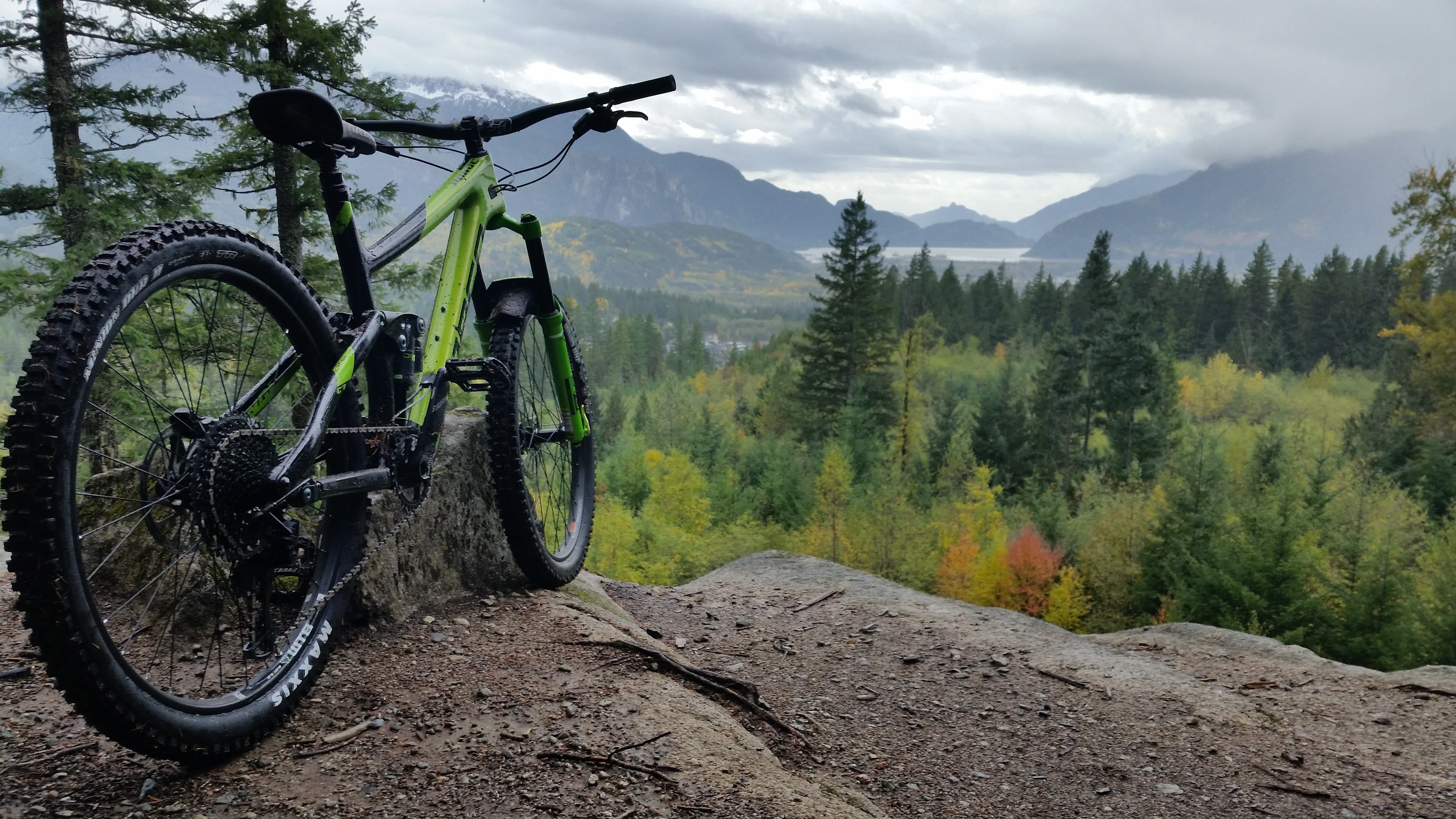
A mountain bike (MTB) or mountain bicycle is a bicycle designed for off-road cycling. Mountain bikes share some similarities with other bicycles, but incorporate features designed to enhance durability and performance in rough terrain, which makes them heavier, more complex and less efficient on smooth surfaces. These typically include a suspension fork, large knobby tires, more durable wheels, more powerful brakes, straight, extra wide handlebars to improve balance and comfort over rough terrain, and wide-ratio gearing optimised for topography and application (e.g., steep climbing or fast descending). Rear suspension is ubiquitous in heavier-duty bikes and now common even in lighter bikes. Dropper posts can be installed to allow the rider to quickly adjust the seat height (an elevated seat position is more effective for pedaling, but poses a hazard in aggressive maneuvers). Mountain bikes are generally specialized for use on mountain trails, single track, fire roads, and othe ... [...More Info...] [...Related Items...] OR: [Wikipedia] [Google] [Baidu] |


