|
Bhandardara Village
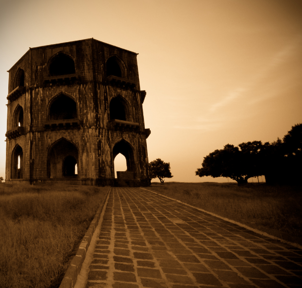
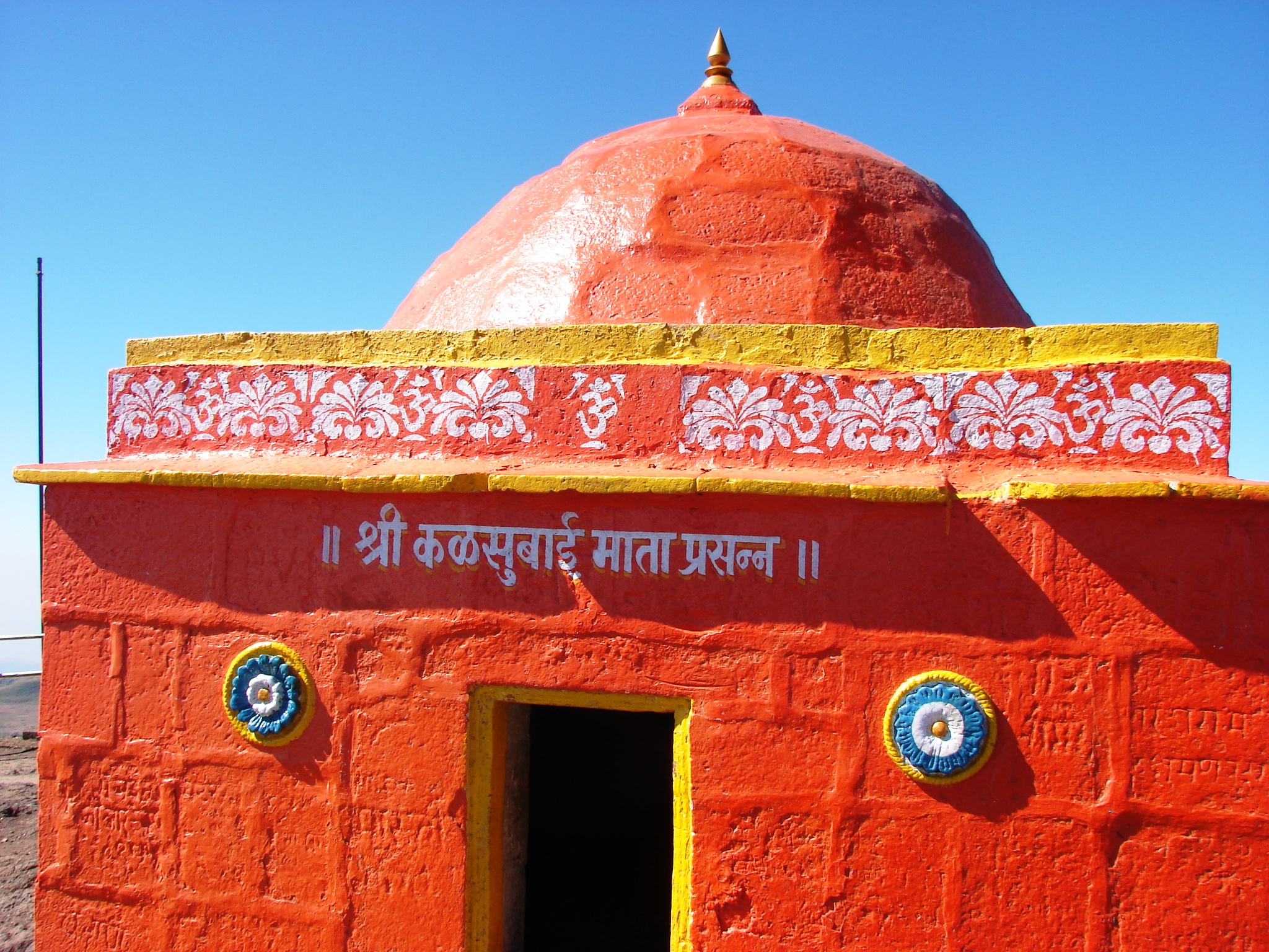
Bhandardara is a holiday resort village near Igatpuri, in the western ghats of India. The village is located in the Akole tehsil, Ahmednagar district of the state of Maharashtra, about from Mumbai and from Ahmednagar. Bhandardara sits by the Pravara River, and the natural environment, waterfalls, mountains, Wilson dam, Arthur lake and Randha falls are tourist attractions. Bhandardara attractions include Wilson Dam and Arthur Lake. The recent attraction in this place is Fireflies camp in the Purushwadi area. There are number of historic and natural places of interest near the dam. From Bhandardara, visitors can climb up to see the Ratangad and Harishchandragad forts. Or visitors can follow the trails that lead to Ajoba and Ghanchakkar peaks. The highest peak in Maharashtra, Mount Kalsubai is 1646 m, and the starting point for this trek is Bari Village, located 12 km away from Bhandardara. Atop, there is a small temple located at the summit, with views of Sahyadris a ... [...More Info...] [...Related Items...] OR: [Wikipedia] [Google] [Baidu] |
States And Territories Of India
India is a federal union comprising 28 states and 8 union territories, with a total of 36 entities. The states and union territories are further subdivided into districts and smaller administrative divisions. History Pre-independence The Indian subcontinent has been ruled by many different ethnic groups throughout its history, each instituting their own policies of administrative division in the region. The British Raj mostly retained the administrative structure of the preceding Mughal Empire. India was divided into provinces (also called Presidencies), directly governed by the British, and princely states, which were nominally controlled by a local prince or raja loyal to the British Empire, which held ''de facto'' sovereignty ( suzerainty) over the princely states. 1947–1950 Between 1947 and 1950 the territories of the princely states were politically integrated into the Indian union. Most were merged into existing provinces; others were organised into ... [...More Info...] [...Related Items...] OR: [Wikipedia] [Google] [Baidu] |
Ahmednagar
Ahmednagar (), is a city located in the Ahmednagar district in the state of Maharashtra, India, about 120 km northeast of Pune and 114 km from Aurangabad. Ahmednagar takes its name from Ahmad Nizam Shah I, who founded the town in 1494 on the site of a battlefield where he won a battle against superior Bahamani forces. It was close to the site of the village of Bhingar. With the breakup of the Bahmani Sultanate, Ahmad established a new sultanate in Ahmednagar, also known as Nizam Shahi dynasty. Ahmednagar has several dozen buildings and sites from the Nizam Shahi period. Ahmednagar Fort, once considered almost impregnable, was used by the British to house Jawaharlal Nehru (the first prime minister of India) and other Indian Nationalists before Indian independence. A few rooms there have been converted to a museum. During his confinement by the British at Ahmednagar Fort in 1944, Nehru wrote the famous book ''The Discovery of India''. Ahmednagar is home to the Indian A ... [...More Info...] [...Related Items...] OR: [Wikipedia] [Google] [Baidu] |
Monsoon
A monsoon () is traditionally a seasonal reversing wind accompanied by corresponding changes in precipitation but is now used to describe seasonal changes in atmospheric circulation and precipitation associated with annual latitudinal oscillation of the Intertropical Convergence Zone (ITCZ) between its limits to the north and south of the equator. Usually, the term monsoon is used to refer to the rainy phase of a seasonally changing pattern, although technically there is also a dry phase. The term is also sometimes used to describe locally heavy but short-term rains. The major monsoon systems of the world consist of the West African, Asia–Australian, the North American, and South American monsoons. The term was first used in English in British India and neighboring countries to refer to the big seasonal winds blowing from the Bay of Bengal and Arabian Sea in the southwest bringing heavy rainfall to the area. Etymology The etymology of the word monsoon is not wholl ... [...More Info...] [...Related Items...] OR: [Wikipedia] [Google] [Baidu] |
Pravara River
Pravara is the smallest of the major tributaries of Godavari river located in Maharashtra, India. Among the 7 major tributaries, it is the only tributary which originates in the Western Ghats akin to Godavari. Also, it is the only major tributary of Godavari to have both its source and confluence located within the same district - Ahmednagar. Etymology As per Indian Vedas, Sage Agastya meditated by consuming only water and air for a long tenure. Due to his incredible devotion, Lord Shiva appeared, blessed him, and left a stream of Ganga that came to be known as the Pravara River. Origin The Pravara rises on the eastern slopes of the Sahayadris between Kulang and Ratangad mountains in the Ahmednagar District of Maharashtra. Course Close to its origin the river flows into the town of Bhandardara. Here, the Bhandardara Dam is constructed across the river forming the Arthur Lake. The gates of the dam are periodically opened, to allow drownstream flow of the Pravara, giving ... [...More Info...] [...Related Items...] OR: [Wikipedia] [Google] [Baidu] |
Sandhan Valley
Akole is a city and Taluka in Akole tehsil, Ahmednagar district in the state of Maharashtra, India. Akole is surrounded by the Sahyadri Mountains of Western Ghats, India. Several historical sites in the city honor Akole's connection to the history and culture of Maharashtra. General Knowledge * Akole being a tehsil has Vidhan Sabha seat. And is included in Shirdi Lok Sabha constituency. *It is the westernmost part of Ahmednagar district. *Akole tehsil is full of tourist places so, is a major tourist attraction. History * It is believed that lord Rama visited Akole after departing to 14 yrs vanvaas. *King Harishchandra built a fort for his wife Taramati known as Harishchandragad it is located in Akole tehsil. *Great Maratha emperor Shivaji Maharaj visited Vishramgad in Akole after looting Surat and halted here for 30 days for recovery from the exhaustion due to Surat tour. Geography * Kalsubai is the highest peak in Maharashtra, standing at . * Ghatghar – situated from Bh ... [...More Info...] [...Related Items...] OR: [Wikipedia] [Google] [Baidu] |
Alang Fort
Alang Fort (also known as Alangad or Alang) is a fort located in the Kalsubai range of the Western Ghats mountains, Nashik, ( Maharashtra, India). Alang Fort, Madangad Fort, Kulang Fort, and the trek connecting them are known as Alang, Madan, and Kulang (AMK). Alang Fort is regarded as one of the most difficult places to reach in the region. As the Maharashtra Culture Government website notes, "Alang-Madan-Kurland is one of Maharashtra's most challenging treks, especially because of its challenging stretches of water and dense forests." This route is suitable for experienced mountaineers. While the forts are difficult to access because of heavy local rains and poorly marked trails, they remain a popular tourist destination. The fort is situated on a large natural plateau. Inside the fort are two caves, a small temple, and 11 water cisterns. The two caves can accommodate up to 40 people. Remnants of historic buildings are spread throughout the fort. To the east of the fort l ... [...More Info...] [...Related Items...] OR: [Wikipedia] [Google] [Baidu] |
Kalsubai
Kalsubai ( mr, कळसूबाई शिखर) is a mountain in the Western Ghats, located in the Indian state of Maharashtra. Its summit, situated at an elevation of , is the highest point in Maharashtra. The mountain range lies within the Kalsubai-Harishchandragad Wildlife Sanctuary. It is visited throughout the year by avid trekkers, Kalsubai temple devotees and wildlife enthusiasts alike. It is named after one of the three sisters Kalsubai, Ratnabai and Katrabai. The other peak Ratangad is named after Ratnabai. Geology The mountain range was formed by the same geological events that gave birth to the Western Ghats. Resting on the Deccan Plateau, a large igneous province, it consists of solidified flood basalt dating back to the Cenozoic era. Geography and topography The peak along with the adjoining hills spans along a downward-slanting east to the west axis eventually merging with the formidable escarpment of the Western Ghats at almost right angles. Along it ... [...More Info...] [...Related Items...] OR: [Wikipedia] [Google] [Baidu] |
Harishchandragad
Harishchandra Fort is a hill fort in the Ahmednagar district of India. Its history is linked with that of Malshej Ghat, kothale village and it has played a major role in guarding and controlling the surrounding region. History The fort is quite ancient. Remnants of Microlithic man have been discovered here. The various Puranas (ancient scriptures) like ''Matsyapurana, Agnipurana and Skandapurana'' include many references about Harishchandragad. Its origin is said to have been in the 6th century, during the rule of Kalachuri dynasty. The citadel was built during this era. The various caves probably have been carved out in the 11th century. In these caves are idols of Lord Vishnu. Though the cliffs are named Taramati and Rohidas, they are not related to Ayodhya. Great sage Changdev (one who created the epic ''Tatvasaar''), used to meditate here in the 14th century. The caves are from the same period. The various constructions on the fort and those existing the surrounding region ... [...More Info...] [...Related Items...] OR: [Wikipedia] [Google] [Baidu] |
Ratangad
Ratangad ( mr, रतनगड) is a fort in Ratan Wadi, Maharashtra, India, overlooking the locale of Bhandardara, one of the oldest artificial catchment area. This fort is located in the Ahmadnagar district of Maharashtra. It is on the boundary of Ahmadnagar and Thane districts. The fort is about 400 years old. This fort is often covered with flowering plants in November. Ratangad is also called Jewel of the Sahyadris. Places to see Ratangad has a natural rock peak with a cavity in it at the top which is called 'Nedhe' or 'Eye of the Needle'. The fort has four gates Ganesh, Hanuman, Konkan and Trimbak. The sculptures of Lord Ganesh and Hanuman are seen on the main gate. It also has many wells on the top. The main attraction at Ratanwadi is the Amruteshwar Temple, famous for its carvings, dating back to the Hemadpant Era - roughly from the eighth century. The fort is origin for the river Pravara/Amrutvahini. The Bhandardara dam (Arthar dam) is built on this river. From the top ... [...More Info...] [...Related Items...] OR: [Wikipedia] [Google] [Baidu] |


