|
Beyul
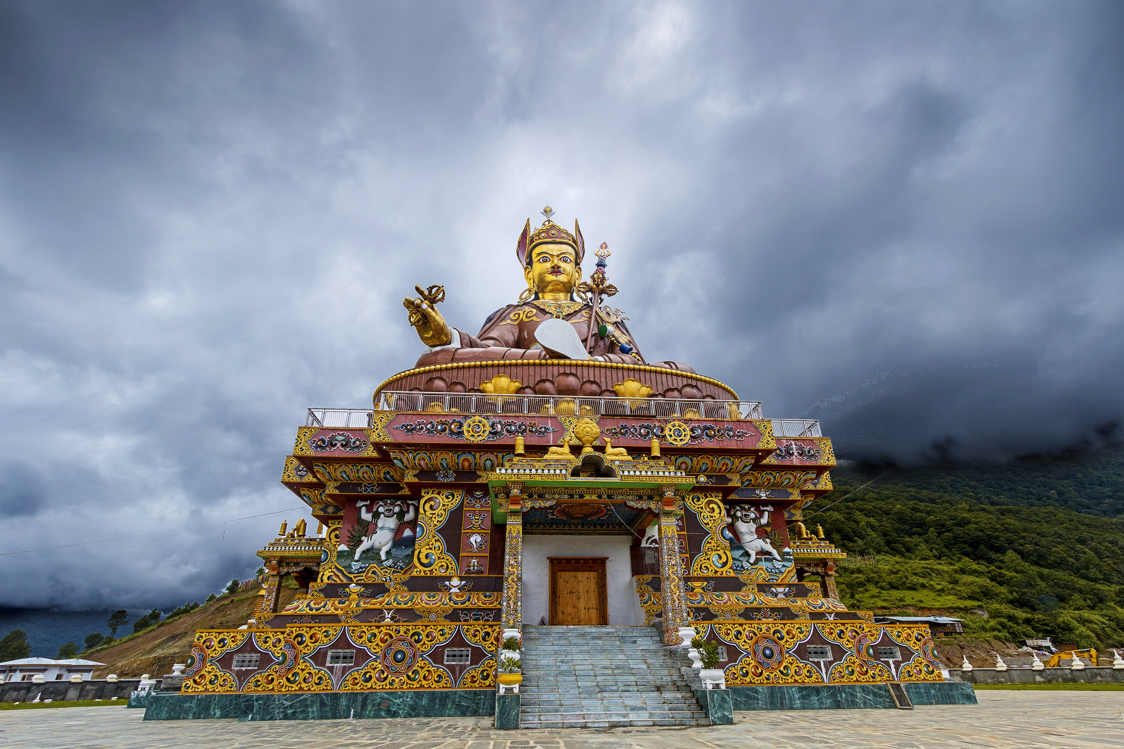
According to the beliefs of the Nyingma school of Tibetan Buddhism, Beyul () are hidden valleys often encompassing hundreds of square kilometers, which Padmasambhava blessed as refuges. Tertöns may reveal them from terma at specific and appropriate times. Their locations were kept on scrolls (lamyig or neyig) hidden under rocks and inside caves, monasteries and stupas. They are places where physical and spiritual worlds overlap and Tantric practice effectiveness increases with multiple perception dimensions. Padmasambhava assigned deities to protect the beyul. Protective forces manifest as snowstorms, mists and snow leopards. Buddhist texts indicate beyul are discovered when the planet is approaching destruction and the world becomes too corrupt for spiritual practice. They describe valleys reminiscent of paradise, which can only be reached with enormous hardship. Pilgrims who travel to these wild and distant places often recount extraordinary experiences similar to those e ... [...More Info...] [...Related Items...] OR: [Wikipedia] [Google] [Baidu] |
Sherpa People
The Sherpa are one of the Tibetan ethnic groups native to the most mountainous regions of Nepal, Tingri County in the Tibet Autonomous Region and the Himalayas. The term ''sherpa'' or ''sherwa'' derives from the Sherpa language words ("east") and ("people"), which refer to their geographical origin of eastern Tibet. Most Sherpa people live in the eastern regions of Nepal and Tingri County, though some live farther west in the Rolwaling Valley, Bigu and in the Helambu region north of Kathmandu, Nepal. Sherpas establish gompas where they practice their religious traditions. Tengboche was the first celibate monastery in Solu-Khumbu. Sherpa people also live in Tingri County, Bhutan, and the Indian states of Sikkim and the northern portion of West Bengal, specifically the district of Darjeeling. The Sherpa language belongs to the south branch of the Tibeto-Burman languages, mixed with Eastern Tibet (Khamba) and central Tibetan dialects. However, this language is separate from L ... [...More Info...] [...Related Items...] OR: [Wikipedia] [Google] [Baidu] |
Tibetan Buddhism
Tibetan Buddhism (also referred to as Indo-Tibetan Buddhism, Lamaism, Lamaistic Buddhism, Himalayan Buddhism, and Northern Buddhism) is the form of Buddhism practiced in Tibet and Bhutan, where it is the dominant religion. It is also in majority regions surrounding the Himalayan areas of India (such as Ladakh, Sikkim, Arunachal Pradesh, and a minority in Himachal Pradesh and Uttarakhand), in much of Central Asia, in the southern Siberian regions such as Tuva, and in Mongolia. Tibetan Buddhism evolved as a form of Mahāyāna Buddhism stemming from the latest stages of Indian Buddhism (which also included many Vajrayāna elements). It thus preserves many Indian Buddhist tantric practices of the post-Gupta early medieval period (500 to 1200 CE), along with numerous native Tibetan developments. In the pre-modern era, Tibetan Buddhism spread outside of Tibet primarily due to the influence of the Mongol Yuan dynasty (1271–1368), founded by Kublai Khan, which had ruled China, ... [...More Info...] [...Related Items...] OR: [Wikipedia] [Google] [Baidu] |
Bomê County
Pome County () or Bomê County () is a county of Nyingchi Prefecture in the south-east of the Tibet Autonomous Region. Historically known as Powo or Poyul, it was the seat of a quasi-independent kingdom until the early 20th century when troops of the Dalai Lama's Lhasa government integrated it into the central Tibetan realm. The population was 25,897 in 2004. Geography The region of Powo or Poyul, which is now constituted as the Pome County, lies to the northeast of the Tsangpo gorge, where the Yarlung Tsangpo (Brahmaputra) river turns abruptly to the south on its course towards India. Two major rivers Yi'ong Tsangpo and Parlung Tsangpo flow into the Pome County from opposite directions to join near Tang-me. The combined river (called Yi'ong Tsangpo) exits the Pome County to the south to join Yarlung Tsangpo near Mount Gyala Peri. OpenStre ... [...More Info...] [...Related Items...] OR: [Wikipedia] [Google] [Baidu] |
Nyingma
Nyingma (literally 'old school') is the oldest of the four major schools of Tibetan Buddhism. It is also often referred to as ''Ngangyur'' (, ), "order of the ancient translations". The Nyingma school is founded on the first lineages and translations of Buddhist scriptures from Sanskrit into Tibetan in the eighth century, during the reign of King Trisong Detsen (r. 710–755). Nyingma traditional histories consider their teachings to trace back to the first Buddha Samantabhadra (Güntu Sangpo) and Indian mahasiddhas such as Garab Dorjé, Śrī Siṃha and Jñānasūtra. Traditional sources trace the origin of the Nyingma order in Tibet to figures associated with the initial introduction of Buddhism in the 8th century, such as Padmasambhava, Yeshe Tsogyal, Vimalamitra, Vairotsana, Buddhaguhya and Śāntarakṣita, Shantaraksita. The Nyingma tradition is also seen having been founded at Samye, Samyé, the first monastery in Tibet. Nyingma teachings are also known for having be ... [...More Info...] [...Related Items...] OR: [Wikipedia] [Google] [Baidu] |
Powo Kingdom
The Kingdom of Powo or sPo bo () was a kingdom located in present-day Bomê County, Tibet. The ruler of Powo used the title Kanam Gyelpo (''kaH gnam rgyal po'') or Kanam Depa (''kaH gnam sde pa''). It was said that the monarchs of Powo were descendants of Drigum Tsenpo. The kingdom was annexed by Qing China in 1910, but the King restored it the next year. In 1928, the kingdom was annexed by Tibet Tibet (; ''Böd''; ) is a region in East Asia, covering much of the Tibetan Plateau and spanning about . It is the traditional homeland of the Tibetan people. Also resident on the plateau are some other ethnic groups such as Monpa people, .... References History of Tibet Former countries in Chinese history States and territories disestablished in 1928 {{Tibet-stub ... [...More Info...] [...Related Items...] OR: [Wikipedia] [Google] [Baidu] |
Langtang
Langtang valley is a Himalayan valley in the mountains of north-central Nepal, known for its trekking routes and natural environment. Administrative The Langtang valley lies in the Rasuwa district of the Bagmati Province in Nepal. Situated 80 kilometres north of the Kathmandu Valley, the valley lies within the Langtang national park, which borders the Tibet autonomous region of China. Prior to the 2015 earthquake, 668 individuals are estimated to have lived within the Langtang valley. Ecology The Langtang valley lies within the Langtang National Park. The park contains a wide variety of climatic zones, from subtropical to alpine. Approximately 25% of the park is forested. Trees include the deciduous oak and maple, evergreens like pine, and various types of rhododendron. Animal life includes the Himalayan black bear, Himalayan tahr, Assam macaque, snow leopard, yak, red panda and more than 250 species of birds. Culture Among themselves, the local inhabitants of the ... [...More Info...] [...Related Items...] OR: [Wikipedia] [Google] [Baidu] |
Barun Valley
Barun Valley () is a Himalayan valley situated at the base of Mt. Makalu in the Sankhuwasabha district of Nepal. This valley rests entirely inside the Makalu Barun National Park. The Barun Valley provides stunning contrasts, where high waterfalls cascade into deep gorges, craggy rocks rise from lush green forests, and colourful flowers bloom beneath white snow peaks. This unique landscape shelters some of the last pristine mountain ecosystems on earth. Rare species of animals and plants flourish in diverse climates and habitats, relatively undisturbed by humankind. History The valley was created by the Barun River which becomes a glacier in winter. The river is known as Chukchuwa in the local Limbu language. The study has shown that this place was originally inhabited by Yakkha and Limbu centuries ago. Beyul In the ancient religious Buddhist books, seven Beyul ( Nghe-Beyul Khimpalung) situated in the Himalayan region are described as mystical and spectacularly beautiful evergre ... [...More Info...] [...Related Items...] OR: [Wikipedia] [Google] [Baidu] |
Pakistan
Pakistan ( ur, ), officially the Islamic Republic of Pakistan ( ur, , label=none), is a country in South Asia. It is the world's List of countries and dependencies by population, fifth-most populous country, with a population of almost 243 million people, and has the world's Islam by country#Countries, second-largest Muslim population just behind Indonesia. Pakistan is the List of countries and dependencies by area, 33rd-largest country in the world by area and 2nd largest in South Asia, spanning . It has a coastline along the Arabian Sea and Gulf of Oman in the south, and is bordered by India to India–Pakistan border, the east, Afghanistan to Durand Line, the west, Iran to Iran–Pakistan border, the southwest, and China to China–Pakistan border, the northeast. It is separated narrowly from Tajikistan by Afghanistan's Wakhan Corridor in the north, and also shares a maritime border with Oman. Islamabad is the nation's capital, while Karachi is its largest city and fina ... [...More Info...] [...Related Items...] OR: [Wikipedia] [Google] [Baidu] |
China
China, officially the People's Republic of China (PRC), is a country in East Asia. It is the world's most populous country, with a population exceeding 1.4 billion, slightly ahead of India. China spans the equivalent of five time zones and borders fourteen countries by land, the most of any country in the world, tied with Russia. Covering an area of approximately , it is the world's third largest country by total land area. The country consists of 22 provinces, five autonomous regions, four municipalities, and two Special Administrative Regions (Hong Kong and Macau). The national capital is Beijing, and the most populous city and financial center is Shanghai. Modern Chinese trace their origins to a cradle of civilization in the fertile basin of the Yellow River in the North China Plain. The semi-legendary Xia dynasty in the 21st century BCE and the well-attested Shang and Zhou dynasties developed a bureaucratic political system to serve hereditary monarchies, or dyna ... [...More Info...] [...Related Items...] OR: [Wikipedia] [Google] [Baidu] |
India
India, officially the Republic of India (Hindi: ), is a country in South Asia. It is the seventh-largest country by area, the second-most populous country, and the most populous democracy in the world. Bounded by the Indian Ocean on the south, the Arabian Sea on the southwest, and the Bay of Bengal on the southeast, it shares land borders with Pakistan to the west; China, Nepal, and Bhutan to the north; and Bangladesh and Myanmar to the east. In the Indian Ocean, India is in the vicinity of Sri Lanka and the Maldives; its Andaman and Nicobar Islands share a maritime border with Thailand, Myanmar, and Indonesia. Modern humans arrived on the Indian subcontinent from Africa no later than 55,000 years ago., "Y-Chromosome and Mt-DNA data support the colonization of South Asia by modern humans originating in Africa. ... Coalescence dates for most non-European populations average to between 73–55 ka.", "Modern human beings—''Homo sapiens''—originated in Africa. Then, int ... [...More Info...] [...Related Items...] OR: [Wikipedia] [Google] [Baidu] |
Bhutan
Bhutan (; dz, འབྲུག་ཡུལ་, Druk Yul ), officially the Kingdom of Bhutan,), is a landlocked country in South Asia. It is situated in the Eastern Himalayas, between China in the north and India in the south. A mountainous country, Bhutan is known as "Druk Yul," or "Land of the Thunder Dragon". Nepal and Bangladesh are located near Bhutan but do not share a land border. The country has a population of over 727,145 and territory of and ranks 133rd in terms of land area and 160th in population. Bhutan is a Constitutional Democratic Monarchy with King as head of state and Prime Minister as head of government. Mahayana and Vajrayana Buddhism is the state religion and the Je Khenpo is the head of state religion. The subalpine Himalayan mountains in the north rise from the country's lush subtropical plains in the south. In the Bhutanese Himalayas, there are peaks higher than above sea level. Gangkhar Puensum is Bhutan's highest peak and is the highest uncl ... [...More Info...] [...Related Items...] OR: [Wikipedia] [Google] [Baidu] |

.jpeg/1200px-Tibetan_Buddhism_(214837929).jpeg)

