|
Betuwe
Batavia (; , ) is a historical and geographical region in the Netherlands, forming large fertile islands in the river delta formed by the waters of the Rhine (Dutch: ''Rijn'') and Meuse (Dutch: ''Maas'') rivers. During the Roman empire, it was an important frontier region and source of imperial soldiers. Its name is possibly pre-Roman. Administratively, the modern version, Betuwe, is a part of the modern province of Gelderland and although the rivers and provinces have changed over history it is roughly the same. Today it has the Waal river on the south and the Lek and Nederrijn in the north (all rivers which start in the delta itself and are branches of the Rhine or Maas). Historically, the former municipality of Rijnwaarden belonged to Betuwe, now in Zevenaar, which was cut off by the building of the Pannerdens Kanaal. A major freight railroad, the Betuweroute, passes through the Betuwe. It was opened in 2007 after many years of controversy. The Betuwe region is divided into 9 ... [...More Info...] [...Related Items...] OR: [Wikipedia] [Google] [Baidu] |
Nederrijn
300px, Course of the Nederrijn Nederrijn (; "Lower Rhine"; not to be confused with the section called Lower Rhine further upstream) is the name of the Dutch part of the Rhine from the confluence at the town of Angeren of the cut-off Rhine bend of Oude Rijn (Gelderland) and the Pannerdens Kanaal (which was dug to form the new connection between the Waal and Nederrijn branches). The city of Arnhem lies on the right (north) bank of the Nederrijn, just past the point where the IJssel branches off. The Nederrijn flows on to the city of Wijk bij Duurstede, from where it continues as the Lek. The once-important but now small Kromme Rijn branch (in Roman times part of the Limes Germanicus and border river of the Roman Empire) carries the name "Rhine" towards the city of Utrecht. From the city of Utrecht Kromme Rijn forks into the Vecht to the north, and into the Oude Rijn (Utrecht and South Holland) to the west. The first part is channelised and known as Leidse Rijn (Leiden Rhine), aft ... [...More Info...] [...Related Items...] OR: [Wikipedia] [Google] [Baidu] |
Tiel
Tiel () is a municipality and a town in the middle of the Netherlands. The town is enclosed by the Waal river and the Linge river to the South and the North, and the Amsterdam-Rhine Canal to the East. Tiel comprises the population centres Kapel-Avezaath, Tiel and Wadenoijen. The city was founded in the 5th century CE. The town of Tiel Tiel is the largest town in the Betuwe area, which is famous for being one of the centres of Dutch fruit production. Orchards in the area produce apples, pears, plums and cherries. Tiel once housed the famous jam factory ''De Betuwe''. After production was moved to Breda in 1993, the entire complex was demolished, although a part was reconstructed later. Reminding of this industry is a jam manufacturing museum and a statue of Flipje, the raspberry-based comic figure who starred in De Betuwe's, jam factory advertisements since the 1930s. Originally located on the Linge river Tiel became an important centre of trade in the early Middle Ages, ... [...More Info...] [...Related Items...] OR: [Wikipedia] [Google] [Baidu] |
Buren
Buren () is a town and municipality in the Betuwe region of the Netherlands. Buren has 27,168 inhabitants as of 1 January 2022. Geography Buren is located in Gelderland, a province of the Netherlands. It is part of the landscape of Betuwe, a very fertile strip of land between two branches of Rhine-Meuse Delta, the Nederrijn in the north and the Waal in the south. Population Centers Population centers include: History The earliest known settlement of the region occurred as early as 772. The castle was built by the Lords of Buren and was first mentioned in 1298. The town was granted city rights in 1395 by Sir Alard IV of Buren which led to the construction of a defensive wall and a moat, significant portions of which still stand. In 1492, the region was promoted to a county (i.e. a territory ruled by a count) but had limited economic influence due to its geographic isolation. By 1574, the previously Catholic parish church of Saint-Lambert ( nl, Sint Lambertus) became Calvin ... [...More Info...] [...Related Items...] OR: [Wikipedia] [Google] [Baidu] |
Neder-Betuwe
Neder-Betuwe () is a municipality in the province of Gelderland, in the east of the Netherlands. On 1 April 2003, it was established as the new name of the redivided municipality of Kesteren. Neder-Betuwe counted 25,042 inhabitants on 1 january 2022. History Archaeological excavations have found remains dating back to the Stone Age and Iron Age although it is not known if the area was permanently inhabited. The Neder-Betuwe area is along the northernmost border or limes of the Roman empire. Evidence suggests that a Roman fort (Castra) was maintained where the town of Kesteren now is. Around 1300 the first dikes were put up to protect the inhabitants and agricultural lands from flooding. Most churches are reformed, there are no Catholic churches in the Neder-Betuwe area. The eastern municipal border also marks an invisible religious border, to the east a considerable part of the population is Catholic. This can be explained by the presence of a dike called the Spanjaardsdijk or S ... [...More Info...] [...Related Items...] OR: [Wikipedia] [Google] [Baidu] |
Overbetuwe
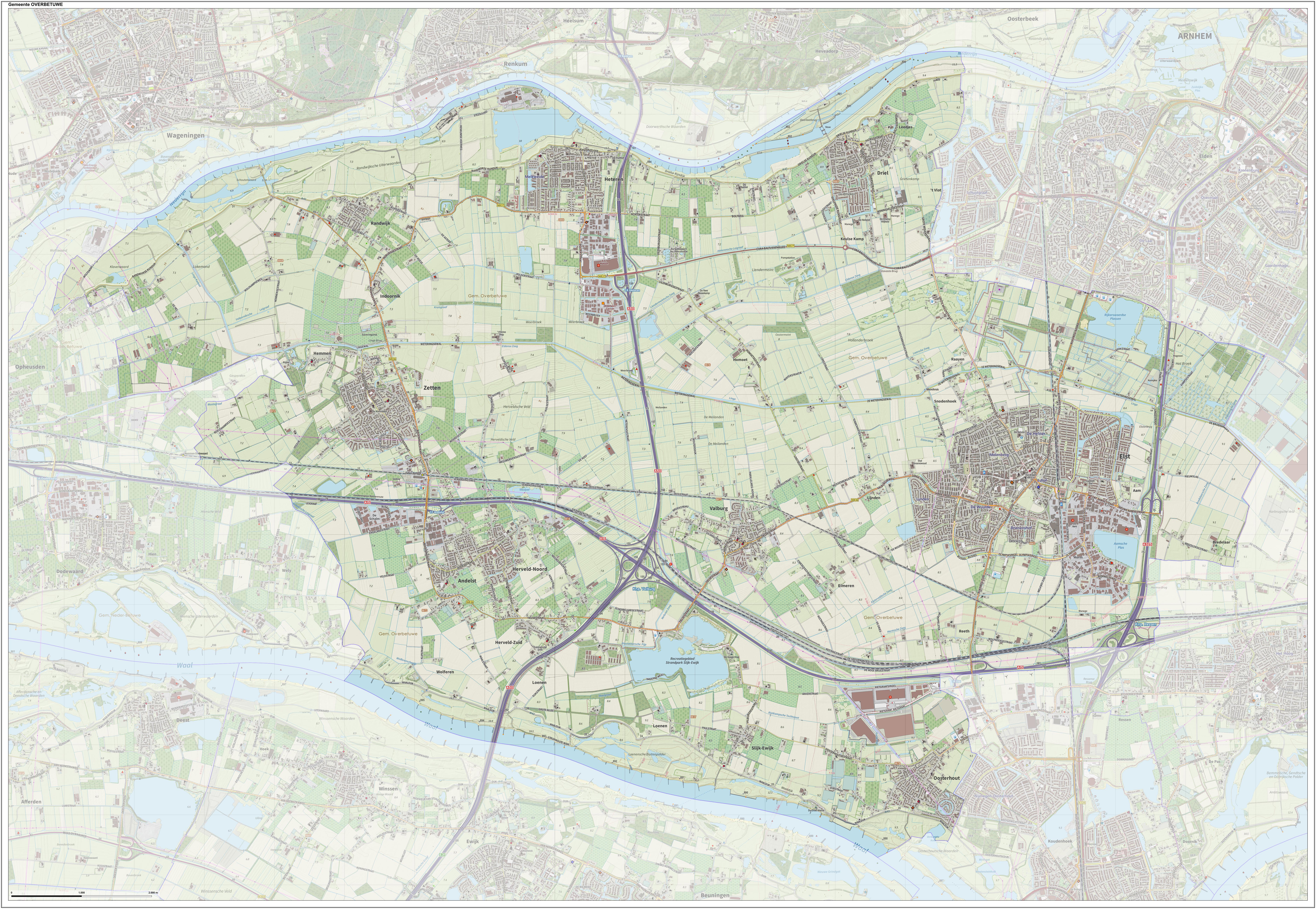
Overbetuwe () is a municipality in the province of Gelderland in the Netherlands. It was formed on 1 January 2001 as a merger of three former municipalities: Elst, Heteren and Valburg. Overbetuwe is bordered in the north by the river Rhine and in the south by the river Waal. The city hall is located in Elst, the largest town in the municipality. Together with eighteen other municipalities it forms the ' Knooppunt Arnhem-Nijmegen' (English: 'Arnhem-Nijmegen conurbation'), or simply 'KAN', which is a regional collaboration. Towns Transportation Because of its central location between the cities of Nijmegen and Arnhem, many inhabitants of Overbetuwe commute between these cities. Three major highways are situated in the municipality; the A50, A15 and A325. Overbetuwe has two railway stations: Elst and Zetten-Andelst. Besides these two existing railway lines, a controversial freight line called the Betuweroute has been operational from 2007. Politics The gemeenteraad (city co ... [...More Info...] [...Related Items...] OR: [Wikipedia] [Google] [Baidu] |
Nijmegen
Nijmegen (;; Spanish and it, Nimega. Nijmeegs: ''Nimwèège'' ) is the largest city in the Dutch province of Gelderland and tenth largest of the Netherlands as a whole, located on the Waal river close to the German border. It is about 60 km south east of Utrecht and 50 km north east of Eindhoven. Nijmegen is the oldest city in the Netherlands, the second to be recognized as such in Roman times, and in 2005 celebrated 2,000 years of existence. Nijmegen became a free imperial city in 1230 and in 1402 a Hanseatic city. Since 1923 it has been a university city with the opening of a Catholic institution now known as the Radboud University Nijmegen. The city is well known for the International Four Days Marches Nijmegen event. Its population in 2022 was 179,000; the municipality is part of the Arnhem–Nijmegen metropolitan area, with 736,107 inhabitants in 2011. Population centres The municipality is formed by the city of Nijmegen, incorporating the former villages of Ha ... [...More Info...] [...Related Items...] OR: [Wikipedia] [Google] [Baidu] |
Arnhem
Arnhem ( or ; german: Arnheim; South Guelderish: ''Èrnem'') is a city and municipality situated in the eastern part of the Netherlands about 55 km south east of Utrecht. It is the capital of the province of Gelderland, located on both banks of the rivers Nederrijn and Sint-Jansbeek, which was the source of the city's development. Arnhem had a population of 163.972 on 1 December 2021, which made it one of the larger cities of the Netherlands. The municipality is part of the Arnhem–Nijmegen metropolitan area, which has a combined number of 774,506 inhabitants on 31 January 2022. Arnhem is home to the Hogeschool van Arnhem en Nijmegen, ArtEZ Institute of the Arts, Netherlands Open Air Museum, Airborne Museum 'Hartenstein', Royal Burgers' Zoo, NOC*NSF and National Sports Centre Papendal. The north corner of the municipality is part of the Hoge Veluwe National Park. It is approximately in area, consisting of heathlands, sand dunes, and woodlands. History Early history T ... [...More Info...] [...Related Items...] OR: [Wikipedia] [Google] [Baidu] |
Lingewaard
Lingewaard () is a municipality in the eastern Netherlands. It is located in the province of Gelderland, in the most eastern part of the Betuwe. The municipality is situated in the lowlands between the major cities of Arnhem and Nijmegen, where most inhabitants work. Lingewaard was part of the Arnhem–Nijmegen metropolitan area until 2015. Population centres The municipality of Lingewaard consists of the undermentioned population centres. Lingewaard was formed in 2001 as a merger between the former municipalities of Bemmel, Gendt and Huissen. The municipality was initially named Bemmel after the largest former municipality, but later renamed 'Lingewaard' in a referendum. 'Lingewaard' itself is not a population centre but an artificial name for the municipality, which is favoured by the majority of the voters. The industrial park and hamlet of Looveer (included with Loo) comprises a small area located across the Pannerden Canal. Other notable hamlets in Lingewaard are Hulh ... [...More Info...] [...Related Items...] OR: [Wikipedia] [Google] [Baidu] |
Municipality
A municipality is usually a single administrative division having corporate status and powers of self-government or jurisdiction as granted by national and regional laws to which it is subordinate. The term ''municipality'' may also mean the governing body of a given municipality. A municipality is a general-purpose administrative subdivision, as opposed to a special-purpose district. The term is derived from French and Latin . The English word ''municipality'' derives from the Latin social contract (derived from a word meaning "duty holders"), referring to the Latin communities that supplied Rome with troops in exchange for their own incorporation into the Roman state (granting Roman citizenship to the inhabitants) while permitting the communities to retain their own local governments (a limited autonomy). A municipality can be any political jurisdiction, from a sovereign state such as the Principality of Monaco, to a small village such as West Hampton Dunes, New York. Th ... [...More Info...] [...Related Items...] OR: [Wikipedia] [Google] [Baidu] |
Betuweroute
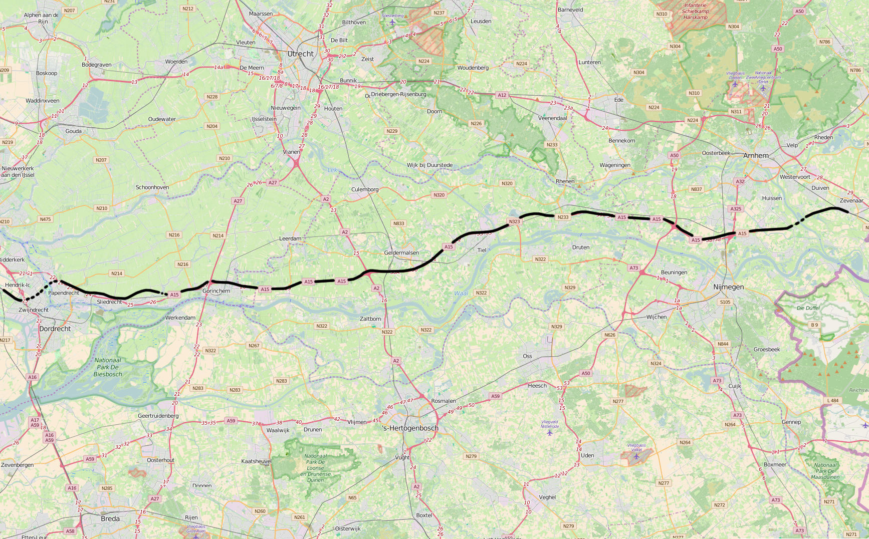
The Betuweroute is a double track freight railway between Rotterdam and Germany. is the official name, after the Betuwe area through which the route passes. The line is popularly called Betuwelijn, after an older track in the same region. The line extends into Germany as the Oberhausen–Arnhem railway, and it is part of Project 5 of the Trans-European Transport Network (TEN-T). History In 1985 the Van Bonde Commission began to investigate the future of west–east transport. The main advocate of the proposed line was the then minister Neelie Kroes, later Commissioner in the European Union until 2014. In 1992 the German and Dutch governments signed the Treaty of Warnemünde, which addressed enhancing rail traffic and focused on the tracks from Amsterdam and Rotterdam to Duisburg. The original plan was for three branch rail lines towards Germany. The northern branch via Oldenzaal was abandoned in 1999 and the southern branch via Venlo was abandoned in 2004. Also in 2004, ... [...More Info...] [...Related Items...] OR: [Wikipedia] [Google] [Baidu] |


