|
Berfilya
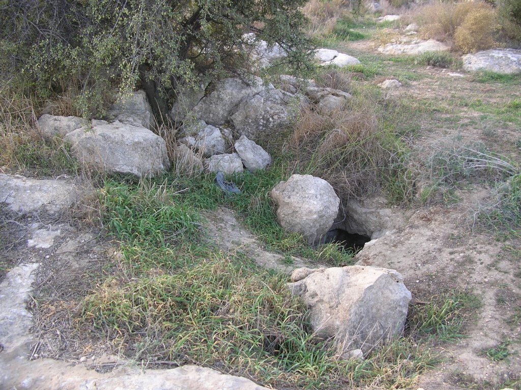
Barfiliya ( ar, برفيلية) was a Palestinian people, Palestinian village located east of Ramla that was depopulated during the 1948 Arab–Israeli War. Located on a Tell (archaeology), tell, excavations conducted there by Israeli archaeologists beginning in 1995 found artifact (archaeology), artifacts dating back to the Pre-Pottery Neolithic A (PPNA) period (circa 9,500-8,000 BCE). Barfiliya lay on a road between Jerusalem and Lod, Lydda that was built in Roman times. During the Crusades, it was known as ''Porfylia''. In the early Ottoman Empire, Ottoman era, it was a small village of 44 inhabitants. By 1945, before the end of the Mandatory Palestine and the outbreak of 1948 Arab–Israeli War, its population had grown to 730. Depopulated on July 14, 1948, Barifiliya was subsequently destroyed. Geography Barfiliya was located in Wadi Jaar, along with the villages of Innaba, Annabeh, Al-Burj, Ramla, Al-Burj, and Bir Ma'in, Bir Main.Saunders et al., 1881, p 44 A high road betw ... [...More Info...] [...Related Items...] OR: [Wikipedia] [Google] [Baidu] |
Palestine Exploration Fund
The Palestine Exploration Fund is a British society based in London. It was founded in 1865, shortly after the completion of the Ordnance Survey of Jerusalem, and is the oldest known organization in the world created specifically for the study of the Levant region, also known as Palestine. Often simply known as the PEF, its initial objective was to carry out surveys of the topography and ethnography of Ottoman Palestine – producing the PEF Survey of Palestine – with a remit that fell somewhere between an expeditionary survey and military intelligence gathering. It had a complex relationship with Corps of Royal Engineers, and its members sent back reports on the need to salvage and modernise the region.Ilan Pappé (2004) A history of modern Palestine: one land, two peoples Cambridge University Press, pp 34-35 History Following the completion of the Ordnance Survey of Jerusalem, the Biblical archaeologists and clergymen who supported the survey financed the creation of t ... [...More Info...] [...Related Items...] OR: [Wikipedia] [Google] [Baidu] |
Wadi
Wadi ( ar, وَادِي, wādī), alternatively ''wād'' ( ar, وَاد), North African Arabic Oued, is the Arabic term traditionally referring to a valley. In some instances, it may refer to a wet (ephemeral) riverbed that contains water only when heavy rain occurs. Etymology The term ' is very widely found in Arabic toponyms. Some Spanish toponyms are derived from Andalusian Arabic where ' was used to mean a permanent river, for example: Guadalcanal from ''wādī al-qanāl'' ( ar, وَادِي الْقَنَال, "river of refreshment stalls"), Guadalajara from ''wādī al-ḥijārah'' ( ar, وَادِي الْحِجَارَة, "river of stones"), or Guadalquivir, from ''al-wādī al-kabīr'' ( ar, اَلْوَادِي الْكَبِير, "the great river"). General morphology and processes Wadis are located on gently sloping, nearly flat parts of deserts; commonly they begin on the distal portions of alluvial fans and extend to inland sabkhas or dry lakes. In basin and r ... [...More Info...] [...Related Items...] OR: [Wikipedia] [Google] [Baidu] |
Diocese
In Ecclesiastical polity, church governance, a diocese or bishopric is the ecclesiastical district under the jurisdiction of a bishop. History In the later organization of the Roman Empire, the increasingly subdivided Roman province, provinces were administratively associated in a larger unit, the Roman diocese, diocese (Latin ''dioecesis'', from the Greek language, Greek term διοίκησις, meaning "administration"). Christianity was given legal status in 313 with the Edict of Milan. Churches began to organize themselves into Roman diocese, dioceses based on the Roman diocese, civil dioceses, not on the larger regional imperial districts. These dioceses were often smaller than the Roman province, provinces. Christianity was declared the Empire's State church of the Roman Empire, official religion by Theodosius I in 380. Constantine the Great, Constantine I in 318 gave litigants the right to have court cases transferred from the civil courts to the bishops. This situ ... [...More Info...] [...Related Items...] OR: [Wikipedia] [Google] [Baidu] |
Kingdom Of Jerusalem
The Kingdom of Jerusalem ( la, Regnum Hierosolymitanum; fro, Roiaume de Jherusalem), officially known as the Latin Kingdom of Jerusalem or the Frankish Kingdom of Palestine,Example (title of works): was a Crusader state that was established in the Levant immediately after the First Crusade. It lasted for almost two hundred years, from the accession of Godfrey of Bouillon in 1099 until the siege of Acre in 1291. Its history is divided into two periods with a brief interruption in its existence, beginning with its collapse after the siege of Jerusalem in 1187 and its restoration after the Third Crusade in 1192. The original Kingdom of Jerusalem lasted from 1099 to 1187 before being almost entirely overrun by the Ayyubid Sultanate under Saladin. Following the Third Crusade, it was re-established in Acre in 1192. The re-established state is commonly known as the "Second Kingdom of Jerusalem" or alternatively as the "Kingdom of Acre" after its new capital city. Acre remained t ... [...More Info...] [...Related Items...] OR: [Wikipedia] [Google] [Baidu] |
Beit Iksa
Beit Iksa ( ar, بيت إكسا;) is a Palestinian village in the Jerusalem Governorate, located northwest of Jerusalem in the West Bank. The village is surrounded on all sides by the Israeli West Bank barrier, and outside Palestinians are denied access through the one Israeli checkpoint leading to it. In 2014 Israeli military authorities announced they would confiscate a further 3,167 acres of Beit Iksa lands, leaving the township, according to the village head, Saada al-Khatib, as a 2,500-dunum area. Beit Iksa contains two primary schools run by the Palestinian National Authority. Students attending secondary school travel to Jerusalem or nearby towns for education. Location Beit Iksa is a Palestinian village located (horizontally) north-west of Jerusalem. It is bordered by Beit Hanina al Balad and Shu'fat to the east, An Nabi Samwil to the north, Beit Surik and Lifta to the west. History Beit Iksa lies on one of the historical routes that joined the Mediterranean coasta ... [...More Info...] [...Related Items...] OR: [Wikipedia] [Google] [Baidu] |
Biddu
Biddu Appaiah (born 8 February 1944) is a British-Indian singer-songwriter, composer, and music producer who composed and produced many worldwide hit records during a career spanning five decades. Considered one of the pioneers of disco, Euro disco, and Indian pop, he has sold millions of records worldwide, and has received an Ivor Novello award for his work. He has been ranked at number 34 on '' NME''s "The 50 Greatest Producers Ever" list. Biddu was born in Bangalore, Karnataka, India. He began his music career in the 1960s, singing as part of a music band in India before moving to England where he would start his career as a producer. He eventually found some success producing a hit song for Japanese band The Tigers in 1969, scoring the soundtrack for 1972 British film ''Embassy'', and producing several early disco songs that would find a niche audience in British northern soul clubs during the early 1970s. His international breakthrough came in 1974 with " Kung Fu Fight ... [...More Info...] [...Related Items...] OR: [Wikipedia] [Google] [Baidu] |
Beit Liqya
Beit Liqya ( ar, بيت لقيا) is a Palestinian town located in the Ramallah and al-Bireh Governorate in the northern West Bank. According to the Palestinian Central Bureau of Statistics, it had a population of approximately 7,710 in 2007, of whom 3,799 were male and 3,911 were female. Location Beit Liqya is located 13.5 km southwest of Ramallah. It is bordered by Beit ‘Anan and Beit ‘Ur al Foqa to the east, Kharbatha al Misbah to the north, Beit Sira and Beit Nuba to the west, and Beit Nuba and Kharayib Umm al Lahim to the south. History In 1882, Conder and Kitchener suggested identifying Beit Liqya with the biblical ''Eltekeh'' of .Conder and Kitchener, 1881, SWP III, p16/ref> However, later researchers have suggested Tel Shalaf, north of Ge'alya as the location of ''Eltekeh''. Medieval period In the early 1200, the revenues from Beit Liqya were given as a waqf designated for the Al-Haram al-Sharif. Ottoman era Beit Liqya, like the rest of Palestine, w ... [...More Info...] [...Related Items...] OR: [Wikipedia] [Google] [Baidu] |
Palestine (region)
Palestine ( el, Παλαιστίνη, ; la, Palaestina; ar, فلسطين, , , ; he, פלשתינה, ) is a geographic region in Western Asia. It is usually considered to include Israel and the State of Palestine (i.e. West Bank and Gaza Strip), though some definitions also include part of northwestern Jordan. The first written records to attest the name of the region were those of the Twentieth dynasty of Egypt, which used the term "Peleset" in reference to the neighboring people or land. In the 8th century, Assyrian inscriptions refer to the region of "Palashtu" or "Pilistu". In the Hellenistic period, these names were carried over into Greek, appearing in the Histories of Herodotus in the more recognizable form of "Palaistine". The Roman Empire initially used other terms for the region, such as Judaea, but renamed the region Syria Palaestina after the Bar Kokhba revolt. During the Byzantine period, the region was split into the provinces of Palaestina Prima, Palaestin ... [...More Info...] [...Related Items...] OR: [Wikipedia] [Google] [Baidu] |
Roman Empire
The Roman Empire ( la, Imperium Romanum ; grc-gre, Βασιλεία τῶν Ῥωμαίων, Basileía tôn Rhōmaíōn) was the post-Republican period of ancient Rome. As a polity, it included large territorial holdings around the Mediterranean Sea in Europe, North Africa, and Western Asia, and was ruled by emperors. From the accession of Caesar Augustus as the first Roman emperor to the military anarchy of the 3rd century, it was a Principate with Italia as the metropole of its provinces and the city of Rome as its sole capital. The Empire was later ruled by multiple emperors who shared control over the Western Roman Empire and the Eastern Roman Empire. The city of Rome remained the nominal capital of both parts until AD 476 when the imperial insignia were sent to Constantinople following the capture of the Western capital of Ravenna by the Germanic barbarians. The adoption of Christianity as the state church of the Roman Empire in AD 380 and the fall of the Western ... [...More Info...] [...Related Items...] OR: [Wikipedia] [Google] [Baidu] |
Bethoron
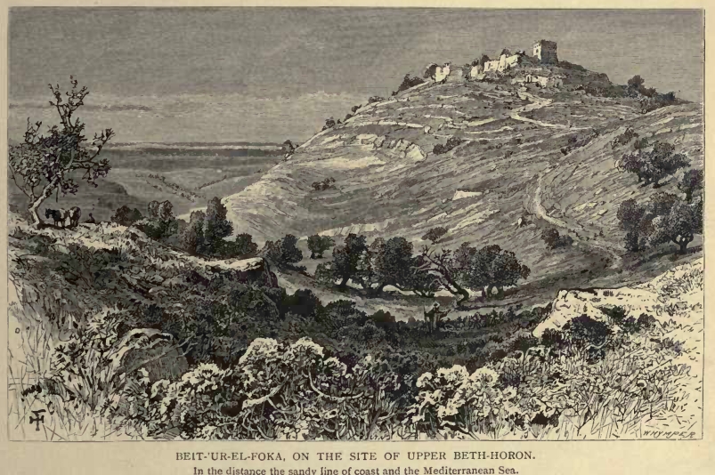
Bethoron ( he, בֵית־חוֹרֹ֔ן, lit=house of Horon; grc, Ὡρωνείν), also Beth-Horon, was the name of two adjacent ancient towns strategically located on the Gibeon-Aijalon road, guarding the "ascent of Beth-Horon". The towns are mentioned in the Hebrew Bible and in other ancient sources: Upper Bethoron appears in ''Joshua'' and Lower Bethoron in ''Joshua'' and ''1 Chronicles'' and I Maccabees 3:16. The ancient towns of Upper Bethoron and Lower Bethoron are identified respectively with the present day Palestinian Arab villages of Beit Ur al-Fauqa and Beit Ur al-Tahta, which are believed to preserve the ancient names. Etymology The Hebrew name Bethoron (Beit Horon, ) is derived from the name of an Egypto- Canaanite deity, ''Horon'', mentioned in Ugaritic literature. The city is mentioned among the cities and towns smitten by Sheshonq I in his inscription at the Temple of Karnak as Batae Houarn. History Upper Bethoron is mentioned several times in the Hebrew B ... [...More Info...] [...Related Items...] OR: [Wikipedia] [Google] [Baidu] |
Aijalon
The Ayalon Valley ( he, or , ''ʾAyyālōn'') is a valley in the lowland of the Shephelah in the States of Palestine and Israel, identified in the 19th century as Yalo at the foot of the Bethoron pass, a Palestinian Arab village located southeast of Ramla in the West Bank but destroyed in 1967. History In the Tell el-Amarna letters, written during the last twelve years of Pharaoh Akhenaten and the first regnal year of Tutankhamun (14th century BCE), Abdi-Heba speaks of the destruction of the "city of Ajalon" by the invaders, and describes himself as "afflicted, greatly afflicted" by the calamities that had come on the land, urging the king of Egypt to hasten to his help. This event may have been connected to an attack of the Amorites, before the arrival of the Israelites under Joshua. But since the valley stretches as far to the west as to a point halfway between Sha'alvim and Latrun, the city referenced in these letters may have been any settlement in the valley. Ajalon i ... [...More Info...] [...Related Items...] OR: [Wikipedia] [Google] [Baidu] |
Jaffa
Jaffa, in Hebrew Yafo ( he, יָפוֹ, ) and in Arabic Yafa ( ar, يَافَا) and also called Japho or Joppa, the southern and oldest part of Tel Aviv-Yafo, is an ancient port city in Israel. Jaffa is known for its association with the biblical stories of Jonah, Solomon and Saint Peter as well as the mythological story of Andromeda and Perseus, and later for its oranges. Today, Jaffa is one of Israel's mixed cities, with approximately 37% of the city being Arab. Etymology The town was mentioned in Egyptian sources and the Amarna letters as ''Yapu''. Mythology says that it is named for Yafet (Japheth), one of the sons of Noah, the one who built it after the Flood. The Hellenist tradition links the name to ''Iopeia'', or Cassiopeia, mother of Andromeda. An outcropping of rocks near the harbor is reputed to have been the place where Andromeda was rescued by Perseus. Pliny the Elder associated the name with Iopa, daughter of Aeolus, god of the wind. The medieval Ara ... [...More Info...] [...Related Items...] OR: [Wikipedia] [Google] [Baidu] |


