|
Belly River Formation
The Belly River Group is a stratigraphical unit of Late Cretaceous age in the Western Canadian Sedimentary Basin. It takes the name from the Belly River, a tributary of the Oldman River in southern Alberta, and was first described in outcrop on the banks of the Oldman River (at the time considered part of the Belly River) and Bow River by George Mercer Dawson in 1883.Dawson, G.M., 1883. Preliminary report on the geology of the Bow and Belly river region, Northwest Territory, with special reference to the coal deposits. Geological Survey of Canada, Report of Progress for 1880-81-82, Part B. Lithology The Belly River Group is composed of very fine grained sandstone with coarse grained beds and minor bentonite, coal, green shale, and concretionary beds. Hydrocarbon production Gas is produced from the Belly River Group in the Deep Basin, in west- central Alberta and in the Canadian Rockies foothills. Paleofauna Dinosaur remains are among the fossils that have been ... [...More Info...] [...Related Items...] OR: [Wikipedia] [Google] [Baidu] |
Oldman River
The Oldman River is a river in southern Alberta, Canada. It flows roughly west to east from the Rocky Mountains, through the communities of Fort Macleod, Lethbridge, and on to Grassy Lake, where it joins the Bow River to form the South Saskatchewan River, which eventually drains into the Hudson Bay. Oldman River has a total length of and a drainage area of . History The Oldman River was, at one time, known as the Belly River. The Belly River is now a separate river that is a tributary of the Oldman. In 1991, the Alberta government finished construction of the Oldman River Dam. The Piikani renegade, led by Milton Born With A Tooth, had attempted to divert the Oldman River away from the Lethbridge Northern Irrigation District canal intake, leading to an armed standoff. The dam was constructed where the Oldman, Crowsnest, and Castle river systems converge. 2013 floods On June 21, 2013, during the 2013 Alberta floods Alberta experienced heavy rainfall that triggered catastrop ... [...More Info...] [...Related Items...] OR: [Wikipedia] [Google] [Baidu] |
Southern Alberta
Southern Alberta is a region located in the Canadian province of Alberta. In 2004, the region's population was approximately 272,017.Southwest Regional. Marketplace Profile AlbertaFirst.com. Accessed 22 December 2006. AlbertaFirst.com. Accessed 22 December 2006. The primary cities are Lethbridge and Medicine Hat. The region is known mostly for agricultural production ... [...More Info...] [...Related Items...] OR: [Wikipedia] [Google] [Baidu] |
Montanoceratops
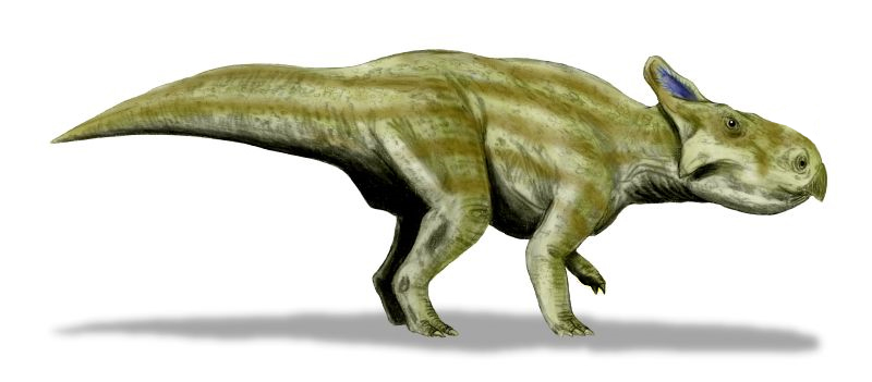
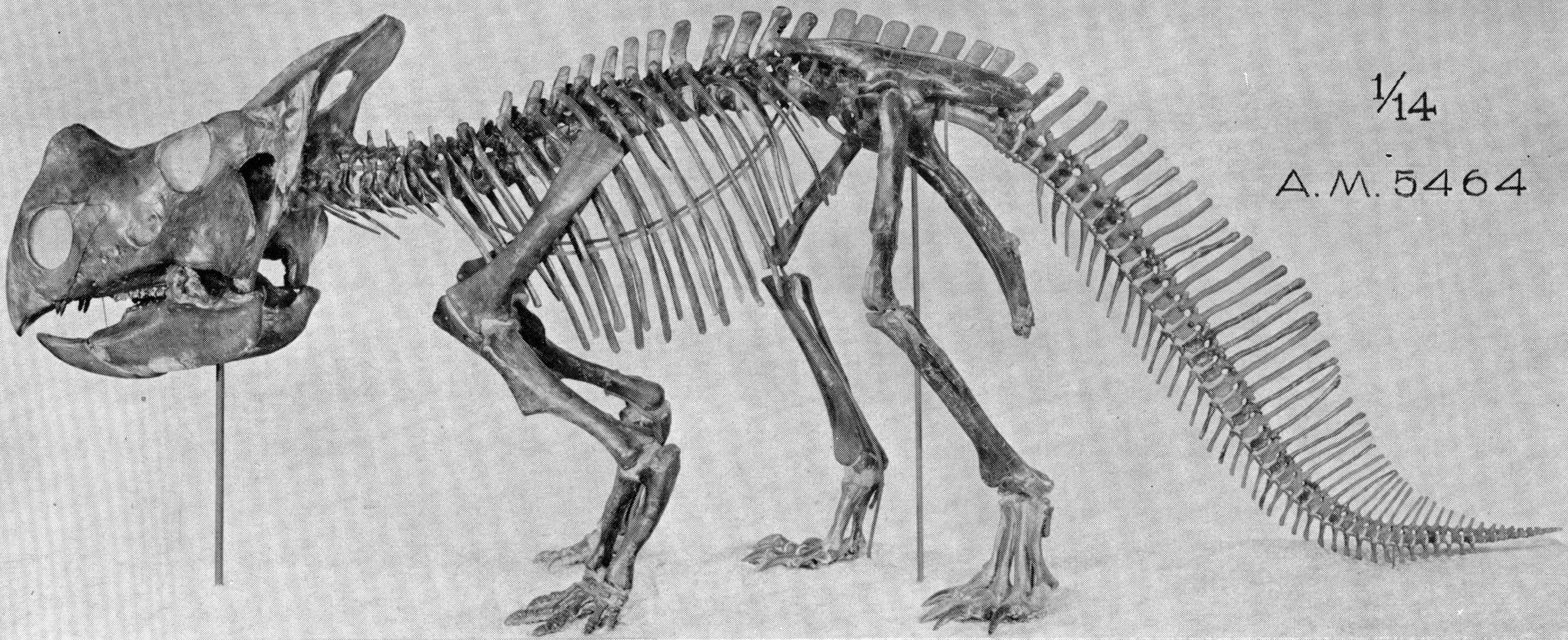
''Montanoceratops'' is an extinct genus of small ceratopsian dinosaur that lived approximately 70 million years ago during the latter part of the Cretaceous Period in what is now Montana and Alberta. ''Montanoceratops'' was a small sized, moderately-built, ground-dwelling, quadrupedal herbivore, that could grow up to an estimated in length and in body mass. Description ''Montanoceratops'' was a typical primitive ceratopsian in many respects, distinguished from the later species by the presence of claws, rather than hooves, and by having teeth in its upper jaw, rather than a toothless beak. It was once thought to have a horn on its nose but that was a misplaced cheek horn.Holtz, Thomas R. Jr. (2008) ''Dinosaurs: The Most Complete, Up-to-Date Encyclopedia for Dinosaur Lovers of All Ages'Supplementary Information/ref> According to Brown and Schlaikjer (1935), ''Montanoceratops'' can be distinguished based on the following characteristics: * the nasal bone is proportionally l ... [...More Info...] [...Related Items...] OR: [Wikipedia] [Google] [Baidu] |
Dinosaur
Dinosaurs are a diverse group of reptiles of the clade Dinosauria. They first appeared during the Triassic period, between 243 and 233.23 million years ago (mya), although the exact origin and timing of the evolution of dinosaurs is the subject of active research. They became the dominant terrestrial vertebrates after the Triassic–Jurassic extinction event 201.3 mya; their dominance continued throughout the Jurassic and Cretaceous periods. The fossil record shows that birds are feathered dinosaurs, having evolved from earlier theropods during the Late Jurassic epoch, and are the only dinosaur lineage known to have survived the Cretaceous–Paleogene extinction event approximately 66 mya. Dinosaurs can therefore be divided into avian dinosaurs—birds—and the extinct non-avian dinosaurs, which are all dinosaurs other than birds. Dinosaurs are varied from taxonomic, morphological and ecological standpoints. Birds, at over 10,700 living species ... [...More Info...] [...Related Items...] OR: [Wikipedia] [Google] [Baidu] |
Canadian Rockies
The Canadian Rockies (french: Rocheuses canadiennes) or Canadian Rocky Mountains, comprising both the Alberta Rockies and the British Columbian Rockies, is the Canadian segment of the North American Rocky Mountains. It is the easternmost part of the Canadian Cordillera, which is the northern segment of the North American Cordillera, the expansive system of interconnected mountain ranges between the Interior Plains and the Pacific Coast that runs northwest–southeast from central Alaska to the Isthmus of Tehuantepec in Mexico. Canada officially defines the Rocky Mountains system as the mountain chains east of the Rocky Mountain Trench extending from the Liard River valley in northern British Columbia to the Albuquerque Basin in New Mexico, not including the Mackenzie, Richardson and British Mountains/ Brooks Range in Yukon and Alaska (which are all included as the "Arctic Rockies" in the United States' definition of the Rocky Mountains system). The Canadian Rockies ... [...More Info...] [...Related Items...] OR: [Wikipedia] [Google] [Baidu] |
Central Alberta
Central Alberta is a region located in the Canadian province of Alberta. Central Alberta is the most densely populated rural area in the province. Agriculture and energy are important to the area's economy. Geography Central Alberta is bordered by the Canadian Rockies in the west, Southern Alberta and the Calgary Region to the south, Saskatchewan to the east and Northern Alberta to the north. It completely surrounds the Edmonton Capital Region and contains the central part of the heavily populated Calgary-Edmonton Corridor. The North Saskatchewan River crosses the region from west to east. Other rivers traversing the area are Red Deer River, Battle River, Athabasca River, Pembina River, Brazeau River, Beaver River. Tourist attractions in the region include: Alberta Prairie Railway Excursions, the Canadian Petroleum Discovery Centre in Leduc, Discovery Wildlife Park, Kerry Wood Nature Centre and Gaetz Lake Sanctuary in Red Deer, Nordegg Heritage Centre and Mine Sit ... [...More Info...] [...Related Items...] OR: [Wikipedia] [Google] [Baidu] |
Deep Basin
Deep or The Deep may refer to: Places United States * Deep Creek (Appomattox River tributary), Virginia * Deep Creek (Great Salt Lake), Idaho and Utah * Deep Creek (Mahantango Creek tributary), Pennsylvania * Deep Creek (Mojave River tributary), California * Deep Creek (Pine Creek tributary), Pennsylvania * Deep Creek (Soque River tributary), Georgia * Deep Creek (Texas), a tributary of the Colorado River * Deep Creek (Washington), a tributary of the Spokane River * Deep River (Indiana), a tributary of the Little Calumet River * Deep River (Iowa), a minor tributary of the English River * Deep River (North Carolina) * Deep River (Washington), a minor tributary of the Columbia River * Deep Voll Brook, New Jersey, also known as Deep Brook Elsewhere * Deep Creek (Bahamas) * Deep Creek (Melbourne, Victoria), Australia, a tributary of the Maribyrnong River * Deep River (Western Australia) People * Deep (given name) * Deep (rapper), Punjabi rapper from Houston, Texas * Ra ... [...More Info...] [...Related Items...] OR: [Wikipedia] [Google] [Baidu] |
Natural Gas
Natural gas (also called fossil gas or simply gas) is a naturally occurring mixture of gaseous hydrocarbons consisting primarily of methane in addition to various smaller amounts of other higher alkanes. Low levels of trace gases like carbon dioxide, nitrogen, hydrogen sulfide, and helium are also usually present. Natural gas is colorless and odorless, so odorizers such as mercaptan (which smells like sulfur or rotten eggs) are commonly added to natural gas supplies for safety so that leaks can be readily detected. Natural gas is a fossil fuel and non-renewable resource that is formed when layers of organic matter (primarily marine microorganisms) decompose under anaerobic conditions and are subjected to intense heat and pressure underground over millions of years. The energy that the decayed organisms originally obtained from the sun via photosynthesis is stored as chemical energy within the molecules of methane and other hydrocarbons. Natural gas can be burned for he ... [...More Info...] [...Related Items...] OR: [Wikipedia] [Google] [Baidu] |
Concretion
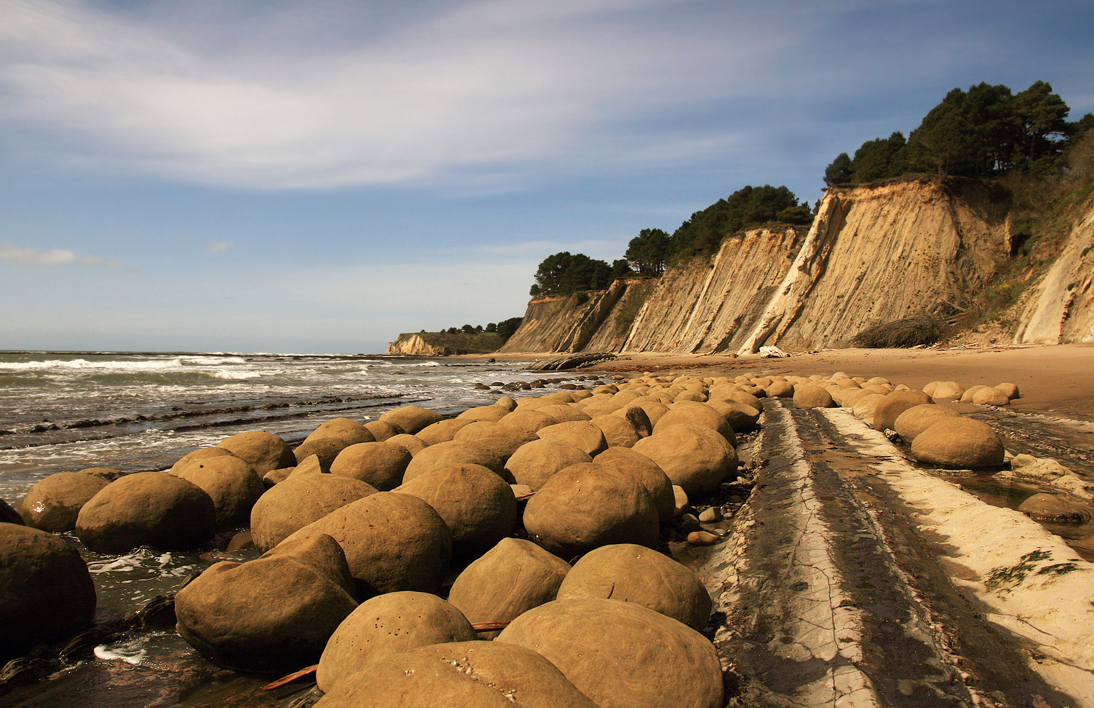
A concretion is a hard, compact mass of matter formed by the precipitation of mineral cement within the spaces between particles, and is found in sedimentary rock or soil. Concretions are often ovoid or spherical in shape, although irregular shapes also occur. The word 'concretion' is derived from the Latin "(act of) compacting, condensing, congealing, uniting", itself from ''con'' meaning 'together' and ''crescere'' meaning "to grow". Concretions form within layers of sedimentary strata that have already been deposited. They usually form early in the burial history of the sediment, before the rest of the sediment is hardened into rock. This concretionary cement often makes the concretion harder and more resistant to weathering than the host stratum. There is an important distinction to draw between concretions and nodules. Concretions are formed from mineral precipitation around some kind of nucleus while a nodule is a replacement body. Descriptions dating from the 18th ... [...More Info...] [...Related Items...] OR: [Wikipedia] [Google] [Baidu] |
Shale
Shale is a fine-grained, clastic sedimentary rock formed from mud that is a mix of flakes of clay minerals (hydrous aluminium phyllosilicates, e.g. kaolin, Al2 Si2 O5( OH)4) and tiny fragments (silt-sized particles) of other minerals, especially quartz and calcite.Blatt, Harvey and Robert J. Tracy (1996) ''Petrology: Igneous, Sedimentary and Metamorphic'', 2nd ed., Freeman, pp. 281–292 Shale is characterized by its tendency to split into thin layers ( laminae) less than one centimeter in thickness. This property is called '' fissility''. Shale is the most common sedimentary rock. The term ''shale'' is sometimes applied more broadly, as essentially a synonym for mudrock, rather than in the more narrow sense of clay-rich fissile mudrock. Texture Shale typically exhibits varying degrees of fissility. Because of the parallel orientation of clay mineral flakes in shale, it breaks into thin layers, often splintery and usually parallel to the otherwise indistinguishable bed ... [...More Info...] [...Related Items...] OR: [Wikipedia] [Google] [Baidu] |
Coal
Coal is a combustible black or brownish-black sedimentary rock, formed as stratum, rock strata called coal seams. Coal is mostly carbon with variable amounts of other Chemical element, elements, chiefly hydrogen, sulfur, oxygen, and nitrogen. Coal is formed when dead plant matter decays into peat and is converted into coal by the heat and pressure of deep burial over millions of years. Vast deposits of coal originate in former wetlands called coal forests that covered much of the Earth's tropical land areas during the late Carboniferous (Pennsylvanian (geology), Pennsylvanian) and Permian times. Many significant coal deposits are younger than this and originate from the Mesozoic and Cenozoic eras. Coal is used primarily as a fuel. While coal has been known and used for thousands of years, its usage was limited until the Industrial Revolution. With the invention of the steam engine, coal consumption increased. In 2020, coal supplied about a quarter of the world's primary energ ... [...More Info...] [...Related Items...] OR: [Wikipedia] [Google] [Baidu] |
Bentonite
Bentonite () is an absorbent swelling clay consisting mostly of montmorillonite (a type of smectite) which can either be Na-montmorillonite or Ca-montmorillonite. Na-montmorillonite has a considerably greater swelling capacity than Ca-montmorillonite. Bentonite usually forms from the weathering of volcanic ash in seawater, or by hydrothermal circulation through the porosity of volcanic ash beds, which converts ( devitrification) the volcanic glass (obsidian, rhyolite, dacite) present in the ash into clay minerals. In the mineral alteration process, a large fraction (up to 40-50 wt.%) of amorphous silica is dissolved and leached away, leaving the bentonite deposit in place. Bentonite beds are white or pale blue or green (traces of reduced ) in fresh exposures, turning to a cream color and then yellow, red, or brown (traces of oxidized ) as the exposure is weathered further. As a swelling clay, bentonite has the ability to absorb large quantities of water, whic ... [...More Info...] [...Related Items...] OR: [Wikipedia] [Google] [Baidu] |


