|
Belimbla Park, New South Wales
Belimbla Park is a semi-rural estate in the Macarthur Region of New South Wales, Australia, in the Wollondilly Shire Wollondilly Shire is a periurban local government area adjacent to the south-western fringe of Sydney Sydney ( ) is the capital city of the state of New South Wales, and the most populous city in both Australia and Oceania. Located on Aus .... It is located west of The Oaks and east of Oakdale. At the , it had a population of 581. The residents of the estate often have vegetable gardens or small orchards, horses and ponies or other hobby farms. The estate is the result of a subdivision of an apple orchard, with blocks often between 2-10 acres in size. References {{authority control Localities in New South Wales Wollondilly Shire ... [...More Info...] [...Related Items...] OR: [Wikipedia] [Google] [Baidu] |
Macarthur, New South Wales
Macarthur is a region in the south-west of Sydney, in the state of New South Wales, Australia. The region includes the local government areas of the City of Campbelltown, Camden Council, and Wollondilly Shire. It covers an area of 3,067 square kilometres and has a population of close to 310,000 residents. The region geographically forms the foothills between the Blue Mountains and Southern Highlands regions. The region is bounded at the north by Glenfield; at the south by Yanderra; at the east by the town of Appin; and at the west by the hamlet Nattai. Most of the area is taken up by the semi-rural Wollondilly Shire; most of the population lives within the satellite city of Campbelltown and its surrounding suburbs. The region is one of the fastest-growing regions in the Sydney metropolitan area, with many new modern suburbs sprouting up in recent decades such as Glen Alpine, Macquarie Links, Harrington Park, Blair Athol, Mount Annan, Currans Hill, Englorie Park ... [...More Info...] [...Related Items...] OR: [Wikipedia] [Google] [Baidu] |
Electoral District Of Wollondilly
Wollondilly is an electoral district of the Legislative Assembly in the Australian state of New South Wales. It is currently represented by independent Judy Hannan, who defeated sitting member Nathaniel Smith at the 2023 New South Wales state election. History Wollondilly was first established in 1904, partly replacing Bowral. In 1920, with the introduction of proportional representation, it absorbed Wollongong and Allowrie and elected three members simultaneously. In 1927, it was split into the single-member electorates of Wollondilly, Wollongong and Illawarra. It was abolished in 1981, but was recreated for the 2007 election, partly replacing Southern Highlands. Wollondilly is one of four electorates in the New South Wales Legislative Assembly to have been held by two Premiers of New South Wales while in office. Both Premiers Tom Lewis and George Fuller held Wollondilly while in office, the other three electorates being Ku-ring-gai, Maroubra and Willoughby ... [...More Info...] [...Related Items...] OR: [Wikipedia] [Google] [Baidu] |
Division Of Hume
The Division of Hume is an Australian electoral division in the state of New South Wales. Geography Since 1984, federal electoral division boundaries in Australia have been determined at redistributions by a redistribution committee appointed by the Australian Electoral Commission. Redistributions occur for the boundaries of divisions in a particular state, and they occur every seven years, or sooner if a state's representation entitlement changes or when divisions of a state are malapportioned. History The division was proclaimed in 1900, and was one of the original 65 divisions to be contested at the first federal election. The division was named after Hamilton Hume, one of the first Europeans to travel through the area. The division is located in the central part of the state, north of the Australian Capital Territory. The division covers a large rural and regional area, with agriculture being the main industry. It also includes a portion of outer Sydney suburbs at its ... [...More Info...] [...Related Items...] OR: [Wikipedia] [Google] [Baidu] |
Sydney CBD
The Sydney central business district (CBD) is the historical and main commercial centre of Sydney. The CBD is Sydney's city centre, or Sydney City, and the two terms are used interchangeably. Colloquially, the CBD or city centre is often referred to simply as "Town" or "the City". The Sydney city centre extends southwards for about from Sydney Cove, the point of first European settlement in which the Sydney region was initially established. Due to its pivotal role in Australia's early history, it is one of the oldest established areas in the country. Geographically, its north–south axis runs from Circular Quay in the north to Central railway station in the south. Its east–west axis runs from a chain of parkland that includes Hyde Park, The Domain, Royal Botanic Gardens and Farm Cove on Sydney Harbour in the east; to Darling Harbour and the Western Distributor in the west. The Sydney City is Australia's main financial and economic centre, as well as a leading hub ... [...More Info...] [...Related Items...] OR: [Wikipedia] [Google] [Baidu] |
Mittagong
Mittagong () is a town located in the Southern Highlands of New South Wales, Australia, in Wingecarribee Shire. The town acts as the gateway to the Southern Highlands when coming from Sydney. Mittagong is situated at an elevation of . The town is close to Bowral, Berrima, Moss Vale and the Northern Villages such as Yerrinbool and Colo Vale. Moreover, Mittagong is home to many wineries of the Southern Highlands which has been a recent growing wine and cellar door region. Geography The town lies between three small mountain reserves, Mount Alexandra above sea level, Mount Gibraltar above sea level and Ninety Acre Hill (part of the greater Gibbergunyah Reserve) above sea level. Popular among locals and visitors is a small man made lake, Lake Alexandra, that feeds into the nearby Nattai River. Lookouts are available at all three reserves for viewing. Lookouts on Mount Gibraltar include Bowral Lookout, Mittagong Lookout and Mount Jellore Lookout. Lookouts on Mount Alexand ... [...More Info...] [...Related Items...] OR: [Wikipedia] [Google] [Baidu] |
Blue Mountains National Park
The Blue Mountains National Park is a protected national park that is located in the Blue Mountains region of New South Wales, in eastern Australia. The national park is situated approximately west of Sydney, and the park boundary is quite irregular as it is broken up by roads, urban areas and inholdings. Despite the name mountains, the area is an uplifted plateau, dissected by a number of larger rivers. The highest point in the park is Mount Werong at above sea level; while the low point is on the Nepean River at above sea level as it leaves the park. The national park is one of the eight protected areas that, in 2000, was inscribed to form part of the UNESCO World Heritagelisted Greater Blue Mountains Area. The Greater Blue Mountains was one of 15 World Heritage places included in the National Heritage List on 21 May 2007. The Blue Mountains National Park is the most central of the eight protected areas within the World Heritage Site and it forms part of the Great ... [...More Info...] [...Related Items...] OR: [Wikipedia] [Google] [Baidu] |
Orangeville, New South Wales
Orangeville is a small town in the Macarthur Region of New South Wales, Australia, in the Wollondilly Shire. It reported a population of 1,250 in the . Heritage listings Orangeville has a number of heritage-listed sites, including: * Brownlow Hill Loop Road, Brownlow Hill: Brownlow Hill Estate Brownlow Hill Estate is a heritage-listed former residence and working farm and now residence and dairy farm located at Brownlow Hill Loop Road in the outer south-western Sydney settlement of Brownlow Hill in the Wollondilly Shire local gover ... References Wollondilly Shire Towns in the Macarthur (New South Wales) {{NewSouthWales-geo-stub ... [...More Info...] [...Related Items...] OR: [Wikipedia] [Google] [Baidu] |
The Oaks, New South Wales
The Oaks is a town in the Macarthur Region of New South Wales, Australia in Wollondilly Shire on the south western edge of the Sydney Basin. The Oaks is located south-west of Sydney via the Hume Highway, west of Camden and 290m above sea-level. At the , The Oaks and the surrounding area had a population of 2,525. Despite a long-standing economic dependence upon coal mining and despite the urban development inspired by its proximity to Sydney, The Oaks has essentially remained an attractive semi-rural district. Pre European history The area was once part of the traditional land of the Tharawal people prior to colonisation, whose territory stretched from Botany Bay in Sydney down to Jervis Bay on the south coast, and into Burragorang in the ranges. The area was fiercely contested between the Tharawal and the Europeans, particularly between 1812 and 1816, culminating in a massacre at Cataract Gorge. A group of the Gandangara people near Appin were caught by Macquarie's troops ... [...More Info...] [...Related Items...] OR: [Wikipedia] [Google] [Baidu] |
Glenmore, New South Wales
Glenmore is a small village in the Macarthur Region of New South Wales, Australia, in the Wollondilly Shire Wollondilly Shire is a periurban local government area adjacent to the south-western fringe of Sydney Sydney ( ) is the capital city of the state of New South Wales, and the most populous city in both Australia and Oceania. Located on Aus .... References Localities in New South Wales Wollondilly Shire {{NewSouthWales-geo-stub ... [...More Info...] [...Related Items...] OR: [Wikipedia] [Google] [Baidu] |
Lakesland, New South Wales
Lakesland is a locality next to the Nattai National Park of New South Wales, Australia Australia, officially the Commonwealth of Australia, is a Sovereign state, sovereign country comprising the mainland of the Australia (continent), Australian continent, the island of Tasmania, and numerous List of islands of Australia, sma ..., in Wollondilly Shire. At the , Lakesland had a population of 432. References {{authority control Towns in the Macarthur (New South Wales) Towns in New South Wales Wollondilly Shire ... [...More Info...] [...Related Items...] OR: [Wikipedia] [Google] [Baidu] |
Oakdale, New South Wales
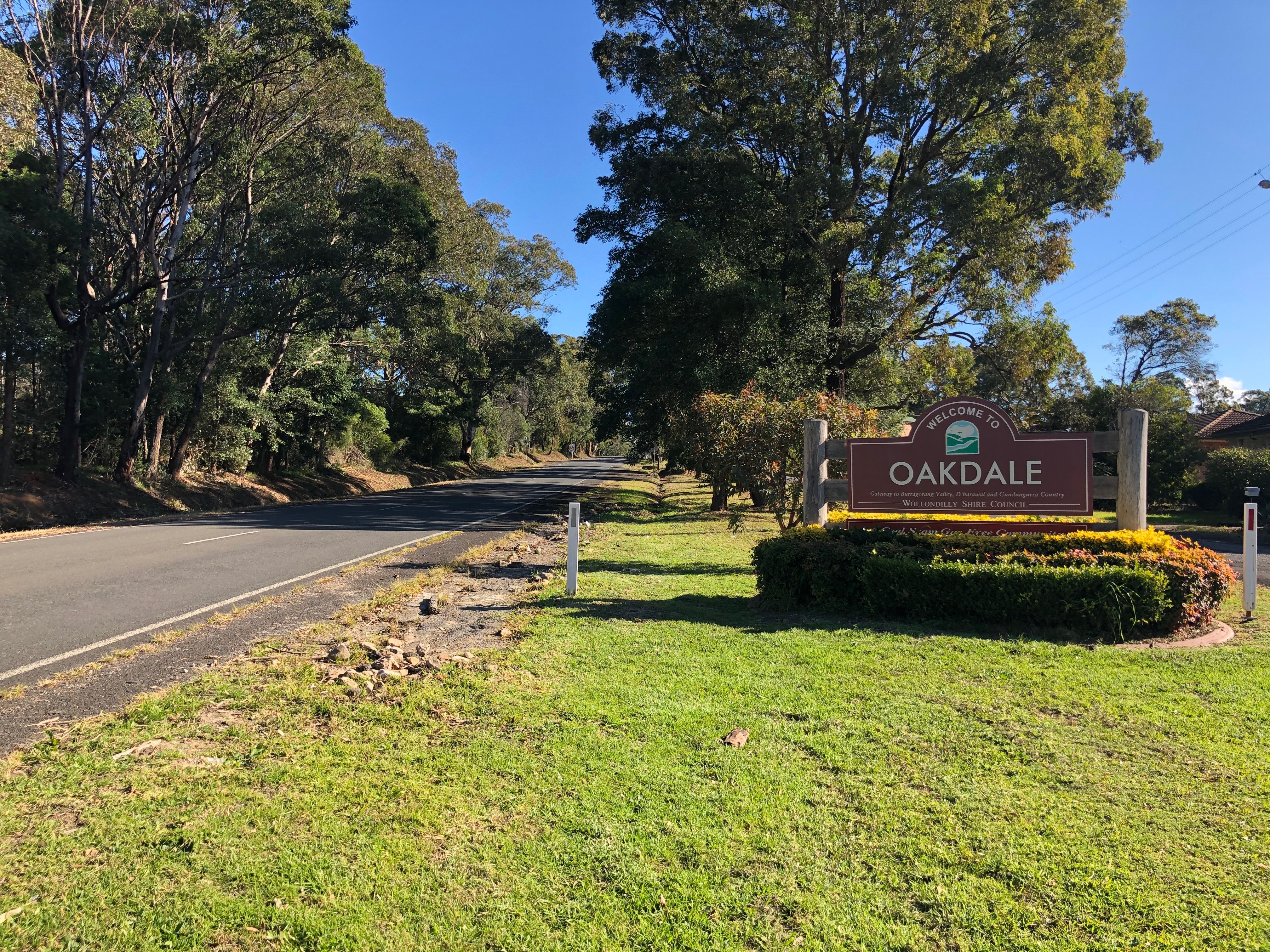
Oakdale is a semi-rural suburb or district in Wollondilly Shire in Sydney Sydney ( ) is the capital city of the state of New South Wales, and the most populous city in both Australia and Oceania. Located on Australia's east coast, the metropolis surrounds Sydney Harbour and extends about towards the Blue Mountain ...'s southwest in New South Wales, Australia. At the , Oakdale had a population of 1,843. Notes and references Towns in the Macarthur (New South Wales) Wollondilly Shire {{Sydney-geo-stub ... [...More Info...] [...Related Items...] OR: [Wikipedia] [Google] [Baidu] |
New South Wales
) , nickname = , image_map = New South Wales in Australia.svg , map_caption = Location of New South Wales in AustraliaCoordinates: , subdivision_type = Country , subdivision_name = Australia , established_title = Before federation , established_date = Colony of New South Wales , established_title2 = Establishment , established_date2 = 26 January 1788 , established_title3 = Responsible government , established_date3 = 6 June 1856 , established_title4 = Federation , established_date4 = 1 January 1901 , named_for = Wales , demonym = , capital = Sydney , largest_city = capital , coordinates = , admin_center = 128 local government areas , admin_center_type = Administration , leader_title1 = Monarch , leader_name1 = Charles III , leader_title2 = Governor , leader_name2 = Margaret Beazley , leader_title3 = Premier , leader_name3 = Dominic Perrottet (Liberal) , national_representation = Parliament of Australia , national_representation_type1 = Senat ... [...More Info...] [...Related Items...] OR: [Wikipedia] [Google] [Baidu] |


-Location-Map.png)


