|
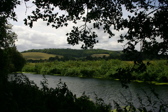
Belchalwell Street
Belchalwell Street is a village in Dorset, England, at the foot of Bell Hill, generally included in the village of Belchalwell Belchalwell is a small village in the civil parish of Okeford Fitzpaine in the Blackmore Vale, North Dorset, England. It lies south of Sturminster Newton and northwest of Blandford Forum. Belchalwell Street is sited on Upper Greensand, with .... External linksBelchalwell Villages in Dorset {{Dorset-geo-stub ... [...More Info...] [...Related Items...] OR: [Wikipedia] [Google] [Baidu] |
Dorset
Dorset ( ; archaically: Dorsetshire , ) is a county in South West England on the English Channel coast. The ceremonial county comprises the unitary authority areas of Bournemouth, Christchurch and Poole and Dorset (unitary authority), Dorset. Covering an area of , Dorset borders Devon to the west, Somerset to the north-west, Wiltshire to the north-east, and Hampshire to the east. The county town is Dorchester, Dorset, Dorchester, in the south. After the Local Government Act 1972, reorganisation of local government in 1974, the county border was extended eastward to incorporate the Hampshire towns of Bournemouth and Christchurch. Around half of the population lives in the South East Dorset conurbation, while the rest of the county is largely rural with a low population density. The county has a long history of human settlement stretching back to the Neolithic era. The Roman conquest of Britain, Romans conquered Dorset's indigenous Durotriges, Celtic tribe, and during the Ear ... [...More Info...] [...Related Items...] OR: [Wikipedia] [Google] [Baidu] |
Belchalwell
Belchalwell is a small village in the civil parish of Okeford Fitzpaine in the Blackmore Vale, North Dorset, England. It lies south of Sturminster Newton and northwest of Blandford Forum. Belchalwell Street is sited on Upper Greensand, with Lower Belchalwell on the boundary of Gault and Kimmeridge Clay, both beneath the north slopes of Bell Hill, part of the Dorset Downs. Belchalwell is Saxon in origin, with a medieval church, St Aldhelm's Church, much renovated. The name of the village describes a cold well on a hillside. The village has approximately 30 properties with fewer than a hundred residents, and is much reduced in size from former times, largely due to reductions in agricultural employment, which has always been the primary industry. One former resident was the TV personality Jack Hargreaves Jack Hargreaves OBE (1911–1994) was an English television presenter and writer whose enduring interest was to comment without nostalgia or sentimentality on accelera ... [...More Info...] [...Related Items...] OR: [Wikipedia] [Google] [Baidu] |
England
England is a country that is part of the United Kingdom. It shares land borders with Wales to its west and Scotland to its north. The Irish Sea lies northwest and the Celtic Sea to the southwest. It is separated from continental Europe by the North Sea to the east and the English Channel to the south. The country covers five-eighths of the island of Great Britain, which lies in the North Atlantic, and includes over 100 smaller islands, such as the Isles of Scilly and the Isle of Wight. The area now called England was first inhabited by modern humans during the Upper Paleolithic period, but takes its name from the Angles, a Germanic tribe deriving its name from the Anglia peninsula, who settled during the 5th and 6th centuries. England became a unified state in the 10th century and has had a significant cultural and legal impact on the wider world since the Age of Discovery, which began during the 15th century. The English language, the Anglican Church, and Engli ... [...More Info...] [...Related Items...] OR: [Wikipedia] [Google] [Baidu] |
Bell Hill, Dorset
At 258 metres, Bell Hill is one of the highest hills in the county of Dorset, England and a high point on the Wessex Ridgeway. Location Bell Hill lies about 5 miles west of Blandford Forum. The village of Ibberton nestles against its southwestern foot, whilst a little further to the northeast, below Okeford Hill on the same ridgeline, is the village of Okeford Fitzpaine.Ordnance Survey 1:50,000 Landranger series, no. 194 The summit itself lies on a ridge running from northeast to southwest. To the northwest its escarpment drops steeply in to the Blackmore Vale and River Stour, Dorset, Stour Valley, whilst to the southeast the woods of Turnworth Clump and Ringmoor are bracketed by two more ridges, Ibberton Long Down and Turnworth Down, forming a horseshoe with Bell Hill. Another spur runs east from Turnworth Down to Shillingstone Hill, site of a quarry and a popular cross-country race. A trig point on the Wessex Ridgeway marks this subsidiary summit. History There is evidenc ... [...More Info...] [...Related Items...] OR: [Wikipedia] [Google] [Baidu] |

