|
Beinn Bhreac (Glen Derry)
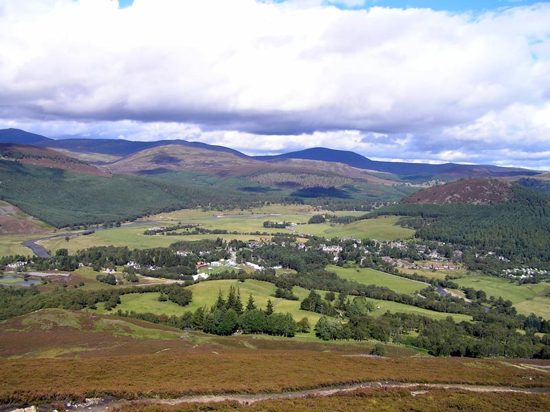
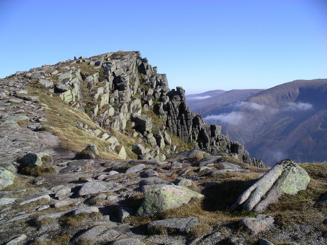
Beinn Bhreac is a twin-peaked Scottish mountain located above Glen Derry in the Cairngorm Mountains approximately north-west of Braemar. Overview Beinn Bhreac is a remote mountain located at the southern end of a featureless, boggy moorland plateau called the Moine Bhealaidh (Yellow Moss in Gaelic). The eastern peak is higher than the western peak. It is commonly approached from the Linn of Dee to the south and is often combined with the neighbouring Munro Beinn a' Chaorainn. From its summit there are extensive views to the surrounding giants of the Cairngorm Mountains including Ben MacDui, Great Britain's second highest mountain. Geography At Beinn Bhreac is a Munro and is ranked as the 249th highest mountain in Scotland. The mountain has two peaks, the eastern one of which is higher than the western peak and therefore the summit. The mountain is bounded by Dubh Ghleann to the East and Glen Derry to the West. Both of these sides are steep and rocky in places. Moder ... [...More Info...] [...Related Items...] OR: [Wikipedia] [Google] [Baidu] |
Munro
A Munro () is defined as a mountain in Scotland with a height over , and which is on the Scottish Mountaineering Club (SMC) official list of Munros; there is no explicit topographical prominence requirement. The best known Munro is Ben Nevis (Beinn Nibheis), the highest mountain in the British Isles at . Munros are named after Sir Hugh Munro, 4th Baronet (1856–1919), who produced the first list of such hills, known as ''Munro's Tables'', in 1891. Also included were what Munro considered lesser peaks, now known as Munro Tops, which are also over 3,000 feet but are lower than the nearby primary mountain. The publication of the original list is usually considered to be the epoch event of modern peak bagging. The list has been the subject of subsequent variation and as of 10 December 2020, the Scottish Mountaineering Club has listed 282 Munros and 226 Munro Tops. "Munro bagging" is the activity of climbing all the listed Munros. As of 31 December 2021, 7,098 people had reported ... [...More Info...] [...Related Items...] OR: [Wikipedia] [Google] [Baidu] |
Scottish Gaelic Language
Scottish Gaelic ( gd, Gàidhlig ), also known as Scots Gaelic and Gaelic, is a Goidelic language (in the Celtic branch of the Indo-European language family) native to the Gaels of Scotland. As a Goidelic language, Scottish Gaelic, as well as both Irish and Manx, developed out of Old Irish. It became a distinct spoken language sometime in the 13th century in the Middle Irish period, although a common literary language was shared by the Gaels of both Ireland and Scotland until well into the 17th century. Most of modern Scotland was once Gaelic-speaking, as evidenced especially by Gaelic-language place names. In the 2011 census of Scotland, 57,375 people (1.1% of the Scottish population aged over 3 years old) reported being able to speak Gaelic, 1,275 fewer than in 2001. The highest percentages of Gaelic speakers were in the Outer Hebrides. Nevertheless, there is a language revival, and the number of speakers of the language under age 20 did not decrease between the 2001 and 20 ... [...More Info...] [...Related Items...] OR: [Wikipedia] [Google] [Baidu] |
Braemar
Braemar is a village in Aberdeenshire, Scotland, around west of Aberdeen in the Highlands. It is the closest significantly-sized settlement to the upper course of the River Dee sitting at an elevation of . The Gaelic ''Bràigh Mhàrr'' properly refers to the area of upper Marr (as it literally means), i.e. the area of Marr to the west of Aboyne, the village itself being Castleton of Braemar (''Baile a' Chaisteil''). The village used to be known as ''Cinn Drochaid'' (bridge end); ''Baile a' Chaisteil'' referred to only the part of the village on the east bank of the river, the part on the west bank being known as ''Ach an Droighinn'' (thorn field). Geography Braemar is approached from the South on the A93 from Glen Clunie and the Cairnwell Pass and from the East also on the A93 from Deeside. Braemar can be approached on foot from the West through Glen Tilt, Glen Feshie, Glen Dee (by the Lairig Ghru), and Glen Derry (by the Lairig an Laoigh). Braemar is within a one-and-a-hal ... [...More Info...] [...Related Items...] OR: [Wikipedia] [Google] [Baidu] |
Scotland
Scotland (, ) is a country that is part of the United Kingdom. Covering the northern third of the island of Great Britain, mainland Scotland has a border with England to the southeast and is otherwise surrounded by the Atlantic Ocean to the north and west, the North Sea to the northeast and east, and the Irish Sea to the south. It also contains more than 790 islands, principally in the archipelagos of the Hebrides and the Northern Isles. Most of the population, including the capital Edinburgh, is concentrated in the Central Belt—the plain between the Scottish Highlands and the Southern Uplands—in the Scottish Lowlands. Scotland is divided into 32 administrative subdivisions or local authorities, known as council areas. Glasgow City is the largest council area in terms of population, with Highland being the largest in terms of area. Limited self-governing power, covering matters such as education, social services and roads and transportation, is devolved from the Scott ... [...More Info...] [...Related Items...] OR: [Wikipedia] [Google] [Baidu] |
Ordnance Survey
, nativename_a = , nativename_r = , logo = Ordnance Survey 2015 Logo.svg , logo_width = 240px , logo_caption = , seal = , seal_width = , seal_caption = , picture = , picture_width = , picture_caption = , formed = , preceding1 = , dissolved = , superseding = , jurisdiction = Great BritainThe Ordnance Survey deals only with maps of Great Britain, and, to an extent, the Isle of Man, but not Northern Ireland, which has its own, separate government agency, the Ordnance Survey of Northern Ireland. , headquarters = Southampton, England, UK , region_code = GB , coordinates = , employees = 1,244 , budget = , minister1_name = , minister1_pfo = , chief1_name = Steve Blair , chief1_position = CEO , agency_type = , parent_agency = , child1_agency = , keydocument1 = , website = , footnotes = , map = , map_width = , map_caption = Ordnance Survey (OS) is the national mapping agency for Great Britain. The agency's name indicates its original military purpose (se ... [...More Info...] [...Related Items...] OR: [Wikipedia] [Google] [Baidu] |
Hiking
Hiking is a long, vigorous walk, usually on trails or footpaths in the countryside. Walking for pleasure developed in Europe during the eighteenth century.AMATO, JOSEPH A. "Mind over Foot: Romantic Walking and Rambling." In ''On Foot: A History of Walking'', 101-24. NYU Press, 2004. Accessed March 1, 2021. http://www.jstor.org/stable/j.ctt9qg056.7. Religious pilgrimages have existed much longer but they involve walking long distances for a spiritual purpose associated with specific religions. "Hiking" is the preferred term in Canada and the United States; the term "walking" is used in these regions for shorter, particularly urban walks. In the United Kingdom and the Republic of Ireland, the word "walking" describes all forms of walking, whether it is a walk in the park or backpacking in the Alps. The word hiking is also often used in the UK, along with rambling , hillwalking, and fell walking (a term mostly used for hillwalking in northern England). The term bushwalking is end ... [...More Info...] [...Related Items...] OR: [Wikipedia] [Google] [Baidu] |
Mountain
A mountain is an elevated portion of the Earth's crust, generally with steep sides that show significant exposed bedrock. Although definitions vary, a mountain may differ from a plateau in having a limited Summit (topography), summit area, and is usually higher than a hill, typically rising at least 300 metres (1,000 feet) above the surrounding land. A few mountains are Monadnock, isolated summits, but most occur in mountain ranges. Mountain formation, Mountains are formed through Tectonic plate, tectonic forces, erosion, or volcanism, which act on time scales of up to tens of millions of years. Once mountain building ceases, mountains are slowly leveled through the action of weathering, through Slump (geology), slumping and other forms of mass wasting, as well as through erosion by rivers and glaciers. High elevations on mountains produce Alpine climate, colder climates than at sea level at similar latitude. These colder climates strongly affect the Montane ecosystems, ecosys ... [...More Info...] [...Related Items...] OR: [Wikipedia] [Google] [Baidu] |
Cairngorm Mountains
The Cairngorms ( gd, Am Monadh Ruadh) are a mountain range in the eastern Highlands of Scotland closely associated with the mountain Cairn Gorm. The Cairngorms became part of Scotland's second national park (the Cairngorms National Park) on 1 September 2003. Although the Cairngorms give their name to, and are at the heart of, the Cairngorms National Park, they only form one part of the national park, alongside other hill ranges such as the Angus Glens and the Monadhliath, and lower areas like Strathspey. The Cairngorms consists of high plateaux at about above sea level, above which domed summits (the eroded stumps of once much higher mountains ) rise to around . Many of the summits have tors, free-standing rock outcrops that stand on top of the boulder-strewn landscape. In places, the edges of the plateau form steep cliffs of granite and they are excellent for skiing, rock climbing and ice climbing. The Cairngorms form an arctic-alpine mountain environment, with tundra-lik ... [...More Info...] [...Related Items...] OR: [Wikipedia] [Google] [Baidu] |
Beinn A' Chaorainn (Cairngorms)
Beinn a' Chaorainn is a Scottish mountain in the heart of the Cairngorms range. It is quite a remote hill, being located roughly 19 kilometres south east of Aviemore and 14 kilometres north west of Braemar. The mountain stands on the border of the Moray and Aberdeenshire council areas. The hill's name used to be spelt as Beinn a' Chaoruinn,"Hamish's Mountain Walk" Page 136 Gives spelling as Beinn a' Chaoruinn. but the spelling of the word ''caorunn'' (in genitive case here) was altered to ''caorann'' by the Gaelic Orthographic Convention's attempts to standardise spelling. Overview The mountain is a pointed hill, however it is not particularly conspicuous in views being overshadowed by the more imposing and impressive peaks of the Cairngorms which stand nearby. The hill is located at the head of Glen Derry and faces its higher and better-known neighbour Beinn Mheadhoin across the Lairig an Laoigh (The Pass of the Calves). Beinn a' Chaorainn reaches a height of 1083 metres ( ... [...More Info...] [...Related Items...] OR: [Wikipedia] [Google] [Baidu] |
Ben MacDui
Ben Macdui ( gd, Beinn MacDuibh, meaning "MacDuff's mountain") is the second-highest mountain in Scotland and all of the British Isles, after Ben Nevis, and the highest of the Cairngorm Mountains. The summit is above sea level and it is classed as a Munro. Ben Macdui sits on the southwestern edge of the Cairngorm plateau, overlooking the Lairig Ghru pass to the west, and Loch Etchachan to the east. It lies on the boundary between the historic counties of Aberdeenshire and Banffshire. Before the production of accurate maps of Scotland in the 19th century, it was not known for certain that Ben Nevis was the highest point in Britain, and it was often thought that Ben Macdui might be higher. Following surveys of both peaks in 1846–47, Ben Nevis was confirmed as the higher. The summit of the mountain has a direction indicator erected in 1925 by the Cairngorm Club of Aberdeen in memory of former president Alexander Copland. The indicator shows the directions of the most notew ... [...More Info...] [...Related Items...] OR: [Wikipedia] [Google] [Baidu] |
National Trust For Scotland
The National Trust for Scotland for Places of Historic Interest or Natural Beauty, commonly known as the National Trust for Scotland ( gd, Urras Nàiseanta na h-Alba), is a Scottish conservation organisation. It is the largest membership organisation in Scotland and describes itself as "the conservation charity that protects and promotes Scotland's natural and cultural heritage for present and future generations to enjoy". The Trust owns and manages around 130 properties and of land, including castles, ancient small dwellings, historic sites, gardens, coastline, mountains and countryside. It is similar in function to the National Trust, which covers England, Wales, and Northern Ireland, and to other national trusts worldwide. History The Trust was established in 1931 following discussions held in the smoking room of Pollok House (now a Trust property). The Trust was incorporated on 1 May 1931, with John Stewart-Murray, 8th Duke of Atholl being elected as its first president, ... [...More Info...] [...Related Items...] OR: [Wikipedia] [Google] [Baidu] |
Aviemore
Aviemore (; gd, An Aghaidh Mhòr ) is a town and tourist resort, situated within the Cairngorms National Park in the Highlands of Scotland. It is in the Badenoch and Strathspey committee area, within the Highland council area. The town is popular for skiing and other winter sports, and for hill-walking in the Cairngorm Mountains. Etymology ''Aviemore'' represents the Gaelic form ''An Aghaidh Mhòr''. ''Aghaidh'' may be Pictish and involve an element equivalent to Welsh ''ag'' meaning "cleft". History The area was inhabited in the Bronze Age already, and three clava cairns remain. Prior to 1790, Aviemore was in an exclave of the county of Moray and from 1890 to 1975 it was in the county of Inverness-shire, until the later date being within the Civil Parish of Duthil and Rothiemurchus. The village began to grow as a result of it becoming a railway junction in 1898, following which the Highland Railway became a major employer constructing housing for its staff and the Aviemor ... [...More Info...] [...Related Items...] OR: [Wikipedia] [Google] [Baidu] |


