|
Bedretto
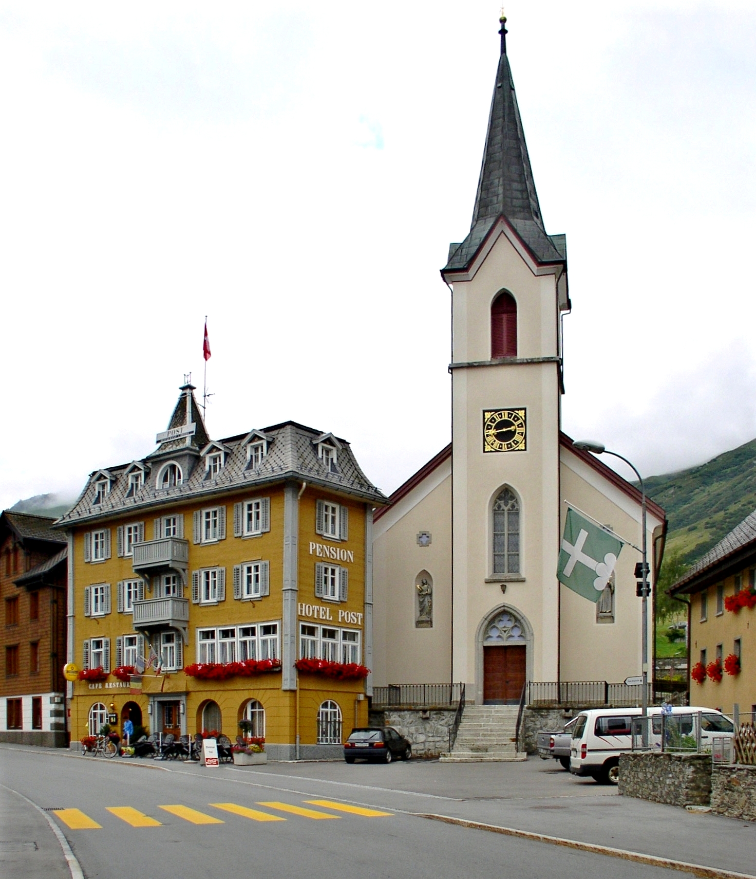
Bedretto is a municipality and a village in the Val Bedretto, the upper most part of the river Ticino. It belongs to the district of Leventina in the canton of Ticino in Switzerland. History In 1906 pre-Roman graves and a Roman era villa and coins were discovered in Bedretto. The presumption, that it was originally part of Airolo, could not be confirmed by any available records. Bedretto is first mentioned in 1210 as ''Bedoledo'' and at that time it was a separate municipality. Already in 1227, when the alpine pastures of Leventina valley were divided among the communities, Bedretto had dependent, surrounding farms and hamlets. Bedretto was the only community that was not given any alpine pastures. In 1227, Bedretto is also mentioned as a separate parish. The parish church of SS Martiri Maccabei in the settlement of Villa was rebuilt after its destruction by an avalanche in 1594. The existing building dates from the 19th Century. The hospice in All'Acqua was the starting p ... [...More Info...] [...Related Items...] OR: [Wikipedia] [Google] [Baidu] |
Ticino (river)
The river Ticino ( , ; lmo, Tesín; French language, French and german: Tessin; la, Ticīnus) is the most important perennial left-bank tributary of the Po (river), Po. It has given its name to the Canton of Ticino, Swiss canton through which its upper portion flows. It is one of the four major rivers taking their source in the Gotthard Massif, Gotthard region, along with the Rhône, Reuss (river), Reuss and Rhine. Name The name may have meant "the runner," from Proto-Indo-European *tekʷ-ino-s, from *tekʷ- (“to run, flow”). Course The river rises in the Val Bedretto in Switzerland at the frontier between the cantons of Canton of Valais, Valais and Ticino, is fed by the glaciers of the Alps and later flows through Lake Maggiore, before entering Italy. The Ticino joins the Po a few kilometres downstream (along the Ticino) from Pavia. It is about long. The highest point of the drainage basin is the summit of Grenzgipfel (a subpeak of Monte Rosa), at . Beneath it flows the A ... [...More Info...] [...Related Items...] OR: [Wikipedia] [Google] [Baidu] |
Furka Base Tunnel
The Furka Base Tunnel is a Swiss railway base tunnel on the Matterhorn Gotthard Bahn's Furka–Oberalp line, an east-west railway connecting the cantons of Valais and Uri. Its west portal lies east of Oberwald (VS), at above sea level and its east portal lies south of Realp (UR), at . Prior to its construction, all traffic had to use the historic high-level route via the long Furka Summit Tunnel, which was only available seasonally due to the threat posed by heavy snowfalls. Construction commenced during 1971, taking ten years to complete. An innovative permanent support system was used, comprising rock anchors and a shotcrete coating, which included the first use of polyurethane-based grouting within a railway tunnel. The tunnel has a relatively narrow cross section, which has been attributed with slowing the construction effort somewhat. The interconnecting Bedretto tunnel was used during the Furka Base Tunnel's construction for the removal of excavating spoil as well as ... [...More Info...] [...Related Items...] OR: [Wikipedia] [Google] [Baidu] |
Leventina (district)
The Leventina District is one of the eight districts of the largely Italian-speaking canton of Ticino in Switzerland. The capital of the district is Faido but the largest town is Airolo on the southern flank of the Gotthard Pass. Situated to the north of the canton, its territory covers the area of the Ticino River as far south as Biasca, in particular the Bedretto Valley and the Leventina Valley. Leventina is divided into four sub-districts, termed 'circles' ( it, circoli), and a total area of with a population of (as of ). Its capital is the municipality ( it, comune) of Faido. The valley became part of Switzerland on 5 March 1480, following the treaty of Lucerne with the Duchy of Milan. Geography The Leventina District has an area, , of . Of this area, or 4.2% is used for agricultural purposes, while or 36.5% is forested. Of the rest of the land, or 2.8% is settled (buildings or roads), or 1.9% is either rivers or lakes and or 36.5% is unproductive land. Of the b ... [...More Info...] [...Related Items...] OR: [Wikipedia] [Google] [Baidu] |
Leventina District
The Leventina District is one of the eight districts of the largely Italian-speaking canton of Ticino in Switzerland. The capital of the district is Faido but the largest town is Airolo on the southern flank of the Gotthard Pass. Situated to the north of the canton, its territory covers the area of the Ticino River as far south as Biasca, in particular the Bedretto Valley and the Leventina Valley. Leventina is divided into four sub-districts, termed 'circles' ( it, circoli), and a total area of with a population of (as of ). Its capital is the municipality ( it, comune) of Faido. The valley became part of Switzerland on 5 March 1480, following the treaty of Lucerne with the Duchy of Milan. Geography The Leventina District has an area, , of . Of this area, or 4.2% is used for agricultural purposes, while or 36.5% is forested. Of the rest of the land, or 2.8% is settled (buildings or roads), or 1.9% is either rivers or lakes and or 36.5% is unproductive land. Of t ... [...More Info...] [...Related Items...] OR: [Wikipedia] [Google] [Baidu] |
Canton Of Ticino
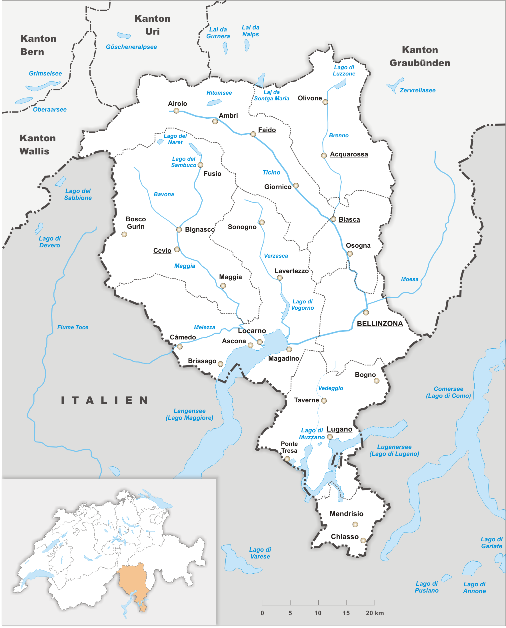
Ticino (), sometimes Tessin (), officially the Republic and Canton of Ticino or less formally the Canton of Ticino,, informally ''Canton Ticino'' ; lmo, Canton Tesin ; german: Kanton Tessin ; french: Canton du Tessin ; rm, Chantun dal Tessin . is one of the 26 cantons forming the Swiss Confederation. It is composed of eight districts and its capital city is Bellinzona. It is also traditionally divided into the Sopraceneri and the Sottoceneri, respectively north and south of Monte Ceneri. Red and blue are the colours of its flag. Ticino is the southernmost canton of Switzerland. It is one of the three large southern Alpine cantons, along with Valais and the Grisons. However, unlike all other cantons, it lies almost entirely south of the Alps, and has no natural access to the Swiss Plateau. Through the main crest of the Gotthard and adjacent mountain ranges, it borders the canton of Valais to the northwest, the canton of Uri to the north and the canton of Grisons to the northea ... [...More Info...] [...Related Items...] OR: [Wikipedia] [Google] [Baidu] |
Cevio
Cevio is the capital of the district of Vallemaggia in the canton of Ticino in Switzerland. In 2006 Cevio grew by incorporating the villages of Bignasco and Cavergno, previously municipalities in their own right. History Cevio was first mentioned in 1335 as ''Zevio''. The municipality has long been the principal town of the district. In 1858, the municipality of Linescio was separated from it. Chancellor Giovan Angelo Franzoni, who was in power for 36 years, built himself a Patrician palazzo outside the center of Cevio. After the Second World War a rapid diversification of the historical heritage began. In 1962, the Museo di Valmaggia was founded to preserve and show the material heritage of the valley. After acquisition and restoration of the Palazzo Franzoni, the first regional ethnographic museum of the canton of Ticino was opened in 1963 there. In the fall of 2006, Cavergno and Bignasco were incorporated into the municipality; Bignasco failed to resist the incorpora ... [...More Info...] [...Related Items...] OR: [Wikipedia] [Google] [Baidu] |
Formazza
Formazza ( wae, Pumât, pms, Formassa) is a ''comune'' (municipality) in the Province of Verbano-Cusio-Ossola in the Italian region Piedmont, located about northeast of Turin and about north of Verbania, on the border with Switzerland. Formazza borders the following municipalities: Baceno, Bedretto (Switzerland), Bignasco (Switzerland), Binn (Switzerland), Bosco/Gurin (Switzerland), Cavergno (Switzerland), Premia, Reckingen-Gluringen (Switzerland), Ulrichen (Switzerland). The village was founded by Walser and Walser German is still spoken. Geography and climate The village is situated about an elevation of above sea level on the Formazza plateau in Formazza valley. Its altitude and location directly under the high mountains of the western Alps influences the climate. In fact, there is an average of more than one meter and thirty centimeters of precipitation per year (especially snow). The climate is the type ''Dfb''/''Dfc'' (Köppen climate classification), which means i ... [...More Info...] [...Related Items...] OR: [Wikipedia] [Google] [Baidu] |
Lavizzara
Lavizzara is a municipality in the district of Vallemaggia in the canton of Ticino in Switzerland. The municipality was created in 2004 by a merger of Broglio, Brontallo, Fusio, Menzonio, Peccia and Prato-Sornico.Amtliches Gemeindeverzeichnis der Schweiz published by the Swiss Federal Statistical Office accessed 14 January 2010 History Broglio is first mentioned in 1361 as ''Brono''. Brontallo is first mentioned in 1574 as ''Bruntalo''. Fusio is first mentioned in 1258 as ''Fuxio''. Menzonio is first mentioned in 1364 as ''Menzone''. Peccia is first mentioned in 1374 as ''Petia''. Prato and Sorn ...[...More Info...] [...Related Items...] OR: [Wikipedia] [Google] [Baidu] |
Nufenen Pass
Nufenen Pass (Italian: ''Passo della Novena'', German: ''Nufenenpass'') (el. 2478 m.) is the highest mountain pass with a paved road within Switzerland. It lies between the summits of Pizzo Gallina (north) and the Nufenenstock (south). The pass road from Ulrichen in canton of Valais leads to the Bedretto valley in the canton of Ticino, linking Brig to Airolo. It is not the lowest pass between the two valleys, as it is located one kilometre north of an unnamed slightly lower pass at 2,440 metres (vs 2478 m.), which is traversed by a trail. The road is of relatively recent construction, having been opened to motor vehicle traffic only since September 1969. The source of the Ticino River lies east of the top of the pass. Towards the north are views of the Bernese Alps, including the Finsteraarhorn while there is a view over the Gries Glacier to the south. See also * List of highest paved roads in Europe * List of mountain passes Bibliography * Nicola Pfund, ''Sui passi in ... [...More Info...] [...Related Items...] OR: [Wikipedia] [Google] [Baidu] |
Realp
Realp (archaic : ''Frialp'') is a municipality in the canton of Uri in Switzerland. History Realp is first mentioned in 1363 as ''Riealb''. Geography Realp has an area, , of . Of this area, 41.6% is used for agricultural purposes, while 2.3% is forested. Of the rest of the land, 0.6% is settled (buildings or roads) and the remainder (55.4%) is non-productive (rivers, glaciers or mountains). , 0.2% of the total land area was heavily forested, while 2.1% is covered in small trees and shrubbery. Of the agricultural land, 1.6% is used for orchards or vine crops and 40.0% is used for alpine pastures. Of the settled areas, 0.1% is covered with buildings, and 0.5% is transportation infrastructure. Of the unproductive areas, 0.1% is unproductive standing water (ponds or lakes), 1.1% is unproductive flowing water (rivers), 43.3% is too rocky for vegetation, and 10.9% is other unproductive land. [...More Info...] [...Related Items...] OR: [Wikipedia] [Google] [Baidu] |
Airolo
Airolo (''Airöö'' in Lombard, in rm, italic=yes, ) is a municipality in the district of Leventina in the canton of Ticino in Switzerland. Geography Airolo is located in Leventina valley and the Lepontine Alps, on the southern flank of the St. Gotthard Pass. Both the Gotthard rail tunnel, on the important Gotthard railway linking northern and southern Europe, and the Gotthard road tunnel, on the A2 motorway, have their southern portal in Airolo. It is the largest municipality in the canton of Ticino, and consists of the village of Airolo and the hamlets of Valle, Madrano, Brugnasco, Nante and Fontana. The municipalities of Airolo and Quinto are considering a merger some time in the future into a new municipality which will be known as Airolo-Quinto.Amtliches Ge ... [...More Info...] [...Related Items...] OR: [Wikipedia] [Google] [Baidu] |

.jpg)


