|
Başbaşı
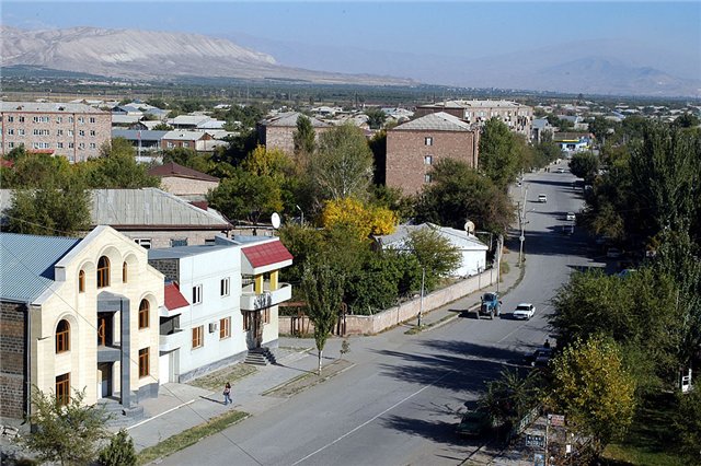
Başbaşı (also, Bashbashi and Bash-bashy) is a settlement in the municipality of Nakhchivan in Nakhchivan City, Nakhchivan Autonomous Republic, Azerbaijan. It is located 12 km in the south-west from the Nakhchivan city, on the bank of the Araz River. The station in the railway line of the Baku-Nakhchivan. It was founded during the construction of the railway line (1908) of the Ulukhanlu (present Armenia Armenia, officially the Republic of Armenia, is a landlocked country in the Armenian Highlands of West Asia. It is a part of the Caucasus region and is bordered by Turkey to the west, Georgia (country), Georgia to the north and Azerbaijan to ...) - Julfa. It has not permanent population. The salt which have got out from the salt mine of Nakhchivan, were brought to the station of ''Bashbashi'' via cable. At present, the station is used as a meeting point of the trains. There is a terminal. The settlement covers an area of 3.2 hectares. Etymology The name of the sett ... [...More Info...] [...Related Items...] OR: [Wikipedia] [Google] [Baidu] |
Nakhchivan City
Nakhchivan ( ; ) is the capital and largest city of the eponymous Nakhchivan Autonomous Republic, a true exclave of Azerbaijan, located west of Baku. The municipality of Nakhchivan consists of the city of Nakhchivan, the settlement of Əliabad and the villages of Başbaşı, Bulqan, Haciniyyət, Qaraçuq, Qaraxanbəyli, Tumbul, Qarağalıq, and Daşduz. It is spread over the foothills of Zangezur Mountains, on the right bank of the Nakhchivan River at an altitude of above sea level. Toponymy The city's official Azerbaijani spelling is "Nakhchivan" (). The name is transliterated from Persian as Nakhjavan (). The city's name is transliterated from Russian as Nakhichevan' () and from Armenian as Nakhijevan (). The city was first mentioned in Ptolemy's ''Geography'' as ''Naxuana'' (, ). [...More Info...] [...Related Items...] OR: [Wikipedia] [Google] [Baidu] |
Administrative Divisions Of Azerbaijan
Azerbaijan is administratively divided into 67 districts () and 11 cities () that are subordinate to the Republic. Out of these districts and cities, 7 districts and 1 city are located within the Nakhchivan Autonomous Republic. The districts are further divided into Municipalities of Azerbaijan, municipalities (). Additionally, the districts of Azerbaijan are grouped into 14 Economic regions of Azerbaijan, Economic Regions (). On 7 July 2021, President of Azerbaijan Ilham Aliyev signed a decree "On the new division of economic regions in the Republic of Azerbaijan". Administrative divisions Contiguous Azerbaijan The list below represents the districts of contiguous Azerbaijan. For those of the Nakhchivan exclave, see further below. Nakhchivan Autonomous Republic The seven districts and one municipality of the Nakhchivan Autonomous Republic are listed below. Economic regions Nagorno-Karabakh The territory of former Nagorno-Karabakh Autonomous Oblast presently ... [...More Info...] [...Related Items...] OR: [Wikipedia] [Google] [Baidu] |
Nakhchivan Autonomous Republic
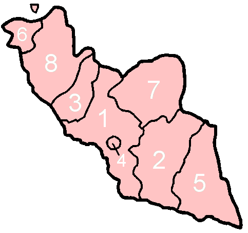
The Nakhchivan Autonomous Republic (, ) is a landlocked country, landlocked Enclave and exclave, exclave of the Azerbaijan, Republic of Azerbaijan. The region covers Official portal of Nakhchivan Autonomous RepublicNakhchivan Autonomous Republic with a population of 459,600. It is bordered by Armenia to the east and north, Iran to the southwest, and Turkey to the west. It is the sole autonomous republic of Azerbaijan, governed by Supreme Assembly (Nakhchivan), its own elected legislature. The republic, especially the capital city of Nakhchivan (city), Nakhchivan, has a long history dating back to about 1500 BC. ''Nakhijevan'' was one the Provinces of the kingdom of Armenia (antiquity), cantons of the historical Armenian province of Vaspurakan in the Kingdom of Armenia (antiquity), Kingdom of Armenia. Historically, the Persians, Armenians, Mongols, and Turkic peoples, Turks all competed for the region. The area that is now Nakhchivan became part of Safavid Iran in the 16th centur ... [...More Info...] [...Related Items...] OR: [Wikipedia] [Google] [Baidu] |
Azerbaijan Time
Azerbaijan Time () is the standard time zone in Azerbaijan, four hours ahead of UTC ( UTC+04:00). The daylight saving time adjustment, Azerbaijan Summer Time (), was one hour ahead at UTC+05:00; it was introduced in 1997 and discontinued in March 2016. Azerbaijan Time is the same as Samara Time (Russia), United Arab Emirates Standard Time, Georgia Time, Armenia Time and Seychelles Time. History Azerbaijan, formerly the Azerbaijan Soviet Socialist Republic (Azerbaijan SSR), adhered to timekeeping regulations instituted by the Soviet Union The Union of Soviet Socialist Republics. (USSR), commonly known as the Soviet Union, was a List of former transcontinental countries#Since 1700, transcontinental country that spanned much of Eurasia from 1922 until Dissolution of the Soviet .... In 1930, the Council of People’s Commissars of the USSR implemented " Decree Time," which mandated a one-hour advancement of standard time across the entire Soviet territory. This mov ... [...More Info...] [...Related Items...] OR: [Wikipedia] [Google] [Baidu] |
Azerbaijan
Azerbaijan, officially the Republic of Azerbaijan, is a Boundaries between the continents, transcontinental and landlocked country at the boundary of West Asia and Eastern Europe. It is a part of the South Caucasus region and is bounded by the Caspian Sea to the east, Russia's republic of Dagestan to the north, Georgia (country), Georgia to the northwest, Armenia and Turkey to the west, and Iran to the south. Baku is the capital and largest city. The territory of what is now Azerbaijan was ruled first by Caucasian Albania and later by various Persian empires. Until the 19th century, it remained part of Qajar Iran, but the Russo-Persian wars of Russo-Persian War (1804–1813), 1804–1813 and Russo-Persian War (1826–1828), 1826–1828 forced the Qajar Empire to cede its Caucasian territories to the Russian Empire; the treaties of Treaty of Gulistan, Gulistan in 1813 and Treaty of Turkmenchay, Turkmenchay in 1828 defined the border between Russia and Iran. The region north o ... [...More Info...] [...Related Items...] OR: [Wikipedia] [Google] [Baidu] |
Aras (river)
The Aras is a transboundary river in the Caucasus. It rises in eastern Turkey and flows along the borders between Turkey and Armenia, between Turkey and the Nakhchivan exclave of Azerbaijan, between Iran and both Azerbaijan and Armenia, and, finally, through Azerbaijan where it flows into the Kura river as a right tributary. It drains the south side of the Lesser Caucasus Mountains, while the Kura drains the north side of the Lesser Caucasus. The river's total length is and its watershed covers an area of . The Aras is one of the longest rivers in the Caucasus. Names In classical antiquity, the river was known to the Greeks as Araxes (). Its modern Armenian name is ''Arax'' or ''Araks'' (). Historically, it was called (, in modern pronunciation) by Armenians and its Old Georgian name is ''Rakhsi'' (). In Azerbaijani, the river's name is ''Araz''. In Persian, Kurdish and Turkish its name is (''Aras''). Geography The Aras is supported by the Kocagün stream, Dallı s ... [...More Info...] [...Related Items...] OR: [Wikipedia] [Google] [Baidu] |
Ulukhanlu
Masis () is a town and administrative centre of the Masis Municipality of the Ararat Province of Armenia, located on the left bank of the Hrazdan River, 9 km southwest of Yerevan towards Mount Ararat. The town has a large railroad commodity station that serves Yerevan, and used to connect the capital city with the Nakhichevan Autonomous Soviet Socialist Republic until the closing of the border with Azerbaijan. Masis is one of the closest settlements to Mount Ararat and Little Ararat. The mountains are visible from most of the areas in the town. As of the 2011 census, the population of the town was 20,215. As per the 2016 official estimate, the town has a population of 18,500. As of the 2022 census, the population of the town was 20,081 and is the biggest town in the Ararat Province. Etymology Masis () is the Armenian name for the peak of Mount Ararat.Thomson, p. 90-98. The ''History of Armenia'' derives the name from king ''Amasia'', the great-grandson of the Armenian patri ... [...More Info...] [...Related Items...] OR: [Wikipedia] [Google] [Baidu] |
Armenia
Armenia, officially the Republic of Armenia, is a landlocked country in the Armenian Highlands of West Asia. It is a part of the Caucasus region and is bordered by Turkey to the west, Georgia (country), Georgia to the north and Azerbaijan to the east, and Iran and the Azerbaijani exclave of Nakhchivan Autonomous Republic, Nakhchivan to the south. Yerevan is the Capital city, capital, largest city and Economy of Armenia, financial center. The Armenian Highlands has been home to the Hayasa-Azzi, Shupria and Nairi. By at least 600 BC, an archaic form of Proto-Armenian language, Proto-Armenian, an Indo-European languages, Indo-European language, had diffused into the Armenian Highlands.Robert Drews (2017). ''Militarism and the Indo-Europeanizing of Europe''. Routledge. . p. 228: "The vernacular of the Great Kingdom of Biainili was quite certainly Armenian. The Armenian language was obviously the region's vernacular in the fifth century BC, when Persian commanders and Greek writers ... [...More Info...] [...Related Items...] OR: [Wikipedia] [Google] [Baidu] |
Julfa District
Julfa District () is one of the 7 districts of the Nakhchivan Autonomous Republic of Azerbaijan. The district borders the districts of Ordubad, Babek, Shahbuz, as well as the Syunik Province of Armenia and the East Azerbaijan Province of Iran. Its capital and largest city is Julfa. As of 2020, the district had a population of 47,000. History Established in 1930 and initially named Abragunus, it has been called Julfa District since 1950. The names, Jolfa/Julfa are also used for several regions in neighboring Iran. On November 28, 2014, by the decree of the President of Azerbaijan Republic, the Nahajir and Goynuk villages of Julfa District were removed and added to the territory of Babek District. Geography The district borders Armenia to the North-East, and Iran to the South. Julfa District is in the east from Nakhchivan city. ''Damirlidagh Mountain'' (3368 m) is the highest point of the district. Summer of the district is hot and dry, but winter is cold. Averag ... [...More Info...] [...Related Items...] OR: [Wikipedia] [Google] [Baidu] |
Populated Places In Azerbaijan
Population is a set of humans or other organisms in a given region or area. Governments conduct a census to quantify the resident population size within a given jurisdiction. The term is also applied to non-human animals, microorganisms, and plants, and has specific uses within such fields as ecology and genetics. Etymology The word ''population'' is derived from the Late Latin ''populatio'' (a people, a multitude), which itself is derived from the Latin word ''populus'' (a people). Use of the term Social sciences In sociology and population geography, population refers to a group of human beings with some predefined feature in common, such as location, race, ethnicity, nationality, or religion. Ecology In ecology, a population is a group of organisms of the same species which inhabit the same geographical area and are capable of interbreeding. The area of a sexual population is the area where interbreeding is possible between any opposite-sex pair within the area ... [...More Info...] [...Related Items...] OR: [Wikipedia] [Google] [Baidu] |


