|
Bača Pri Podbrdu
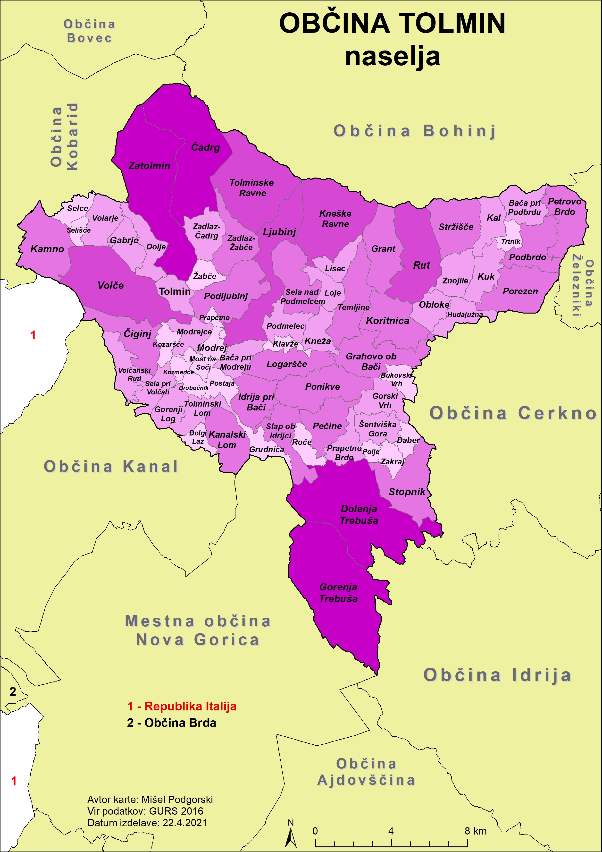
Bača pri Podbrdu () is a dispersed settlement above Podbrdo in the Municipality of Tolmin in the Littoral region of Slovenia. It lies on the southern slopes of Mount Kobla and is a popular starting point for hiking trips into the surrounding peaks of the southern Julian Alps. The local church is dedicated to Saint Leonard and belongs to the Parish A parish is a territorial entity in many Christian denominations, constituting a division within a diocese. A parish is under the pastoral care and clerical jurisdiction of a priest, often termed a parish priest, who might be assisted by one or m ... of Podbrdo. Name The name of the settlement was changed from ''Bača'' to ''Bača pri Podbrdu'' (literally, 'Bača near Podbrdo') in 1955, distinguishing it from nearby Bača pri Modreju. The settlement was attested as ''Binchinvel'' in 1377. The origin of the name ''Bača'' is uncertain; it may be derived from the Slavic root *''bač-'', referring to a wet or damp place, or, less like ... [...More Info...] [...Related Items...] OR: [Wikipedia] [Google] [Baidu] |
Flag Of Slovenia
The national flag of Slovenia ( sl, zastava Slovenije) features three equal horizontal bands of white (top), blue, and red, with the Coat of arms of Slovenia located in the upper hoist side of the flag centered in the white and blue bands. The coat of arms is a shield with the image of Mount Triglav, Slovenia's highest peak, in white against a blue background at the center; beneath it are two wavy blue lines representing the Adriatic Sea and local rivers, and above it are three six-pointed golden stars arranged in an inverted triangle which are taken from the coat of arms of the Counts of Celje, the great Slovene dynastic house of the late 14th and early 15th centuries. The flag's colors are considered to be Pan-Slavism, Pan-Slavic, but they actually come from the Middle Ages, medieval coat of arms of the Duchy of Carniola, consisting of 3 stars, a mountain, and three colors (red, blue, yellow). crescent. The existing Slovene tricolor was raised for the first time in history duri ... [...More Info...] [...Related Items...] OR: [Wikipedia] [Google] [Baidu] |
Slovenia
Slovenia ( ; sl, Slovenija ), officially the Republic of Slovenia (Slovene: , abbr.: ''RS''), is a country in Central Europe. It is bordered by Italy to the west, Austria to the north, Hungary to the northeast, Croatia to the southeast, and the Adriatic Sea to the southwest. Slovenia is mostly mountainous and forested, covers , and has a population of 2.1 million (2,108,708 people). Slovenes constitute over 80% of the country's population. Slovene, a South Slavic language, is the official language. Slovenia has a predominantly temperate continental climate, with the exception of the Slovene Littoral and the Julian Alps. A sub-mediterranean climate reaches to the northern extensions of the Dinaric Alps that traverse the country in a northwest–southeast direction. The Julian Alps in the northwest have an alpine climate. Toward the northeastern Pannonian Basin, a continental climate is more pronounced. Ljubljana, the capital and largest city of Slovenia, is geogr ... [...More Info...] [...Related Items...] OR: [Wikipedia] [Google] [Baidu] |
Slovenian Littoral
The Slovene Littoral ( sl, Primorska, ; it, Litorale; german: Küstenland) is one of the five traditional regions of Slovenia. Its name recalls the former Austrian Littoral (''Avstrijsko Primorje''), the Habsburg possessions on the upper Adriatic coast, of which the Slovene Littoral was part. Geography The region forms the westernmost part of Slovenia, bordering the intermunicipal union of Giuliana in the region of Friuli Venezia Giulia of Italy. It stretches from the Adriatic Sea in the south up to the Julian Alps in the north. The Slovene Littoral comprises two traditional provinces: Goriška and Slovene Istria. The Goriška region takes its name from the town of Gorizia () now in Italy; the neighbouring conurbation of Nova Gorica and Šempeter-Vrtojba today is the urban centre of the Slovene Littoral. Slovene Istria comprises the northern part of the Istria peninsula and provides, on the Slovene Riviera coastline with the ports of Koper, Izola, and Piran, the countr ... [...More Info...] [...Related Items...] OR: [Wikipedia] [Google] [Baidu] |
Statistical Regions Of Slovenia
The statistical regions of Slovenia are 12 administrative entities created in 2000 for legal and statistical purposes. Division By a decree in 2000, Slovenia has been divided into 12 statistical regions ( NUTS-3 level), which are grouped in two cohesion regions (NUTS-2 level). which replace the historical regions of the country. The statistical regions have been grouped into two cohesion regions are: *Eastern Slovenia (''Vzhodna Slovenija'' – SI01), which groups the Mura, Drava, Carinthia, Savinja, Central Sava, Lower Sava, Southeast Slovenia, and Littoral–Inner Carniola regions. * Western Slovenia (''Zahodna Slovenija'' – SI02), which groups the Central Slovenia, Upper Carniola, Gorizia, and Coastal–Karst regions. Sources Slovenian regions in figures 2014 See also *List of Slovenian regions by Human Development Index *Municipalities of Slovenia Slovenia is divided into 212 municipalities ( Slovene: ''občine'', singular'' občina''), of which 12 have urban (metr ... [...More Info...] [...Related Items...] OR: [Wikipedia] [Google] [Baidu] |
Gorizia Statistical Region
The Gorizia Statistical Region ( sl, Goriška statistična regija) is a statistical region in western Slovenia, along the border with Italy. It is named after the Italian town of Gorizia (the feminine adjective ''goriška'' comes from the Slovenian name for Gorizia: ''Gorica''). The Julian Alps, the Soča River, and the Vipava Valley are the most prominent natural features of this region. It contributed just over 5% to total national GDP in 2012, but in terms of GDP per capita it ranked fourth in the country. In the same year, disposable income per capita in the region the highest, in second place behind the Central Slovenia Statistical Region. Housing stock estimates indicate that at the end of 2013 the region had the highest share of dwellings with three or more rooms (around 70%). The share of single-room dwellings was less than 10%. Dwellings here are larger than the Slovenian average, with 37 m² of usable floor space per person on average. The number of cars per 1,000 popul ... [...More Info...] [...Related Items...] OR: [Wikipedia] [Google] [Baidu] |
Municipalities Of Slovenia
Slovenia is divided into 212 municipalities ( Slovene: ''občine'', singular'' občina''), of which 12 have urban (metropolitan) status. Municipalities are further divided into local communities and districts. Slovene is an official language of all the municipalities. Hungarian is a second official language of three municipalities in Prekmurje: Dobrovnik/Dobronak, Hodoš/Hodos, and Lendava/Lendva. Italian is a second official language of four municipalities (of which one has urban status) in the Slovene Littoral The Slovene Littoral ( sl, Primorska, ; it, Litorale; german: Küstenland) is one of the five traditional regions of Slovenia. Its name recalls the former Austrian Littoral (''Avstrijsko Primorje''), the Habsburg possessions on the upper Adria ...: Ankaran/Ancarano, Izola/Isola, Koper/Capodistria, and Piran/Pirano. In the EU statistics, the municipalities of Slovenia are classified as "local administrative unit 2" (LAU 2), below 58 administrative units ('), which ... [...More Info...] [...Related Items...] OR: [Wikipedia] [Google] [Baidu] |
Municipality Of Tolmin
The Municipality of Tolmin (; sl, Občina Tolmin) is a municipalities of Slovenia, municipality in northwestern Slovenia. Its seat and largest settlement is Tolmin. History In ancient times the area was inhabited by the Illyrians and then by the Ancient Rome, Romans. In the 6th century the Slavs, ancestors of present-day Slovenes, settled the area. Until 1420 it belonged to the Patriarchate of Aquileia (State), Patriarchate of Aquileia, when it was acquired by the Republic of Venice. In 1514 it became a possession of the Habsburgs, who gave it as fief to the Coronini-Cronberg family. Medieval documents testify to a long series of uprisings, culminating in the Tolmin peasant revolt of 1713. That particular insurgence spread from Tolmin County to the Vipava Valley, Karst Plateau, Karst, and Brda (Slovenia), Brda, and further on to northern Istria. The uprising was mercilessly crushed by the Holy Roman Emperors, imperial army and its eleven leaders were beheaded. In the 16th centu ... [...More Info...] [...Related Items...] OR: [Wikipedia] [Google] [Baidu] |
Dispersed Settlement
A dispersed settlement, also known as a scattered settlement, is one of the main types of settlement patterns used by landscape historians to classify rural settlements found in England and other parts of the world. Typically, there are a number of separate farmsteads scattered throughout the area. A dispersed settlement contrasts with a nucleated village. It can be known as main human settlements. The French term ''bocage'' is sometimes used to describe the type of landscape found where dispersed settlements are common. In addition to Western Europe, dispersed patterns of settlement are found in parts of Papua New Guinea, as among the Gainj, Ankave, and Baining tribes. It is also frequently met with in nomadic pastoral societies. In Ghana, Kumbyili in the northern region is also an example of a dispersed settlement England In England, dispersed settlements are often found in the areas of ancient enclosure outside the central region—for example, Essex, Kent and the West Cou ... [...More Info...] [...Related Items...] OR: [Wikipedia] [Google] [Baidu] |
Podbrdo, Tolmin
Podbrdo (; it, Piedicolle, german: Untereck) is a settlement in the Municipality of Tolmin in the Littoral region of Slovenia. It lies in narrow valley of the Bača River, next to the Bohinj Railway line at the end of the longest railway tunnel in Slovenia (6,327.3 m) and next to the road from Bohinjska Bistrica and Železniki across Petrovo Brdo towards Most na Soči. Name The name ''Podbrdo'' is a fused prepositional phrase that has lost its case inflection, from ''pod'' 'under' + ''brdo'' 'hill', thus referring to the local geography. History The settlement was founded in the 16th century by German-speaking settlers from Tyrol, but the area was settled earlier. Church The most important building in the village is the parish church; it is dedicated to Saint Nicholas and belongs to the Diocese of Koper. ... [...More Info...] [...Related Items...] OR: [Wikipedia] [Google] [Baidu] |
Hiking
Hiking is a long, vigorous walk, usually on trails or footpaths in the countryside. Walking for pleasure developed in Europe during the eighteenth century.AMATO, JOSEPH A. "Mind over Foot: Romantic Walking and Rambling." In ''On Foot: A History of Walking'', 101-24. NYU Press, 2004. Accessed March 1, 2021. http://www.jstor.org/stable/j.ctt9qg056.7. Religious pilgrimages have existed much longer but they involve walking long distances for a spiritual purpose associated with specific religions. "Hiking" is the preferred term in Canada and the United States; the term "walking" is used in these regions for shorter, particularly urban walks. In the United Kingdom and the Republic of Ireland, the word "walking" describes all forms of walking, whether it is a walk in the park or backpacking in the Alps. The word hiking is also often used in the UK, along with rambling , hillwalking, and fell walking (a term mostly used for hillwalking in northern England). The term bushwalking is end ... [...More Info...] [...Related Items...] OR: [Wikipedia] [Google] [Baidu] |
Julian Alps
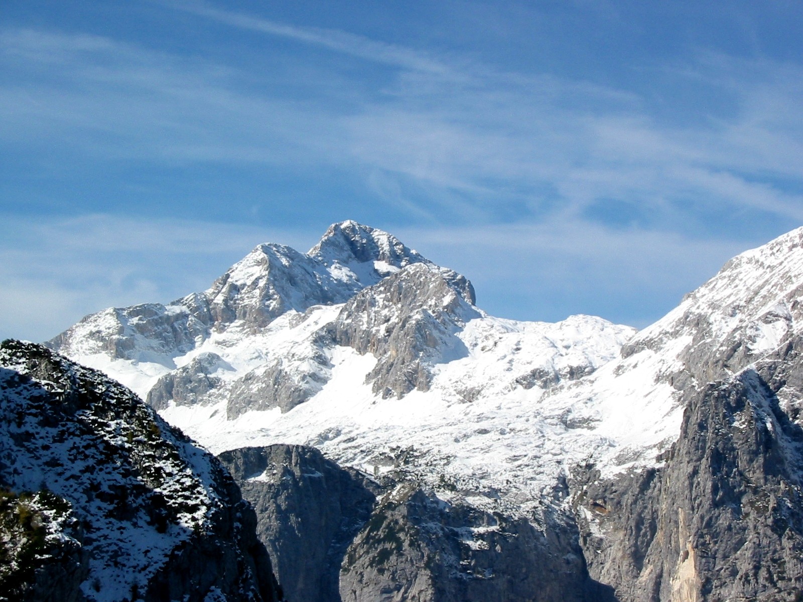
The Julian Alps ( sl, Julijske Alpe, it, Alpi Giulie, , ) are a mountain range of the Southern Limestone Alps that stretch from northeastern Italy to Slovenia, where they rise to 2,864 m at Mount Triglav, the highest peak in Slovenia. A large part of the Julian Alps is included in Triglav National Park. The second highest peak of the range, the 2,755 m high Jôf di Montasio, lies in Italy. The Julian Alps cover an estimated 4,400 km2 (of which 1,542 km2 lies in Italy). They are located between the Sava Valley and Canale Valley. They are divided into the Eastern and Western Julian Alps. Name The Julian Alps were known in antiquity as ''Alpe Iulia'', and also attested as ''Alpes Juliana'' AD 670, ''Alpis Julia'' 734, and ''Alpes Iulias'' in 1090. Like the municipium of ''Forum Julii'' (now Cividale del Friuli) at the foot of the mountains, the range was named after Julius Caesar of the Julian clan, perhaps due to a road built by Julius Caesar and completed by Aug ... [...More Info...] [...Related Items...] OR: [Wikipedia] [Google] [Baidu] |


