|
Baynes Sound
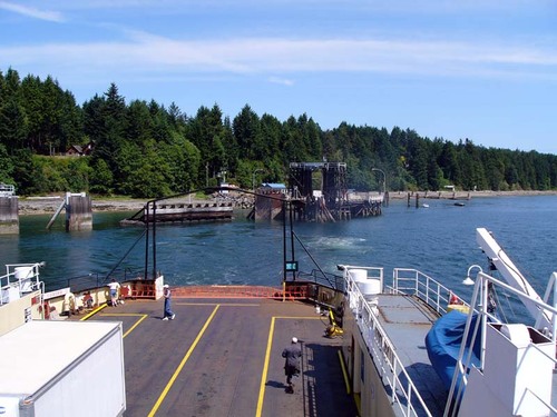
Baynes Sound is the channel between Denman Island and Vancouver Island, British Columbia, Canada. The sound is a narrow western offshoot of the Strait of Georgia that separates Vancouver Island from the mainland of British Columbia. The area is actively harvested by the local oyster industry, as is apparent by an abundance of oyster farms. It produces 39% of the oysters and 55% of the manila clams farmed in British Columbia. The sound is long and is wide at its widest point, although the average width is less than . The southern boundary lies around Chrome Island, a small island off Boyle Point, the southern tip of Denman. The northern boundary is less defined, but lies between Tree Island at the northern end of Denman and the Comox harbour. The sound is dotted with the small communities of (north to south) Royston, Union Bay, Buckley Bay, Mud Bay, Fanny Bay, and Deep Bay on Vancouver Island. The crossing is served by the British Columbia Ferry Services Inc. ship MV Baynes S ... [...More Info...] [...Related Items...] OR: [Wikipedia] [Google] [Baidu] |
Denman Island
Denman Island, or Sla-dai-aich (Taystayic), its Indigenous name, is one of the Northern Gulf Islands and part of the Comox Valley Regional District of British Columbia, Canada. It is a member of the Islands Trust group of islands and is home to a small community of 1391 year-round residents. History Denman Island was first inhabited by Indigenous peoples including the Pentlatch and Sliammon as evidenced by middens, gravesites, and oral history. The site most recently occupied by Pentlatch people was previously named Village Point but is now called Denman Point. That village was occupied until the 1862 smallpox epidemic severely reduced its population and the survivors moved to join the K'ómoks people in nearby Comox. The Island was seen and mapped by Europeans during the 1791 voyage of the Spanish ship ''Santa Saturnina'', under Juan Carrasco and José María Narváez. It was named by Captain Richards in 1860 for Rear Admiral Joseph Denman who was commander of the Pacific ... [...More Info...] [...Related Items...] OR: [Wikipedia] [Google] [Baidu] |
Fanny Bay
Fanny Bay is a small hamlet in the Canadian province of British Columbia. It is located on Baynes Sound on the east coast of Vancouver Island. In 2001, its population was listed as 815. It is best known for its fine oysters. The area is served by the Island Highway and Island Rail Corridor. Origin of the name There is no consensus on the origin of the name Fanny Bay and none of the various explanations — comical, romantic, local or historical — can be considered without skepticism. The name first appeared on British Columbia maps in 1913 and was officially adopted by the government in 1923. This adoption was based on British Admiralty charts of the 1860s, taken from surveys by Royal Navy Captain G.H. Richards. However, if Capt. Richards knew who "Fanny" was, he did not record the information. Geographer A.B. McNeill wrote in his book ''Origin of Station Names, Esquimalt and Nanaimo Division'' that "...Fanny Bay was named after a sea captain who lived in this vicinity"; how ... [...More Info...] [...Related Items...] OR: [Wikipedia] [Google] [Baidu] |
Lateral Mark
A lateral buoy, lateral post or lateral mark, as defined by the International Association of Marine Aids to Navigation and Lighthouse Authorities, is a sea mark used in maritime pilotage to indicate the edge of a channel. Each mark indicates the edge of the safe water channel in terms of port (left-hand) or starboard (right-hand). These directions are relative to the ''direction of buoyage''; this is usually a nominally upstream direction. In a river, the direction of buoyage is towards the river's source; in a harbour, the direction of buoyage is into the harbour from the sea. Where there may be doubt, it will be labelled on the appropriate chart. Often the cardinal mark system is used instead, when confusion about the direction would be common. A vessel heading in the direction of buoyage (e.g. into a harbour) and wishing to keep in the main channel should: * keep port marks to its port (left) side, and * keep starboard marks to its starboard (right) side. IALA System M ... [...More Info...] [...Related Items...] OR: [Wikipedia] [Google] [Baidu] |
Desolation Sound
, image = Desolation sound 2006.jpg , image_size = 250px , alt = , caption = Desolation Sound , image_bathymetry = Carte baie Desolation fr.png , alt_bathymetry = , caption_bathymetry = Extent of Desolation Sound , location = Discovery Islands, British Columbia , group = , coordinates = , type = Sound , etymology = , part_of = Salish Sea , inflow = , rivers = , outflow = , oceans = , catchment = , basin_countries = , agency = , designation = , date-built = , engineer = , date-flooded = , length = , width = , area = , depth = , max-depth = , volume = , residence_time = , salinity = , shore = , elevation ... [...More Info...] [...Related Items...] OR: [Wikipedia] [Google] [Baidu] |
Deep Bay Marine Field Station
The Deep Bay Marine Field Station is a marine biological research facility operated by Vancouver Island University's Centre for Shellfish Research. It is located at Deep Bay, British Columbia on Vancouver Island, off the waters of Baynes Sound, north-west of the main university campus at Nanaimo, British Columbia. Facilities include a seawater tank farm, a laboratory, a demonstration shellfish farm and a combined research facility for shellfish aquaculture, marine ecology and water quality. The culinary program of VIU uses the kitchen facilities to prepare seafood and other dishes. The building received the first LEED platinum rating among Canadian universities and a 2011 National Green Buildings Award. Located on a site, it is accessed by a road topped with crushed oyster shells. Beetle-killed pine flooring and other BC wood products were used in construction. It opened in 2011. Research Early priorities were research concerning geoduck clams and the possibility of r ... [...More Info...] [...Related Items...] OR: [Wikipedia] [Google] [Baidu] |
Vancouver Island University
Vancouver Island University (abbreviated as VIU, formerly known as Malaspina University-College and earlier as Malaspina College) is a Canadian public university serving Vancouver Island and coastal British Columbia. Malaspina College began in 1969 and it has grown into a university which plays an important role in the educational, cultural, and economic life of the region. The main campus is located in Nanaimo; there are regional campuses in Duncan and Powell River as well as a centre in Parksville. History Vancouver Island University enrolled its first students in September 1969 as Malaspina College, named after Captain Alessandro Malaspina, who explored Vancouver Island. Registration in the first year was over 600 students, almost double what was initially expected. In 1976, after seven years at the original campus in the old Nanaimo Hospital building at 388 Machleary Street, Malaspina College moved to its new campus on Fifth Street (the present location of VIU) on former D ... [...More Info...] [...Related Items...] OR: [Wikipedia] [Google] [Baidu] |
Pacific Station
The Pacific Station was created in 1837 as one of the geographical military formations into which the Royal Navy divided its worldwide responsibilities. The South America Station was split into the Pacific Station and the South East Coast of America Station. History The British Pacific Squadron was established in 1813 to support British interests along the eastern shores of the Pacific Ocean at Valparaíso, Chile. In 1837, when the South America station was split, this responsibility was passed to the Commander-in-Chief, Pacific. In 1843, Lord George Paulet, George Paulet, captain of , took her out from Valparaíso to Honolulu to demand the islands of the Kingdom of Hawaii for Britain. King Kamehameha III capitulated and signed the islands over to Paulet. In the summer of that year, Rear-Admiral Richard Darton Thomas set out from Valparaíso in to rein Paulet in. On 31 July 1843, Thomas assured the King that the occupation was over and that there was no Paulet Affair (1843) ... [...More Info...] [...Related Items...] OR: [Wikipedia] [Google] [Baidu] |
Robert Lambert Baynes
Admiral Sir Robert Lambert Baynes (4 September 1796 – 7 September 1869) was a British Royal Navy admiral who as Commander-in-Chief, Pacific Station prevented the 1859 Pig War from escalating to a major conflict between the United States and the United Kingdom. Baynes joined the Royal Navy in 1810 and served in the Napoleonic Wars and the War of 1812. He took part in the Battle of Navarino in 1827 during the Greek War of Independence. He was promoted to captain in 1828 and commanded the vessels HMS ''Andromache'' and HMS ''Bellerophon'' and served as one of the senior officers in the Baltic Sea during the Crimean War. In 1857, he was made Commander-in-Chief, Pacific Station. Early career Baynes was born to Commander Thomas Baynes of the British Royal Navy and Edith Denman in Millbrook, Hampshire. Baynes followed his father and joined the Royal Navy on 19 April 1810 at the age of 14 and was assigned to during the Napoleonic Wars. The ship patrolled off the coast of Ca ... [...More Info...] [...Related Items...] OR: [Wikipedia] [Google] [Baidu] |
MV Baynes Sound Connector
The ''Baynes Sound Connector'' is a car ferry owned and operated by B.C. Ferries that runs between Buckley Bay on Vancouver Island and Denman Island. It is the first and only cable ferry A cable ferry (including the terms chain ferry, swing ferry, floating bridge, or punt) is a ferry that is guided (and in many cases propelled) across a river or large body of water by cables connected to both shores. Early cable ferries often ... in the BC Ferries fleet and replaced the self-propelled MV ''Quinitsa'' in February 2016. Red and green transit lights are installed at both Buckley Bay and Denman West terminals facing oncoming marine traffic in each direction. It is illegal to cross the channel while the red light is on, signifying the ferry is in transit. The crossing of approximately 1900 metres is the longest cable ferry crossing in the world. The ferry was built by Seaspan at its Vancouver Shipyards at a cost of CAD$15 Million. It is a 258-foot-long ferry designed for 150 ... [...More Info...] [...Related Items...] OR: [Wikipedia] [Google] [Baidu] |
BC Ferries
British Columbia Ferry Services Inc., operating as BC Ferries (BCF), is a former provincial Crown corporation, now operating as an independently managed, publicly owned Canadian company. BC Ferries provides all major passenger and vehicle ferry services for coastal and island communities in the Canadian province of British Columbia. Set up in 1960 to provide a similar service to that provided by the Black Ball Line and the Canadian Pacific Railway, which were affected by job action at the time, BC Ferries has become the largest passenger ferry line in North America, operating a fleet of 36 vessels with a total passenger and crew capacity of over 27,000, serving 47 locations on the B.C. coast. The federal and provincial governments subsidize BC Ferries to provide agreed service levels on essential links between the BC mainland, coastal islands, and parts of the mainland without road access. The inland ferries operating on British Columbia's rivers and lakes are not run by BC Fer ... [...More Info...] [...Related Items...] OR: [Wikipedia] [Google] [Baidu] |
Deep Bay, British Columbia
Deep Bay is an unincorporated area on the east coast of Vancouver Island, in British Columbia, Canada across Baynes Sound from Denman Island which has a government marina in a naturally protected harbour. It is situated on Highway 19A north of Qualicum Beach between Fanny Bay and Bowser. The June 23, 1946 Vancouver Island earthquake shocked the Strait of Georgia region, causing the bottom of Deep Bay to sink between and . Deep Bay is the home of the Deep Bay Marine Field Station. The Island Rail Corridor passes through the area. References External links Deep Bay Harbour Authority web siteAerial Photo of Deep BayFisheries and Oceans Canada Fisheries and Oceans Canada (DFO; french: Pêches et Océans Canada, MPO), is a department of the Government of Canada that is responsible for developing and implementing policies and programs in support of Canada's economic, ecological and sci ..., Accessed October 23, 2011 Unincorporated settlements in British Columbia P ... [...More Info...] [...Related Items...] OR: [Wikipedia] [Google] [Baidu] |
Mud Bay, British Columbia
Mud Bay is the name of the northeast side of Boundary Bay on the Canada–United States border, and an unincorporated place on the bay. The area is served by the coast-spanning Island Highway and the Island Rail Corridor The Island Rail Corridor, previously the Esquimalt & Nanaimo Railway (E&N Railway), is a railway operation on Vancouver Island and is the only remaining railway on Vancouver Island after the closure of the Englewood Railway in November 2017. .... References {{coord, 49, 04, 32, N, 122, 52, 41, W, type:bay, display=title Bays of British Columbia Designated places in British Columbia Landforms of Lower Mainland Delta, British Columbia Surrey, British Columbia White Rock, British Columbia ... [...More Info...] [...Related Items...] OR: [Wikipedia] [Google] [Baidu] |


