|
Battle Of Solicinium
The Battle of Solicinium was fought in 368 between a Roman army and the Alemanni. The Roman force was led by Emperor Valentinian I, and they managed to repel the Alemanni but suffered heavy losses during the battle. Background After the death of Julian in Persia in 363, the Alemans, forgetting the treaty of truce which the emperor had extorted from them after his four successful campaigns beyond the Rhine (in 357, 358, 359, and 360), renewed their incursions into Gaul, alleging as the pretext for war the contempt of Valentinian I's ministers in failing to supply them the accustomed tribute. In the year 366 they crossed the Rhine, and after amply compensating for the remission by the plunder which they secured, retired beyond the river. The next year, when they repeated their expedition, they found the Romans prepared, for Valentinian had crossed the Alps to secure the threatened province. However, in two successive battles, they defeated his generals, signalizing their victory ... [...More Info...] [...Related Items...] OR: [Wikipedia] [Google] [Baidu] |
Western Roman Empire
The Western Roman Empire comprised the western provinces of the Roman Empire at any time during which they were administered by a separate independent Imperial court; in particular, this term is used in historiography to describe the period from 395 to 476, where there were separate coequal courts dividing the governance of the empire in the Western and the Eastern provinces, with a distinct imperial succession in the separate courts. The terms Western Roman Empire and Eastern Roman Empire were coined in modern times to describe political entities that were ''de facto'' independent; contemporary Romans did not consider the Empire to have been split into two empires but viewed it as a single polity governed by two imperial courts as an administrative expediency. The Western Roman Empire collapsed in 476, and the Western imperial court in Ravenna was formally dissolved by Justinian in 554. The Eastern imperial court survived until 1453. Though the Empire had seen periods with m ... [...More Info...] [...Related Items...] OR: [Wikipedia] [Google] [Baidu] |
Paris
Paris () is the capital and most populous city of France, with an estimated population of 2,165,423 residents in 2019 in an area of more than 105 km² (41 sq mi), making it the 30th most densely populated city in the world in 2020. Since the 17th century, Paris has been one of the world's major centres of finance, diplomacy, commerce, fashion, gastronomy, and science. For its leading role in the arts and sciences, as well as its very early system of street lighting, in the 19th century it became known as "the City of Light". Like London, prior to the Second World War, it was also sometimes called the capital of the world. The City of Paris is the centre of the Île-de-France region, or Paris Region, with an estimated population of 12,262,544 in 2019, or about 19% of the population of France, making the region France's primate city. The Paris Region had a GDP of €739 billion ($743 billion) in 2019, which is the highest in Europe. According to the Economist Intelli ... [...More Info...] [...Related Items...] OR: [Wikipedia] [Google] [Baidu] |
Hechingen
Hechingen ( Swabian: ''Hächenga'') is a town in central Baden-Württemberg, Germany. It is situated about south of the state capital of Stuttgart and north of Lake Constance and the Swiss border. Geography The town lies at the foot of the Swabian Alps below Hohenzollern Castle. City districts The city of Hechingen is subdivided into nine neighborhoods, and the downtown is separated into ''Oberstadt''/''Altstadt'' (Upper Town/Old Town) and ''Unterstadt'' (Lower Town). Surrounding region Other cities in the area include Bodelshausen, Mössingen, Jungingen, Bisingen, Grosselfingen, Rangendingen, and Hirrlingen. History Early history Recent research shows that the battle of Solicinium, fought in 368 between the invading Alamanni and a Roman army led by Emperor Valentinian I, probably took place in the northern part of what is today Hechingen and the lost city Solicinium was located where the Roman museum of Hechingen is located today. Middle Ages Hechingen is the ... [...More Info...] [...Related Items...] OR: [Wikipedia] [Google] [Baidu] |
Tübingen
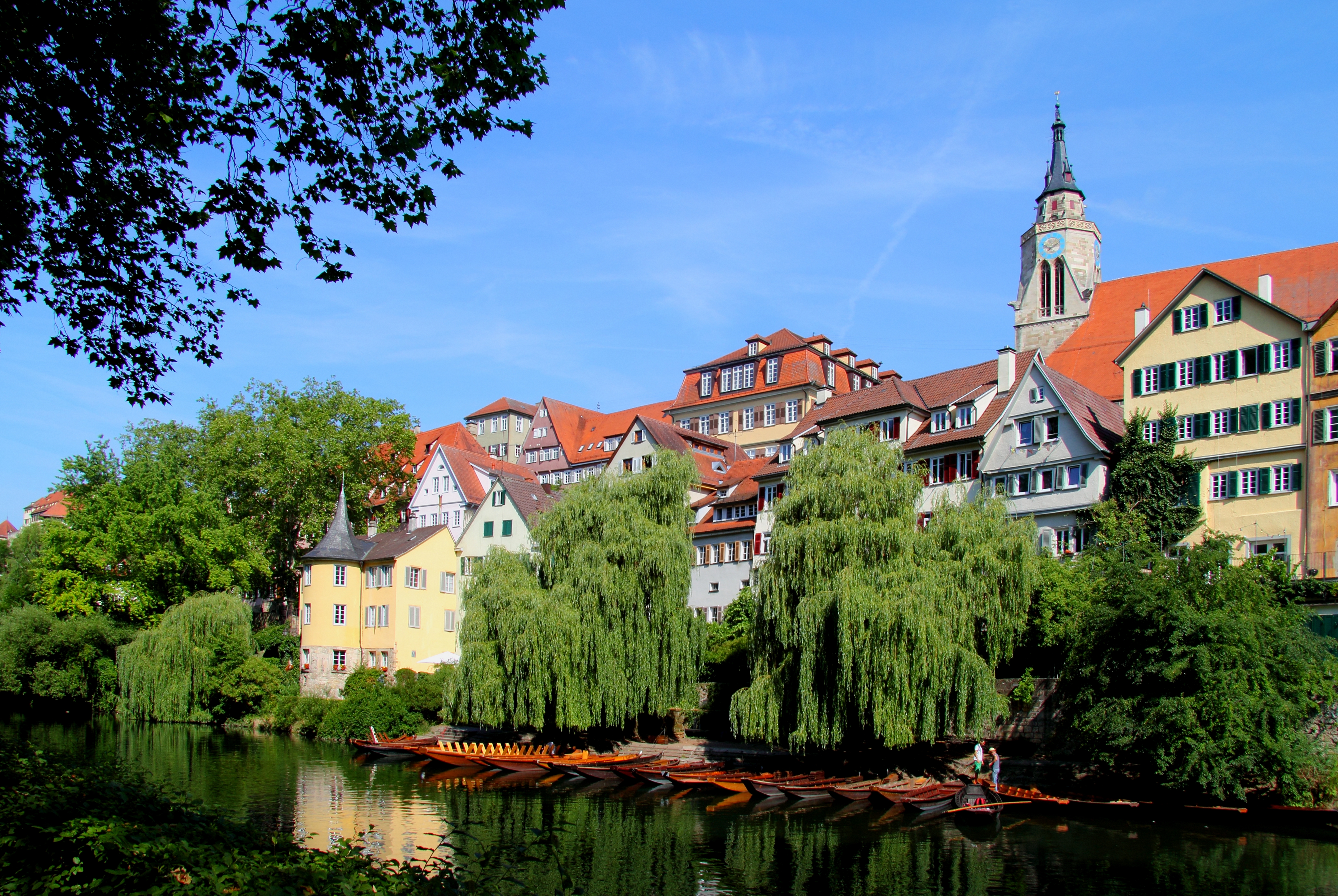
Tübingen (, , Swabian: ''Dibenga'') is a traditional university city in central Baden-Württemberg, Germany. It is situated south of the state capital, Stuttgart, and developed on both sides of the Neckar and Ammer rivers. about one in three of the 90,000 people living in Tübingen is a student. As of the 2018/2019 winter semester, 27,665 students attend the Eberhard Karls University of Tübingen. The city has the lowest median age in Germany, in part due to its status as a university city. As of December 31, 2015, the average age of a citizen of Tübingen is 39.1 years. The city is known for its veganism and environmentalism. Immediately north of the city lies the Schönbuch, a densely wooded nature park. The Swabian Alb mountains rise about (beeline Tübingen City to Roßberg - 869 m) to the southeast of Tübingen. The Ammer and Steinlach rivers are tributaries of the Neckar river, which flows in an easterly direction through the city, just south of the medieval old t ... [...More Info...] [...Related Items...] OR: [Wikipedia] [Google] [Baidu] |
Spitzberg (Tübingen)
Spitzberg (Tübingen) is a mountain of Baden-Württemberg, Germany. It is located within the city of Tübingen. See also * List of hills of the Schönbuch Mountains and hills of Baden-Württemberg {{BadenWürttemberg-geo-stub ... [...More Info...] [...Related Items...] OR: [Wikipedia] [Google] [Baidu] |
Glauberg
The Glauberg is a Celtic oppidum in Hesse, Germany consisting of a fortified settlement and several burial mounds, "a princely seat of the late Hallstatt and early La Tène periods." Archaeological discoveries in the 1990s place the site among the most important early Celtic centres in Europe. It provides unprecedented evidence on Celtic burial, sculpture and monumental architecture. Location and topography Geologically, the Glauberg, a ridge (271 m asl) on the east edge of the Wetterau plain, is a basalt spur of the Vogelsberg range. Rising about 150 m above the surrounding areas, it is located between the rivers Nidder and Seeme and belongs to the community of Glauburg. The hilltop forms a nearly horizontal plateau of 800 by 80–200m. Its southwest promontory is known as Enzheimer Köpfchen. To the northwest, the Glauberg slopes steeply down towards the Nidder valley and, in the south, it is connected with undulating uplands. The plateau contained a small perennial pond, w ... [...More Info...] [...Related Items...] OR: [Wikipedia] [Google] [Baidu] |
Rottenburg Am Neckar
Rottenburg am Neckar (; until 10 July 1964 only ''Rottenburg''; Swabian: ''Raodaburg'') is a medium-sized town in the administrative district (''Landkreis'') of Tübingen in Baden-Württemberg, Germany. It lies about 50 kilometres (31 miles) southwest of the provincial capital Stuttgart and about 12 km (7 mi) southwest of the district town Tübingen. Rottenburg is the second-largest town of the district after Tübingen and makes up a secondary centre for the surrounding community. Since 1 May 1972, Rottenburg am Neckar has been a district town (''Große Kreisstadt''). Rottenburg agreed to an administrative collective with the municipalities of Hirrlingen, Neustetten and Starzach. Rottenburg is the seat of a Roman Catholic bishop, being the official centre of the diocese of Rottenburg-Stuttgart. Moreover, it has a college of church music and a university of applied sciences (German ''Fachhochschule''), specialising in forestry. Geography Rottenburg is divided int ... [...More Info...] [...Related Items...] OR: [Wikipedia] [Google] [Baidu] |
Schwetzingen
Schwetzingen (; pfl, Schwetzinge) is a German town in northwest Baden-Württemberg, around southwest of Heidelberg and southeast of Mannheim. Schwetzingen is one of the five biggest cities of the Rhein-Neckar-Kreis district and a medium-sized centre between Heidelberg and Mannheim. The city is most famous for Schwetzingen Palace and the Schlosstheater. The palace grounds also feature a mosque, the oldest in Germany. Although not functional, it was used by Muslim prisoners in the Franco-Prussian War. Geography Schwetzingen is located in the ''Rhine-Neckar-triangle'' in the plain of the Rhine river, lying west of the Odenwald and in the east of the Rhine. A small stream, the Leimbach, runs through the city before joining the Rhine. Neighbouring municipalities The following municipalities, listed clockwise beginning in the north, border on the city limits of Schwetzingen: Mannheim, Plankstadt, Oftersheim, Hockenheim, Ketsch and Brühl. The municipal area of Schwetzing ... [...More Info...] [...Related Items...] OR: [Wikipedia] [Google] [Baidu] |
Heidelberg
Heidelberg (; Palatine German language, Palatine German: ''Heidlberg'') is a city in the States of Germany, German state of Baden-Württemberg, situated on the river Neckar in south-west Germany. As of the 2016 census, its population was 159,914, of which roughly a quarter consisted of students. Located about south of Frankfurt, Heidelberg is the List of cities in Baden-Württemberg by population, fifth-largest city in Baden-Württemberg. Heidelberg is part of the densely populated Rhine-Neckar, Rhine-Neckar Metropolitan Region. Heidelberg University, founded in 1386, is Germany's oldest and one of Europe's most reputable universities. Heidelberg is a Science, scientific hub in Germany and home to several internationally renowned #Research, research facilities adjacent to its university, including the European Molecular Biology Laboratory and four Max Planck Society, Max Planck Institutes. The city has also been a hub for the arts, especially literature, throughout the centurie ... [...More Info...] [...Related Items...] OR: [Wikipedia] [Google] [Baidu] |
Sulz Am Neckar
Sulz am Neckar is a town in the district of Rottweil, in Baden-Württemberg, Germany. It is situated on the river Neckar, 22 km north of Rottweil, and 19 km southeast of Freudenstadt. Sulz am Neckar came in the possession of the Hohengeroldseck in AD 1242. At Sulz a powerline for traction current crosses the Neckar Valley in a large span, which is mounted on two 61-metre-tall electricity pylons. Geography Geographical Location The city is situated between Black Forest and Swabian Jura as well as between Stuttgart and Lake Constance at the Neckar at an altitude of 410 to 675 m. Sulz has with a size of 87,60 km² the largest municipal area in the Rottweil (district). Urban structure The city of Sulz is divided into the core city of Sulz with its two districts Sulz-Kastell and Sulz-Schillerhöhe as well as the nine districts Bergfelden, Dürrenmettstetten, Fischingen, Glatt, Holzhausen, Hopfau, Mühlheim, Renfrizhausen, Sigmarswangen History Early histor ... [...More Info...] [...Related Items...] OR: [Wikipedia] [Google] [Baidu] |
Württemberg
Württemberg ( ; ) is a historical German territory roughly corresponding to the cultural and linguistic region of Swabia. The main town of the region is Stuttgart. Together with Baden and Hohenzollern, two other historical territories, Württemberg now forms the Federal State of Baden-Württemberg. Württemberg was formerly also spelled Würtemberg and Wirtemberg. History Originally part of the old Duchy of Swabia, its history can be summarized in the following periods: *County of Württemberg (1083–1495) * Duchy of Württemberg (1495–1803) *Electorate of Württemberg (1803–1806) *Kingdom of Württemberg (1806–1918) *Free People's State of Württemberg (1918–1945) After World War II, it was split into Württemberg-Baden and Württemberg-Hohenzollern due to the different occupation zones of the United States and France. Finally, in 1952, it was integrated into Baden-Württemberg. Stuttgart, the historical capital city of Württemberg, became the capital of the p ... [...More Info...] [...Related Items...] OR: [Wikipedia] [Google] [Baidu] |
Rhaetia
Raetia ( ; ; also spelled Rhaetia) was a province of the Roman Empire, named after the Rhaetian people. It bordered on the west with the country of the Helvetii, on the east with Noricum, on the north with Vindelicia, on the south-west with Transalpine Gaul and on the south with Venetia et Histria, a region of Roman Italy. It thus comprised the districts occupied in modern times by eastern and central Switzerland (containing the Upper Rhine and Lake Constance), southern Germany (Bavaria and most of Baden-Württemberg), Vorarlberg and the greater part of Tyrol in Austria, and part of northern Lombardy in Italy. The region of Vindelicia (today eastern Württemberg and western Bavaria) was annexed to the province at a later date than the others. The northern border of Raetia during the reigns of emperors Augustus and Tiberius was the River Danube. Later the Limes Germanicus marked the northern boundary, stretching for 166 km north of the Danube. Raetia linked to Italy across ... [...More Info...] [...Related Items...] OR: [Wikipedia] [Google] [Baidu] |


