|
Barysh (Dniester Tributary)
Barysh ( uk, –ë–∞—Ä–∏—à) is a river in Ukraine, which flows within the Chortkiv Raion of Ternopil Oblast. Left tributary of the river Dniester from the Black Sea basin.–ë–∞—Ä–∏—à / –ü. –Ü. –®—Ç–æ–π–∫–æ // Encyclopedia of Modern Ukraine ï–ª–µ–∫—Ç—Ä–æ–Ω–Ω–∏–π —Ä–µ—Å—É—Ä—Å/ –Ý–µ–¥–∫–æ–ª. : –Ü. –ú. –î–∑—é–±–∞, –ê. –Ü. –ñ—É–∫–æ–≤—Å—å–∫–∏–π, –ú. –ì. –ñ–µ–ª–µ–∑–Ω—è–∫ Ç–∞ —ñ–Ω.; –ù–ê–ù –£–∫—Ä–∞—ó–Ω–∏, –ù–¢–®. ‚Äì –ö. : –Ü–Ω—Å—Ç–∏—Ç—É—Ç –µ–Ω—Ü–∏–∫–ª–æ–ø–µ–¥–∏—á–Ω–∏—Ö –¥–æ—Å–ª—ñ–¥–∂–µ–Ω—å –ù–ê–ù –£–∫—Ä–∞—ó–Ω–∏, 2003. Length 38 km, basin a ... [...More Info...] [...Related Items...] OR: [Wikipedia] [Google] [Baidu] |
Porokhova
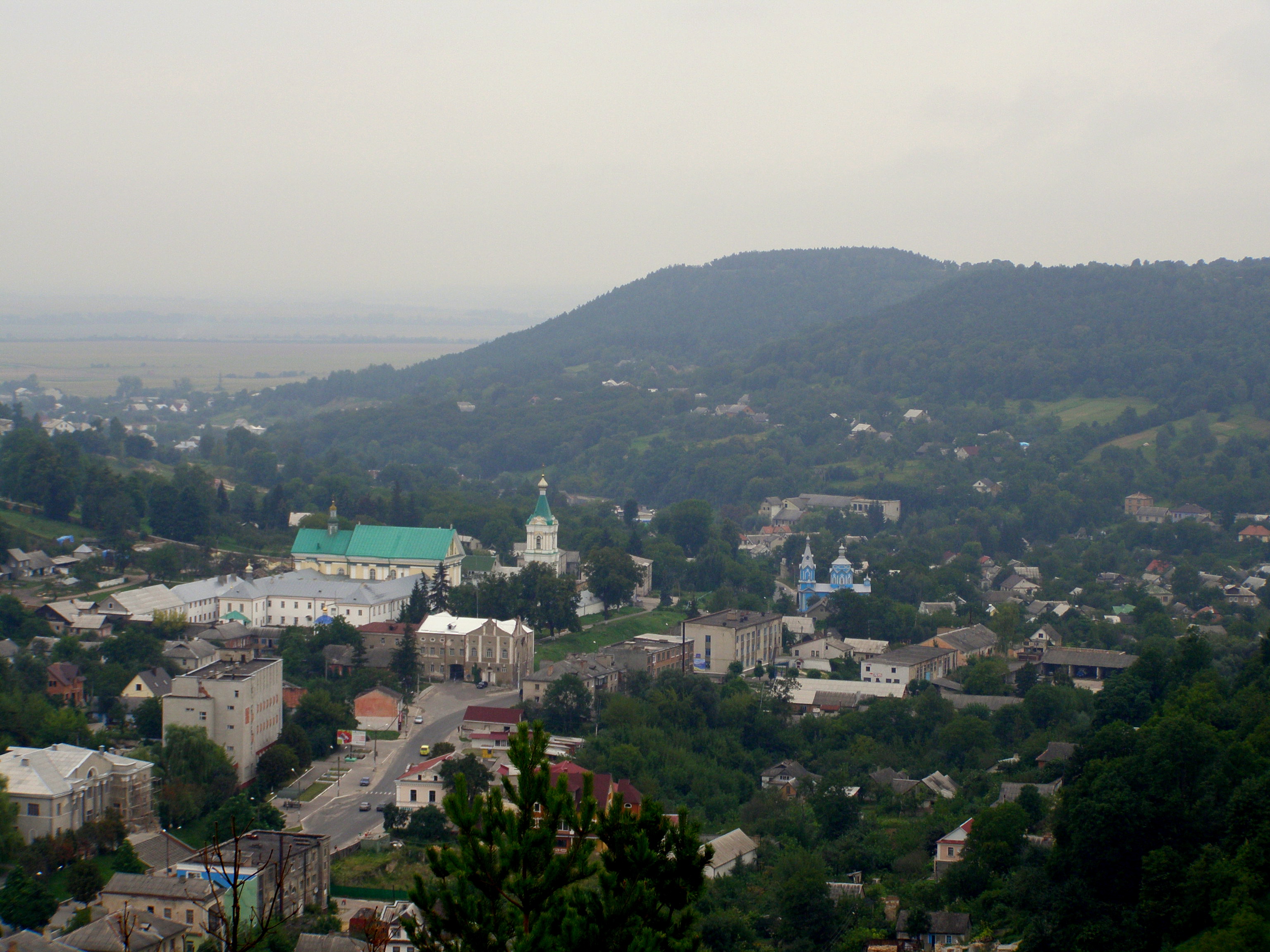
Porokhova ( uk, –ü–æ—Ä–æ—Ö–æ–≤–∞) is a village in Buchach urban hromada, Chortkiv Raion, Ternopil Oblast, Ukraine. History The first written mention of the village was in 1452. After the liquidation of the Buchach Raion Buchach Raion ( uk, –ë—É—á–∞—Ü—å–∫–∏–π —Ä–∞–π–æ–Ω) was a raion of Ternopil Oblast in western Ukraine. Its administrative center was the city of Buchach. The raion was abolished on 18 July 2020 as part of the administrative reform of Ukraine, which ... on 19 July 2020, the village became part of the Chortkiv Raion.–ü–æ—Å—Ç–∞–Ω–æ–≤–∞ –í–µ—Ä—Ö–æ–≤–Ω–æ—ó –Ý–∞–¥–∏ –£–∫—Ä–∞—ó–Ω–∏ –≤—ñ–¥ 17 –ª–∏–ø–Ω—è 2020 —Ä–æ–∫—É ‚Ññ 807-IX–ü—Ä–æ —É—Ç–≤–æ—Ä–µ–Ω–Ω—è —Ç–∞ –ª—ñ–∫–≤—ñ–¥–∞—Ü—ñ—é —Ä–∞–π–æ–Ω—ñ–≤ Religion * Church of the Intercession (1812, brick, restored in 1989‚Äì1991); * Church of the Divine Mercy and the Mother of God ‚Äì Queen of Peace (1930s, restored in 1995, RCC). References Sources * * Buchach urban hromada Villages in Chortkiv Raion {{Ternopil-geo ... [...More Info...] [...Related Items...] OR: [Wikipedia] [Google] [Baidu] |
Ozeriany, Buchach Urban Hromada, Chortkiv Raion, Ternopil Oblast
Ozeriany ( uk, Озеряни) is a village in Buchach urban hromada, Chortkiv Raion, Ternopil Oblast, Ukraine. Децентралізація History The first written mention of the village is from 1469.Religion * There are two churches of Saint Michael (built in 1913, 2002)Notable residents * Amvrosii Krushelnytskyi (1841–1902), Ukrainian Greek Catholic priest, public figure, choral conductor, father of the singer |
Dniester
The Dniester, ; rus, –î–Ω–µÃÅ—Å—Ç—Ä, links=1, Dn√©str, Ààd‚Åø ≤estr; ro, Nistru; grc, Œ§œçœÅ·æ±œÇ, TyrƒÅs, ; la, TyrƒÅs, la, Danaster, label=none, ) ( ,) is a transboundary river in Eastern Europe. It runs first through Ukraine and then through Moldova (from which it more or less separates the breakaway territory of Transnistria), finally discharging into the Black Sea on Ukrainian territory again. Names The name ''Dniester'' derives from Sarmatian ''dƒÅnu nazdya'' "the close river." (The Dnieper, also of Sarmatian origin, derives from the opposite meaning, "the river on the far side".) Alternatively, according to Vasily Abaev ''Dniester'' would be a blend of Scythian ''dƒÅnu'' "river" and Thracian ''Ister'', the previous name of the river, literally DƒÅn-Ister (River Ister). The Ancient Greek name of Dniester, ''Tyras'' (Œ§œçœÅŒ±œÇ), is from Scythian ''t≈´ra'', meaning "rapid." The names of the Don and Danube are also from the same Indo-Iranian word ''*dƒÅnu'' "ri ... [...More Info...] [...Related Items...] OR: [Wikipedia] [Google] [Baidu] |
Ukraine
Ukraine ( uk, Україна, Ukraïna, ) is a country in Eastern Europe. It is the second-largest European country after Russia, which it borders to the east and northeast. Ukraine covers approximately . Prior to the ongoing Russian invasion, it was the eighth-most populous country in Europe, with a population of around 41 million people. It is also bordered by Belarus to the north; by Poland, Slovakia, and Hungary to the west; and by Romania and Moldova to the southwest; with a coastline along the Black Sea and the Sea of Azov to the south and southeast. Kyiv is the nation's capital and largest city. Ukraine's state language is Ukrainian; Russian is also widely spoken, especially in the east and south. During the Middle Ages, Ukraine was the site of early Slavic expansion and the area later became a key centre of East Slavic culture under the state of Kievan Rus', which emerged in the 9th century. The state eventually disintegrated into rival regional po ... [...More Info...] [...Related Items...] OR: [Wikipedia] [Google] [Baidu] |
Chortkiv Raion
Chortkiv Raion ( uk, –ß–æ—Ä—Ç–∫—ñ–≤—Å—å–∫–∏–π —Ä–∞–π–æ–Ω) is a raion in Ternopil Oblast in western Ukraine. Its administrative center is the city of Chortkiv. It has a population of On 18 July 2020, as part of the administrative reform of Ukraine, the number of raions of Ternopil Oblast was reduced to three, and the area of Chortkiv Raion was significantly expanded. Five abolished raions, Borshchiv, Buchach, Husiatyn, Monastyryska, and Zalishchyky Raions, as well as the city of Chortkiv, which was previously incorporated as a city of oblast significance and did not belong to the raion, were merged into Chortkiv Raion. The January 2020 estimate of the raion population was Subdivisions Current After the reform in July 2020, the raion consisted of 22 hromadas: * Bilche-Zolote rural hromada with the administration in the selo of Bilche-Zolote, transferred from Borshchiv Raion; * Bilobozhnytsia rural hromada with the administration in the selo of Bilobozhnytsia, retained from ... [...More Info...] [...Related Items...] OR: [Wikipedia] [Google] [Baidu] |
Ternopil Oblast
Ternopil Oblast ( uk, Тернопі́льська о́бласть, translit=Ternopilska oblast; also referred to as Ternopilshchyna, uk, Терно́пільщина, label=none, or Ternopillia, uk, Тернопілля, label=none) is an oblast (province) of Ukraine. Its administrative center is Ternopil, through which flows the Seret, a tributary of the Dniester. Population: One of the natural wonders of the region are its cave complexes.Tell about Ukraine. Ternopil Oblast 24 Kanal (youtube). Although Ternopil Oblast is among the smallest regions in Ukraine, over 100 caves have been discovered there. Scientists believe these are only 20% of all possible caves in the region. The biggest cave is |
Black Sea
The Black Sea is a marginal mediterranean sea of the Atlantic Ocean lying between Europe and Asia, east of the Balkans, south of the East European Plain, west of the Caucasus, and north of Anatolia. It is bounded by Bulgaria, Georgia, Romania, Russia, Turkey, and Ukraine. The Black Sea is supplied by major rivers, principally the Danube, Dnieper, and Don. Consequently, while six countries have a coastline on the sea, its drainage basin includes parts of 24 countries in Europe. The Black Sea covers (not including the Sea of Azov), has a maximum depth of , and a volume of . Most of its coasts ascend rapidly. These rises are the Pontic Mountains to the south, bar the southwest-facing peninsulas, the Caucasus Mountains to the east, and the Crimean Mountains to the mid-north. In the west, the coast is generally small floodplains below foothills such as the Strandzha; Cape Emine, a dwindling of the east end of the Balkan Mountains; and the Dobruja Plateau considerably farth ... [...More Info...] [...Related Items...] OR: [Wikipedia] [Google] [Baidu] |
Encyclopedia Of Modern Ukraine
Encyclopedia of Modern Ukraine ( uk, Енциклопедія Сучасної України (ЕСУ), translit=Entsyklopediia Suchasnoi Ukrainy (ESU)), abbreviated EMU, is a multi-Volume (bibliography), volume national encyclopedia of Ukraine. It is an academic project of the Institute of Encyclopaedic Research of the National Academy of Sciences of Ukraine. Today, the reference work is available in a print edition and online. The ''EMU'' provides an integral image of modern Ukraine describing events, institutions, organizations, activities, notions and people from the early 20th century to the present. It embraces all spheres of life in Ukraine, and reflects current views on historical events and personalities. Paper edition A first edition has been in progress. 30 volumes are planned — by 2022 24 volumes had been published and it has already become the most comprehensive paper encyclopedia on Ukraine to date. Published volumes are co-edited by Ivan Dziuba, Arkadii Zhukov ... [...More Info...] [...Related Items...] OR: [Wikipedia] [Google] [Baidu] |
Podolian Upland
The Podolian Upland (Podolian Plateau) or Podillia Upland ( uk, –ø–æ–¥—ñ–ª—å—Å—å–∫–∞ –≤–∏—Å–æ—á–∏–Ω–∞, ''podilska vysochyna'') is a Upland (geology), highland area in southwestern Ukraine, on the left (northeast) bank of the Dniester, Dniester River, with small portions in its western extent stretching into eastern Poland. The region lies roughly between the Southern Bug and Dniester Rivers, with the Western Bug also originating in the northwest of the highlands. The average altitude of the Podolian Upland is over with the maximum being a hill known as Kamula Mountain, at . The surface is characterized by a combination of wide flat interfluves and deep canyon-like valleys (so called Dale (landform), dales) dissected into separate natural sub-regions: *Wooded heightened hills ** Roztocze, Roztochia ** Holohory ** Voronyaky ** Kremenets Hills (Mountains) ** Tovtry *Flat treeless plateaus ** Ternopil Plateau ** Upper Bug Plateau ** North-Podolian Plateau The Podolian Upland and t ... [...More Info...] [...Related Items...] OR: [Wikipedia] [Google] [Baidu] |


