|
Barlow Trail
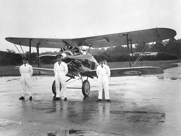
Barlow Trail is a major arterial road in Calgary, Alberta, that is composed of three parts: the southern section which runs from Deerfoot Trail near 130 Avenue SE to Deerfoot Trail at the intersection with Peigan Trail. The afore mentioned section is the central section which runs from 17 Avenue SE to McCall Way; and the northern section which runs from Airport Road (the main entrance into the Calgary International Airport) to 128 Avenue NE. The central and northern sections of Barlow Trail is run roughly where the fifth meridian lies in the Dominion Land Survey. The road is named for Noel Barlow, a resident of Carseland, Alberta, Canada, who served as the ground crewman to Douglas Bader, a Royal Air Force flying ace in World War II. History Barlow Trail used to be the main northern entrance into the city of Calgary and was a continuous roadway. It served as a portion of Alberta Highway 2 from the northern city limits to Blackfoot Trail, near the present location of the M ... [...More Info...] [...Related Items...] OR: [Wikipedia] [Google] [Baidu] |
Calgary
Calgary ( ) is the largest city in the western Canadian province of Alberta and the largest metro area of the three Prairie Provinces. As of 2021, the city proper had a population of 1,306,784 and a metropolitan population of 1,481,806, making it the third-largest city and fifth-largest metropolitan area in Canada. Calgary is situated at the confluence of the Bow River and the Elbow River in the south of the province, in the transitional area between the Rocky Mountain Foothills and the Canadian Prairies, about east of the front ranges of the Canadian Rockies, roughly south of the provincial capital of Edmonton and approximately north of the Canada–United States border. The city anchors the south end of the Statistics Canada-defined urban area, the Calgary–Edmonton Corridor. Calgary's economy includes activity in the energy, financial services, film and television, transportation and logistics, technology, manufacturing, aerospace, health and wellness, retail, and ... [...More Info...] [...Related Items...] OR: [Wikipedia] [Google] [Baidu] |
Douglas Bader
Group Captain Sir Douglas Robert Steuart Bader, (; 21 February 1910 – 5 September 1982) was a Royal Air Force flying ace during the Second World War. He was credited with 22 aerial victories, four shared victories, six probables, one shared probable and 11 enemy aircraft damaged. Bader joined the RAF in 1928, and was commissioned in 1930. In December 1931, while attempting some aerobatics, he crashed and lost both his legs. Having been on the brink of death, he recovered, retook flight training, passed his check flights and then requested reactivation as a pilot. Although there were no regulations applicable to his situation, he was retired against his will on medical grounds. After the outbreak of the Second World War in 1939, however, Douglas Bader returned to the RAF and was accepted as a pilot. He scored his first victories over Dunkirk during the Battle of France in 1940. He then took part in the Battle of Britain and became a friend and supporter of Air Vice Marshal ... [...More Info...] [...Related Items...] OR: [Wikipedia] [Google] [Baidu] |
Partial Cloverleaf Interchange
A partial cloverleaf interchange or parclo is a modification of a cloverleaf interchange. The design has been well received, and has since become one of the most popular freeway-to-arterial interchange designs in North America. It has also been used occasionally in some European countries, such as Germany, Hungary, Italy, the Netherlands, and the United Kingdom. Comparison with other interchanges *A diamond interchange has four ramps. *A cloverleaf interchange has eight ramps, as does a stack interchange. They are fully grade separated, unlike a parclo, and have traffic flow without stops on all ramps and throughways. *A parclo generally has either four or six ramps but less commonly has five ramps. Naming In Ontario, the specific variation is identified by a letter/number suffix after the name. Ontario's naming conventions are used in this article. The letter ''A'' designates that two ramps meet the freeway ''ahead'' of the arterial road, while ''B'' designates that two ram ... [...More Info...] [...Related Items...] OR: [Wikipedia] [Google] [Baidu] |
Split Intersection
A split intersection is a rarely built at-grade variant of the diamond interchange. Compared to a conventional four-leg intersection or road crossing, the arterial road is split into separate carriageways by , allowing a queue of left turning vehicles behind a completed turn into the crossroad without any conflict to oncoming traffic. On the crossroad, the four leg intersection is being replaced by two intersections. The beginning one-way traffic at the fourth leg makes the intersections reduce the number of conflicts similar to a three leg T-intersection to improve traffic flow. Existing examples * At Legacy Drive and Preston Road, Plano, Texas, with Texas U-turn lanes, * At New Dallas Highway (US-77) and E. Industrial Boulevard TX-340 in Lacy Lakeview, Texas, * At Stock Road and Winterfold Road in Perth, Australia * It is the most common intersection design on Utah State Route 85, also called Mountain View Corridor. They are planned to be later converted, mostly into diamon ... [...More Info...] [...Related Items...] OR: [Wikipedia] [Google] [Baidu] |
Trumpet Interchange
In the field of road transport, an interchange (American English) or a grade-separated junction (British English) is a road junction that uses grade separations to allow for the movement of traffic between two or more roadways or highways, using a system of interconnecting roadways to permit traffic on at least one of the routes to pass through the junction without interruption from crossing traffic streams. It differs from a standard intersection, where roads cross at grade. Interchanges are almost always used when at least one road is a controlled-access highway (freeway or motorway) or a limited-access divided highway (expressway), though they are sometimes used at junctions between surface streets. Terminology ''Note:'' The descriptions of interchanges apply to countries where vehicles drive on the right side of the road. For left-side driving, the layout of junctions is mirrored. Both North American (NA) and British (UK) terminology is included. ; Freeway junction, ... [...More Info...] [...Related Items...] OR: [Wikipedia] [Google] [Baidu] |
Interchange (road)
In the field of road transport, an interchange (American English) or a grade-separated junction (British English) is a road junction that uses grade separations to allow for the movement of traffic between two or more roadways or highways, using a system of interconnecting roadways to permit traffic on at least one of the routes to pass through the junction without interruption from crossing traffic streams. It differs from a standard intersection, where roads cross at grade. Interchanges are almost always used when at least one road is a controlled-access highway (freeway or motorway) or a limited-access divided highway (expressway), though they are sometimes used at junctions between surface streets. Terminology ''Note:'' The descriptions of interchanges apply to countries where vehicles drive on the right side of the road. For left-side driving, the layout of junctions is mirrored. Both North American (NA) and British (UK) terminology is included. ; Freeway juncti ... [...More Info...] [...Related Items...] OR: [Wikipedia] [Google] [Baidu] |
Rocky View County
Rocky View County is a municipal district in southern Alberta, Canada that is named for its views of the nearby Rocky Mountains to the west. It surrounds most of Calgary, forming the city's northern boundary and most of the city's western and eastern boundaries. At a population of 41,028 in 2021, Rocky View County is the most populous municipal district in Alberta. Though predominantly rural in nature, Rocky View County is home to 14 hamlets, including Langdon, one of Alberta's most populous hamlets. Its rural areas are home to numerous country residential subdivisions. History The Municipal District (MD) of Calgary No. 44 was originally formed on January 1, 1955 from part of Improvement District No. 46 and parts of five municipal districts – the MD of Serviceberry No. 43, the MD of Conrich No. 44, the MD of Springbank No. 45, the MD of Kneehill No. 48, and the MD of Mountain View No. 49. The MD of Calgary No. 44 was renamed the MD of Rocky View No. 44 on January ... [...More Info...] [...Related Items...] OR: [Wikipedia] [Google] [Baidu] |
Stoney Trail
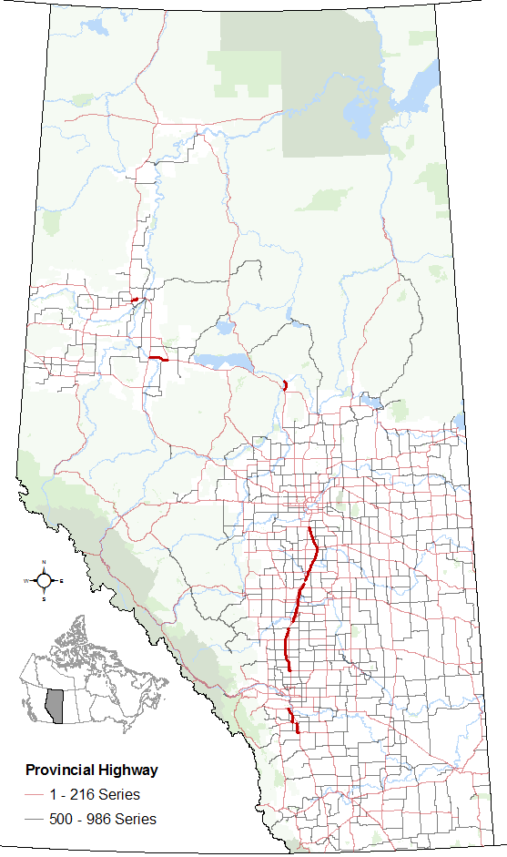
Alberta Provincial Highway No. 201, officially named Stoney Trail and Tsuut'ina Trail, is an approximately freeway in Calgary, Alberta. It forms part of the CANAMEX Corridor which connects Calgary to Edmonton and Interstate 15 in the United States via Highways 2, 3, and 4. Planned for a total length of , the final segment of the ring road is currently under construction to be completed by 2024 at the latest, delayed from an original target of 2022. The freeway serves as a bypass for the congested routes of 16 Avenue N and Deerfoot Trail through Calgary ( Highways 1 and 2, respectively). At its busiest point near Beddington Trail in north Calgary, the six-lane freeway carried nearly 79,000 vehicles per day in 2019. Stoney Trail begins in the city's northwest at Highway 1 near Canada Olympic Park, running north across the Bow River and Crowchild Trail. It winds through the hills of northwest Calgary to Deerfoot Trail and the Queen Eli ... [...More Info...] [...Related Items...] OR: [Wikipedia] [Google] [Baidu] |
Traffic Calming
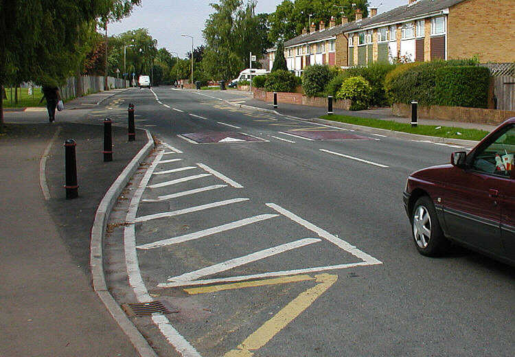
Traffic calming uses physical design and other measures to improve safety for motorists, pedestrians and bicycle-friendly, cyclists. It has become a tool to combat speeding and other unsafe behaviours of drivers in the neighbourhoods. It aims to encourage safer, more responsible driving and potentially reduce traffic flow. Urban planners and Traffic engineering (transportation), traffic engineers have many strategies for traffic calming, including narrowed roads and speed humps. Such measures are common in Australia and Europe (especially Northern Europe), but less so in North America. Traffic calming is a calque (literal translation) of the German word ''Verkehrsberuhigung'' – the term's first published use in English was in 1985 by Carmen Hass-Klau. History In its early development in the UK in the 1930s, traffic calming was based on the idea that residential areas should be protected from through-traffic. Subsequently, it became valued for its ability to improve pedest ... [...More Info...] [...Related Items...] OR: [Wikipedia] [Google] [Baidu] |
Alberta Highway 2A
Alberta Provincial Highway No. 2A is the designation of six alternate routes off Highway 2 in Alberta, Canada. In general, these are original sections of Highway 2, such as the southern portion of Macleod Trail in Calgary. They passed through communities before limited-access freeways were built to shorten driving distance, accommodate heavier volumes and to bypass city traffic. Portions of the alignment of Highway 2A follow the route of the former Calgary and Edmonton Trail. High River – Calgary Highway 2A currently begins in the Town of High River and follows 12 Avenue SE and Centre Street before passing by Aldersyde and intersecting Highway 7. The highway then travels westward to the Town of Okotoks, where it branches north and follows Southridge Drive and Northridge Drive through Okotoks before rejoining Highway 2 near De Winton. In 2003, it was extended north by sharing a common alignment with Highway 2 for until it splits to Deerfoot Trail (Highway 2) Macleod T ... [...More Info...] [...Related Items...] OR: [Wikipedia] [Google] [Baidu] |
Macleod Trail
Macleod Trail is a major road in Calgary, Alberta. It is a six- to eight-lane principal arterial road extending from downtown Calgary to the south of the city, where it merges into Highway 2. South of Anderson Road, Macleod Trail is an expressway and is slated to be upgraded to a freeway in the future. It is named for its destination to the south, Fort Macleod. Route description Macleod Trail effectively divides the southwest and the southeast quadrants of the city, and many communities (inner city as well as suburban) were developed along its course. Macleod Trail (along with Crowchild Trail and Deerfoot Trail) constitutes one of the three major north-south corridors of the city. Beginning as a one-way street for northbound traffic (with southbound traffic following 1st Street SE one block to the west), the road passes by Calgary City Hall, Olympic Plaza, the building that housed the former Calgary Central Library, and the EPCOR Centre for the Performing Arts. South of downtow ... [...More Info...] [...Related Items...] OR: [Wikipedia] [Google] [Baidu] |
Max Bell Centre (Calgary)
Max Bell Centre (commonly Max Bell Arena) is an ice hockey arena in Calgary, Alberta, Canada, in the community of Radisson Heights. It seats 2,121 for hockey, with a standing room capacity of over 3,000. It is named after Max Bell, a philanthropist who was a prominent businessman in Calgary. It hosted curling and short-track speed skating events at the 1988 Winter Olympics, both demonstration events. Presently, the arena is home to the Calgary Canucks of the Alberta Junior Hockey League and the primary facility for the Northeast Calgary Athletic Association's minor hockey teams. The arena also hosts Rocky Mountain Lacrosse League games. Late December, it serves as the primary venue for the Mac's AAA midget hockey tournament. It is home to the Mac's Tourney's "Wall of Fame" featuring every tournament alumni who has gone on to play in the National Hockey League The National Hockey League (NHL; french: Ligue nationale de hockey—LNH, ) is a professional ice hockey league in ... [...More Info...] [...Related Items...] OR: [Wikipedia] [Google] [Baidu] |


