|
Bakulahi River
The Bakulahi River (Hindi: बकुलाही नदी, Urdu: باکلاهی) Bakulahi river is situated between Sai River and Ganga River in upper Ganga floodplain with about 841 km2Shukla, S.S. & Mishra, M. Arab J Geosci (2019) 12: 304. https://doi.org/10.1007/s12517-019-4429-6 basin area. The length of the present Bakulahi River is about 177 km.Shukla, S.S. & Mishra, M. Arab J Geosci (2019) 12: 304. https://doi.org/10.1007/s12517-019-4429-6 It is one of the tributary of Sai River (the tributary of Gomati River) flowing from north-west to south-east joining Sai river in the south-east of Pratapgarh city. The Bakulahi River originates from interconnected series of tals—Khair tal, Barna tal, Garhi tal, Panhi tal, and Manjhihar tal and collects headwaters from the surrounding highlands, flowing through southern part of Raibareli district.Shukla, S.S. & Mishra, M. Arab J Geosci (2019) 12: 304. https://doi.org/10.1007/s12517-019-4429-6 Its banks are densely populated and ... [...More Info...] [...Related Items...] OR: [Wikipedia] [Google] [Baidu] |
Raibareli District
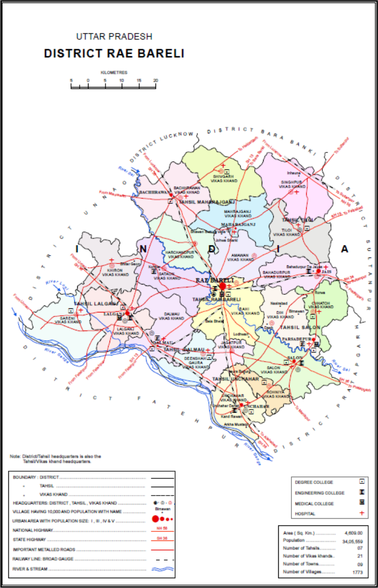
Raebareli district is a district of Uttar Pradesh state in northern India. The city of Raebareli is the district headquarters. This district is a part of Lucknow Division in Uttar Pradesh state. The total area of Raebareli district is 3,371 Sq. km. As of 2011, its population is 3,405,559, which makes it the 27th largest in the state. It is a predominantly rural district, with 91% of the population living in rural areas. Geography Raebareli district is located in the southern part of Awadh, at the southern end of Lucknow Division. It is compact in shape — no part of the district is especially far from the city of Raebareli. In general, the terrain is flat or gently undulating, and the soil is especially fertile and well-suited to agriculture. The elevation ranges from 100 to 120 m above sea level. The prevailing slope is from higher in the northwest to lower in the southeast, and the rivers that traverse the district all flow in this direction. The main river of Ra ... [...More Info...] [...Related Items...] OR: [Wikipedia] [Google] [Baidu] |
Hindi
Hindi (Devanāgarī: or , ), or more precisely Modern Standard Hindi (Devanagari: ), is an Indo-Aryan language spoken chiefly in the Hindi Belt region encompassing parts of northern, central, eastern, and western India. Hindi has been described as a standardised and Sanskritised register of the Hindustani language, which itself is based primarily on the Khariboli dialect of Delhi and neighbouring areas of North India. Hindi, written in the Devanagari script, is one of the two official languages of the Government of India, along with English. It is an official language in nine states and three union territories and an additional official language in three other states. Hindi is also one of the 22 scheduled languages of the Republic of India. Hindi is the '' lingua franca'' of the Hindi Belt. It is also spoken, to a lesser extent, in other parts of India (usually in a simplified or pidginised variety such as Bazaar Hindustani or Haflong Hindi). Outside India, several ot ... [...More Info...] [...Related Items...] OR: [Wikipedia] [Google] [Baidu] |
Vedas
upright=1.2, The Vedas are ancient Sanskrit texts of Hinduism. Above: A page from the '' Atharvaveda''. The Vedas (, , ) are a large body of religious texts originating in ancient India. Composed in Vedic Sanskrit, the texts constitute the oldest layer of Sanskrit literature and the oldest scriptures of Hinduism. There are four Vedas: the Rigveda, the Yajurveda, the Samaveda and the Atharvaveda. Each Veda has four subdivisions – the Samhitas (mantras and benedictions), the Aranyakas (text on rituals, ceremonies, sacrifices and symbolic-sacrifices), the Brahmanas (commentaries on rituals, ceremonies and sacrifices), and the Upanishads (texts discussing meditation, philosophy and spiritual knowledge).Gavin Flood (1996), ''An Introduction to Hinduism'', Cambridge University Press, , pp. 35–39A Bhattacharya (2006), ''Hindu Dharma: Introduction to Scriptures and Theology'', , pp. 8–14; George M. Williams (2003), Handbook of Hindu Mythology, Oxford University Press, , p ... [...More Info...] [...Related Items...] OR: [Wikipedia] [Google] [Baidu] |
Ramayana
The ''Rāmāyana'' (; sa, रामायणम्, ) is a Sanskrit literature, Sanskrit Indian epic poetry, epic composed over a period of nearly a millennium, with scholars' estimates for the earliest stage of the text ranging from the 8th to 4th centuries BCE, and later stages extending up to the 3rd century CE. ''Ramayana'' is one of the two important epics of Hinduism, the other being the ''Mahabharata, Mahābhārata''. The epic, traditionally ascribed to the Maharishi Valmiki, narrates the life of Sita, the Princess of Janakpur, and Rama, a legendary prince of Ayodhya city in the kingdom of Kosala. The epic follows his fourteen-year exile to the forest urged by his father King Dasharatha, on the request of Rama's stepmother Kaikeyi; his travels across forests in the South Asia, Indian subcontinent with his wife Sita and brother Lakshmana, the kidnapping of Sita by Ravana – the king of Lanka, that resulted in war; and Rama's eventual return to Ayodhya to be crowned kin ... [...More Info...] [...Related Items...] OR: [Wikipedia] [Google] [Baidu] |
Mahabharata
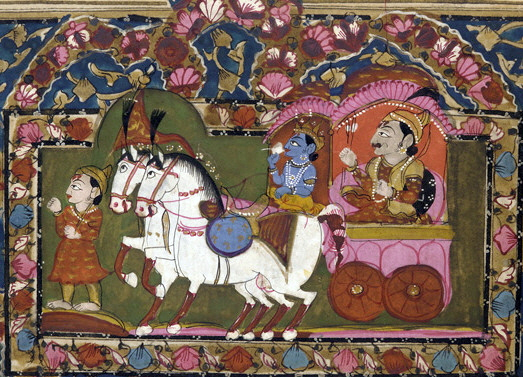
The ''Mahābhārata'' ( ; sa, महाभारतम्, ', ) is one of the two major Sanskrit epics of ancient India in Hinduism, the other being the ''Rāmāyaṇa''. It narrates the struggle between two groups of cousins in the Kurukshetra War and the fates of the Kaurava and the Pāṇḍava princes and their successors. It also contains philosophical and devotional material, such as a discussion of the four "goals of life" or ''puruṣārtha'' (12.161). Among the principal works and stories in the ''Mahābhārata'' are the '' Bhagavad Gita'', the story of Damayanti, the story of Shakuntala, the story of Pururava and Urvashi, the story of Savitri and Satyavan, the story of Kacha and Devayani, the story of Rishyasringa and an abbreviated version of the ''Rāmāyaṇa'', often considered as works in their own right. Traditionally, the authorship of the ''Mahābhārata'' is attributed to Vyāsa. There have been many attempts to unravel its historical growth and c ... [...More Info...] [...Related Items...] OR: [Wikipedia] [Google] [Baidu] |
Rae Bareli District
Raebareli district is a district of Uttar Pradesh state in northern India. The city of Raebareli is the district headquarters. This district is a part of Lucknow Division in Uttar Pradesh state. The total area of Raebareli district is 3,371 Sq. km. As of 2011, its population is 3,405,559, which makes it the 27th largest in the state. It is a predominantly rural district, with 91% of the population living in rural areas. Geography Raebareli district is located in the southern part of Awadh, at the southern end of Lucknow Division. It is compact in shape — no part of the district is especially far from the city of Raebareli. In general, the terrain is flat or gently undulating, and the soil is especially fertile and well-suited to agriculture. The elevation ranges from 100 to 120 m above sea level. The prevailing slope is from higher in the northwest to lower in the southeast, and the rivers that traverse the district all flow in this direction. The main river of Raeba ... [...More Info...] [...Related Items...] OR: [Wikipedia] [Google] [Baidu] |
Uttar Pradesh
Uttar Pradesh (; , 'Northern Province') is a state in northern India. With over 200 million inhabitants, it is the most populated state in India as well as the most populous country subdivision in the world. It was established in 1950 after India had become a republic. It was a successor to the United Provinces (UP) during the period of the Dominion of India (1947–1950), which in turn was a successor to the United Provinces (UP) established in 1935, and eventually of the United Provinces of Agra and Oudh established in 1902 during the British Raj. The state is divided into 18 divisions and 75 districts, with the state capital being Lucknow, and Prayagraj serving as the judicial capital. On 9 November 2000, a new state, Uttaranchal (now Uttarakhand), was created from Uttar Pradesh's western Himalayan hill region. The two major rivers of the state, the Ganges and its tributary Yamuna, meet at the Triveni Sangam in Prayagraj, a Hindu pilgrimage site. Ot ... [...More Info...] [...Related Items...] OR: [Wikipedia] [Google] [Baidu] |
Pratapgarh District, Uttar Pradesh
The Pratapgarh district is one of the districts of Uttar Pradesh state of India, and Pratapgarh city is the district headquarters. Pratapgarh district is a part of Allahabad division. The total area of Pratapgarh district is 3730 Sq. Km. Wildlife The district has Ganga Dolphins in its river. History The City pratapgarh is named by famous King of Somvanshi Dynasty, Raja pratap bahadur singh a rajput ruler who made a castle named pratapgarh After time around the areas of the castle was also known by, pratapgarh; In 1928, the arrival of Simon Commission in India led to widespread agitations against the British government. Many of the Talukdars took the lead in the movement and openly displayed their opposition against the Imperial Government. On July 10, the Congress politician Jawaharlal Nehru and Mohanlal Saxena, visited the Pratapgarh district to address a public meeting at Hadi Hall (in Bela Pratapgarh), they were welcomed by Brajesh Singh. The district was also visite ... [...More Info...] [...Related Items...] OR: [Wikipedia] [Google] [Baidu] |
Mandhata, Uttar Pradesh
Mandhata is a village in Pratapgarh District, Uttar Pradesh State of India. Mandhata is located 21 km distance from its District Main City Pratapgarh. It is located 150 km distance from its State Main City Lucknow Lucknow (, ) is the capital and the largest city of the Indian state of Uttar Pradesh and it is also the second largest urban agglomeration in Uttar Pradesh. Lucknow is the administrative headquarters of the eponymous district and division .... Geography Geographical Location : Mandhata, Pratapgarh, Uttar Pradesh, India Geographical Coordinates : 25° 47' 53.5344" North and 81° 52' 52.32036" East Mandhata is situated at Pratapgarh Uttar Pradesh District and its geographical coordinates are 25° 47' 53.5344" North, 81° 52' 52.32036" East. The town lies through the bank of Bakulahi River. References Villages in Pratapgarh district, Uttar Pradesh {{Pratapgarh-geo-stub ... [...More Info...] [...Related Items...] OR: [Wikipedia] [Google] [Baidu] |
Raebareli District
Raebareli district is a district of Uttar Pradesh state in northern India. The city of Raebareli is the district headquarters. This district is a part of Lucknow Division in Uttar Pradesh state. The total area of Raebareli district is 3,371 Sq. km. As of 2011, its population is 3,405,559, which makes it the 27th largest in the state. It is a predominantly rural district, with 91% of the population living in rural areas. Geography Raebareli district is located in the southern part of Awadh, at the southern end of Lucknow Division. It is compact in shape — no part of the district is especially far from the city of Raebareli. In general, the terrain is flat or gently undulating, and the soil is especially fertile and well-suited to agriculture. The elevation ranges from 100 to 120 m above sea level. The prevailing slope is from higher in the northwest to lower in the southeast, and the rivers that traverse the district all flow in this direction. The main river of Raeba ... [...More Info...] [...Related Items...] OR: [Wikipedia] [Google] [Baidu] |


