|
Bakamuna
Bakamuna ( si, බකමුණ) is a village town in Sri Lanka. It is located within North Central Province. History It has many ancient ruins in Sri Lanka such as ''Buduruwayaya temple'', ''Oru bedi Siyambalawa'', and the city is located near Moragahakanda reservoir with Mahaweli River tributary Amban Ganga. At the time of King Mahasen, the village was known as "Bakka amuna - Bakka Dam". The city got its name from the reservoir called ''Bak Amuna Pathaha'' which had a large basin (reservoir). Today this reservoir has been rehabilitated as a tank and it belongs to the Minneriya Giritale Forest Reserve. An agricultural settlement based on paddy cultivation, the settlements in this forest area were established in the 1940s during the time of Prime Minister D. S. Senanayake. The nearby Amban River originates in the vicinity of the Dumbara Hills in Matale and the Nalanda Hills. King Vasabha built the Elahera Anicut and Canal which is 48 km in length, by crossing the anicuts ... [...More Info...] [...Related Items...] OR: [Wikipedia] [Google] [Baidu] |
Polonnaruwa District
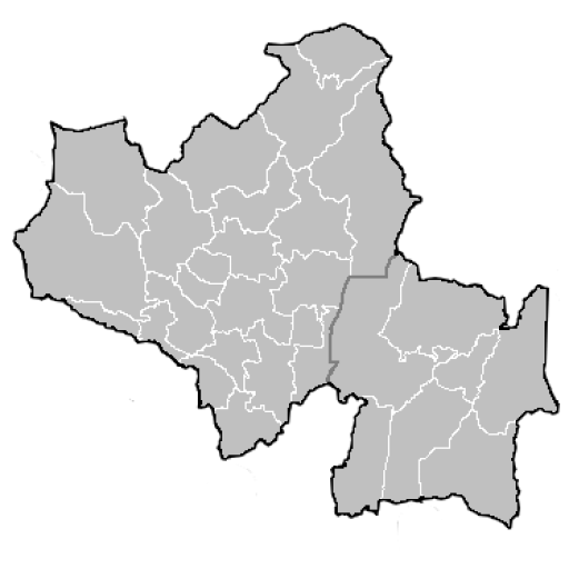
Polonnaruwa District ( si, පොළොන්නරුව දිස්ත්රික්කය; ta, பொலன்னறுவை மாவட்டம்) is one of the 25 districts of Sri Lanka, the second level administrative division of the country. It is also one of the two districts of North Central Province and has an area of 3,293 km2. The district is administered by a District Secretariat headed by a District Secretary (previously known as a Government Agent) appointed by the central government of Sri Lanka. The capital of the district is the city of Polonnaruwa. Administrative Units Demographics Ethnicity The majority of the population are Sinhalese with a minority Sri Lankan Moor and Sri Lankan Tamil population. Religion According to the 2011 censusDepartment of Census and StatisticThe Census of Population and Housing of Sri Lanka-2011/ref> 89.7% of the population were Buddhists, 7.5% Muslim, 1.7% Hindu and 1% Christian. Politics and government ... [...More Info...] [...Related Items...] OR: [Wikipedia] [Google] [Baidu] |
North Central Province, Sri Lanka
North Central Province ( si, උතුරු මැද පළාත ''Uturumæda Paḷāta'', ta, வட மத்திய மாகாணம் ''Wada Maththiya Mākāṇam'') is one of the nine provinces of Sri Lanka, the first level administrative division of the country. The provinces have existed since the 19th century but did not have any legal status until 1987 when the 13th Amendment to the Constitution of Sri Lanka established provincial councils. The province is the largest by size, and second least populated in the country. The province consists of the districts of Anuradhapura and Polonnaruwa, both of which were important ancient Sri Lankan kingdoms. The climate is semi-arid, and the forests are dry evergreen forests. History The centralised system of Sri Lanka, which is a unitary state, failed to satisfy the aspirations of the people. There was growing insistence on decentralisation of administrative processes to achieve rapid economic and social development of t ... [...More Info...] [...Related Items...] OR: [Wikipedia] [Google] [Baidu] |
Village
A village is a clustered human settlement or community, larger than a hamlet but smaller than a town (although the word is often used to describe both hamlets and smaller towns), with a population typically ranging from a few hundred to a few thousand. Though villages are often located in rural areas, the term urban village is also applied to certain urban neighborhoods. Villages are normally permanent, with fixed dwellings; however, transient villages can occur. Further, the dwellings of a village are fairly close to one another, not scattered broadly over the landscape, as a dispersed settlement. In the past, villages were a usual form of community for societies that practice subsistence agriculture, and also for some non-agricultural societies. In Great Britain, a hamlet earned the right to be called a village when it built a church. [...More Info...] [...Related Items...] OR: [Wikipedia] [Google] [Baidu] |
Mahasena Of Anuradhapura
Mahasena, also known in some records as Mahasen, was a king of Sri Lanka who ruled the country from 277 to 304 CE. He started the construction of large tanks or reservoirs in Sri Lanka, and built sixteen such tanks. After becoming king, Mahasena discriminated the Buddhists belonging to the Theravada-school and destroyed several of their temples including the Mahavihara (the main Theravada temple) before his chief minister led him to realise his mistakes. He mended his ways and built the Jethavana stupa. Mahasena's countrymen regarded him as a god or deity (deva) after the construction of the Minneriya tank, he became known as ''Minneri Deviyo'' (God of Minneriya). Discrimination against Theravada Buddhism Mahasena was the younger son of King Gotabaya, who ruled the country from 253 to 266 CE. His elder brother and predecessor to the throne was King Jetthatissa, who was the king from 266 to 275. Mahasen and Jetthatissa were educated by a Buddhist monk named Sanghamitta, who was a ... [...More Info...] [...Related Items...] OR: [Wikipedia] [Google] [Baidu] |
Parakramabahu I
Parākramabāhu I ( Sinhala: මහා පරාක්රමබාහු, 1123–1186), or Parakramabahu the Great, was the king of Polonnaruwa from 1153 to 1186. He oversaw the expansion and beautification of his capital, constructed extensive irrigation systems, reorganised the country's army, reformed Buddhist practices, encouraged the arts and undertook military campaigns in South India and Burma. The adage "Not even a little water that comes from the rain must not flow into the ocean without being made useful to man" is one of his most famous utterances. In 1140, Parakramabahu following the death of his uncle, Kitti Sri Megha, Prince of Dakkinadesa, ascended the throne of Dakkhinadesa. Over the next decade, improved both Dakkhinadesi infrastructure and military. Following a protracted civil war, he secured power over the entire island around 1153 and remained in this position until his death in 1186. During Parākramabāhu's reign, he launched a punitive campaign against t ... [...More Info...] [...Related Items...] OR: [Wikipedia] [Google] [Baidu] |
Wasgamuwa National Park
Wasgamuwa National Park is a natural park in Sri Lanka situated in the Matale and Polonnaruwa Districts. It was declared to protect and to make a refuge for the displaced wild animals during the Mahaweli Development Project in 1984 and is one of the four National Parks designated under the Project. Originally it was designated as a nature reserve in 1938, and then in the early 1970s the area was regraded as a strict nature reserve. Wasgamuwa is one of the protected areas where Sri Lankan Elephants can be seen in large herds. It is also one of the Important Bird Areas in Sri Lanka. The name of the Wasgamuwa has derived through the words "Walas Gamuwa". "Walasa" is Sinhala for sloth bear and "Gamuwa" means a wood. The park is situated 225 km away from Colombo. Physical features The National Park's annual daily temperature is and has a dry zone climate. Annual rainfall ranges between 1650–2100 mm. Rain is received during the northeastern monsoon, from October to Januar ... [...More Info...] [...Related Items...] OR: [Wikipedia] [Google] [Baidu] |
Giritale
Giritale is a small city in the Polonnaruwa District of Sri Lanka. The location has tourist attraction due its nature and close link with Polonnaruwa, an ancient capital of Sri Lanka. Giritale has some mid-range and up hotels. It is situated on the main road from Colombo to Polonnaruwa Poḷonnaruwa, ( si, පොළොන්නරුව, translit=Poḷonnaruva; ta, பொலன்னறுவை, translit=Polaṉṉaṟuvai) also referred as Pulathisipura and Vijayarajapura in ancient times, is the main town of Polonnaruwa Dis ... and Batticaloa. Giritale tank (Giritale Wewa) has historical background that connect with king Pandukhabaya's birth (437-367 BC) and other stories. Giritale shares a sanctuary with Minneriya, and it is known as Giritale-Minneriya sanctuary. References Populated places in Polonnaruwa District {{NorthCentralLK-geo-stub ... [...More Info...] [...Related Items...] OR: [Wikipedia] [Google] [Baidu] |
Kalu Ganga Dam
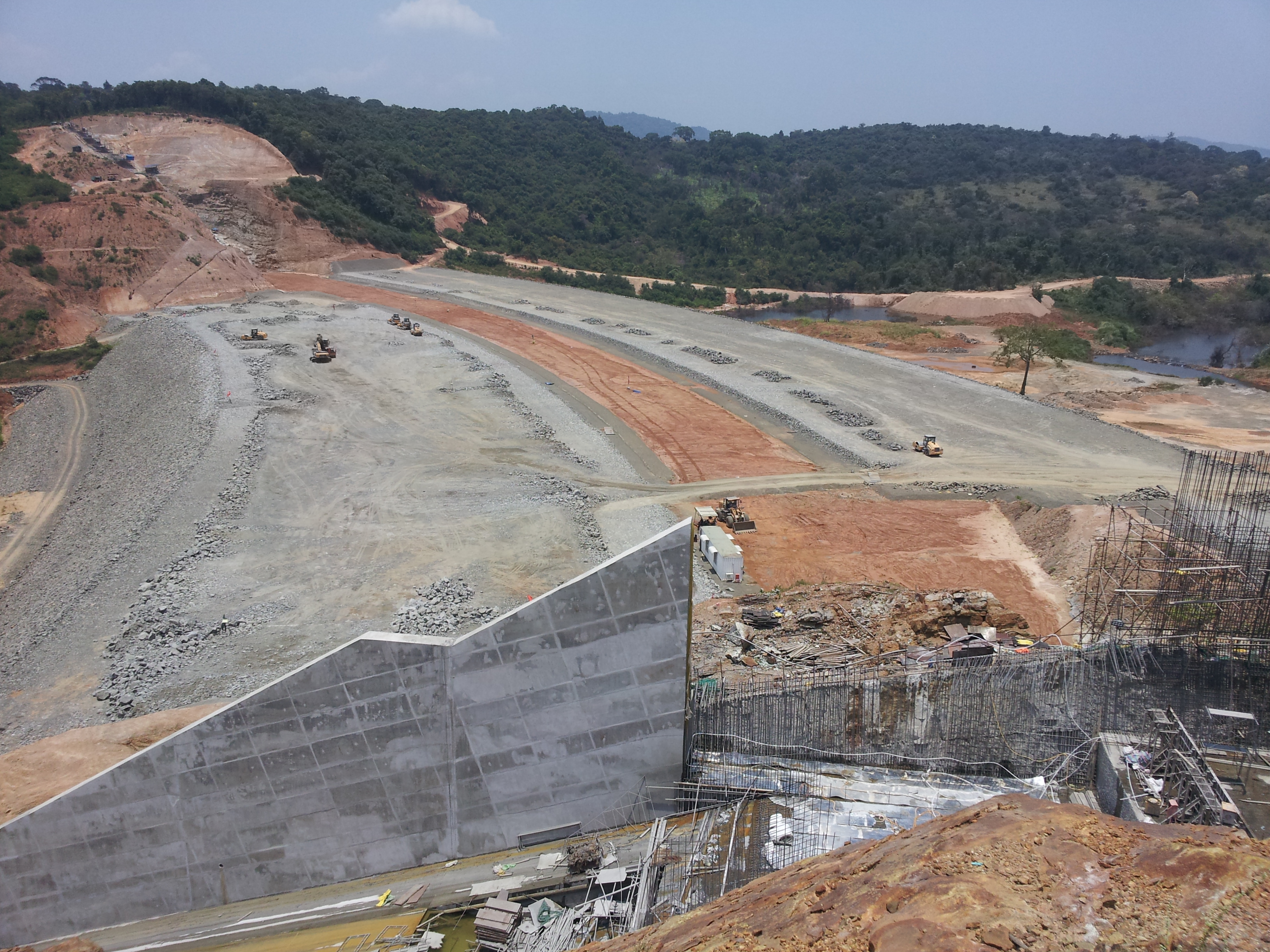
The Kalu Ganga Dam is a large gravity dam, and the second vital component of the larger and more complex Moragahakanda — Kalu Ganga Project, currently under construction across the Kalu Ganga at Pallegama, in the Matale District of Sri Lanka. This Kalu Ganga is a tributary of Amban Ganga which is itself a tributary of the Mahaweli River the longest river in Sri Lanka. This shall not be confused with Kalu Ganga. Construction of the project was launched by President Mahinda Rajapaksa on . The maiden waters of the dam was released in July 2018. The larger combined project involves the construction of the Kalu Ganga Dam and Reservoir, along with the separate Moragahakanda Dam and Reservoir, for irrigation and power generation purposes. Both these sites would be located approximately apart. The total development cost for both sites totals to approximately (approximately ) and is being carried out by Central Engineering Consultancy Bureau and Sinohydro.(refhttps://www.parliament ... [...More Info...] [...Related Items...] OR: [Wikipedia] [Google] [Baidu] |
Dambulla
Dambulla ( si, දඹුල්ල ''Dam̆bulla'', ta, தம்புள்ளை ''Tampuḷḷai'') is a town situated in the north of Matale District, Central Province of Sri Lanka. It is the second largest populated and urbanised centre after Matale in the Matale District. It is situated north-east of Colombo, north of Matale and north of Kandy. Due to its location at a major junction, it is the centre of major vegetable distribution in the country. Major attractions of the area include the largest and best preserved cave temple complex of Sri Lanka, sigiriya rock fortress located in the division and the Rangiri Dambulla International Stadium, famous for being built in just 167 days. The area also boasts the largest rose quartz mountain range in South Asia, and the Iron wood forest, or Na Uyana Aranya. Ibbankatuwa prehistoric burial site near Dambulla cave temple complexes is the latest archaeological site of significant historical importance found in Dambulla, which i ... [...More Info...] [...Related Items...] OR: [Wikipedia] [Google] [Baidu] |
Minneriya National Park
Minneriya National Park ( si, මින්නේරිය ජාතික වනෝද්යානය, translit=Minnēriya Jātika Vanōdyānaya; ta, மின்னேரியா தேசிய வனம், translit=Miṉṉēriyā Tēciya Vaṉam) is a national park in North Central Province of Sri Lanka. The area was designated as a national park on 12 August 1997, having been originally declared as a wildlife sanctuary in 1938. The reason for declaring the area as protected is to protect the catchment of Minneriya tank and the wildlife of the surrounding area. The tank is of historical importance, having been built by King Mahasen in third century AD. The park is a dry season feeding ground for the elephant population dwelling in forests of Matale, Polonnaruwa, and Trincomalee districts. The park earned revenue of Rs. 10.7 million in the six months ending in August 2009. Along with Kaudulla and Girithale, Minneriya forms one of the 70 Important Bird Areas (IBAs) of ... [...More Info...] [...Related Items...] OR: [Wikipedia] [Google] [Baidu] |
Skarn
Skarns or tactites are hard, coarse-grained metamorphic rocks that form by a process called metasomatism. Skarns tend to be rich in calcium-magnesium-iron-manganese-aluminium silicate minerals, which are also referred to as calc-silicate minerals.Ray, G.E., and Webster, I.C.L. (1991): An Overview of Skarn Deposits; in Ore Deposits, Tectonics and Metallogeny in the Canadian Cordillera; McMillan, W.J., compiler, B. C. Ministry of Energy, Mines and Petroleum Resources, Paper 1991-4, pages 213-252.Meinert, L.D., 1992. Skarns and Skarn Deposits; Geoscience Canada, Vol. 19, No. 4, p. 145-162.Hammarstrom, J.M., Kotlyar, B.B., Theodore, T.G., Elliott, J.E., John, D.A., Doebrich, J.L., Nash, J.T., Carlson, R.R., Lee, G.K., Livo, K.E., Klein, D.P., 1995. Cu, Au, and Zn-Pb Skarn Deposits, Chapter 12; United States Geological Survey: Preliminary Compilation of Descriptive Geoenvironmental Mineral Deposit Models: https://pubs.usgs.gov/of/1995/ofr-95-0831/CHAP12.pdf. These minerals form as a res ... [...More Info...] [...Related Items...] OR: [Wikipedia] [Google] [Baidu] |
Corundum
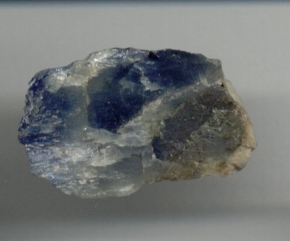
Corundum is a crystalline form of aluminium oxide () typically containing traces of iron, titanium, vanadium and chromium. It is a rock-forming mineral. It is a naturally transparent material, but can have different colors depending on the presence of transition metal impurities in its crystalline structure. Corundum has two primary gem varieties: ruby and sapphire. Rubies are red due to the presence of chromium, and sapphires exhibit a range of colors depending on what transition metal is present. A rare type of sapphire, padparadscha sapphire, is pink-orange. The name "corundum" is derived from the Tamil- Dravidian word ''kurundam'' (ruby-sapphire) (appearing in Sanskrit as ''kuruvinda''). Because of corundum's hardness (pure corundum is defined to have 9.0 on the Mohs scale), it can scratch almost all other minerals. It is commonly used as an abrasive on sandpaper and on large tools used in machining metals, plastics, and wood. Emery, a variety of corundum with no value a ... [...More Info...] [...Related Items...] OR: [Wikipedia] [Google] [Baidu] |


