|
Baga National Park
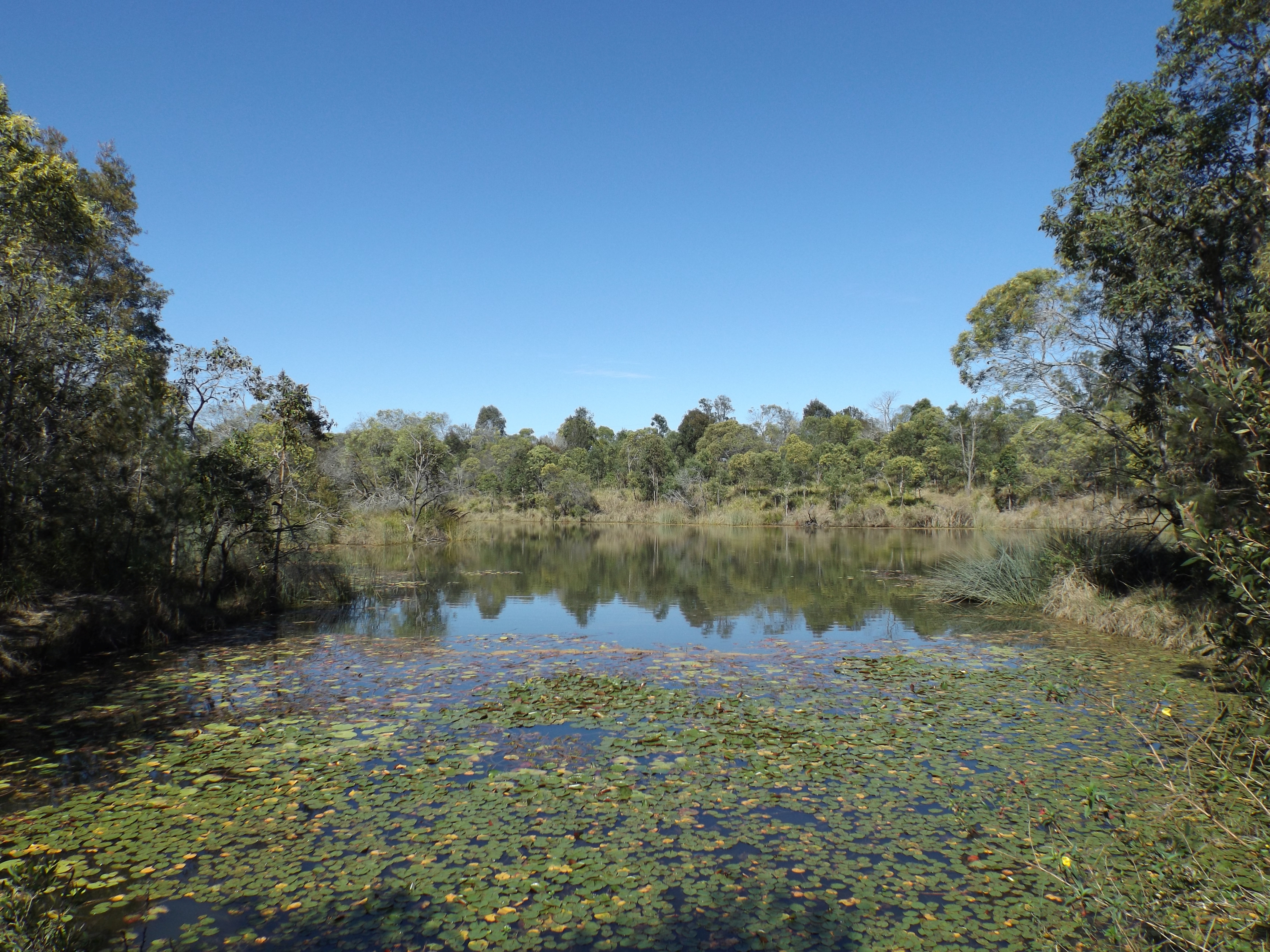
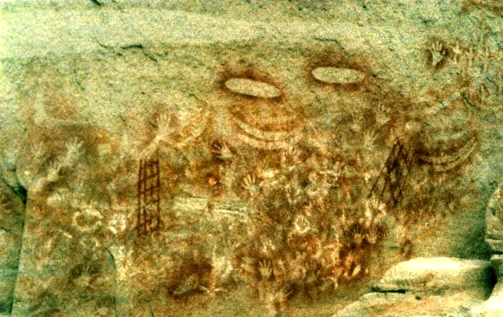
Baga National Park (formerly known as Mount Jim Crow National Park) is a national park in Queensland, Australia, northwest of Brisbane. It lies just beside the main road between Rockhampton and Yeppoon. Camping is not permitted in the park and there are no facilities. The main feature of the park is Baga, a trachyte plug which is a remnant of an extinct volcano. The Darumbal people have traditionally regarded Baga as a significance place in their Dreamtime stories. Many species of birds can be found in the park, most notably in Hedlow Creek lagoons, where they come to drink water, such as striated pardalotes, squawking rainbow lorikeets and Lewin's honeyeaters. See also * Protected areas of Queensland Queensland is the second largest state in Australia. It contains around 500 separate protected areas. In 2020, it was estimated a total of 14.2 million hectares or 8.25% of Queensland's landmass was protected. List of terrestrial protected are ... References N ... [...More Info...] [...Related Items...] OR: [Wikipedia] [Google] [Baidu] |
Billabong
Billabong ( ) is an Australian term for an oxbow lake, an isolated pond left behind after a river changes course. Billabongs are usually formed when the path of a creek or river changes, leaving the former branch with a dead end. As a result of the arid Australian climate in which these "dead rivers" are often found, billabongs fill with water seasonally but can be dry for a greater part of the year. Etymology The etymology of the word ''billabong'' is disputed. The word is most likely derived from the Wiradjuri term ''bilabaŋ'', which means "a watercourse that runs only after rain". It is derived from ''bila'', meaning "river", It may have been combined with ''bong'' or ''bung'', meaning "dead". One source, however, claims that the term is of Scottish Gaelic origin. Billabongs were significant because they held water longer than parts of rivers; it was important for people to identify and name these areas. [...More Info...] [...Related Items...] OR: [Wikipedia] [Google] [Baidu] |
Mount Baga
Mount Baga (formerly Mount Jim Crow) is a trachyte plug that lies between Rockhampton and Yeppoon, Australia. Standing at approximately 150 m above the surrounding plains (221 m above sea level), Mount Baga affords a panoramic view of the surrounding landscape. Mount Wheeler (now Mount Gai-i) can be seen to the southeast, while many other trachyte formations can be seen to the north and west. Well covered by trees and scrub, Mount Baga has no signed walking trails and climbing up the slopes is not recommended. The surface consists mostly of broken shale rock. There are several small but sheer cliffs, mostly on the southeastern face, which can be clearly seen from the Capricorn Highway. Mount Baga holds a significance to the Darumbal Aboriginal people and its creation is told in a Dreaming legend: In the Dreamtime long ago, a boy and a girl from the tribe fell in love and wanted to marry. The old people were distraught as it was against the tribal code to marry someone from the ... [...More Info...] [...Related Items...] OR: [Wikipedia] [Google] [Baidu] |
Protected Areas Of Queensland
Queensland is the second largest state in Australia. It contains around 500 separate protected areas. In 2020, it was estimated a total of 14.2 million hectares or 8.25% of Queensland's landmass was protected. List of terrestrial protected areas Conservation Parks * Anderson Street * Archer Point * Baddow Island * Baffle Creek * Bakers Creek * Baldwin Swamp * Bare Hill * Barubbra Island * Baywulla Creek * Beachmere * Beelbi Creek * Bell Creek * Bingera 1 * Bingera 2 * Bird Island * Blackwater * Bloomfield River * Bloomsbury * Boat Mountain 1 * Boat Mountain 2 * Bottle Creek * Boyne Island * Broadwater * Buccan * Buckleys Hole * Bullock Creek * Bullyard * Bunya Mountains * Bunyaville * Burleigh Knoll * Byron Creek * Cabbage Tree Point * Caloundra * Cape Pallarenda * Carbrook Wetlands * Carello Palm Swamp * Carraba * Causeway Lake * Charon Point * Combo 1 * Combo 2 * Coolmunda * Cooloothin * Coombabah Lake * Cressbrook * Currimundi Lake * Curr ... [...More Info...] [...Related Items...] OR: [Wikipedia] [Google] [Baidu] |
Lewin's Honeyeater
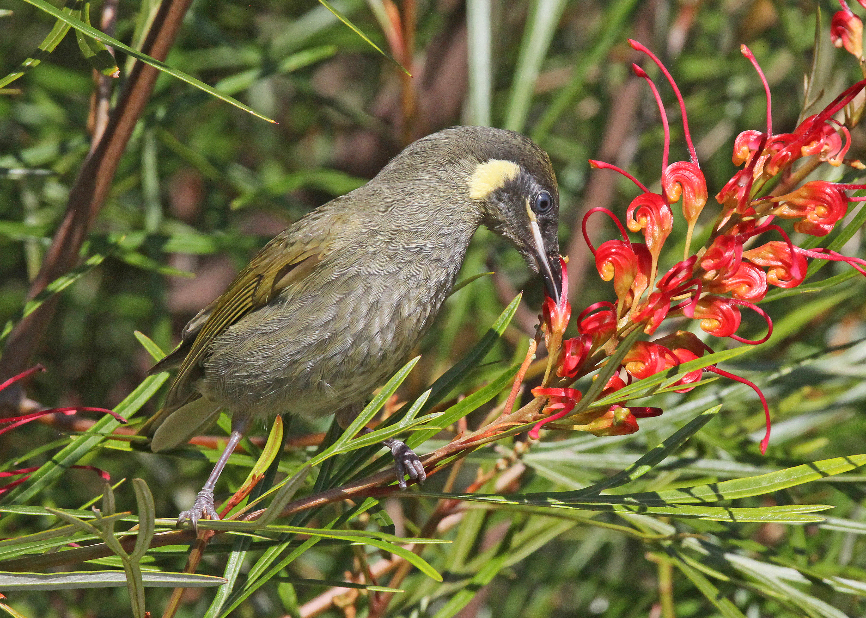
Lewin's honeyeater (''Meliphaga lewinii'') is a bird that inhabits the ranges along the east coast of Australia. It has a semicircular ear-patch, pale yellow in colour. The name of this bird commemorates the Australian artist John Lewin. Description The Lewin's honeyeater is small to medium in size . It is dark greenish-grey in colour, with a creamy yellow gape (i.e., the fleshy corners of the mouth). It has large, yellowish, crescent-shaped ear-patches, which distinguish it from other honeyeaters, apart from two similar, but smaller, species in tropical Queensland. In flight, the pale yellow edges of the flight feathers can be seen. The bill is black and the eye is blue-grey. Both sexes are similar in appearance. Young Lewin's honeyeaters are similar to the adults, but have brown eyes. The strong 'machine gun-like' rattling notes of Lewin's honeyeater are heard over long distances, and reveal its presence in an area. Body size, voice, and the shape and size of the ear-patch he ... [...More Info...] [...Related Items...] OR: [Wikipedia] [Google] [Baidu] |
Rainbow Lorikeet
The rainbow lorikeet (''Trichoglossus moluccanus'') is a species of parrot found in Australia. It is common along the eastern seaboard, from northern Queensland to South Australia. Its habitat is rainforest, coastal bush and woodland areas. Six taxa traditionally listed as subspecies of the rainbow lorikeet are now treated as separate species (see ''Taxonomy''). Rainbow lorikeets have been introduced to Perth, Western Australia;ScienceWA Rainbow lorikeet joins Perth pest list ; , |
Striated Pardalote
The striated pardalote (''Pardalotus striatus'') is the least colourful and most common of the four pardalote species. Other common names include pickwick, wittachew and chip-chip. It is a very small, short-tailed bird that is more often heard than seen, foraging noisily for lerps and other small creatures in the treetops. Taxonomy Four full species were originally named, and are clearly recognisable in the field. They are now classified as merely well-defined subspecies instead. * The yellow-tipped pardalote (subspecies ''striatus'') is found mainly in Tasmania, but crosses the 200 miles of Bass Strait to the mainland each winter in a migration. * The striated pardalote, subspecies ''substriatus'', central and western Australia. * The eastern striated or red-tipped pardalote, subspecies ''ornatus'', from the sub-tropical east coast, including the Sydney region. * Two subspecies of the black-headed pardalote, ''melanocephalus'' and ''uropygialis'', from north-eastern New South ... [...More Info...] [...Related Items...] OR: [Wikipedia] [Google] [Baidu] |
Dreamtime
The Dreaming, also referred to as Dreamtime, is a term devised by early anthropologists to refer to a religio-cultural worldview attributed to Australian Aboriginal mythology, Australian Aboriginal beliefs. It was originally used by Francis James Gillen, Francis Gillen, quickly adopted by his colleague Walter Baldwin Spencer, Baldwin Spencer and thereafter popularised by A. P. Elkin, who, however, later revised his views. The Dreaming is used to represent Aboriginal concepts of ''Everywhen'', during which the land was inhabited by ancestral figures, often of heroic proportions or with supernatural abilities. These figures were often distinct from gods, as they did not control the material world and were not worshipped but only reverence (emotion), revered. The concept of the Dreamtime has subsequently become widely adopted beyond its original Australian context and is now part of global popular culture. The term is based on a rendition of the Arandic languages, Arandic word '' ... [...More Info...] [...Related Items...] OR: [Wikipedia] [Google] [Baidu] |
Darumbal
The Darumbal people, also spelt Dharumbal, are the Aboriginal Australians that have traditionally occupied Central Queensland, speaking dialects of the Darumbal language. Darumbal people of the Keppel Islands and surrounding regions are sometimes also known as Woppaburra or Ganumi, and the terms are sometimes used interchangeably. Country Traditional Darumbal land is considered to encompass an estimated around most of coastal Central Queensland, running from Arthur Point at Shoalwater Bay to Yeppoon, and taking in the mouth of Fitzroy River and Keppel Islands. From Keppel Bay they extended inland to Boomer Range, and Marlborough, Yaamba, Rockhampton, and Gracemere. History With the arrival of European settlers in the region, some Darumbal people were tolerated as part of fringe communities of the new settlements, but most were systematically killed to make way for pastoral development. According to some estimates, "between 1865 and 1902 the population of the Keppel Islands ... [...More Info...] [...Related Items...] OR: [Wikipedia] [Google] [Baidu] |
Volcanic Plug
A volcanic plug, also called a volcanic neck or lava neck, is a volcanic object created when magma hardens within a vent on an active volcano. When present, a plug can cause an extreme build-up of high gas pressure if rising volatile-charged magma is trapped beneath it, and this can sometimes lead to an explosive eruption. In a plinian eruption the plug is destroyed and ash is ejected. Glacial erosion can lead to exposure of the plug on one side, while a long slope of material remains on the opposite side. Such landforms are called crag and tail. If a plug is preserved, erosion may remove the surrounding rock while the erosion-resistant plug remains, producing a distinctive upstanding landform. Examples of volcanic plugs Africa Near the village of Rhumsiki in the Far North Province of Cameroon, Kapsiki Peak is an example of a volcanic plug and is one of the most photographed parts of the Mandara Mountains. Spectacular volcanic plugs are present in the center of La Gomer ... [...More Info...] [...Related Items...] OR: [Wikipedia] [Google] [Baidu] |
Trachyte
Trachyte () is an extrusive igneous rock composed mostly of alkali feldspar. It is usually light-colored and aphanitic (fine-grained), with minor amounts of mafic minerals, and is formed by the rapid cooling of lava enriched with silica and alkali metals. It is the volcanic equivalent of syenite. Trachyte is common wherever alkali magma is erupted, including in late stages of ocean island volcanismMacDonald 1983, pp. 51-52 and in continental rift valleys, above mantle plumes,Philpotts and Ague 2009, pp. 390-394 and in areas of back-arc extension. Trachyte has also been found in Gale crater on Mars. Trachyte has been used as decorative building stone and was extensively used as dimension stone in the Roman Empire and the Republic of Venice. Chemical composition Trachyte has a silica content of 60 to 65% and an alkali oxide content of over 7%. This gives it less SiO2 than rhyolite and more (Na2O plus K2O) than dacite. These chemical differences are consistent with the positio ... [...More Info...] [...Related Items...] OR: [Wikipedia] [Google] [Baidu] |
Yeppoon, Queensland
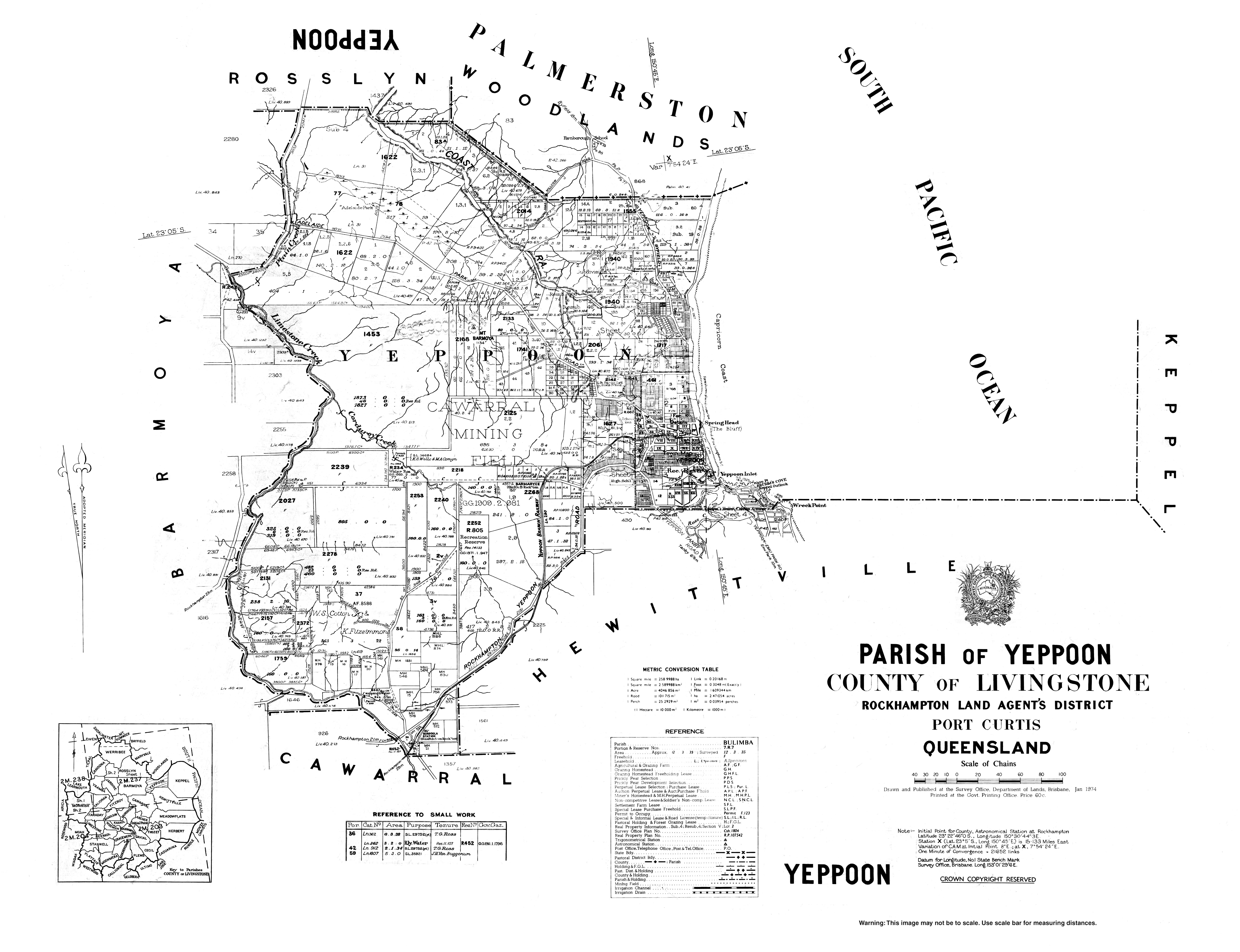
Yeppoon is a coastal town and locality in the Shire of Livingstone, Queensland, Australia. Yeppoon is renowned for its beaches, tropical climate, and the islands out on the bay. Located from the city of Rockhampton, Yeppoon is the seat of the Shire of Livingstone and the principal town on the Capricorn Coast, a string of seaside communities stretching more than from north to south. The beaches and shallow coves provide a destination both for tourists and retirees settling down in Central Queensland. Offshore, there are 27 islands including Great Keppel Island which is from Yeppoon. In the , the locality of Yeppoon had a population of 7,037 people; this does not include any neighbouring suburbs. Geography Yeppoon is located on Keppel Bay which opens to the Coral Sea, around north of the state capital, Brisbane, and from Rockhampton City. It is located within the local government area of Shire of Livingstone in Central Queensland. Between 2008 and 2013, it was within the R ... [...More Info...] [...Related Items...] OR: [Wikipedia] [Google] [Baidu] |
Melaleuca Leucadendra
''Melaleuca leucadendra'', commonly known as weeping paperbark, long-leaved paperbark or white paperbark is a plant in the myrtle family, Myrtaceae and is widespread in northern Australia, Southeast Asia, New Guinea and the Torres Strait Islands. It is a tree, sometimes growing to more than with a trunk covered with thick, white, papery bark and weeping thinner branches. It has a long flowering season, can flower at almost any time of the year and is often grown as a tree in parks and on roadsides. It was the first melaleuca to be described and was described from a specimen growing in Indonesia. Description ''Melaleuca leucadendra'' is a large tree, usually less than, but sometimes more than tall. Its thick bark is papery, usually white but also pinkish or cream and it has weeping branches. Its leaves and young branches are covered with fine, short, white hairs when young but become glabrous as they mature. The leaves are arranged alternately, long, wide, flat, narrow egg-sh ... [...More Info...] [...Related Items...] OR: [Wikipedia] [Google] [Baidu] |


