|
Darumbal
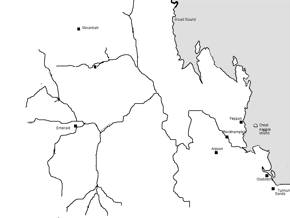
The Darumbal people, also spelt Dharumbal, are the Aboriginal Australians that have traditionally occupied Central Queensland, speaking dialects of the Darumbal language. Darumbal people of the Keppel Islands and surrounding regions are sometimes also known as Woppaburra or Ganumi, and the terms are sometimes used interchangeably. Country Traditional Darumbal land is considered to encompass an estimated around most of coastal Central Queensland, running from Arthur Point at Shoalwater Bay to Yeppoon, and taking in the mouth of Fitzroy River and Keppel Islands. From Keppel Bay they extended inland to Boomer Range, and Marlborough, Yaamba, Rockhampton, and Gracemere. History With the arrival of European settlers in the region, some Darumbal people were tolerated as part of fringe communities of the new settlements, but most were systematically killed to make way for pastoral development. According to some estimates, "between 1865 and 1902 the population of the Keppel Islands ... [...More Info...] [...Related Items...] OR: [Wikipedia] [Google] [Baidu] |
Darumbal Language
Darumbal, also spelt Dharambal, is an Aboriginal Australian language of Queensland in Australia declared extinct. It was spoken in the Rockhampton area of Queensland. Dialects were Guwinmal, Karunbara, Rakiwara, and Wapabura. It is classified with Bayali as a Kingkel language, but the two are not close, with a low 21% shared vocabulary. Indeed, Angela Terrill states that "there is no evidence on which to base a claim of a low-level genetic group including Dharumbal with any other language". Name Spelling and Pronunciation There is some variation in the naming of the language community. Walter Roth spells ''Ta-rum-bal'' and ''Taroombal'' while Norman Tindale records ''Dharumbal'' and cites the alternatives ''Tarumbul'', ''Tarambol'', ''Tarmbal'' and ''Charumbul''. Nils Holmer, who undertook the first modern field study of the language uses Darumbal, as does thDarumbal-Noolar Murree Aboriginal Corporation for Land and Culture However, Holmer also uses ⟨D⟩ to indicate an in ... [...More Info...] [...Related Items...] OR: [Wikipedia] [Google] [Baidu] |
Mount Wheeler
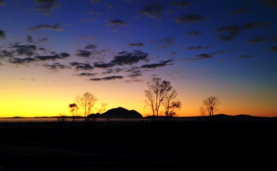
Gai-i (previously known as Mount Wheeler) is a small mountain situated between Rockhampton and Yeppoon in the state of Queensland, Australia. It is one of several igneous volcanic plug formations that feature on the landscape near the Capricorn Coast. The mountain is situated on a site known as Gawula, which is administered by the Gawula Aboriginal Land Trust. Traditionally home to a group of Aboriginal Australians known as the Darumbal people, it was returned to them in 2007 under the Aboriginal Land Act. History Gawula is the traditional home of the Darumbal people. Many indigenous groups from the region would meet at this site to exchange tools and arrange marriages. A confrontation between early European settlers and the Aboriginal Darumbal people reportedly occurred on or near Mt Wheeler, involving a number of Aboriginal deaths. In 1868 gold was found on the mountain. While initial mining was successful, a report in 1887 states that one of the largest gold nuggets in ... [...More Info...] [...Related Items...] OR: [Wikipedia] [Google] [Baidu] |
Rockhampton
Rockhampton is a city in the Rockhampton Region of Central Queensland, Australia. The population of Rockhampton in June 2021 was 79,967, Estimated resident population, 30 June 2018. making it the fourth-largest city in the state outside of the cities of South East Queensland, and the 22nd-largest city in Australia. Today, Rockhampton is an industrial and agricultural centre of the north, and is the regional centre of Central Queensland. Rockhampton is one of the oldest cities in Queensland and in Northern Australia. In 1853, Charles and William Archer came across the Toonooba river, which is now also known as the Fitzroy River, which they claimed in honour of Sir Charles FitzRoy. The Archer brothers took up a run near Gracemere in 1855, and more settlers arrived soon after, enticed by the fertile valleys. The town of Rockhampton was proclaimed in 1858, and surveyed by William Henry Standish, Arthur F Wood and Francis Clarke, the chosen street design closely resembled the Hod ... [...More Info...] [...Related Items...] OR: [Wikipedia] [Google] [Baidu] |
Shoalwater Bay
Shoalwater Bay is a large bay on the Capricorn Coast of Central Queensland, Australia 100 km north of the coastal town of Yeppoon and 628 km north-north-west of the state capital, Brisbane. Since 1966, the land surrounding Shoalwater Bay has been under the ownership of the Australian Defence Force, for the purpose of military training exercises. Shoalwater Bay is also a noted dugong habitat and is part of the Great Barrier Reef Marine Park.Captain Cook's Journal during his first voyage round the world . James Cook. Chapter 8: "Exploration of East Coast of Australia". April 1770. The bay is bounded by the Torilla Peninsula to the west and the [...More Info...] [...Related Items...] OR: [Wikipedia] [Google] [Baidu] |
Bayali Language
Bayali (also spelt Biyali, Baiali, Byelle, Byellee, and also known as Orambul or Urambal) is an extinct Australian Aboriginal language of Queensland in Australia, spoken in the Rockhampton and Gladstone areas, but a project is under way to revive the language. Classification Bayali belongs to the Pama–Nyungan language family. It has been classified together with Darumbal as a Kingkel language, but the two are not close, and Bowern (2011)Bowern, Claire. 2011.How Many Languages Were Spoken in Australia?, ''Anggarrgoon: Australian languages on the web'', December 23, 2011correctedFebruary 6, 2012) reclassified Darumbal as a Maric language. Language revival Since 2017, the Central Queensland Language Centre has been working on helping to restore three languages from the region – Yiiman, Byelle and Taribelang (also known as Gureng Gureng). , Bayali (spelt Bayelle) is one of 20 languages prioritised as part of the Priority Languages Support Project, being undertaken by ... [...More Info...] [...Related Items...] OR: [Wikipedia] [Google] [Baidu] |
Yaamba
Yaamba is a rural town and locality in the Livingstone Shire, Queensland, Australia. In the , the locality of Yaamba had a population of 62 people. Geography Yaamba is bounded by the Fitzroy River to the south and by its tributary Alligator Creek to the east. The town is in the south of the locality beside the river. The Bruce Highway enters the locality from the east ( Milman) where it is locally known as Yaamba Road. It passes to the immediate north of the town, after which it is locally known as Kunwarara Road, and exits to the west ( Canoona). The North Coast railway line also passes through the locality from east to west, roughly parallel and north of the highway. The town is served by Yaamba railway station (). The land is predominantly used for grazing. There are two clusters of housing in the town, one cluster is around the highway and railway station; the other is further south nearer the river. History The Darumbal (Tarumbul, Tharoombool) language region inc ... [...More Info...] [...Related Items...] OR: [Wikipedia] [Google] [Baidu] |
Fitzroy River (Queensland)
The Fitzroy River (Darumbal: ''Toonooba'') is a river located in Central Queensland, Australia. Its catchment covers an area of , making it the largest river catchment flowing to the eastern coast of Australia. It is also the largest river basin that discharges onto the Great Barrier Reef. Course and features Formed by the confluence of the Mackenzie and Dawson rivers that drain the Expedition Range and the Carnarvon Range respectively, the Fitzroy River rises near Duaringa and flows initially north by east, then northward near the Goodedulla National Park. The river then flows in an easterly direction near the Lake Learmouth State Forest and parallel with the Bruce Highway through the settlement of , before turning south to where the river is crossed by the Bruce Highway. After flowing through Rockhampton, the river flows south by east past the Berserker Range past Humbug Point to the south of the Flat Top Range and eventually discharging into Keppel Bay in the Coral Sea nea ... [...More Info...] [...Related Items...] OR: [Wikipedia] [Google] [Baidu] |
Glenmore Homestead
Glenmore Homestead is a heritage-listed homestead at Belmont Road, Parkhurst, Rockhampton Region, Queensland, Australia. It was built from to . The homestead and associated buildings once belonged to pastoral run on the Fitzroy River, seven kilometres northwest of Rockhampton, Queensland. Originally much larger at 127 square miles the current size of the property is . It was added to the Queensland Heritage Register on 21 October 1992. History The grazing property was originally settled in 1858 by leaseholder John Arthur McCartney. In 1860, Macartney opposed a proposal to establish a municipality for Rockhampton with a proposed area of about 225 square kilometres. Glenmore, on the northern side of the river, was as vulnerable as Gracemere Station (the proposed boundaries of the municipality included the head station and Gracemere Homestead). Glenmore, however, did not have the substantial homestead and outbuildings like Gracemere. Eventually, the boundaries for the Munic ... [...More Info...] [...Related Items...] OR: [Wikipedia] [Google] [Baidu] |
Coowonga
Coowonga is a rural locality in the Shire of Livingstone, Central Queensland, Australia. Geography Coowonga is located in coastal hills at the southern end of the Capricorn Coast. It is six kilometres from the Pacific Ocean and the nearest township of Keppel Sands. Much of the district south of Coowonga Road is grazing and fruit-growing land, while to the north lie tidal salt flats that back onto Coorooman Creek. The Rockhampton–Emu Park Road runs through from west to north. History Coowonga is the traditional land of the Darumbal Aboriginal tribe, as is all of the Capricornia region. Coowonga Provision School opened on 9 August 1897. It became Coowonga State School on 1 January 1909. Prior to local government amalgamations in 2008, the Capricorn Coast was administered by Livingstone Shire Council but became part of Rockhampton Region The Rockhampton Region is a local government area (LGA) in Central Queensland, Australia, located on the Tropic of Capricorn abou ... [...More Info...] [...Related Items...] OR: [Wikipedia] [Google] [Baidu] |
Great Keppel Island
Great Keppel Island (''Woppaburra, Wop-Pa, Wapparaburra'') lies from the coast off Yeppoon in the Shire of Livingstone, Queensland, Australia. It is part of the Capricorn Coast of Central Queensland. The island's traditional owners are the Woppaburra people. As the largest of the eighteen islands in the Keppel Group, Wop-Pa covers an area of 1308 hectares. It is within the Local government in Australia, local government area of Shire of Livingstone The Shire of Livingstone is a local government area located in the Capricornia region of Central Queensland, Queensland, Australia, to the immediate north and east of the regional city of Rockhampton. The shire, administered from the coastal to ... (between 2008 and 2013, it was within the Rockhampton Region). The tropical climate and numerous beaches attract tourists from all points, and a number of accommodation villages and houses cater for tourists including Air BnB Houses. There are 17 white sandy beaches with some of the h ... [...More Info...] [...Related Items...] OR: [Wikipedia] [Google] [Baidu] |
Yeppoon
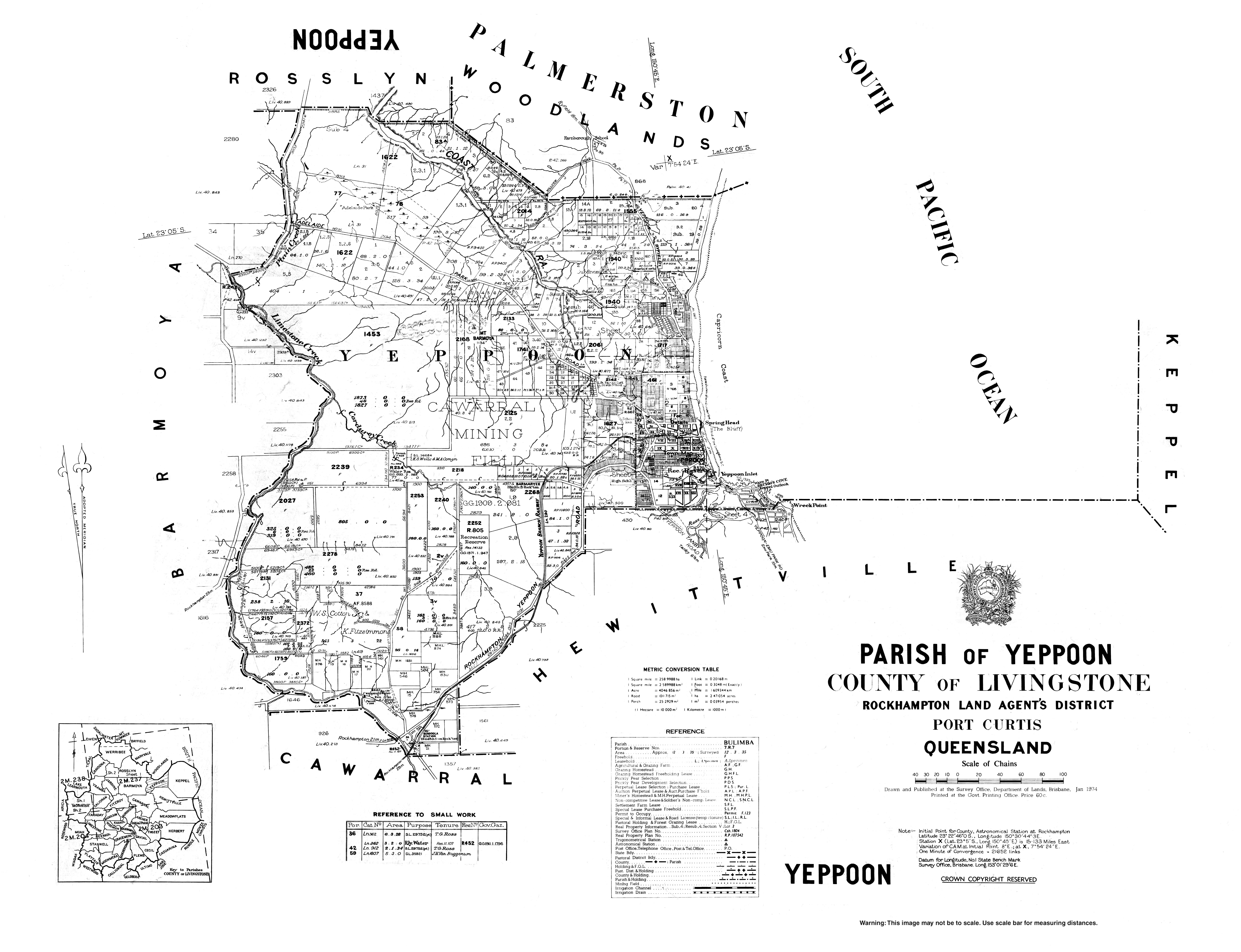
Yeppoon is a coastal town and locality in the Shire of Livingstone, Queensland, Australia. Yeppoon is renowned for its beaches, tropical climate, and the islands out on the bay. Located from the city of Rockhampton, Yeppoon is the seat of the Shire of Livingstone and the principal town on the Capricorn Coast, a string of seaside communities stretching more than from north to south. The beaches and shallow coves provide a destination both for tourists and retirees settling down in Central Queensland. Offshore, there are 27 islands including Great Keppel Island which is from Yeppoon. In the , the locality of Yeppoon had a population of 7,037 people; this does not include any neighbouring suburbs. Geography Yeppoon is located on Keppel Bay which opens to the Coral Sea, around north of the state capital, Brisbane, and from Rockhampton City. It is located within the local government area of Shire of Livingstone in Central Queensland. Between 2008 and 2013, it was within the Roc ... [...More Info...] [...Related Items...] OR: [Wikipedia] [Google] [Baidu] |
Traditional Owner
Native title is the designation given to the common law doctrine of Aboriginal title in Australia, which is the recognition by Australian law that Indigenous Australians (both Aboriginal Australian and Torres Strait Islander people) have rights and interests to their land that derive from their traditional laws and customs. The concept recognises that in certain cases there was and is a continued beneficial legal interest in land held by Indigenous peoples which survived the acquisition of radical title to the land by the Crown at the time of sovereignty. Native title can co-exist with non-Aboriginal proprietary rights and in some cases different Aboriginal groups can exercise their native title over the same land. The foundational case for native title in Australia was ''Mabo v Queensland (No 2)'' (1992). One year after the recognition of the legal concept of native title in ''Mabo'', the Keating Government formalised the recognition by legislation with the enactment by the Au ... [...More Info...] [...Related Items...] OR: [Wikipedia] [Google] [Baidu] |


