|
Badghis
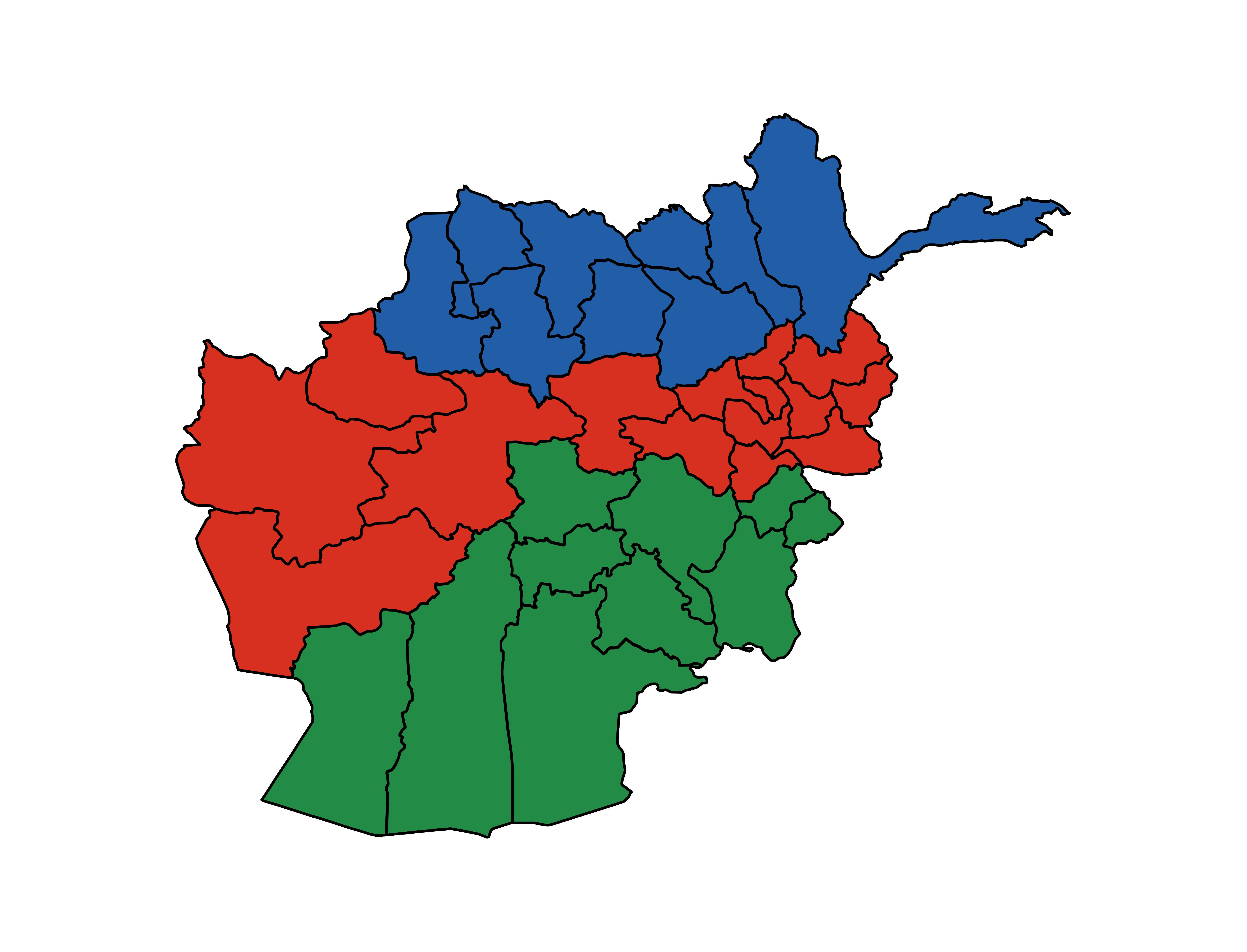
Bādghīs (Dari: ) is one of the thirty-four provinces of Afghanistan, located in the northwest of the country, on the border with Turkmenistan. It is considered to be one of the country's most underdeveloped provinces, with the highest poverty rate. The capital is Qala e Naw, while the most populous city and the district are Bala Murghab. The ruins of the medieval city of Marw al-Rudh, the historical capital of the medieval region of Gharjistan, are located in the province near the modern city of Bala Murghab. Geography Badghis Province is located in the isolated hills of northwestern Afghanistan and shares its borders with Herat, Ghor, and Faryab provinces as well as Turkmenistan. The province has a total area of 20,591 km2. Hydrologically, the province is dominated by the Murghab River which is used for irrigation. It contains some mountains but is predominantly characterized by rolling hills divided by ravines. The province is very windy; the name "Badghis" is a corrup ... [...More Info...] [...Related Items...] OR: [Wikipedia] [Google] [Baidu] |
Bala Murghab
Bala Murghab (Persian/ ps, بالامرغاب) is a city in the Badghis Province of northwestern Afghanistan, located on the Murghab River. It is the district center for the Bala Murghab District. Bala Murghab is the largest city of Badghis Province, while Bala Murghab District, with a population of 109,381, is also the most populous district of the province. Close to Bala Murghab lie the ruins of the medieval city Marw al-Rudh, the historical capital of the medieval region of Gharjistan. Throughout the War in Afghanistan, it was heavily contested by the Taliban and Afghan National Security Forces. The city was captured by the Taliban during the 2021 Taliban offensive. History Marw al-Rudh was a major medieval city in the Gharjistan region at the location of the modern city of Bala Murghab. The Abbasid-era geographers report that Marw al-Rudh was the center of a flourishing agricultural region in Khorasan, at the site where the Murghab River leaves the mountains and enters the step ... [...More Info...] [...Related Items...] OR: [Wikipedia] [Google] [Baidu] |
Qala E Naw
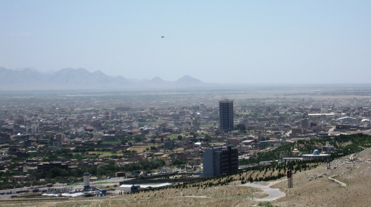
Qala-e-Naw ( prs, قلعه نو) is a town in Qala e Naw District and the capital of Badghis Province, in north-west Afghanistan. Its population was estimated at 9,000 in 2006, of which 80% are Tajiks, Hazaras, and Aimaq Hazara. Other significant communities include Pashtuns, Balochs and Uzbeks. The city of Qala-e-naw has a population of 64,125 people (2015) with 6 Police districts (nahias) and a total land area of 3,752 Hectares. There are 7,125 total number of dwellings in Qala-e-Naw. Qala-e-naw is the provincial capital of Badghis Province. Qala-e-Naw is a Provincial Centre located in western Afghanistan north of the Paropamisus Mountains (Selseleh-ye Safīd Kūh). Barren land accounts for 49% of the total land area and only 28% is classified as built-up. Of the built-up land, 60% is residential. District 4 has a large institutional and transportation land use as a result of the airport located there. It has a small airport, Qala i Naw Airport. On 7 July 2021, the Taliban b ... [...More Info...] [...Related Items...] OR: [Wikipedia] [Google] [Baidu] |
List Of Governors Of Badghis
This is a list of the governors of the province of Badghis, Afghanistan. Governors of Badghis Province See also * List of current governors of Afghanistan Notes {{Reflist Badghis Bādghīs (Dari: ) is one of the thirty-four provinces of Afghanistan, located in the northwest of the country, on the border with Turkmenistan. It is considered to be one of the country's most underdeveloped provinces, with the highest poverty r ... * ... [...More Info...] [...Related Items...] OR: [Wikipedia] [Google] [Baidu] |
Afghanistan
Afghanistan, officially the Islamic Emirate of Afghanistan,; prs, امارت اسلامی افغانستان is a landlocked country located at the crossroads of Central Asia and South Asia. Referred to as the Heart of Asia, it is bordered by Pakistan to the Durand Line, east and south, Iran to the Afghanistan–Iran border, west, Turkmenistan to the Afghanistan–Turkmenistan border, northwest, Uzbekistan to the Afghanistan–Uzbekistan border, north, Tajikistan to the Afghanistan–Tajikistan border, northeast, and China to the Afghanistan–China border, northeast and east. Occupying of land, the country is predominantly mountainous with plains Afghan Turkestan, in the north and Sistan Basin, the southwest, which are separated by the Hindu Kush mountain range. , Demographics of Afghanistan, its population is 40.2 million (officially estimated to be 32.9 million), composed mostly of ethnic Pashtuns, Tajiks, Hazaras, and Uzbeks. Kabul is the country's largest city and ser ... [...More Info...] [...Related Items...] OR: [Wikipedia] [Google] [Baidu] |
Murghab River
The Marghab River (Persian/Pashto: مرغاب, ''Morqâb''), anciently the Margiana (Ancient Greek: Μαργιανή, ''Margianḗ''), is an long river in Central Asia. It rises in the Paropamisus Mountains (''Selseleh-ye Safīd Kūh'') in Ghor Province, flows through the Marghab District in central Afghanistan, then runs northwest towards the Bala Murghab. Reaching the oasis of Mary in the Karakum Desert of Turkmenistan, the Marghab debouches into the Karakum Canal, a diversion of water from the Amu Darya. The catchment area of the Marghab is estimated at . Geography The Marghab River originates in the Ghor Province of central Afghanistan, on a plateau among the chain of mountains of Paropamisus, Gharjistan and Band-i Turkestan. In its higher course, the river runs from east to west, towards Mukhamedkhan, for about in a narrow, steep valley measuring less than one kilometer in width, with narrow gorges in some places. Between Darband-i Kilrekht and Mukhammedkhan, the M ... [...More Info...] [...Related Items...] OR: [Wikipedia] [Google] [Baidu] |
Meymaneh Province
Meymaneh Province was a former province of Afghanistan, which in 1964 was divided, creating Badghis Province and Faryab Province. However, the name "Maymana" survives the administrative center of the Faryab Province Faryab (Dari: ) is one of the thirty-four provinces of Afghanistan, which is located in the north of the country bordering neighboring Turkmenistan. It has a population of about 1,109,223, which is multi-ethnic and mostly a tribal society. The pr .... SourcesStatoids.com - Provinces of Afghanistan Former provinces of Afghanistan History of Badghis Province History of Faryab Province {{Faryab-geo-stub ... [...More Info...] [...Related Items...] OR: [Wikipedia] [Google] [Baidu] |
Faryab
Faryab (Dari: ) is one of the thirty-four provinces of Afghanistan, which is located in the north of the country bordering neighboring Turkmenistan. It has a population of about 1,109,223, which is multi-ethnic and mostly a tribal society. The province encompasses 15 districts and over 1,000 villages. The capital of Faryab province is Maymana. It also borders Jowzjan Province, Sar-e Pol Province, Ghor Province and Badghis Province. History Faryab is a Persian toponym meaning "lands irrigated by diversion of river water". The name Faryab takes its name from a town founded in the area by the Sassanids. It is the home town of the famed Islamic philosopher, al-Farabi (per the biographer Ibn al-Nadim). The area is part of the trans-border region of Greater Khorasan; during the colonial era, British geographers referred to the area as Afghan Turkestan. The history of settlement in Faryab is ancient and comprises layer upon layer of occupation. At times, it was a melting pot within ... [...More Info...] [...Related Items...] OR: [Wikipedia] [Google] [Baidu] |
Provinces Of Afghanistan
Afghanistan is divided into 34 provinces (, '' wilåyat''). The provinces of Afghanistan are the primary administrative divisions. Each province encompasses a number of districts or usually over 1,000 villages. Provincial governors played a critical role in the reconstruction of the Afghan state following the creation of the new government under Hamid Karzai. According to international security scholar Dipali Mukhopadhyay, many of the provincial governors of the western-backed government were former warlords who were incorporated into the political system. Provinces of Afghanistan Regions of Afghanistan UN Regions Former provinces of Afghanistan During Afghanistan's history it had a number of provinces in it. It started out as just Kabul, Herat, Qandahar, and Balkh but the number of provinces increased and by 1880 the provinces consisted of Balkh, Herat, Qandahar, Ghazni, Jalalabad, and Kabul. * Southern Province – dissolved in 1964 to create Paktia Provinc ... [...More Info...] [...Related Items...] OR: [Wikipedia] [Google] [Baidu] |
Herat Province
Herat (Persian: ) is one of the thirty-four provinces of Afghanistan, located in the north-western part of the country. Together with Badghis, Farah, and Ghor provinces, it makes up the north-western region of Afghanistan. Its primary city and administrative capital is Herat City. The province of Herat is divided into about 17 districts and contains over 2,000 villages. It has a population of about 3,780,000, making it the second most populated province in Afghanistan behind Kabul Province. The population is multi-ethnic but largely Persian-speaking. Herat dates back to the Avestan times and was traditionally known for its wine. The city has a number of historic sites, including the Herat Citadel and the Musalla Complex. During the Middle Ages Herat became one of the important cities of Khorasan, as it was known as the Pearl of Khorasa The province of Herat shares a border with Iran in the west and Turkmenistan in the north, making it an important trading region. The Trans-Afg ... [...More Info...] [...Related Items...] OR: [Wikipedia] [Google] [Baidu] |
Marw Al-Rudh
Marw-Rud ( fa, مرورود, also fa, مروروذ ''Marw-Rudh'') or Marw al-Rudh (from ar, مرو الروذ; "Marw on the river"), locally used to be known by the older variants Marwarudh () and Marrudh (),"مرورود" in Dehkhoda Dictionary was a medieval settlement in Khurasan. It was also known as Marw-i Kuchik ( fa, مرو کوچک, "Little Marw") to distinguish it from the nearby Marw al-Shahijan or Greater Marw. The town was located near the modern Afghan settlement of Bala Murghab, at the site where the Murghab River leaves the mountains of Gharjistan and enters the steppe of the Karakum Desert. The modern settlement of Maruchak or Marv-i Kuchik, although named after the medieval town, appears to be the site of a former suburb of it, named Qasr-i Ahnaf. The town existed already in pre-Islamic times, its foundation being attributed to the Sasanian king Bahram Gur (reigned 420–438). Its original name in Persian was Marwirōd () or Marvirot (Mrot in Armenian), which s ... [...More Info...] [...Related Items...] OR: [Wikipedia] [Google] [Baidu] |
Ghor
Ghōr (Dari: ), also spelled Ghowr or Ghur, is one of the thirty-four provinces of Afghanistan. It is located in the western Hindu Kush in central Afghanistan, towards the northwest. The province contains eleven districts, encompassing hundreds of villages, and approximately 764,472 settled people. Firuzkoh (called Chaghcharan until 2014) serves as the capital of the province. Etymology The ancient Indo-European, Sogdian ''gor-''/''gur-'' ("mountain"-) is well preserved in all Slavic ''gor-''/''gór- (goor-/gur-)'', e.g.: Gorals, Goran, Goranci, Góra, Gora..., in Iranian languages, e.g.: Gorani language, Guran (Kurdish tribe)... and even in India and Nepal, e.g.: Gurkha. The Polish notation using ''gór-'' ("ó" stands for a sound between English "oo" and "u") instead of the popular ''gur-'' or ''ghur-'' preserves the ancient orthography. History The inhabitants of Ghor were completely Islamized during the Ghurids era. Before the 12th century, the area was home to Hi ... [...More Info...] [...Related Items...] OR: [Wikipedia] [Google] [Baidu] |


