|
Backaland
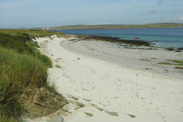
Backaland is a settlement on the island of Eday in Orkney Orkney (; sco, Orkney; on, Orkneyjar; nrn, Orknøjar), also known as the Orkney Islands, is an archipelago in the Northern Isles of Scotland, situated off the north coast of the island of Great Britain. Orkney is 10 miles (16 km) north ..., Scotland. The settlement is also within the parish of Eday, and it is located to the south west of the island. Backaland is situated at the southern end of the B9063. References External links Ports and Harbours of the UK - Backaland (Eday) [...More Info...] [...Related Items...] OR: [Wikipedia] [Google] [Baidu] |
Eday
Eday (, sco, Aidee) is one of the islands of Orkney, which are located to the north of the Scottish mainland. One of the North Isles, Eday is about from the Orkney Mainland. With an area of , it is the ninth-largest island of the archipelago. The bedrock of the island is Old Red Sandstone, which is exposed along the sea-cliffs. There are various well-preserved Neolithic tombs, as well as evidence of Bronze Age settlement and the remains of a Norse-era castle. During the period of Scottish rule the substantial property of Carrick House was developed at Calfsound, which became a burgh for a short period. During the British era many agricultural improvements were introduced, although there has been a substantial decline in the population since the mid-nineteenth century. In the twenty-first century the Eday Partnership has had success in promoting the island's economy. Local placenames reflect the diverse linguistic heritage and the landscapes of the island and its surroundin ... [...More Info...] [...Related Items...] OR: [Wikipedia] [Google] [Baidu] |
Orkney
Orkney (; sco, Orkney; on, Orkneyjar; nrn, Orknøjar), also known as the Orkney Islands, is an archipelago in the Northern Isles of Scotland, situated off the north coast of the island of Great Britain. Orkney is 10 miles (16 km) north of the coast of Caithness and has about 70 islands, of which 20 are inhabited. The largest island, the Mainland, has an area of , making it the sixth-largest Scottish island and the tenth-largest island in the British Isles. Orkney’s largest settlement, and also its administrative centre, is Kirkwall. Orkney is one of the 32 council areas of Scotland, as well as a constituency of the Scottish Parliament, a lieutenancy area, and an historic county. The local council is Orkney Islands Council, one of only three councils in Scotland with a majority of elected members who are independents. The islands have been inhabited for at least years, originally occupied by Mesolithic and Neolithic tribes and then by the Picts. Orkney was co ... [...More Info...] [...Related Items...] OR: [Wikipedia] [Google] [Baidu] |
Faray
Faray (Old Norse: ''Færey'') is a small island in Orkney, Scotland, lying between Eday and Westray. Previously inhabited, the low-lying island is now a successful grey seal breeding colony. Geography Faray and Holm of Faray are formed of a ridge of Old Red Sandstone which extends southwards from Weather Ness at the southern tip of the island of Westray and almost connects Westray to Eday. The two islands are separated by the Lavey Sound. History Faray was known as Pharay (or North Pharay to distinguish it from South Pharay, now called Fara). Both names are derived from the Old Norse 'faerey', "sheep island". The only man-made relic of note is a chambered cairn beside Lavey Sound. Faray had a population of eighty-two in 1861, falling to fifty-eight by 1891. By the late 1930s there were eight families living on the island. They had crofts and supplemented their income by lobster fishing. World War II led to many departures. By 1947 the last islander had left Faray and, apart ... [...More Info...] [...Related Items...] OR: [Wikipedia] [Google] [Baidu] |
Orkney And Shetland (UK Parliament Constituency)
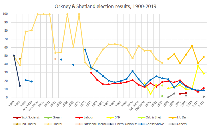
Orkney and Shetland is a constituency of the House of Commons of the Parliament of the United Kingdom. It elects one Member of Parliament (MP) by the first past the post system of election. In the Scottish Parliament, Orkney and Shetland are separate constituencies. The constituency was historically known as Orkney and Zetland (an alternative name for Shetland). In the 2014 Scottish independence referendum A independence referendum, referendum on Scottish independence from the United Kingdom was held in Scotland on 18 September 2014. The referendum question was, "Should Scotland be an independent country?", which voters answered with "Yes" ..., 65.4% of the constituency's electors voted for Scotland to stay part of the United Kingdom. Creation The British parliamentary constituency was created in 1708 following the Acts of Union, 1707 and replaced the former Parliament of Scotland shire constituency of Orkney and Zetland (Parliament of Scotland constituency), Orkne ... [...More Info...] [...Related Items...] OR: [Wikipedia] [Google] [Baidu] |
Orkney (Scottish Parliament Constituency)
Orkney is a constituency of the Scottish Parliament ( Holyrood) covering the council area of Orkney. It elects one Member of the Scottish Parliament (MSP) by the first past the post method of election. It is also one of eight constituencies in the Highlands and Islands electoral region, which elects seven additional members, in addition to the eight constituency MSPs, to produce a form of proportional representation for the region as a whole. Orkney has been held by the Liberal Democrats at all elections since the formation of the Scottish Parliament in 1999, with the current MSP being Liam McArthur, who won the seat at the 2007 Scottish Parliament election. The former Deputy First Minister Jim Wallace represented the constituency from 1999 to 2007. Electoral region Orkney is part of the Highlands and Islands electoral region; the other seven constituencies of are Argyll and Bute, Caithness, Sutherland and Ross, Inverness and Nairn, Moray, Na h-Eileanan an Iar, Sh ... [...More Info...] [...Related Items...] OR: [Wikipedia] [Google] [Baidu] |
Gazetteer For Scotland
The ''Gazetteer for Scotland'' is a gazetteer covering the geography, history and people of Scotland. It was conceived in 1995 by Bruce Gittings of the University of Edinburgh and David Munro of the Royal Scottish Geographical Society, and contains 25,870 entries as of July 2019. It claims to be "the largest dedicated Scottish resource created for the web". The Gazetteer for Scotland provides a carefully researched and editorially validated resource widely used by students, researchers, tourists and family historians with interests in Scotland. Following on from a strong Scottish tradition of geographical publishing, the ''Gazetteer for Scotland'' is the first comprehensive gazetteer to be produced for the country since Francis Groome's '' Ordnance Gazetteer of Scotland'' (1882-6) (the text of which is incorporated into relevant entries). The aim is not to produce a travel guide, of which there are many, but to write a substantive and thoroughly edited description of the ... [...More Info...] [...Related Items...] OR: [Wikipedia] [Google] [Baidu] |
Ordnance Survey
Ordnance Survey (OS) is the national mapping agency for Great Britain. The agency's name indicates its original military purpose (see ordnance and surveying), which was to map Scotland in the wake of the Jacobite rising of 1745. There was also a more general and nationwide need in light of the potential threat of invasion during the Napoleonic Wars. Since 1 April 2015 Ordnance Survey has operated as Ordnance Survey Ltd, a government-owned company, 100% in public ownership. The Ordnance Survey Board remains accountable to the Secretary of State for Business, Energy and Industrial Strategy. It was also a member of the Public Data Group. Paper maps for walkers represent only 5% of the company's annual revenue. It produces digital map data, online route planning and sharing services and mobile apps, plus many other location-based products for business, government and consumers. Ordnance Survey mapping is usually classified as either " large-scale" (in other words, more detaile ... [...More Info...] [...Related Items...] OR: [Wikipedia] [Google] [Baidu] |
Villages In Orkney
A village is a clustered human settlement or community, larger than a hamlet but smaller than a town (although the word is often used to describe both hamlets and smaller towns), with a population typically ranging from a few hundred to a few thousand. Though villages are often located in rural areas, the term urban village is also applied to certain urban neighborhoods. Villages are normally permanent, with fixed dwellings; however, transient villages can occur. Further, the dwellings of a village are fairly close to one another, not scattered broadly over the landscape, as a dispersed settlement. In the past, villages were a usual form of community for societies that practice subsistence agriculture, and also for some non-agricultural societies. In Great Britain, a hamlet earned the right to be called a village when it built a church. [...More Info...] [...Related Items...] OR: [Wikipedia] [Google] [Baidu] |


