|
Atahualpa (ship)
''Atahualpa'' was a United States merchant ship that sailed on four maritime fur trading ventures in the early 1800s. In 1813, in the Hawaiian Islands, ''Atahualpa'' was sold to the Russian-American Company (RAC) and renamed ''Bering'' or ''Behring''. In January 1815 ''Bering'', under the command of the American James Bennett, returned to Hawaii where it wrecked at Waimea Bay, Kauai. ''Atahualpa'' was a 210 ton ship built at Kennebunk, Maine. Its sister ship was ''Guatimozin''. The ''Atahualpa'' was named after the last Inca emperor Atahualpa. ''Guatimozin'' was named after the last Aztec emperor Guatimozin. Both ships were owned by the Boston company of Theodore Lyman and Associates. First voyage In the summer of 1800 ''Atahualpa'', under the command of Dixey Wildes, left Boston in company with the ''Guatimozin''. ''Atahualpa'' sailed to the Pacific Northwest via Cape Horn to trade with the indigenous peoples of the Pacific Northwest coast for sea otter furs, which commanded a ... [...More Info...] [...Related Items...] OR: [Wikipedia] [Google] [Baidu] |
Kennebunk, Maine
Kennebunk is a town in York County, Maine, United States. The population was 11,536 at the 2020 census (The population does not include Kennebunkport, a separate town). Kennebunk is home to several beaches, the Rachel Carson National Wildlife Refuge, the 1799 Kennebunk Inn, many historic shipbuilders' homes, the Brick Store Museum and the Nature Conservancy Kennebunk Plains (known locally as the Blueberry Plains), with 1,500 acres (6 km) of nature trails and blueberry fields. The municipality includes the constituent villages of Kennebunk Village (Town), the Lower Village (Lower Kennebunk), Kennebunk Landing (the Landing), Bartlett Mills, West Kennebunk, Kennebunk Beach, Lords Point, Coopers Corner Crossing, Sea Roads Crossing, Webahennet Grove, and Vinegarhill, Cheshire Commons, Kennebunk Meadows, and various newer neighborhoods. History First settled in 1621, the town developed as a trading and, later, shipbuilding and shipping center with light manufacturing. It was pa ... [...More Info...] [...Related Items...] OR: [Wikipedia] [Google] [Baidu] |
The Limestone Press
The Limestone Press is a one-man publishing house, established in 1972 by historian Richard Pierce (1918–2004). Pierce lived and worked at that time in Kingston, Ontario, and he chose the name from the nickname of Kingston, the “Limestone City”, which has its origins in its many limestone buildings. He published mainly books on Alaska’s history, mostly concerning its Russian era, but also on Ukrainian and African and other topics, as well as books dealing with Kingston's history. It is unclear whether The Limestone Press will publish any new works, since Pierce died in 2004. The remaining back catalogue is being distributed by the University of Alaska Press. The Alaska History Series *Note: The name of the series was originally ''Materials for the Study of Alaska History'', under which name it appeared from 1972 to 1980. This covers numbers 1–17. The new name ''Alaska History'' begins with no. 18. From 1993 on the series has been distributed solely by the University of ... [...More Info...] [...Related Items...] OR: [Wikipedia] [Google] [Baidu] |
Milbanke Sound
Milbanke Sound is a Sound (geography), sound on the coast of the Provinces and territories of Canada, Canadian province of British Columbia. Geography Milbanke Sound extends east from Queen Charlotte Sound (Canada), Queen Charlotte Sound, with Price Island (British Columbia), Price Island on the west, Swindle Island on the north, and the Bardswell Group of islands on the south. Milbanke Sound is one of the open sea portions of the Inside Passage, with Seaforth Channel joining from the east and Finlayson Channel from the north. Mathieson Channel also connects to Milbanke Sound from the north, and leads to Fiordland Conservancy. On the islands surrounding the sound is a group of five volcanos called the Milbanke Sound Group, Milbanke Sound cones. History The Heiltsuk peoples traditionally occupied the land around Milbanke Sound. He named the sound after Vice Admiral Mark Milbanke. Explorer George Vancouver sailed through the sound a few years later. In 1805, a trading ship from Bost ... [...More Info...] [...Related Items...] OR: [Wikipedia] [Google] [Baidu] |
Supercargo
A supercargo (from Spanish ''sobrecargo'') is a person employed on board a vessel by the owner of cargo carried on the ship. The duties of a supercargo are defined by admiralty law and include managing the cargo owner's trade, selling the merchandise in ports to which the vessel is sailing, and buying and receiving goods to be carried on the return voyage. The supercargo has control of the cargo unless limited by other contracts or agreements. For instance, the supercargo has no authority over the stevedores, and has no role in the necessary preparatory work prior to the handling of cargo. Sailing from port to port with the vessel to which they are attached, supercargos differ from factors, who have a fixed place of residence at a port or other trading place. History During the Age of Sail from the 16th to the mid-19th century, the supercargo was the second-most important person aboard a merchant ship after the captain. Sweden On ships of the Swedish East India Company (1731–1 ... [...More Info...] [...Related Items...] OR: [Wikipedia] [Google] [Baidu] |
Cape Of Good Hope
The Cape of Good Hope ( af, Kaap die Goeie Hoop ) ;''Kaap'' in isolation: pt, Cabo da Boa Esperança is a rocky headland on the Atlantic coast of the Cape Peninsula in South Africa. A common misconception is that the Cape of Good Hope is the southern tip of Africa, based on the misbelief that the Cape was the dividing point between the Atlantic and Indian oceans, and have nothing to do with north or south. In fact, by looking at a map, the southernmost point of Africa is Cape Agulhas about to the east-southeast. The currents of the two oceans meet at the point where the warm-water Agulhas current meets the cold-water Benguela current and turns back on itself. That oceanic meeting point fluctuates between Cape Agulhas and Cape Point (about east of the Cape of Good Hope). When following the western side of the African coastline from the equator, however, the Cape of Good Hope marks the point where a ship begins to travel more eastward than southward. Thus, the first mode ... [...More Info...] [...Related Items...] OR: [Wikipedia] [Google] [Baidu] |
Sunda Strait
The Sunda Strait ( id, Selat Sunda) is the strait between the Indonesian islands of Java island, Java and Sumatra. It connects the Java Sea with the Indian Ocean. Etymology The strait takes its name from the Sunda Kingdom, which ruled the western portion of Java (an area covering the present day West Java, Jakarta, Banten, and some of western Central Java) from 669 to around 1579."Sunda Islands". Concise Dictionary of World Place-Names. John Everett-Heath. Oxford University Press 2005. Oxford Reference Online. Oxford University Press. The name also alludes to the Sundanese people native to West Java and Banten, as distinct from the Javanese people, who live mostly in Central and East Java. Geography Extending in a roughly southwest/northeast orientation, with a minimum width of at its northeastern end between Cape Tua on Sumatra and Cape Pujat on Java, the strait is part of the Java Sea. It is essentially triangular in shape, with two large bays on its northern side. It is al ... [...More Info...] [...Related Items...] OR: [Wikipedia] [Google] [Baidu] |
Canton System
The Canton System (1757–1842; zh, t=一口通商, p=Yīkǒu tōngshāng, "Single orttrading relations") served as a means for Qing China to control trade with the West within its own country by focusing all trade on the southern port of Canton (now Guangzhou). The protectionist policy arose in 1757 as a response to a perceived political and commercial threat from abroad on the part of successive Chinese emperors. From the late seventeenth century onwards, Chinese merchants, known as '' Hongs'' (), managed all trade in the port. Operating from the Thirteen Factories located on the banks of the Pearl River outside Canton, in 1760, by order of the Qing Qianlong Emperor, they became officially sanctioned as a monopoly known as the ''Cohong''. Thereafter Chinese merchants dealing with foreign trade ( zh, t=洋行, p=yángháng, links=no, "ocean traders", i.e. "overseas traders" or "foreign traders") acted through the ''Cohong'' under the supervision of the Guangdong Customs Su ... [...More Info...] [...Related Items...] OR: [Wikipedia] [Google] [Baidu] |
Guangzhou
Guangzhou (, ; ; or ; ), also known as Canton () and alternatively romanized as Kwongchow or Kwangchow, is the capital and largest city of Guangdong province in southern China. Located on the Pearl River about north-northwest of Hong Kong and north of Macau, Guangzhou has a history of over 2,200 years and was a major terminus of the maritime Silk Road; it continues to serve as a major port and transportation hub as well as being one of China's three largest cities. For a long time, the only Chinese port accessible to most foreign traders, Guangzhou was captured by the British during the First Opium War. No longer enjoying a monopoly after the war, it lost trade to other ports such as Hong Kong and Shanghai, but continued to serve as a major transshipment port. Due to a high urban population and large volumes of port traffic, Guangzhou is classified as a Large-Port Megacity, the largest type of port-city in the world. Due to worldwide travel restrictions at the beginni ... [...More Info...] [...Related Items...] OR: [Wikipedia] [Google] [Baidu] |
Vancouver Island
Vancouver Island is an island in the northeastern Pacific Ocean and part of the Canadian Provinces and territories of Canada, province of British Columbia. The island is in length, in width at its widest point, and in total area, while are of land. The island is the largest by area and the most populous along the west coasts of the Americas. The southern part of Vancouver Island and some of the nearby Gulf Islands are the only parts of British Columbia or Western Canada to lie south of the 49th parallel north, 49th parallel. This area has one of the warmest climates in Canada, and since the mid-1990s has been mild enough in a few areas to grow Mediterranean Sea, Mediterranean crops such as olives and lemons. The population of Vancouver Island was 864,864 as of 2021. Nearly half of that population (~400,000) live in the metropolitan area of Greater Victoria, the capital city of British Columbia. Other notable cities and towns on Vancouver Island include Nanaimo, Port Alberni, ... [...More Info...] [...Related Items...] OR: [Wikipedia] [Google] [Baidu] |
Nahwitti (trading Site)
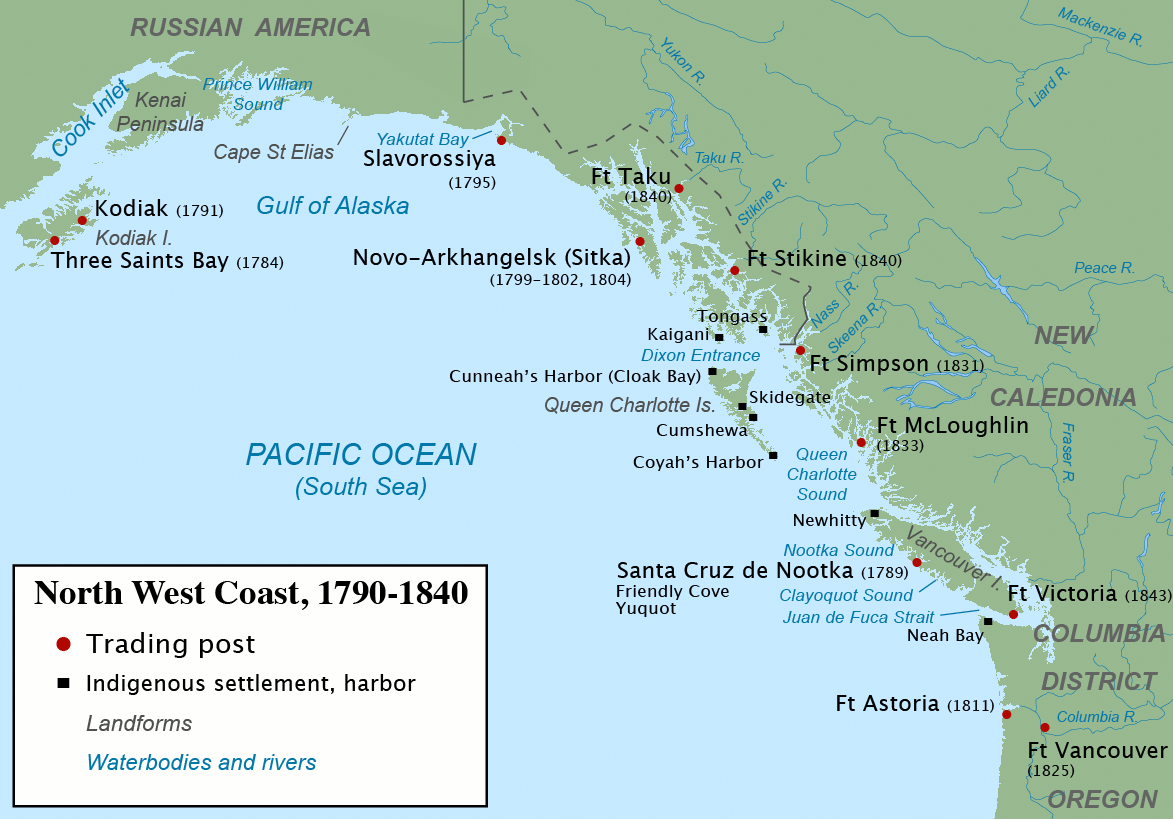
Nahwitti was a Kwakwakaʼwakw First Nation village and a major trading site during the maritime fur trade era of approximately 1790 to 1850. Today it is an Indian reserve under the administration of the Kwakwakaʼwakw Tlatlasikwala Nation. It is located near the northern tip of Vancouver Island, at Cape Sutil on Queen Charlotte Sound, near Hope Island and the Nahwitti River, east of Cape Scott, and not far from historic Fort Rupert and modern Port Hardy. During the early 19th century Nahwitti was the principal town of the Nahwitti First Nation. It was one of the most popular sites for Western trading vessels on the Pacific Northwest coast, and the primary point of contact with the Kwakwakaʼwakw peoples. Hundreds of trading vessels, mostly British and American, visited during this time, mainly seeking sea otter skins to take to China, where they commanded a high price. Maritime fur traders and other early explorers spelled Nahwitti in many ways, including: Newitty, Newhitty, Ne ... [...More Info...] [...Related Items...] OR: [Wikipedia] [Google] [Baidu] |
China
China, officially the People's Republic of China (PRC), is a country in East Asia. It is the world's most populous country, with a population exceeding 1.4 billion, slightly ahead of India. China spans the equivalent of five time zones and borders fourteen countries by land, the most of any country in the world, tied with Russia. Covering an area of approximately , it is the world's third largest country by total land area. The country consists of 22 provinces, five autonomous regions, four municipalities, and two Special Administrative Regions (Hong Kong and Macau). The national capital is Beijing, and the most populous city and financial center is Shanghai. Modern Chinese trace their origins to a cradle of civilization in the fertile basin of the Yellow River in the North China Plain. The semi-legendary Xia dynasty in the 21st century BCE and the well-attested Shang and Zhou dynasties developed a bureaucratic political system to serve hereditary monarchies, or dyna ... [...More Info...] [...Related Items...] OR: [Wikipedia] [Google] [Baidu] |
Sea Otter
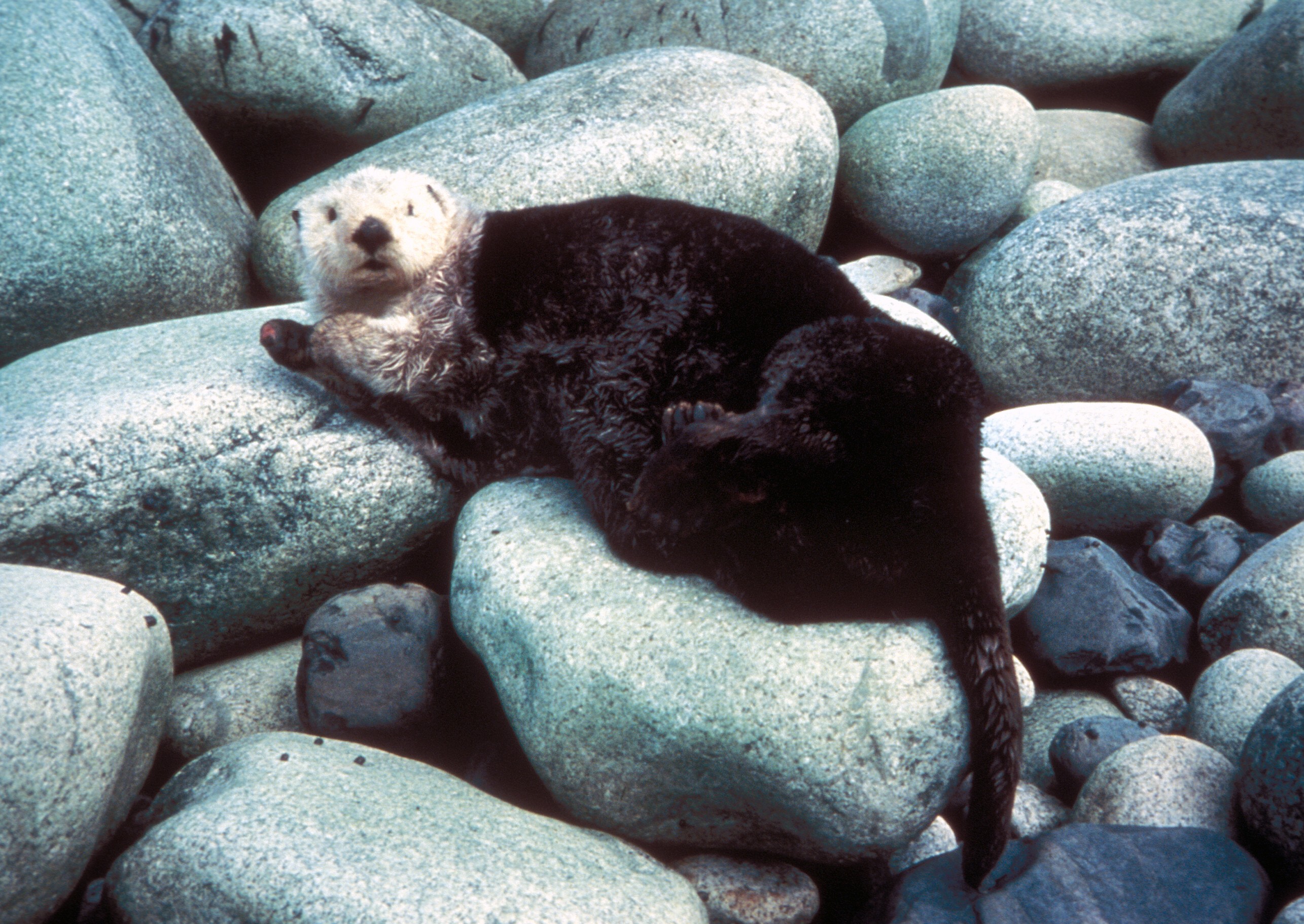
The sea otter (''Enhydra lutris'') is a marine mammal native to the coasts of the northern and eastern North Pacific Ocean. Adult sea otters typically weigh between , making them the heaviest members of the weasel family, but among the smallest marine mammals. Unlike most marine mammals, the sea otter's primary form of insulation is an exceptionally thick coat of fur, the densest in the animal kingdom. Although it can walk on land, the sea otter is capable of living exclusively in the ocean. The sea otter inhabits nearshore environments, where it dives to the sea floor to forage. It preys mostly on marine invertebrates such as sea urchins, various mollusks and crustaceans, and some species of fish. Its foraging and eating habits are noteworthy in several respects. Its use of rocks to dislodge prey and to open shells makes it one of the few mammal species to use tools. In most of its range, it is a keystone species, controlling sea urchin populations which would otherwise in ... [...More Info...] [...Related Items...] OR: [Wikipedia] [Google] [Baidu] |


