|
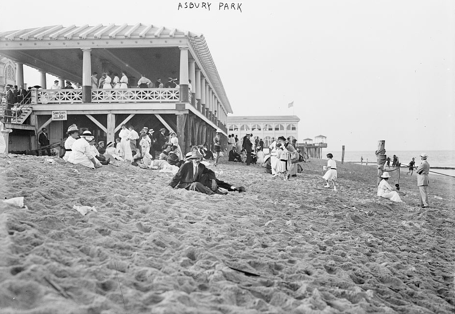
Asbury Park, New Jersey
Asbury Park () is a beachfront city located on the Jersey Shore in Monmouth County in the U.S. state of New Jersey. It is part of the New York metropolitan area. As of the 2020 U.S. census, the city's population was 15,188QuickFacts Asbury Park city, New Jersey . Accessed June 13, 2022. a decrease from 16,116 in 2010, [...More Info...] [...Related Items...] OR: [Wikipedia] [Google] [Baidu] |
City (New Jersey)
A city in the context of local government in New Jersey refers to one of five types and one of eleven forms of municipal government. Despite the widely held perception of a city as a large, urban area, cities in New Jersey have a confused history as a form of government and vary in size from large, densely populated areas to much smaller hamlets. History The 1897 and 1899 city charter laws applied only to areas with a population under 12,000, and provided for a directly elected mayor, who served a two-year term and had strong executive powers. Both featured a council elected from wards to staggered three-year terms, plus one councilman elected at-large for a term of two years. The mayor had a veto power, which could be overridden by a two-thirds vote of the council. The two acts differed in a number of ways, including the process for selection of a board of education (1897: elected; 1899: appointed by the council). By 1987, there were only eleven cities under these City Acts (i ... [...More Info...] [...Related Items...] OR: [Wikipedia] [Google] [Baidu] |
Francis Asbury
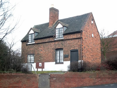
Francis Asbury (August 20 or 21, 1745 – March 31, 1816) was one of the first two bishops of the Methodist Episcopal Church in the United States. During his 45 years in the colonies and the newly independent United States, he devoted his life to ministry, traveling on horseback and by carriage thousands of miles to those living on the frontier. Asbury spread Methodism in British colonial America as part of the Second Great Awakening. He also founded several schools during his lifetime, although his own formal education was limited. His journal is valuable to scholars for its account of frontier society, with references to many towns and villages in Colonial America. Biography Childhood and adolescence Francis Asbury was born at Hamstead Bridge, Staffordshire, England on August 20 or 21, 1745, to Elizabeth and Joseph Asbury. The family moved to a cottage at Great Barr, Sandwell, the next year. His boyhood home still stands and is open as Bishop Asbury Cottage museum. Soon ... [...More Info...] [...Related Items...] OR: [Wikipedia] [Google] [Baidu] |
New York Metropolitan Area
The New York metropolitan area, also commonly referred to as the Tri-State area, is the largest metropolitan area in the world by urban landmass, at , and one of the most populous urban agglomerations in the world. The vast metropolitan area includes New York City, Long Island, the Mid and Lower Hudson Valley in the State of New York; the six largest cities in New Jersey: Newark, Jersey City, Paterson, Elizabeth, Lakewood, and Edison, and their vicinities; and six of the seven largest cities in Connecticut: Bridgeport, Stamford, New Haven, Waterbury, Norwalk, and Danbury, and the vicinities of these cities. The New York metropolitan area comprises the geographic and demographic hub of the larger Northeast megalopolis. The New York metropolitan area is the most populous in the United States, as defined by both the Metropolitan Statistical Area (20.1 million residents in 2020) and the Combined Statistical Area (23.6 million residents in 2020). The metropolita ... [...More Info...] [...Related Items...] OR: [Wikipedia] [Google] [Baidu] |
Jersey Shore
The Jersey Shore (known by locals simply as the Shore) is the coastal region of the U.S. state of New Jersey. Geographically, the term encompasses about of oceanfront bordering the Atlantic Ocean, from Perth Amboy in the north to Cape May Point in the south. The region includes Middlesex, Monmouth, Ocean, Atlantic, and Cape May counties, which are in the central and southern parts of the state. Located in the center of the Northeast Megalopolis, the northern half of the shore region is part of the New York metropolitan area, while the southern half of the shore region is part of the Delaware Valley, a.k.a. the Philadelphia metropolitan area. The Jersey Shore hosts the highest concentration of oceanside boardwalks in the United States. Famous for its many boardwalks with arcades, amusement parks, and water parks boasting hundreds of rides and attractions, the Jersey Shore is a popular vacation spot with residents of North Jersey, New York, Maryland, Delaware, Connecticu ... [...More Info...] [...Related Items...] OR: [Wikipedia] [Google] [Baidu] |
United States Geological Survey
The United States Geological Survey (USGS), formerly simply known as the Geological Survey, is a scientific agency of the United States government. The scientists of the USGS study the landscape of the United States, its natural resources, and the natural hazards that threaten it. The organization's work spans the disciplines of biology, geography, geology, and hydrology. The USGS is a fact-finding research organization with no regulatory responsibility. The agency was founded on March 3, 1879. The USGS is a bureau of the United States Department of the Interior; it is that department's sole scientific agency. The USGS employs approximately 8,670 people and is headquartered in Reston, Virginia. The USGS also has major offices near Lakewood, Colorado, at the Denver Federal Center, and Menlo Park, California. The current motto of the USGS, in use since August 1997, is "science for a changing world". The agency's previous slogan, adopted on the occasion of its hundredt ... [...More Info...] [...Related Items...] OR: [Wikipedia] [Google] [Baidu] |
Geographic Names Information System
The Geographic Names Information System (GNIS) is a database of name and locative information about more than two million physical and cultural features throughout the United States and its territories, Antarctica, and the associated states of the Marshall Islands, Federated States of Micronesia, and Palau. It is a type of gazetteer. It was developed by the United States Geological Survey (USGS) in cooperation with the United States Board on Geographic Names (BGN) to promote the standardization of feature names. Data were collected in two phases. Although a third phase was considered, which would have handled name changes where local usages differed from maps, it was never begun. The database is part of a system that includes topographic map names and bibliographic references. The names of books and historic maps that confirm the feature or place name are cited. Variant names, alternatives to official federal names for a feature, are also recorded. Each feature receives ... [...More Info...] [...Related Items...] OR: [Wikipedia] [Google] [Baidu] |
Federal Information Processing Standards
The Federal Information Processing Standards (FIPS) of the United States are a set of publicly announced standards that the National Institute of Standards and Technology (NIST) has developed for use in computer systems of non-military, American government agencies and contractors. FIPS standards establish requirements for ensuring computer security and interoperability, and are intended for cases in which suitable industry standards do not already exist. Many FIPS specifications are modified versions of standards the technical communities use, such as the American National Standards Institute (ANSI), the Institute of Electrical and Electronics Engineers (IEEE), and the International Organization for Standardization (ISO). Specific areas of FIPS standardization The U.S. government has developed various FIPS specifications to standardize a number of topics including: * Codes, e.g., FIPS county codes or codes to indicate weather conditions or emergency indications. In 1994, ... [...More Info...] [...Related Items...] OR: [Wikipedia] [Google] [Baidu] |
Area Codes 732 And 848
Area codes 732 and 848 are telephone area codes in the North American Numbering Plan (NANP) for parts of the U.S. state of New Jersey. History In the original configuration of the first nationwide telephone numbering plan of 1947, all of New Jersey was a single numbering plan area (NPA), assigned the first of all area codes, 201. By 1959, it was split to create a second numbering plan area, 609. This division generally followed the dividing line between North Jersey, proximate to New York City, and South Jersey, proximate to Philadelphia and the Jersey Shore. Despite the division into two numbering plan areas, all calls within the state of New Jersey were dialed without area codes until July 21, 1963. This configuration of two area code in New Jersey remained in place for c. 33 years, until 1991, when the 201 numbering plan area was further divided to create area code 908 in its southern half. This made available more central office prefixes in the northern part, comprising the ... [...More Info...] [...Related Items...] OR: [Wikipedia] [Google] [Baidu] |
New Jersey
New Jersey is a state in the Mid-Atlantic and Northeastern regions of the United States. It is bordered on the north and east by the state of New York; on the east, southeast, and south by the Atlantic Ocean; on the west by the Delaware River and Pennsylvania; and on the southwest by Delaware Bay and the state of Delaware. At , New Jersey is the fifth-smallest state in land area; but with close to 9.3 million residents, it ranks 11th in population and first in population density. The state capital is Trenton, and the most populous city is Newark. With the exception of Warren County, all of the state's 21 counties lie within the combined statistical areas of New York City or Philadelphia. New Jersey was first inhabited by Native Americans for at least 2,800 years, with the Lenape being the dominant group when Europeans arrived in the early 17th century. Dutch and Swedish colonists founded the first European settlements in the state. The British later seized contro ... [...More Info...] [...Related Items...] OR: [Wikipedia] [Google] [Baidu] |
United States Postal Service
The United States Postal Service (USPS), also known as the Post Office, U.S. Mail, or Postal Service, is an independent agency of the executive branch of the United States federal government responsible for providing postal service in the U.S., including its insular areas and associated states. It is one of the few government agencies explicitly authorized by the U.S. Constitution. The USPS, as of 2021, has 516,636 career employees and 136,531 non-career employees. The USPS traces its roots to 1775 during the Second Continental Congress, when Benjamin Franklin was appointed the first postmaster general; he also served a similar position for the colonies of the Kingdom of Great Britain. The Post Office Department was created in 1792 with the passage of the Postal Service Act. It was elevated to a cabinet-level department in 1872, and was transformed by the Postal Reorganization Act of 1970 into the U.S. Postal Service as an independent agency. Since the early 1980s, m ... [...More Info...] [...Related Items...] OR: [Wikipedia] [Google] [Baidu] |
Eastern Daylight Time
The Eastern Time Zone (ET) is a time zone encompassing part or all of 23 states in the eastern part of the United States, parts of eastern Canada, the state of Quintana Roo in Mexico, Panama, Colombia, mainland Ecuador, Peru, and a small portion of westernmost Brazil in South America, along with certain Caribbean and Atlantic islands. Places that use: * Eastern Standard Time (EST), when observing standard time (autumn/winter), are five hours behind Coordinated Universal Time ( UTC−05:00). * Eastern Daylight Time (EDT), when observing daylight saving time (spring/summer), are four hours behind Coordinated Universal Time ( UTC−04:00). On the second Sunday in March, at 2:00 a.m. EST, clocks are advanced to 3:00 a.m. EDT leaving a one-hour "gap". On the first Sunday in November, at 2:00 a.m. EDT, clocks are moved back to 1:00 a.m. EST, thus "duplicating" one hour. Southern parts of the zone (Panama and the Caribbean) do not observe daylight saving ... [...More Info...] [...Related Items...] OR: [Wikipedia] [Google] [Baidu] |


