|
Anjuman-i-Khurd
Anjuman-i-Khurd is a village in Afghanistan. It lies within the Anjuman Valley, about 18 miles from the mouth of the valley. Another village, Anjuman, lies close by. Around the turn of the 20th century, the village had 30 occupied residences, primarily Tajiks. The grazing in the area was good, and the inhabitants were a peaceful lot, and relatively poorly armed. Khurd and Kalan Khurd and Kalan (Hindi: ख़ुर्द और कलाँ, خرد اور کلاں Punjabi: ਖ਼ੁਰਦ ਅਤੇ ਕਲਾਂ, خرد اتے کلاں) are administrative designations used in India and Pakistan to indicate the smaller (Khu ... Persian language word which means small and Big respectively when two villages have same name then it is distinguished as Kalan means Big and Khurd means Small with Village Name. References Populated places in Kuran wa Munjan District {{Badakhshan-geo-stub ... [...More Info...] [...Related Items...] OR: [Wikipedia] [Google] [Baidu] |
Anjuman, Afghanistan
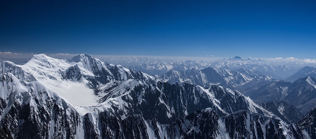
Anjuman ( fa, italic=yes, انجمن Anjoman), also written Anjoman, is the name of a village in Badakhshan Province, Afghanistan. It lies within the Anjuman Valley, about 18 miles from the mouth of the valley. Another village, Anjuman-i-Khurd, lies close by. Around the turn of the 21st century, the village had 90 occupied residences, primarily Tajiks. The grazing in the area was good, and the inhabitants were a peaceful lot, and relatively poorly armed. The village is located on the scenic Anjuman Pass, which connects Badakhshan to the Panjshir Valley in the south. Each year cattle are herded through Anjuman from the high plains of Badakhshan Province down to the south. Retrieved June 12, 2008 Climate Because of its high altitude, Anjuman enjoys an |
Anjuman Valley
The Anjuman Valley is a valley in Afghanistan. It connects to the Munjan valley some twelve miles above Sari Sang. The valley is drained by the Anjuman stream. The valley is passable by mules, although the descent into the valley is impossible for camels to pass. There are two villages in the valley: Anjuman and Anjuman-i-Khurd. They are both situated some eighteen miles from the mouth of the valley. Another village, Scarsap, is situated in a branch valley about 14 miles from the mouth of the Anjuman valley. The grazing in the valley is good. The valley as a whole was within the territory of the hakim of Munjan, and the pass formed the boundary between Badakhshan Province and Kabul Province Kabul (Persian: ), situated in the east of the country, is one of the thirty-four provinces of Afghanistan. The capital of the province is Kabul city, which is also Afghanistan's capital and largest city. The population of the Kabul Province is .... References Valleys of Afghanista ... [...More Info...] [...Related Items...] OR: [Wikipedia] [Google] [Baidu] |
Khurd And Kalan
Khurd and Kalan (Hindi: ख़ुर्द और कलाँ, خرد اور کلاں Punjabi: ਖ਼ੁਰਦ ਅਤੇ ਕਲਾਂ, خرد اتے کلاں) are administrative designations used in India and Pakistan to indicate the smaller (Khurd) and larger (Kalan) segments of a town, village or settlement. They are usually added after place names. For instance, Berote Khurd and Berote Kalan in Abbottabad District in the Khyber-Pakhtunkhwa province, Dangoh Khurd in Una District of Himachal Pradesh and the famous Dariba Kalan jewellery market in Delhi, there was also a smaller street near by, known as Dariba Khurd or Chhota Dariba, both mean small, now known as Kinari Bazaar. In some parts of the former Maratha territory, the word Budruk is used instead of "Kalan". It is a corruption of the Persian word for "greater".{{cite book , title=Maratha town and city planning with reference to the systems of village development during 17th and 18th centuries , chapter=Provincial div ... [...More Info...] [...Related Items...] OR: [Wikipedia] [Google] [Baidu] |
Provinces Of Afghanistan
Afghanistan is divided into 34 provinces (, '' wilåyat''). The provinces of Afghanistan are the primary administrative divisions. Each province encompasses a number of districts or usually over 1,000 villages. Provincial governors played a critical role in the reconstruction of the Afghan state following the creation of the new government under Hamid Karzai. According to international security scholar Dipali Mukhopadhyay, many of the provincial governors of the western-backed government were former warlords who were incorporated into the political system. Provinces of Afghanistan Regions of Afghanistan UN Regions Former provinces of Afghanistan During Afghanistan's history it had a number of provinces in it. It started out as just Kabul, Herat, Qandahar, and Balkh but the number of provinces increased and by 1880 the provinces consisted of Balkh, Herat, Qandahar, Ghazni, Jalalabad, and Kabul. * Southern Province – dissolved in 1964 to create Paktia Provinc ... [...More Info...] [...Related Items...] OR: [Wikipedia] [Google] [Baidu] |
Badakhshan Province
Badakhshan Province (Persian/ Uzbek: , ''Badaxšān'') is one of the 34 provinces of Afghanistan, located in the northeastern part of the country. It is bordered by Tajikistan's Gorno-Badakhshan in the north and the Pakistani regions of Lower and Upper Chitral and Gilgit-Baltistan in the southeast. It also has a 91-kilometer (57-mile) border with China in the east. It is part of a broader historical Badakhshan region, parts of which now also lie in Tajikistan and China. The province contains 22 districts, over 1,200 villages and approximately 1 055 00people. Fayzabad, Badakhshan, Fayzabad serves as the provincial capital. Resistance activity has been reported in the province since the 2021 Taliban takeover of Afghanistan. Etymology Badakhshan's name comes from the Middle Persian word "badaxš", which is an official title. The word "ān" is a suffix which demonstrates a place's name; therefore the word "badaxšān" means a place belonging to a person called "badaxš". Duri ... [...More Info...] [...Related Items...] OR: [Wikipedia] [Google] [Baidu] |
Districts Of Afghanistan
The districts of Afghanistan, known as ''wuleswali'' ( ps, ولسوالۍ, ''wuləswāləi''; fa, شهرستان, ''shahrestān'') are secondary-level administrative units, one level below provinces. The Afghan government issued its first district map in 1973.''Afghanistan; Districts and Codes by Province'', Edition 2.0, AID / Rep. DC&A Mapping Unit, October 1991, Peshawar, Pakista/ref> It recognized 325 districts, counting ''wuleswalis'' (districts), ''alaqadaries'' (sub-districts), and ''markaz-e-wulaiyat'' (provincial center districts). In the ensuing years, additional districts have been added through splits, and some eliminated through merges. In June 2005, the Afghan government issued a map of 398 districts. It was widely adopted by many information management systems, though usually with the addition of ''Sharak-e-Hayratan'' for 399 districts in total. It remains the ''de facto'' standard as of late 2018, despite a string of government announcements of the creation of ... [...More Info...] [...Related Items...] OR: [Wikipedia] [Google] [Baidu] |
Kuran Wa Munjan District
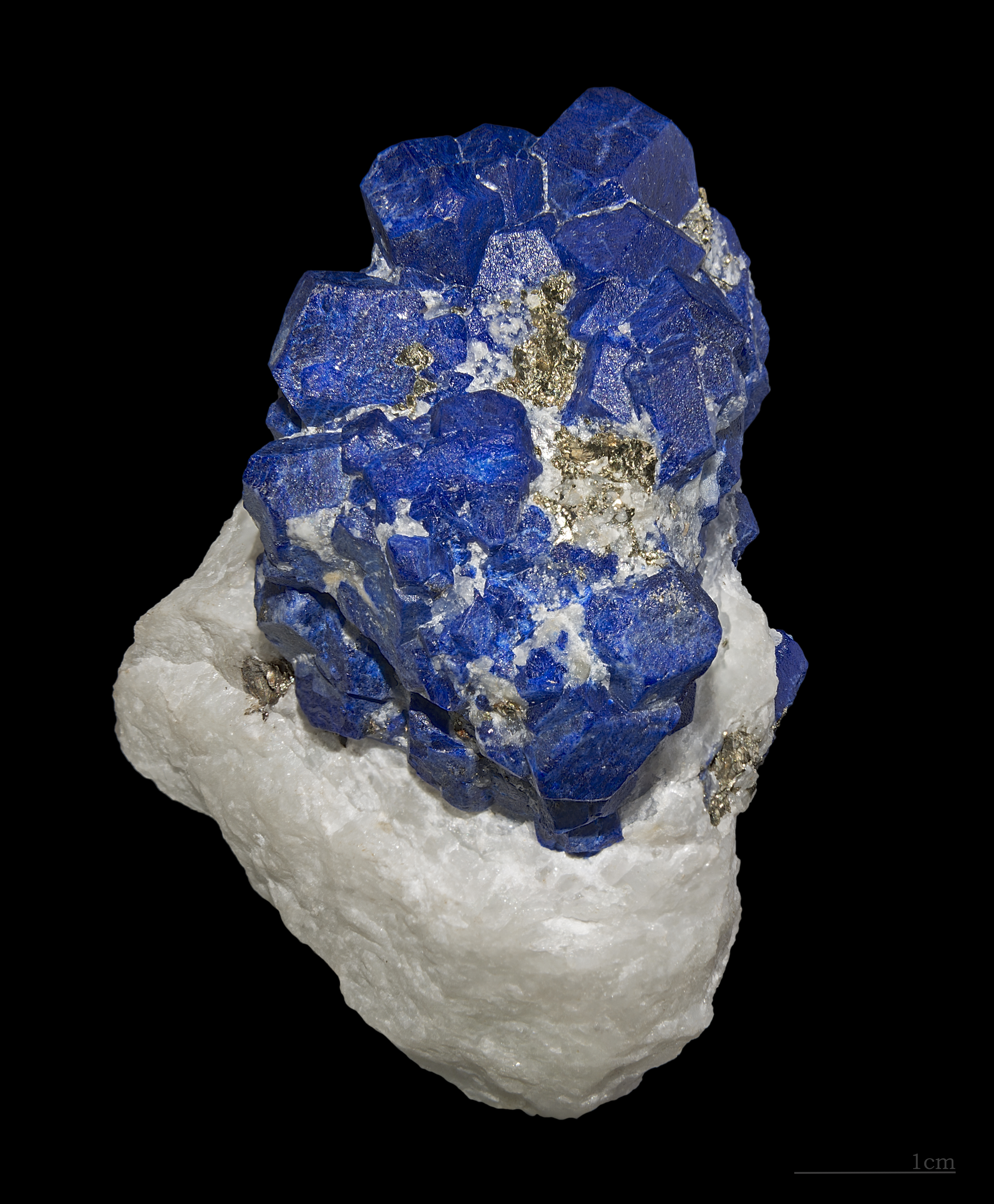
Kuran wa Munjan District is one of the 28 districts of Badakhshan Province in eastern Afghanistan. Located in the Hindu Kush mountains, the district is home to approximately 8,000 residents. The district administrative center is Kuran wa Munjan. The district is in the southwest corner of the province, and is bordered on its northeast side by the Jurm and Zebak Districts. Most of the district's boundaries are adjacent to other Afghan provinces, but a very small section on the eastern edge of the district lies on the international border between Afghanistan and Pakistan. The epicenter of the October 26 2015 Hindu Kush earthquake was 45 km north of here. Famous valleys include the Koksha Valley Koksha ( prs, , mnj, , ps, کوکشه) is a valley that is located in Badakhshan's Kuran Wa Munjan District in Afghanistan. Koksha is famous for its lapis lazuli found in the mines of Sar-e-Sang since the 3rd millennium BC. Koksha Valley i ..., which is famous for its mi ... [...More Info...] [...Related Items...] OR: [Wikipedia] [Google] [Baidu] |
Afghanistan
Afghanistan, officially the Islamic Emirate of Afghanistan,; prs, امارت اسلامی افغانستان is a landlocked country located at the crossroads of Central Asia and South Asia. Referred to as the Heart of Asia, it is bordered by Pakistan to the Durand Line, east and south, Iran to the Afghanistan–Iran border, west, Turkmenistan to the Afghanistan–Turkmenistan border, northwest, Uzbekistan to the Afghanistan–Uzbekistan border, north, Tajikistan to the Afghanistan–Tajikistan border, northeast, and China to the Afghanistan–China border, northeast and east. Occupying of land, the country is predominantly mountainous with plains Afghan Turkestan, in the north and Sistan Basin, the southwest, which are separated by the Hindu Kush mountain range. , Demographics of Afghanistan, its population is 40.2 million (officially estimated to be 32.9 million), composed mostly of ethnic Pashtuns, Tajiks, Hazaras, and Uzbeks. Kabul is the country's largest city and ser ... [...More Info...] [...Related Items...] OR: [Wikipedia] [Google] [Baidu] |
Tājik People
Tajiks ( fa, تاجيک، تاجک, ''Tājīk, Tājek''; tg, Тоҷик) are a Persian-speaking Iranian ethnic group native to Central Asia, living primarily in Afghanistan, Tajikistan, and Uzbekistan. Tajiks are the largest ethnicity in Tajikistan, and the second-largest in Afghanistan and Uzbekistan. They speak varieties of Persian, a Western Iranian language. In Tajikistan, since the 1939 Soviet census, its small Pamiri and Yaghnobi ethnic groups are included as Tajiks. In China, the term is used to refer to its Pamiri ethnic groups, the Tajiks of Xinjiang, who speak the Eastern Iranian Pamiri languages. In Afghanistan, the Pamiris are counted as a separate ethnic group. As a self-designation, the literary New Persian term ''Tajik'', which originally had some previous pejorative usage as a label for eastern Persians or Iranians, has become acceptable during the last several decades, particularly as a result of Soviet administration in Central Asia. Alternative names for t ... [...More Info...] [...Related Items...] OR: [Wikipedia] [Google] [Baidu] |
Graz, Austria
Graz (; sl, Gradec) is the capital city of the Austrian state of Styria and second-largest city in Austria after Vienna. As of 1 January 2021, it had a population of 331,562 (294,236 of whom had principal-residence status). In 2018, the population of the Graz larger urban zone (LUZ) stood at 652,654, based on principal-residence status. Graz is known as a college and university city, with four colleges and four universities. Combined, the city is home to more than 60,000 students. Its historic centre ('' Altstadt'') is one of the best-preserved city centres in Central Europe. In 1999, the city's historic centre was added to the UNESCO list of World Heritage Sites and in 2010 the designation was expanded to include Eggenberg Palace (german: Schloss Eggenberg) on the western edge of the city. Graz was designated the Cultural Capital of Europe in 2003 and became a City of Culinary Delights in 2008. Etymology The name of the city, Graz, formerly spelled Gratz, most likely stems ... [...More Info...] [...Related Items...] OR: [Wikipedia] [Google] [Baidu] |


