|
Ambergate
Ambergate is a village in Derbyshire, England, situated where the River Amber joins the River Derwent, and where the A610 road from Ripley and Nottingham joins the A6 that runs along the Derwent valley between Derby to the south and Matlock to the north. Sawmills and Ridgeway are neighbouring hamlets, and Alderwasley, Heage, Nether Heage and Crich are other significant neighbouring settlements. The village forms part of the Heage and Ambergate ward of Ripley Town Council with a population of 5,013 at the 2011 Census. Ambergate is within the Derwent Valley Mills UNESCO World Heritage site, and has historical connections with George Stephenson; Ambergate is notable for its railway heritage and telephone exchange. Ambergate has an active community life, particularly centred on the school, pubs, churches, sports clubs; and annual village carnival which is relatively large and consistent locally, with popular associated events in carnival week and throughout the year. The carniv ... [...More Info...] [...Related Items...] OR: [Wikipedia] [Google] [Baidu] |
Ambergate Railway Station
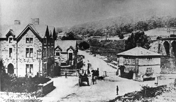
Ambergate railway station is a railway station owned by Network Rail and managed by East Midlands Railway. It serves the village of Ambergate in Derbyshire, England. The station is located on the Derwent Valley Line from Derby to Matlock, which diverges from the Midland Main Line just south of the station at Ambergate Junction. History It has a complicated history. The original station was built for the North Midland Railway in 1840, between Derby and Leeds. It was an ornate building, by Francis Thompson, which would have graced a Lord of the Manor. From Belper the line ran along the Derwent Valley, along a stretch called Broadholme, with four bridges across the river, through Longlands Tunnel, across the River Derwent and Derby road with a magnificent five-arch viaduct. It then entered Hag Wood Tunnel as turned towards the Amber Valley. The station building was just north of this tunnel. Shortly afterwards a proposal was made for an Ambergate, Nottingham, Boston and East ... [...More Info...] [...Related Items...] OR: [Wikipedia] [Google] [Baidu] |
Cromford Canal
The Cromford Canal ran from Cromford to the Erewash Canal in Derbyshire, England with a branch to Pinxton. Built by William Jessop with the assistance of Benjamin Outram, its alignment included four tunnels and 14 locks. From Cromford it ran south following the contour line along the east side of the valley of the Derwent to Ambergate, where it turned eastwards along the Amber valley. It turned sharply to cross the valley, crossing the river and the Ambergate to Nottingham road, by means of an aqueduct at Bullbridge, before turning towards Ripley. From there the Butterley Tunnel took it through to the Erewash Valley. From the tunnel it continued to Ironville, the junction for the branch to Pinxton, and then descended through fourteen locks to meet the Erewash Canal at Langley Mill. The Pinxton Branch became important as a route for Nottinghamshire coal, via the Erewash, to the River Trent and Leicester and was a terminus of the Mansfield and Pinxton Railway. A long sect ... [...More Info...] [...Related Items...] OR: [Wikipedia] [Google] [Baidu] |
River Derwent, Derbyshire
The Derwent is a river in Derbyshire, England. It is long and is a tributary of the River Trent, which it joins south of Derby. Throughout its course, the river mostly flows through the Peak District and its foothills. Much of the river's route, with the exception of the city of Derby, is rural. However, the river has also seen many human uses, and between Matlock and Derby was one of the cradles of the Industrial Revolution. It is the site of the Derwent Valley Mills, the first industrial-scale cotton mills. Today it provides a water supply to several surrounding cities, and its steep-sided valley is an important communications corridor through the uplands of the Peak District. The scenery of the Derwent valley attracts many tourists. The upper reaches pass through the Peak District National Park, whilst the middle reaches around the old spa town of Matlock Bath offer souvenir shops and amusement arcades, together with attractions such as the Heights of Abraham and its ... [...More Info...] [...Related Items...] OR: [Wikipedia] [Google] [Baidu] |
Heage
Heage is a village in Derbyshire, England, situated midway between Belper and Ripley in the Amber Valley district. The village is in the Heage and Ambergate ward, which in the 2011 census had a population of 5,013. Heage is known for its six-sailed windmill; building work started in 1791 and it was first recorded as working in 1797. Each of the six sails weighs nearly one ton, and the tower is built from local sandstone. The name Heage is derived from the Old English ''hēah'' and ''ecg'', and means 'high edge' or 'high ridge'. In 1817, the Lysons recorded that "Heage, alias High-edge, lies about five miles from Duffield, upon the road from Chesterfield to Derby. The manor, which had been parcel of the Earldom and Duchy of Lancaster, was granted, with Duffield, to Ditchfield and others. In 1629 it was conveyed to the Stanhope family. Sir William Stanhope bequeathed it, in 1703, to Godfrey Wentworth, Esq. his nephew, whose son of the same name sold it, in 1767, to Francis Hurt ... [...More Info...] [...Related Items...] OR: [Wikipedia] [Google] [Baidu] |
North Midland Railway
The North Midland Railway was a British railway company, which opened its line from Derby to Rotherham (Masbrough) and Leeds in 1840. At Derby, it connected with the Birmingham and Derby Junction Railway and the Midland Counties Railway at what became known as the Tri-Junct Station. In 1844, the three companies merged to form the Midland Railway. Origin The East Midlands had for some years been at the centre of plans to link the major cities throughout the country. In Yorkshire, George Hudson was the Chairman of the York and North Midland Railway, a proposed line from York towards the industrial markets of Manchester and Liverpool. The new line would connect it, and the Manchester and Leeds Railway as part of a trunk route from the South and London to Yorkshire and the North East of England. Meanwhile, financiers in Birmingham, were looking to expand their system northwards. George Carr Glyn was the first Chairman of the new company, with George Stephenson appointed as engi ... [...More Info...] [...Related Items...] OR: [Wikipedia] [Google] [Baidu] |
Derwent Valley Heritage Way
The Derwent Valley Heritage Way (DVHW) is a waymarked footpath along the Derwent Valley through the Peak District (as far as Rowsley). The walk starts from Ladybower Reservoir in the Peak District National Park via Chatsworth, the scenery around the Derbyshire Dales, and through the Derwent Valley Mills World Heritage Site. It follows the Riverside Path through Derby and continues onwards to the historic inland port of Shardlow. Journey's end is at Derwent Mouth where the River Derwent flows into the River Trent. The walk was established by The Derwent Valley Trust, which was set up in 1996. The route was planned and developed by Derbyshire Countryside Ranger, Rick Jillings. The Duke of Devonshire opened the walk at Chatsworth House in 2003. Route Places on the route and highlights on or near the trail: Ladybower Reservoir to Baslow *Ladybower Reservoir: Heatherdene car park * Thornhill * Mytham Bridge * Shatton Bridge over the River Noe * Leadmill Bridge *Hathersage ... [...More Info...] [...Related Items...] OR: [Wikipedia] [Google] [Baidu] |
Amber Valley (UK Parliament Constituency)
Amber Valley is a constituency in Derbyshire, represented in the House of Commons of the UK Parliament since 2010 by Nigel Mills, a Conservative. History The constituency was created in 1983, and was held by Phillip Oppenheim of the Conservative Party from its creation until Judy Mallaber of the Labour Party won the seat in 1997. She was narrowly defeated in 2010 by Nigel Mills, a Conservative, who increased his majority in 2015 and 2017. Boundaries 1983–1997: The District of Amber Valley wards of Aldercar, Alfreton East, Alfreton West, Codnor, Denby and Horsley Woodhouse, Heage and Ambergate, Heanor and Loscoe, Heanor East, Heanor West, Holbrook and Horsley, Kilburn, Riddings, Ripley, Ripley and Marehay, Shipley Park, Somercotes, Swanwick, and Wingfield, and the Borough of Erewash wards of Breadsall and Morley, Little Eaton, and Stanley. 1997–2010: The Borough of Amber Valley wards of Aldercar, Alfreton East, Alfreton West, Codnor, Crich, Denby and Horsley Woodhouse, H ... [...More Info...] [...Related Items...] OR: [Wikipedia] [Google] [Baidu] |
Ripley, Derbyshire
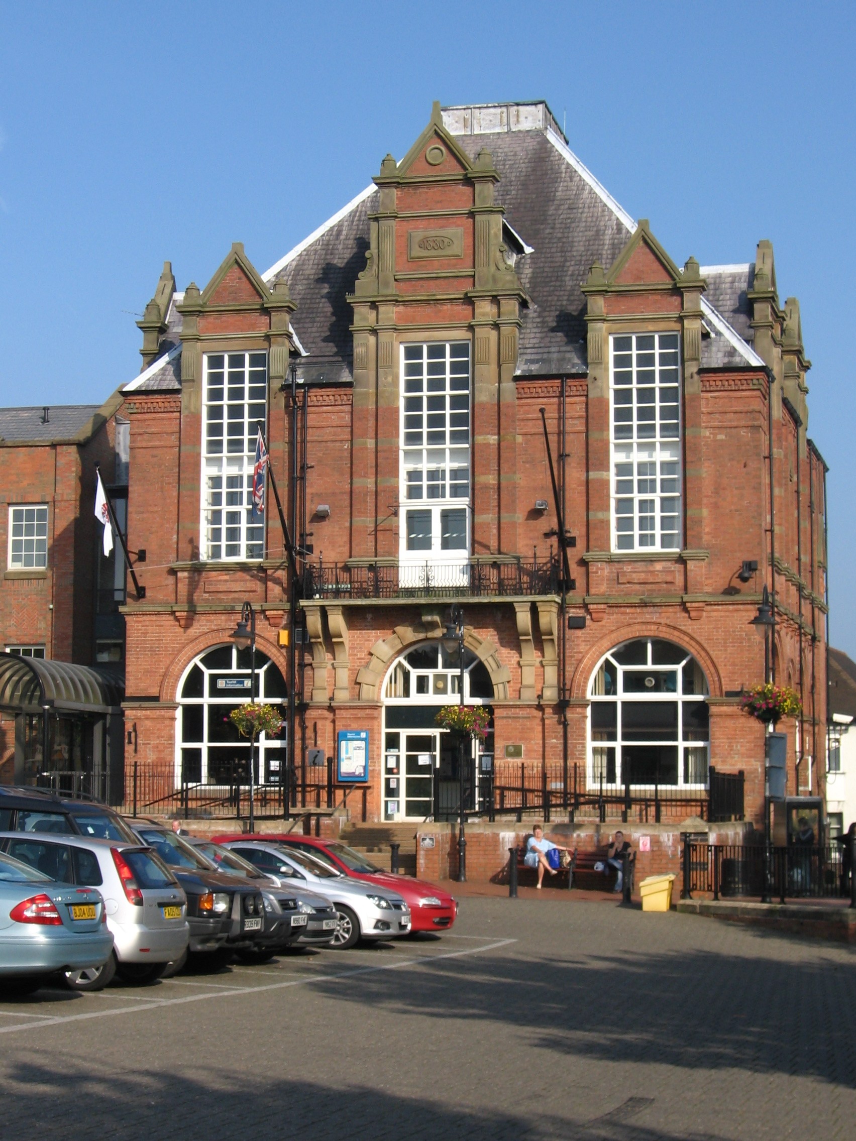
Ripley is a town in the Amber Valley borough of Derbyshire, England. History Little information remains as to when Ripley was founded, but it appears in the 1086 Domesday Book, when it was held by a man called Levenot. In 1251 Henry III granted a charter for "one market one day a week, on Wednesday, at hemanor of Ryppeleg: and one fair each year lasting three days, on the Vigil Day and Morrow of St Helen". Ripley Fair antedates Nottingham Goose Fair. The market day was later altered to Saturdays, with an extra market on Fridays. Medieval Ripley was just a few stone cottages and farms around a village green, with a few dwellings further afield. Corn was ground at a mill owned by the Abbot of Darley. In 1291, Ripley had "two water-mills with fish ponds". The Ripley area has been industrialised since the late 18th century. One of the earliest firms to take advantage of local mineral resources was the Butterley Company. It was formed in 1790 by Benjamin Outram and Francis Beresf ... [...More Info...] [...Related Items...] OR: [Wikipedia] [Google] [Baidu] |
High Peak Junction
High Peak Junction, near Cromford, Derbyshire, England, is the name now used to describe the site where the former Cromford and High Peak Railway (C&HPR), whose workshops were located here, meets the Cromford Canal. It lies within Derwent Valley Mills World Heritage Site, designated in 2001, and today marks the southern end of the High Peak Trail, a trail for walkers, cyclists and horse riders. The Derwent Valley Heritage Way also passes this point, and popular walks lead from here along the towpath in both directions. History as part of the High Peak Railway As first built, the C&HPR – built to standard gauge proportions after initial plans for it to be constructed as a canal route – originally terminated at this location, named in the original Act as "beside the Cromford Canal, at or near to Cromford", where freight was transferred between canal barges and railway wagons. The large wharf-side transit shed, with awning over the canal, still stands on the west b ... [...More Info...] [...Related Items...] OR: [Wikipedia] [Google] [Baidu] |
Cromford Wharf
Cromford Wharf is at Cromford in Derbyshire, England. It is located at the northern terminus of the Cromford Canal, which opened in 1794 and ran 14.5 miles (23 km) from here to the Erewash Canal in Derbyshire. The wharf stands on Mill Lane opposite Richard Arkwright's Cromford Mill, and surviving buildings include two warehouses - one of which is now a cafe - an office or counting house, and two cottages. The wharf was once totally enclosed by a stone perimeter wall, which included other buildings, but these buildings have not survived. The yard serves today as a car park. The Canal Warehouse was built in 1794, soon after the canal opened, and is known as the Gothic Warehouse, after the design of the side elevation. (These Gothic castellations, just visible in the top picture, were probably included at the insistence of Sir Richard Arkwright, who would be able to see it from Willersley Castle, his intended home.) This warehouse was owned by Nathaniel Wheatcroft, ... [...More Info...] [...Related Items...] OR: [Wikipedia] [Google] [Baidu] |
Derbyshire
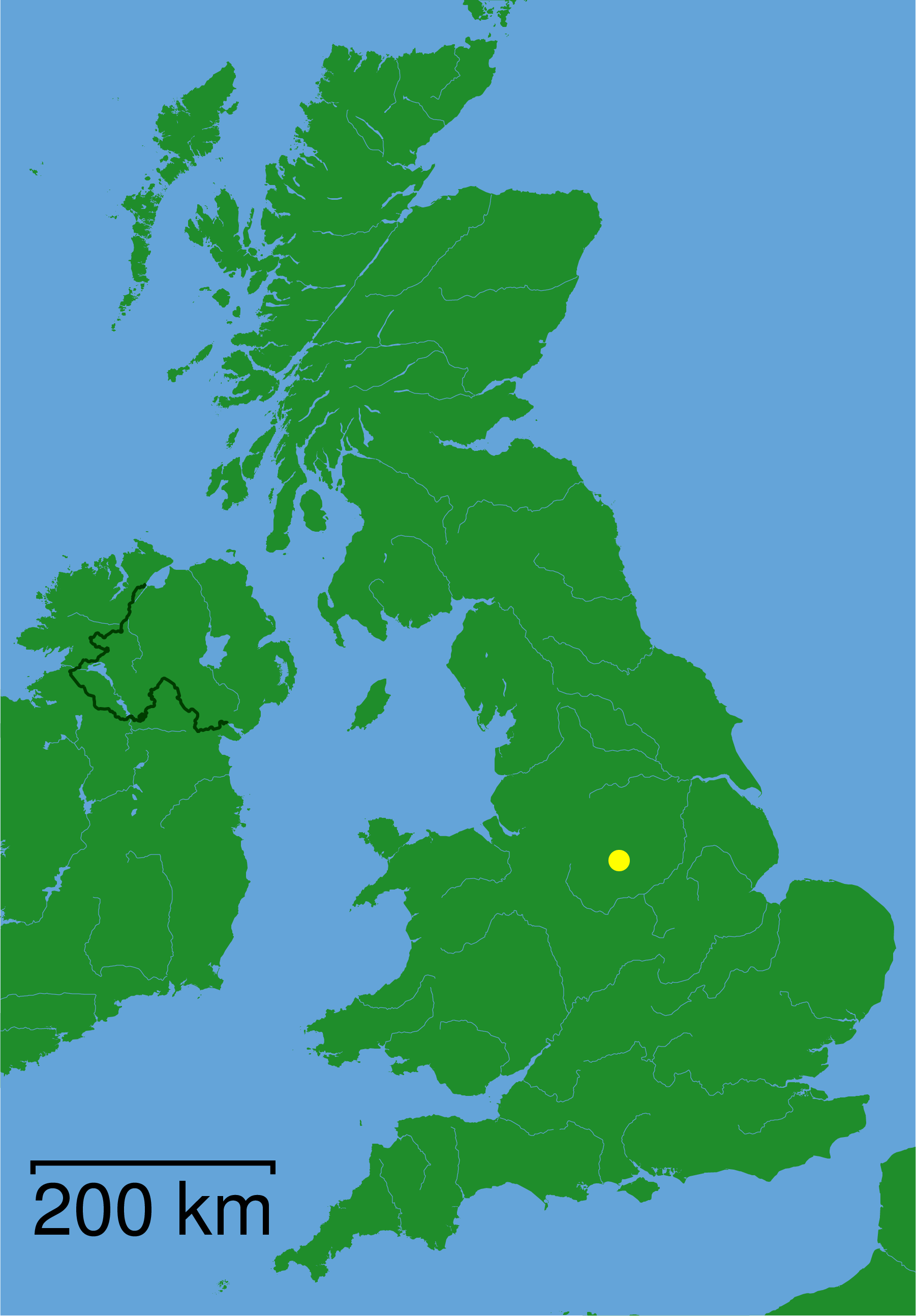
Derbyshire ( ) is a ceremonial county in the East Midlands, England. It includes much of the Peak District National Park, the southern end of the Pennine range of hills and part of the National Forest. It borders Greater Manchester to the north-west, West Yorkshire to the north, South Yorkshire to the north-east, Nottinghamshire to the east, Leicestershire to the south-east, Staffordshire to the west and south-west and Cheshire to the west. Kinder Scout, at , is the highest point and Trent Meadows, where the River Trent leaves Derbyshire, the lowest at . The north–south River Derwent is the longest river at . In 2003, the Ordnance Survey named Church Flatts Farm at Coton in the Elms, near Swadlincote, as Britain's furthest point from the sea. Derby is a unitary authority area, but remains part of the ceremonial county. The county was a lot larger than its present coverage, it once extended to the boundaries of the City of Sheffield district in South Yorkshire where it cov ... [...More Info...] [...Related Items...] OR: [Wikipedia] [Google] [Baidu] |
Amber Valley
Amber Valley is a local government district and borough in the east of Derbyshire, England, taking its name from the River Amber. It covers a semi-rural zone with four main towns whose economy was based on coal mining and remains to some extent influenced by engineering, distribution and manufacturing, holding for instance the headquarters and production site of Thorntons confectionery. The seat in the House of Commons of Amber Valley is of smaller scope. The population at the 2011 Census was 122,309. The village of Crich and other parts of the district were the setting for ITV drama series ''Peak Practice''. Towns of Amber Valley *Alfreton *Belper *Heanor * Ripley Main villages of Amber Valley *Ambergate *Codnor *Crich *Denby * Duffield *Heage *Holbrook * Horsley *Horsley Woodhouse *Kedleston * Kilburn *Langley Mill * Lea & Holloway * Mackworth *Milford *Quarndon *Riddings * Smalley *Somercotes * Swanwick * Whatstandwell The district was formed on 1 April 1974 by the mer ... [...More Info...] [...Related Items...] OR: [Wikipedia] [Google] [Baidu] |


