|
Aiken County, SC
Aiken County is a county in the U.S. state of South Carolina. As of the 2020 Census, its population was 168,808. Its county seat and largest city is Aiken. Aiken County is a part of the Augusta- Richmond County, GA-SC Metropolitan Statistical Area. It is mostly in the Sandhills region, with the northern parts reaching in the Piedmont and southern parts reaching into the Coastal Plain. History In the colonial era the area that is now Aiken County was part of Edgefield and Orangeburgh Districts. The majority of the population were immigrant farmers. Most of whom were from the rural parts of Lincolnshire, England; however, very few were from the town of Lincoln. Virtually all of the farmers from Lincolnshire came to the colony as indentured servants in the 1730s and 1740s. However, by the 1750s, almost all of the Lincolnshire settlers in what is now Aiken County were living on their own private land, almost exclusively engaging in subsistence agriculture on smallholding farms. ... [...More Info...] [...Related Items...] OR: [Wikipedia] [Google] [Baidu] |
William Aiken
William Aiken (1779 – May 5, 1831), or William Aiken, Sr., was the founder and president of the pioneering South Carolina Canal and Rail Road Company. and Born in County Antrim, Ireland, he immigrated to Charleston, South Carolina at age 10. He was raised Presbyterian. He married Henrietta Watt in 1801. They raised two children, living in 456 King Street from 1807 until his death in 1831. The railroad was organized in a meeting at this house in 1827, and Aiken was chosen as President. Construction of the railroad began in January 1830. He was killed in a Charleston carriage accident caused by the train's noise frightening his horse. The railroad was completed in 1833, and was the longest railroad, at 136 miles, under one management, in the world. A historic district comprising one of his homes and selected structures of the railway, William Aiken House and Associated Railroad Structures, was listed on the U.S. National Register of Historic Places and was furthe ... [...More Info...] [...Related Items...] OR: [Wikipedia] [Google] [Baidu] |
Nottinghamshire
Nottinghamshire (; abbreviated Notts.) is a landlocked county in the East Midlands region of England, bordering South Yorkshire to the north-west, Lincolnshire to the east, Leicestershire to the south, and Derbyshire to the west. The traditional county town is Nottingham, though the county council is based at County Hall in West Bridgford in the borough of Rushcliffe, at a site facing Nottingham over the River Trent. The districts of Nottinghamshire are Ashfield, Bassetlaw, Broxtowe, Gedling, Mansfield, Newark and Sherwood, and Rushcliffe. The City of Nottingham was administratively part of Nottinghamshire between 1974 and 1998, but is now a unitary authority, remaining part of Nottinghamshire for ceremonial purposes. The county saw a minor change in its coverage as Finningley was moved from the county into South Yorkshire and is part of the City of Doncaster. This is also where the now-closed Doncaster Sheffield Airport is located (formerly Robin Hood Airport). In 20 ... [...More Info...] [...Related Items...] OR: [Wikipedia] [Google] [Baidu] |
County Antrim
County Antrim (named after the town of Antrim, ) is one of six counties of Northern Ireland and one of the thirty-two counties of Ireland. Adjoined to the north-east shore of Lough Neagh, the county covers an area of and has a population of about 618,000. County Antrim has a population density of 203 people per square kilometre or 526 people per square mile. It is also one of the thirty-two traditional counties of Ireland, as well as part of the historic province of Ulster. The Glens of Antrim offer isolated rugged landscapes, the Giant's Causeway is a unique landscape and a UNESCO World Heritage Site, Bushmills produces whiskey, and Portrush is a popular seaside resort and night-life area. The majority of Belfast, the capital city of Northern Ireland, is in County Antrim, with the remainder being in County Down. According to the 2001 census, it is currently one of only two counties of the Island of Ireland in which a majority of the population are from a Protestant back ... [...More Info...] [...Related Items...] OR: [Wikipedia] [Google] [Baidu] |
Presbyterian
Presbyterianism is a part of the Reformed tradition within Protestantism that broke from the Roman Catholic Church in Scotland by John Knox, who was a priest at St. Giles Cathedral (Church of Scotland). Presbyterian churches derive their name from the presbyterian polity, presbyterian form of ecclesiastical polity, church government by representative assemblies of Presbyterian elder, elders. Many Reformed churches are organised this way, but the word ''Presbyterian'', when capitalized, is often applied to churches that trace their roots to the Church of Scotland or to English Dissenters, English Dissenter groups that formed during the English Civil War. Presbyterian theology typically emphasizes the sovereignty of God, the Sola scriptura, authority of the Scriptures, and the necessity of Grace in Christianity, grace through Faith in Christianity, faith in Christ. Presbyterian church government was ensured in Scotland by the Acts of Union 1707, Acts of Union in 1707, which cre ... [...More Info...] [...Related Items...] OR: [Wikipedia] [Google] [Baidu] |
Matlock, England
Matlock is the county town of Derbyshire, England. It is situated in the south-eastern part of the Peak District, with the National Park directly to the west. The town is twinned with the French town of Eaubonne. The former spa resort of Matlock Bath lies immediately south of the town on the A6. The civil parish of Matlock Town had a population in the 2011 UK census of 9,543. Matlock is nine miles (14 km) south-west of Chesterfield and in easy reach of the cities of Derby (19 miles), Sheffield (20 miles) and Nottingham (29 miles); the Greater Manchester conurbation is 30 miles away. Matlock is within the Derbyshire Dales district, which also includes the towns of Bakewell and Ashbourne, as well as Wirksworth. The headquarters of Derbyshire County Council are in the town. History The name Matlock derives from the Old English ''mæthel'' (or ''mæðel''), meaning assembly or speech, and ''āc'', meaning oak tree; thus Matlock means 'moot-oak', an oak tree where meetings a ... [...More Info...] [...Related Items...] OR: [Wikipedia] [Google] [Baidu] |
Bakewell
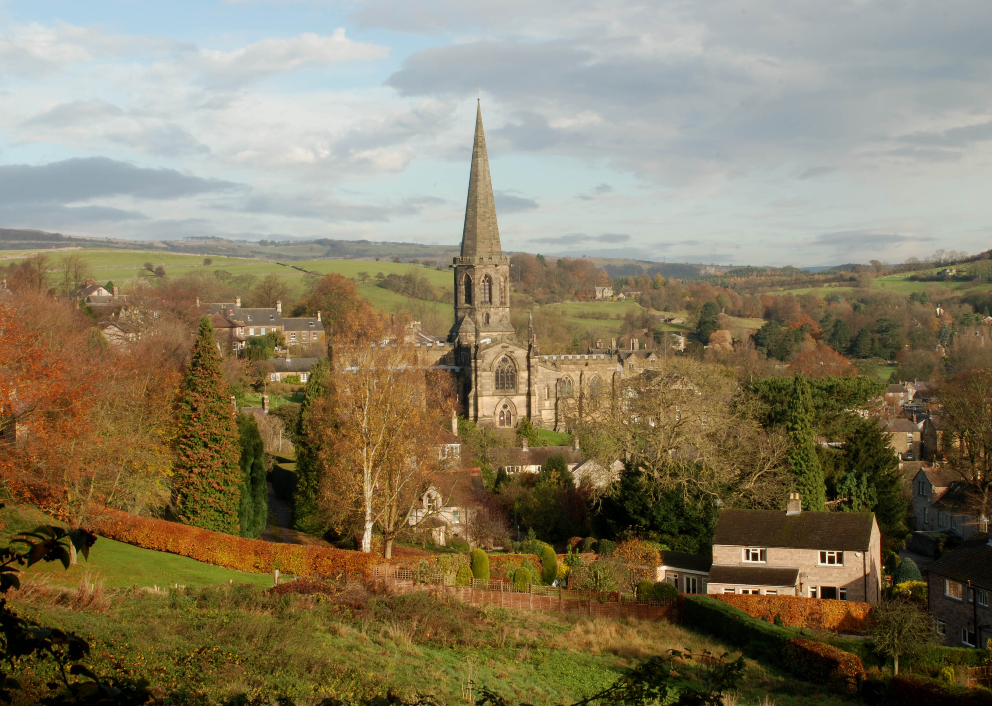
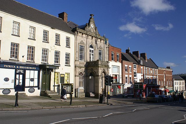
Bakewell is a market town and civil parish in the Derbyshire Dales district of Derbyshire, England, known also for its local Bakewell pudding. It lies on the River Wye, about 13 miles (21 km) south-west of Sheffield. In the 2011 census, the population of the civil parish appeared as 3,949. It was estimated at 3,695 in 2019. The town is close to the tourist attractions of Chatsworth House and Haddon Hall. History Although there is evidence of earlier settlement in the area, Bakewell itself was probably founded in Anglo-Saxon times in the Anglian kingdom of Mercia. The name Bakewell means a spring or stream of a woman named Badeca or Beadeca, so deriving from a personal name with the Old English suffix ''wella''. In 949 it was called Badecanwelle and in the 1086 Domesday Book ''Badequelle''. The Domesday book listing stated that King Edward held land here; the settlement had a church and a mill. These are the outlying estates or berewicks of the manor: Haddon addon or Ov ... [...More Info...] [...Related Items...] OR: [Wikipedia] [Google] [Baidu] |
Ashbourne, Derbyshire
Ashbourne is a market town in the Derbyshire Dales district in Derbyshire, England. Its population was measured at 8,377 in the 2011 census and was estimated to have grown to 9,163 by 2019. It has many historical buildings and independent shops. The town offers a historic annual Shrovetide football match. Its position near the southern edge of the Peak District makes it the closest town to Dovedale, to which Ashbourne is sometimes referred to as the gateway. The town is west of Derby, south-east of Buxton, east of Stoke-on-Trent, south-south-east of Manchester, south-west of Sheffield and north of Lichfield. Nearby towns include Matlock, Uttoxeter, Leek, Cheadle and Bakewell. History The town's name derives from the Old English ''æsc-burna'' meaning "stream with ash trees". Ashbourne was granted a market charter in 1257. In medieval times it was a frequent rest stop for pilgrims walking "St Non's Way" to the shrine of Saint Fremund at Dunstable in Bedfordshire. T ... [...More Info...] [...Related Items...] OR: [Wikipedia] [Google] [Baidu] |
Derbyshire
Derbyshire ( ) is a ceremonial county in the East Midlands, England. It includes much of the Peak District National Park, the southern end of the Pennine range of hills and part of the National Forest. It borders Greater Manchester to the north-west, West Yorkshire to the north, South Yorkshire to the north-east, Nottinghamshire to the east, Leicestershire to the south-east, Staffordshire to the west and south-west and Cheshire to the west. Kinder Scout, at , is the highest point and Trent Meadows, where the River Trent leaves Derbyshire, the lowest at . The north–south River Derwent is the longest river at . In 2003, the Ordnance Survey named Church Flatts Farm at Coton in the Elms, near Swadlincote, as Britain's furthest point from the sea. Derby is a unitary authority area, but remains part of the ceremonial county. The county was a lot larger than its present coverage, it once extended to the boundaries of the City of Sheffield district in South Yorkshire where it cov ... [...More Info...] [...Related Items...] OR: [Wikipedia] [Google] [Baidu] |
Derbyshire Dales
Derbyshire Dales ( ) is a local government district in Derbyshire, England. The population at the 2011 Census was 71,116. Much of it is in the Peak District, although most of its population lies along the River Derwent. The borough borders the districts of High Peak, Amber Valley, North East Derbyshire and South Derbyshire in Derbyshire, Staffordshire Moorlands and East Staffordshire in Staffordshire and Sheffield in South Yorkshire. The district also lies within the Sheffield City Region, and the district council is a non-constituent partner member of the Sheffield City Region Combined Authority. A significant amount of the working population is employed in Sheffield and Chesterfield. The district offices are at Matlock Town Hall in Matlock. It was formed on 1 April 1974, originally under the name of West Derbyshire. The district adopted its current name on 1 January 1987. The district was a merger of Ashbourne, Bakewell, Matlock and Wirksworth urban districts alon ... [...More Info...] [...Related Items...] OR: [Wikipedia] [Google] [Baidu] |
Farndon, Nottinghamshire
Farndon is a small village and civil parish on the Fosse road, 2.5 miles (4 km) south-west of Newark-on-Trent, on the banks of the River Trent. The population of the civil parish as of the 2011 census is 2,405. The A46 previously ran through the village until the development of a new dual carriageway bypass. History The name Farndon means "Fern Hill". It is thought to be the site of the Roman fort Ad Pontem or ''"the place by the bridges."'' The village played a small part in the English Civil War. During the Siege of Newark in 1646, Farndon was occupied by a Parliamentarian regiment led by Sydnam Poyntz. In the 19th century, farming, malting, willow growing and basket making were the main source of employment for men and women. There was also a village blacksmith, butcher, baker, a general store, and a cobbler. Francis White's ''Directory of Nottinghamshire'' described Farndon in 1853 as follows: ''"Farndon is a well built village and parish on the Trent, 2 miles (3& ... [...More Info...] [...Related Items...] OR: [Wikipedia] [Google] [Baidu] |
Kelham
Kelham is a small village and civil parish in Nottinghamshire about northwest of Newark on a bend in the A617 road near its crossing of the River Trent. The population of the civil parish taken at the 2011 census was 207. Historical Kelham is "a small but pleasant village and parish, upon the Worksop Road, and on the west bank of the Trent, north-west of Newark. Its parish contains 208 inhabitants and of land, of which are on the island formed by the two rivers betwixt it and Newark. It has long been the seat and property of the Suttons, who once held the title of Lord Lexington. It is now the property of John Henry Manners Sutton Esq., who resides at the Hall, which is a plain but elegant building, with a centre and wings of brick, with stone corners and window frames, standing in a handsome lawn, near the Trent. "A curious wooden bridge which crosses the river close to the lawn has been taken down, and a light but substantial iron bridge erected in its place at a cost o ... [...More Info...] [...Related Items...] OR: [Wikipedia] [Google] [Baidu] |
Balderton
Balderton is a village and civil parish in Nottinghamshire, England, which had a population of 9,757 at the 2011 Census. Balderton is one of the largest villages in Nottinghamshire, although it may be more properly considered a suburb of Newark-on-Trent, which is almost adjacent to the north-west. Balderton is split into Old Balderton, the southern part of the village, and New Balderton. Geography The busy A1 trunk road once ran through the village, but now skirts Balderton to the west and south. The old A1 near the site of the hospital/hall was called the Ramper. The East Coast Main Line railway between London and Edinburgh crosses the parish north of the village; the nearest station is Newark North Gate. Balderton was also once on the Great North Road. The soil is mostly alluvial clays. Large deposits of gravel and sand were excavated in New Balderton, and the resulting pits were turned into a lakeside park. Gypsum is still mined nearby. The surrounding area is mostly agr ... [...More Info...] [...Related Items...] OR: [Wikipedia] [Google] [Baidu] |


