|
Agbrigg And Morley
Agbrigg and Morley was a wapentake of the West Riding of Yorkshire, England. The main purpose of the wapentake was the administration of justice by a local court. At the time of the Domesday survey in 1086, Agbrigg and Morley were separate wapentakes. For example, Methley was in Agbrigg while Rothwell was in Morley. The wapentakes were probably combined by the 13th century when similar administrative reforms occurred elsewhere in England. It was kept in two divisions, which in the mid-nineteenth century again became wapentakes in their own right. The Agbrigg Division included the parishes of Almondbury, Emley, Kirkburton, Kirkheaton, Normanton, Rothwell, Sandal Magna, Thornhill, Wakefield and Warmfield with Heath and parts of Batley, Dewsbury, Featherstone, Huddersfield and Rochdale. The Morley Division included Birstall, Bradford, Calverley and parts of Batley, Huddersfield and Dewsbury Dewsbury is a minster and market town in the Metropolitan Borough of Kirkl ... [...More Info...] [...Related Items...] OR: [Wikipedia] [Google] [Baidu] |
Wapentakes Of The West Riding Of Yorkshire
A hundred is an administrative division that is geographically part of a larger region. It was formerly used in England, Wales, some parts of the United States, Denmark, Southern Schleswig, Sweden, Finland, Norway, the Bishopric of Ösel–Wiek, Curonia, the Ukrainian state of the Cossack Hetmanate and in Cumberland County in the British Colony of New South Wales. It is still used in other places, including in Australia (in South Australia and the Northern Territory). Other terms for the hundred in English and other languages include ''wapentake'', ''herred'' (Danish and Bokmål Norwegian), ''herad'' ( Nynorsk Norwegian), ''hérað'' (Icelandic), ''härad'' or ''hundare'' (Swedish), ''Harde'' (German), ''hiird'' ( North Frisian), ''satakunta'' or ''kihlakunta'' (Finnish), ''kihelkond'' (Estonian), ''kiligunda'' (Livonian), '' cantref'' (Welsh) and ''sotnia'' (Slavic). In Ireland, a similar subdivision of counties is referred to as a barony, and a hundred is a subdivision of a ... [...More Info...] [...Related Items...] OR: [Wikipedia] [Google] [Baidu] |
Wakefield
Wakefield is a cathedral city in West Yorkshire, England located on the River Calder. The city had a population of 99,251 in the 2011 census.https://www.nomisweb.co.uk/census/2011/ks101ew Census 2011 table KS101EW Usual resident population, West Yorkshire – Wakefield BUASD, code E35000474 The city is the administrative centre of the wider City of Wakefield metropolitan district, which had a population of , the most populous district in England. It is part of the West Yorkshire Built-up Area and the Yorkshire and The Humber region. In 1888, it was one of the last group of towns to gain city status due to having a cathedral. The city has a town hall and county hall, as the former administrative centre of the city's county borough and metropolitan borough as well as county town to both the West Riding of Yorkshire and West Yorkshire, respectively. The Battle of Wakefield took place in the Wars of the Roses, and the city was a Royalist stronghold in the Civil W ... [...More Info...] [...Related Items...] OR: [Wikipedia] [Google] [Baidu] |
Bradford
Bradford is a city and the administrative centre of the City of Bradford district in West Yorkshire, England. The city is in the Pennines' eastern foothills on the banks of the Bradford Beck. Bradford had a population of 349,561 at the 2011 census; the second-largest population centre in the county after Leeds, which is to the east of the city. It shares a continuous built-up area with the towns of Shipley, Silsden, Bingley and Keighley in the district as well as with the metropolitan county's other districts. Its name is also given to Bradford Beck. It became a West Riding of Yorkshire municipal borough in 1847 and received its city charter in 1897. Since local government reform in 1974, the city is the administrative centre of a wider metropolitan district, city hall is the meeting place of Bradford City Council. The district has civil parishes and unparished areas and had a population of , making it the most populous district in England. In the century leading up ... [...More Info...] [...Related Items...] OR: [Wikipedia] [Google] [Baidu] |
Birstall, West Yorkshire
Birstall is a large village in the metropolitan borough of Kirklees, West Yorkshire, England. It is part of Birstall and Birkenshaw ward which had a population of 16,298 at the 2011 census. Historically in the West Riding of Yorkshire, and part of the Heavy Woollen District, the town is approximately south-west of Leeds and situated close to the M62 motorway. The village is situated between Leeds, Bradford, Huddersfield and Wakefield. History Birstall's name is derived from the Old English ''byrh'' and ''stall'' meaning a fortified site. The town is not mentioned in the ''Domesday Book'' but is alluded to as one of two settlements in Gomersal. '' Pigot's National Commercial Directory for 1828–29'' listed it as one of the four villages which make up the township of Gomersal. The hill fort itself would have been situated high above the village, to one side of the present-day Raikes Lane, which heads towards Gildersome, and onto Leeds. In prehistoric days, trackways ran in v ... [...More Info...] [...Related Items...] OR: [Wikipedia] [Google] [Baidu] |
Morley, West Yorkshire
Morley is a market town and a civil parish within the City of Leeds metropolitan borough, in West Yorkshire, England. Morley is the largest town in the Borough of Leeds after Leeds itself. Morley forms part of the Heavy Woollen District. It lies approximately south-west of Leeds city centre. It was built on seven hills: Scatcherd Hill, Dawson Hill, Daisy Hill, Chapel Hill, Hunger Hill, Troy Hill and Banks Hill. In 2011, the town and civil parish had populations of 44,440 and 27,738 respectively. The town is split between the Morley North and Morley South wards (containing the town centre) of Leeds City Council, both making up the western half of the Morley and Outwood parliamentary constituency. History Morley was mentioned in the Domesday Book in 1086 as ''Morelege'', ''Morelei'' and ''Moreleia''. Morley means "open ground by a moor", from Old English ''mōr'' " moor, clearing, pasture" + ''lēah'' "open ground, clearing". It gave its name to ''Morelei Wapentac'', a ... [...More Info...] [...Related Items...] OR: [Wikipedia] [Google] [Baidu] |
Rochdale (ancient Parish)
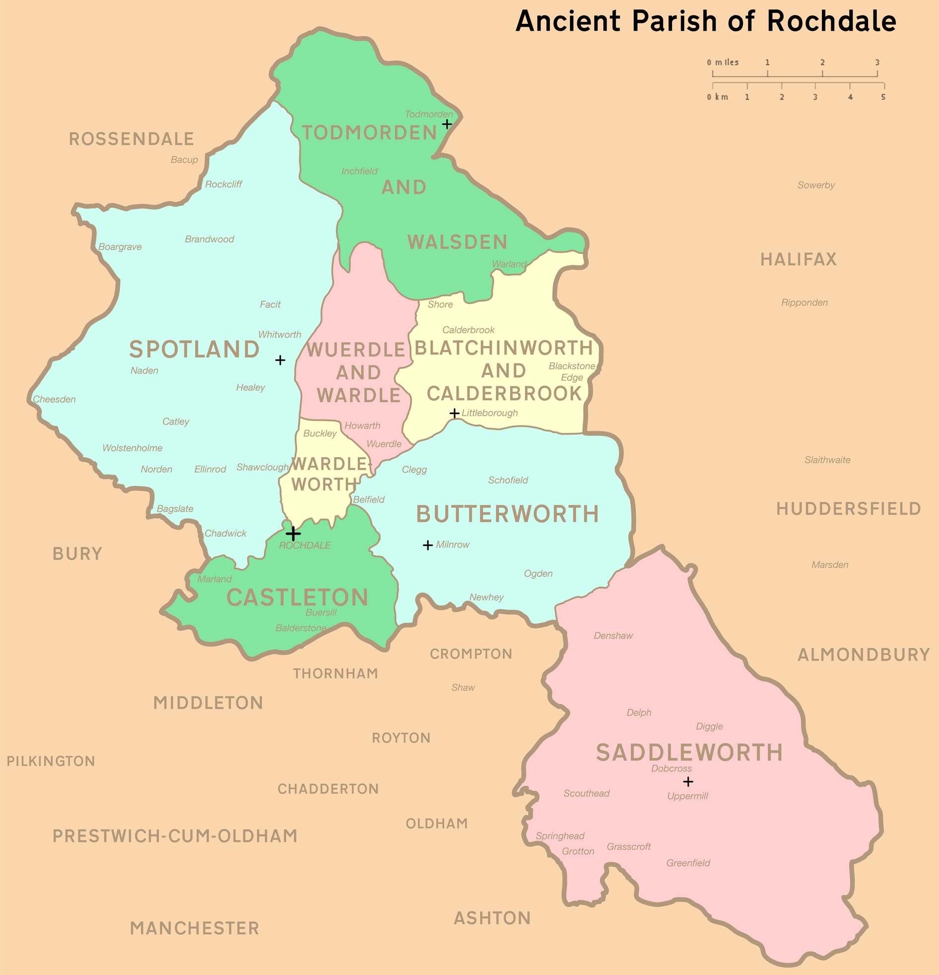
Rochdale was an ecclesiastical parish of early-medieval origin in northern England, administered from the Church of St Chad, Rochdale. At its zenith, it occupied of land amongst the South Pennines, and straddled the historic county boundary between Lancashire and the West Riding of Yorkshire. To the north and north-west was the parish of Whalley; to the southwest was the parish of Bury; to the south was Middleton and Prestwich-cum-Oldham. Anciently a dependency of Whalley Abbey, the parish of Rochdale is believed to be of Anglo-Saxon origin, as evidenced by historical documentation, toponymy and its dedication to Chad of Mercia. Urbanisation, population shifts, and local government reforms all contributed towards the gradual alteration and ultimate dissolution of the historic parish boundaries; the social welfare functions of the parish were broadly superseded by the English Poor Laws and new units of local governance, such as the County Borough of Rochdale and the Miln ... [...More Info...] [...Related Items...] OR: [Wikipedia] [Google] [Baidu] |
Huddersfield
Huddersfield is a market town in the Kirklees district in West Yorkshire, England. It is the administrative centre and largest settlement in the Kirklees district. The town is in the foothills of the Pennines. The River Holme's confluence into the similar-sized Colne to the south of the town centre which then flows into the Calder in the north eastern outskirts of the town. The rivers around the town provided soft water required for textile treatment in large weaving sheds, this made it a prominent mill town with an economic boom in the early part of the Victorian era Industrial Revolution. The town centre has much neoclassical Victorian architecture, one example is which is a Grade I listed building – described by John Betjeman as "the most splendid station façade in England" – and won the Europa Nostra award for architecture. It hosts the University of Huddersfield and three colleges: Greenhead College, Kirklees College and Huddersfield New College. The town ... [...More Info...] [...Related Items...] OR: [Wikipedia] [Google] [Baidu] |
Featherstone
Featherstone is a town and civil parish in the City of Wakefield, West Yorkshire, England, two miles south-west of Pontefract. Historically part of the West Riding of Yorkshire, in 2011 it had a population of 15,244. Featherstone railway station is on the Pontefract Line. History Despite most population growth taking place around the Industrial Revolution, Featherstone traces its history back much further than this. The Domesday Book (1086) records "In Ferestane eatherstoneand Prestone urstonand Arduwic ardwickand Osele ostell Ligulf had 16 carucates of land for geld, and 6 ploughs may be there." It is thought that a local public house, the Traveller's Rest, can trace its origins to the 17th century whilst the former Jubilee Hotel, a listed building now converted to apartments, once provided a resting place for wealthy Victorians and their horses. Standing stone's just outside the village indicate that there is evidence of an ancient druid grove. The original village is ... [...More Info...] [...Related Items...] OR: [Wikipedia] [Google] [Baidu] |
Dewsbury
Dewsbury is a minster and market town in the Metropolitan Borough of Kirklees in West Yorkshire, England. It lies on the River Calder and on an arm of the Calder and Hebble Navigation waterway. It is to the west of Wakefield, east of Huddersfield and south of Leeds. Historically a part of the West Riding of Yorkshire, after undergoing a period of major growth in the 19th century as a mill town, Dewsbury went through a period of decline. Dewsbury forms part of the Heavy Woollen District of which it is the largest town. According to the 2011 census, Dewsbury had a population of 62,945. History Toponymy The ''Domesday Book'' of 1086 records the name as ''Deusberie'', ''Deusberia'', ''Deusbereia'', or ''Deubire'', literally "Dewi's fort", Dewi being an old Welsh name (equivalent to David) and "bury" coming from the old English word "burh", meaning fort. Other, less supported, theories exist as to the name's origin. For example, that it means "dew hill", from Old English ' ... [...More Info...] [...Related Items...] OR: [Wikipedia] [Google] [Baidu] |
Batley
Batley is a market town in the Metropolitan Borough of Kirklees, in West Yorkshire, England. Batley lies south-west of Leeds, north-west of Wakefield and Dewsbury, south-east of Bradford and north-east of Huddersfield. Batley is part of the Heavy Woollen District. In 2011 the population of Batley including Hanging Heaton, Staincliffe, Carlinghow, Birstall, Birstall Smithies, Copley Hill and Howden Clough was 48,730. ''Select "Batley M.B." from "Available Areas"'' History Batley is recorded in the ''Domesday Book'' as 'Bateleia'. After the Norman conquest, the manor was granted to Elbert de Lacy and in 1086 was within the wapentake of Morley. It subsequently passed into the ownership of the de Batleys, and by the 12th century had passed by marriage to the Copley family. Their residence at Batley Hall was held directly from the Crown; at this time the district was part of the Duchy of Lancaster. Howley Hall in Soothill was built during the 1580s by Sir John Savile, a mem ... [...More Info...] [...Related Items...] OR: [Wikipedia] [Google] [Baidu] |
Warmfield With Heath
Warmfield cum Heath is a civil parish in the City of Wakefield in West Yorkshire, England. It has a population of 844. increasing to 941 at the 2011 Census. Until 1974 it formed part of Wakefield Rural District and as of 2004, its under the electoral ward of Normanton. The parish consists of the villages of Warmfield in the east, Heath in the west, and Kirkthorpe in the north, and the hamlet of Goosehill north of Warmfield. The A655 road traverses the area of the parish from southwest to northeast, and the southwestern parish boundary follows the A638 road. North of Kirkthorpe, the railway between Wakefield and Normanton passes through the area, but there is no station. At Goosehill there was a junction with the North Midland Railway. Neighbouring settlements are Agbrigg and Wakefield in the west, Normanton in the northeast, Streethouse in the east, New Sharlston in the southeast, and Walton Walton may refer to: People * Walton (given name) * Walton (surname) * ... [...More Info...] [...Related Items...] OR: [Wikipedia] [Google] [Baidu] |
Thornhill, West Yorkshire
Thornhill is a village and former township in the unparished area of Dewsbury, Kirklees, West Yorkshire, England. Historically part of the West Riding of Yorkshire, Thornhill was absorbed into Dewsbury County Borough in 1910. It is located on a hill on the south side of the River Calder, and has extensive views of Dewsbury, Ossett and Wakefield. It is known for its collection of Anglo-Saxon crosses. History Thornhill is mentioned in the Domesday Book of 1086 as within the ancient wapentake of Agbrigg, while Anglian crosses and other remains indicate that there was a settlement here by the 9th century. A hoard of 27 Roman denarii found in Turnip Lane and pottery at the cross indicates substantially earlier settlement. The tombstone of a certain very high-ranking Anglian called Osberht (a very rare find) was found in the graveyard of Thornhill Parish Church. Some historians claim that the grave bearing the name Osbehrt is that of King Osberht, who was killed on 21 March 86 ... [...More Info...] [...Related Items...] OR: [Wikipedia] [Google] [Baidu] |
.jpg)


.jpg)


