|
Aerolíneas Mas
Aerolíneas Mas was an airline with its corporate headquarters in the ''Ciudad Universitaria'' (University City) in Santo Domingo, Dominican Republic. " Aerolíneas Mas. Retrieved on January 15, 2013. "Dirección de la empresa Calle Modesto Díaz # 9, Ensanche la Julia, Ciudad Universitaria, Santo Domingo, Distrito Nacional, Republica Dominicana." It offered flights to several domestic destinations. Its flight operations were based at in Santo Domingo. History Aerolíneas Mas was founded in 2005 as a charter airline. Then it became a regular airline with all flights to the Caribbean.Fleet Three aircraft conformed ...[...More Info...] [...Related Items...] OR: [Wikipedia] [Google] [Baidu] |
Sunrise Airways
Sunrise Airways S.A. is a Haitian airline that provides scheduled passenger and charter flights. History Sunrise Airways was founded in 2010 and commenced flights on a charter basis on January 1, 2011. In February 2011, the carrier began scheduled flights between Port-au-Prince and Jacmel in Haiti offering passenger, cargo and mail services. In July 2011, all scheduled flights stopped and the airline operated only on a charter basis. On December 20, 2012, it returned to scheduled service, offering two daily commercial flights between Port-au-Prince and Cap-Haïtien with its BAE Jetstream 32. In October 2014, Sunrise Airways started a regularly scheduled service to Santiago de Cuba, the company's first commercial flights to Cuba. In March 2016, a second route to Cuba ( Camaguey) was opened. In 2016 Sunrise was approved to by the United States Department of Transportation to offer flights between Haiti and multiple US destinations. From October 2016 through March 2017, it offered a ... [...More Info...] [...Related Items...] OR: [Wikipedia] [Google] [Baidu] |
La Romana International Airport
La Romana Casa De Campo International Airport is an international airport located on the southeastern coast of the Dominican Republic, adjacent to the tourist town of La Romana and the resort of Casa de Campo. It is located about 68 miles (110 km) from the capital, Santo Domingo, approximately 1 hour and 34 minutes by car. In 2008, 374,724 passengers passed through the airport. Overview The current single terminal is built in the style of an old sugar mill. The airport consists of a main terminal with four modern gates. It has facilities for passengers and for the maintenance of aircraft. This airport receives most of the private flights in the country, principally businessmen that come to La Romana for vacations in Casa de Campo. The La Romana VOR/DME (Ident: LRN) and the La Romana non-directional beacon (Ident: LRN) are located on the field. History The current airport has been open for 22 years and opened in December 2000 and replaced the earlier La Romana Airport with ... [...More Info...] [...Related Items...] OR: [Wikipedia] [Google] [Baidu] |
Defunct Airlines Of The Dominican Republic
{{Disambiguation ...
Defunct (no longer in use or active) may refer to: * ''Defunct'' (video game), 2014 * Zombie process or defunct process, in Unix-like operating systems See also * * :Former entities * End-of-life product * Obsolescence Obsolescence is the state of being which occurs when an object, service, or practice is no longer maintained or required even though it may still be in good working order. It usually happens when something that is more efficient or less risky r ... [...More Info...] [...Related Items...] OR: [Wikipedia] [Google] [Baidu] |
Piarco International Airport
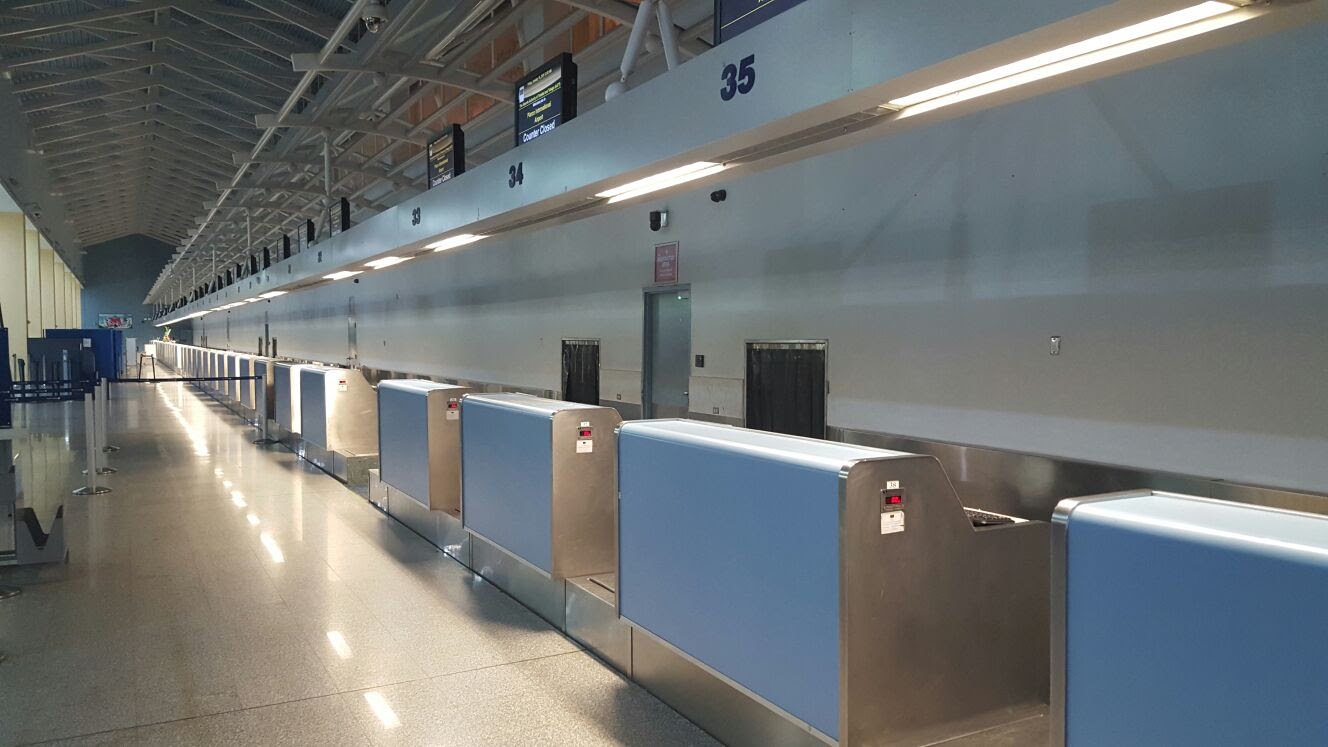
Piarco International Airport is an international airport serving the island of Trinidad and is one of two international airports in Trinidad and Tobago. The airport is located east of Downtown Port of Spain, located in the adjacent town of Piarco. It is the seventh busiest airport in the Caribbean in terms of passengers served and third busiest in the English-speaking Caribbean, after Sangster International Airport and Lynden Pindling International Airport. The airport is also the primary hub and operating base for the country's national airline, as well as the Caribbean's largest airline, Caribbean Airlines. Piarco International Airport has direct scheduled service to destinations in the United States, Canada, Central America, South America and Europe. It is also a significant transit hub for the Southern Caribbean and serves as the primary connection point for many passengers travelling from Guyana. History The Piarco Airport opened on 8 January 1931, to serve Venezuela's '' ... [...More Info...] [...Related Items...] OR: [Wikipedia] [Google] [Baidu] |
Port Of Spain
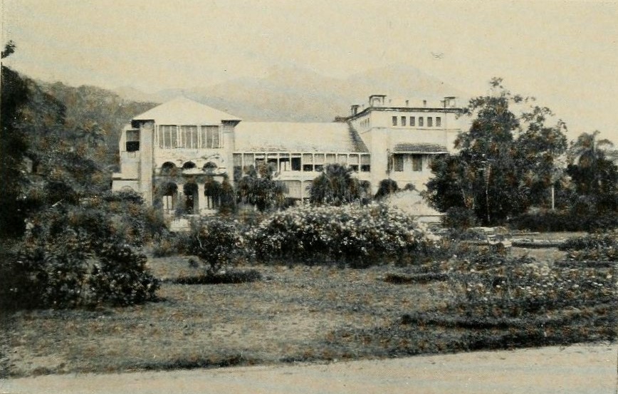
Port of Spain (Spanish: ''Puerto España''), officially the City of Port of Spain (also stylized Port-of-Spain), is the capital of Trinidad and Tobago and the third largest municipality, after Chaguanas and San Fernando. The city has a municipal population of 37,074 (2011 census), an urban population of 81,142 (2011 estimate) and a transient daily population of 250,000. It is located on the Gulf of Paria, on the northwest coast of the island of Trinidad and is part of a larger conurbation stretching from Chaguaramas in the west to Arima in the east with an estimated population of 600,000. The city serves primarily as a retail and administrative centre and it has been the capital of the island since 1757. It is also an important financial services centre for the CaribbeanCIA World Factbook Trinidad an ... [...More Info...] [...Related Items...] OR: [Wikipedia] [Google] [Baidu] |
Princess Julianna International Airport
Princess Juliana International Airport is the main airport on the Caribbean island of Saint Martin. The airport is located on the Dutch side of the island, in the country of Sint Maarten, close to the shore of Simpson Bay Lagoon. In 2015, the airport handled 1,829,543 passengers and around 60,000 aircraft movements. The airport serves as a hub for Winair and is the major gateway for the smaller Leeward Islands, including Anguilla, Saba, Saint Barthélemy and Sint Eustatius. It is named after Queen Juliana of the Netherlands, who landed there while she was heir presumptive in 1944, the year after the airport opened. The airport has very low-altitude flyover landing approaches because one end of its runway is extremely close to the shore and Maho Beach. While Princess Juliana International is the primary aviation gateway to the island, there is also a smaller public-use airport on the French side, in the French Collectivity of Saint Martin, called Grand Case-Espérance Airport. ... [...More Info...] [...Related Items...] OR: [Wikipedia] [Google] [Baidu] |
Philipsburg, Sint Maarten
Philipsburg () is the main town and Capital city, capital of the country of Sint Maarten. The town is on a narrow stretch of land between Great Bay and the Great Salt Pond. It functions as the commercial center of Saint Martin (island), Saint Martin island, whereof Sint Maarten encompasses the southern half. , it has 1,894 inhabitants. History Philipsburg was founded in 1763 by John Philips, a Scottish captain in the Dutch navy; the settlement soon became a bustling centre of international trade. Two historic forts bear witness to Philipsburg's strategic importance in St. Maarten's history: Fort Amsterdam (Sint Maarten), Fort Amsterdam and Fort Willem. Tourism The main shopping district, Front Street, is in the heart of the city. The city also has a port that is visited by many cruise liners. Transport Princess Juliana International Airport World-famous for its close photographs of landing aircraft, Princess Juliana International Airport (IATA: SXM, ICAO: TNCM), west of Phili ... [...More Info...] [...Related Items...] OR: [Wikipedia] [Google] [Baidu] |
Hato International Airport
Hato or HATO may refer to: Places * Hato International Airport, Willemstad, Curaçao * Hato, Curaçao, a village and former plantation in Curaçao * Hato, Santander, a town in Santander Department, Colombia * Hato, San Lorenzo, Puerto Rico, a barrio in San Lorenzo, Puerto Rico (U.S.) People with the surname * Ergilio Hato (1926-2003), football goalkeeper from Curaçao, Netherlands Antilles * Yasuhiro Hato (born 1976), Japanese footballer Other uses * Typhoon Hato Typhoon Hato, known in the Philippines as Severe Tropical Storm Isang, was a strong tropical cyclone that struck South China in August 2017. Developing as the thirteenth named storm and the fourth typhoon of the Pacific typhoon season, Hato form ... * Highways Agency Traffic Officer, UK See also * * {{Dove-surname ... [...More Info...] [...Related Items...] OR: [Wikipedia] [Google] [Baidu] |
Willemstad
Willemstad ( , ; ; en, William I of the Netherlands, William Town, italic=yes) is the capital city of Curaçao, an island in the southern Caribbean Sea that forms a Countries of the Kingdom of the Netherlands, constituent country of the Kingdom of the Netherlands. It was the capital of the Netherlands Antilles prior to its Dissolution of the Netherlands Antilles, dissolution in 2010. The historic centre of the city consists of four quarters: the Punda and Otrobanda, which are separated by the Sint Anna Bay, an inlet that leads into the large natural harbour called the Schottegat, as well as the Scharloo and Pietermaai Smal quarters, which are across from each other on the smaller Waaigat harbour. Willemstad is home to the Curaçao synagogue, the oldest surviving synagogue in the Americas. The city centre, with its unique architecture and harbour entry, has been designated a UNESCO World Heritage Site. History Punda was established in 1634, when the Dutch captured the island fro ... [...More Info...] [...Related Items...] OR: [Wikipedia] [Google] [Baidu] |
Arroyo Barril International Airport
Arroyo Barril International Airport is an airport west of Samaná, the capital of Samaná Province in the Dominican Republic. The airport is on the southern shore of the Samaná Peninsula, facing Samaná Bay to the south. There are tall hills immediately north of the runway. Approach and departure are over the water. The runway length includes a displaced threshold on Runway 11. Airlines and destinations See also *Transport in Dominican Republic *List of airports in Dominican Republic This is a list of airports in the Dominican Republic, grouped by type and sorted by location. Airport names shown in bold indicate the airport has scheduled service on commercial airlines. See also * Transportation in the Dominican Republic ... References External links OpenStreetMap - Arroyo Barril Airport [...More Info...] [...Related Items...] OR: [Wikipedia] [Google] [Baidu] |
Samaná (town)
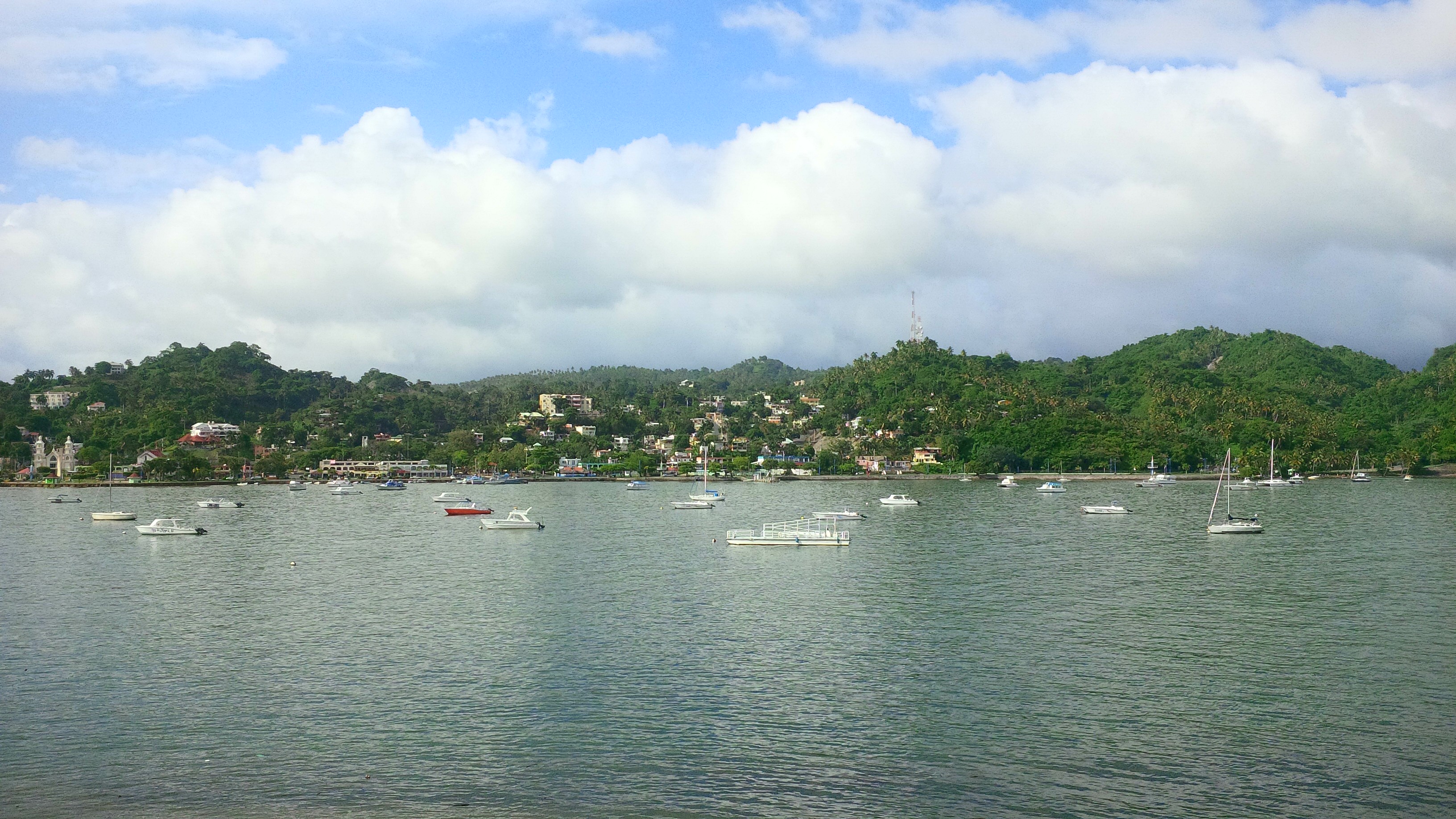
Samaná (old spelling: Xamaná), in full Santa Bárbara de Samaná, is a town and municipality in northeastern Dominican Republic and is the capital of Samaná Province. It is located on the northern coast of Samaná Bay. The town is an important tourism destination and is the main center for whale-watching tours in the Caribbean region. The town has three municipal districts: El Limón, Las Galeras, and Arroyo Barril. According to the 2012 population and housing census, the municipality has a total population of 108,179. Geography Samaná is located in a small plain close to the coast but, now, most of the town is in the hills that enclose the plain. It is the largest municipality of the province. It has a total area of 412.11 km² (almost 49% of the total area of the province), including the three municipal districts that are part of the municipality. Most of the territory is occupied by the Sierra de Samaná, a short mountain range with steep slopes but no high mou ... [...More Info...] [...Related Items...] OR: [Wikipedia] [Google] [Baidu] |
Cabo Rojo Airport
Cabo Rojo Airport ( es, Aeródromo Doméstico de Cabo Rojo) is a Caribbean coastal airport in the Dominican Republic southeast of Pedernales, a port city on the border with Haiti. The airport offers domestic flights to destinations within the Dominican Republic. West approach and departures are over the water. Runway 12 has a displaced threshold. The Cabo Rojo VOR/DME (Ident: DCR) is located on the field. See also * * *Transport in Dominican Republic *List of airports in Dominican Republic This is a list of airports in the Dominican Republic, grouped by type and sorted by location. Airport names shown in bold indicate the airport has scheduled service on commercial airlines. See also * Transportation in the Dominican Republic ... References External linksOpenStreetMap - Cabo Rojo Airport [...More Info...] [...Related Items...] OR: [Wikipedia] [Google] [Baidu] |


_02.jpg)

.jpg)
