|
Adraskan
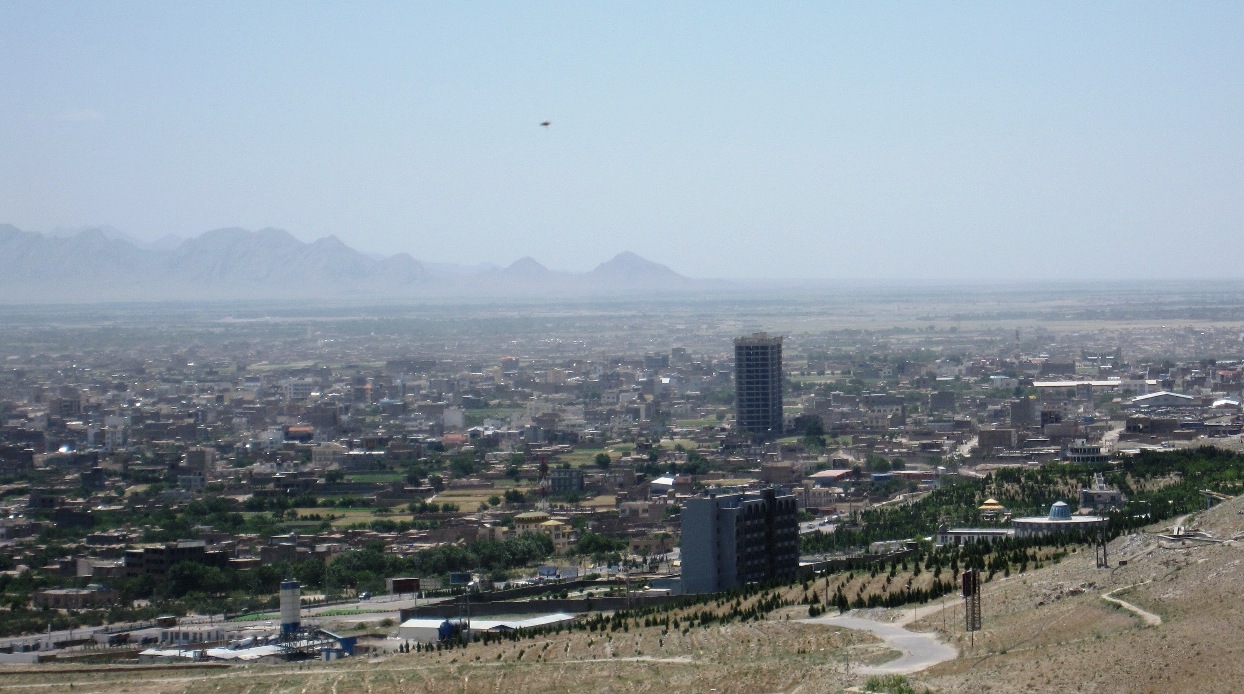
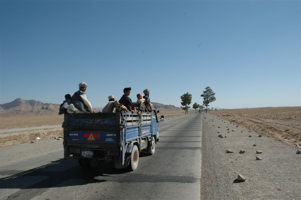
Adraskan (Pashto: ادرسکن) is a historical town in western Afghanistan near the Harut River. It was mentioned in 13th and 14th century geographies as one of four prominent towns in the district of Sabzwar, the Green Place, which, now called Shindand (Pashto equivalent of Sabzwar). Now the town is the center of Adraskan District in Herat Province, Afghanistan. It is located on at 1343 m altitude. The main Kandahar–Herat Highway passes through the town. During the Soviet–Afghan War, the 68th Guards Separate Engineer Battalion, 5th Guards Motor Rifle Division, 40th Army, appears to have been located here. Climate With an influence from the local steppe climate, Adraskan features a cold semi-arid climate (''BSk'') under the Köppen climate classification. The average temperature in Adraskan is 14.2 °C, while the annual precipitation averages 216 mm. July is the hottest month of the year with an average temperature of 26.6 °C. The coldest month January ... [...More Info...] [...Related Items...] OR: [Wikipedia] [Google] [Baidu] |
Adraskan District
Adraskan is a district in the central part of Herat Province in Afghanistan. It is bordered to the west by Iran, to the north by Ghoryan District, Zinda Jan District, Guzara District, Pashtun Zarghun District and Obe District, to the east by Farsi District and to the south by Sabzwar District. The population was estimated at 52,200 in 2012. The district is large; the eastern part is much more populated than the west. The Harut River (also known as the Adraskan River) flows from east to south through Adraskan. The main road from Herat to Kandahar passes in a north–south direction through the district center, the ancient town of Adraskan. See also *Districts of Afghanistan The districts of Afghanistan, known as ''wuleswali'' ( ps, ولسوالۍ, ''wuləswāləi''; fa, شهرستان, ''shahrestān'') are secondary-level administrative units, one level below provinces. The Afghan government issued its first d ... References External links Districts of ... [...More Info...] [...Related Items...] OR: [Wikipedia] [Google] [Baidu] |
5th Guards Motor Rifle Division
The 5th Guards ''Zimovnikovskaya'' order Kutuzov II degree Motor Rifle Division, (Military Unit Number (V/Ch) 51852 from 1979) named on the 60th anniversary of the USSR, was a military formation of the Soviet Ground Forces. It was formed from the 6th Mechanized Corps created in 1940 and destroyed in 1941 in the beginning of Operation Barbarossa. The corps was reformed in November 1942 under the same name, but with a different organizational structure. In early 1943, the 6th Mechanized Corps was granted "Guards" status and became the 5th Guards Mechanized Corps. It was renamed the 5th Guards Mechanized Division in 1945, and subsequently the 5th Guards Motor Rifle Division in 1965. Creation of 6th Mechanized Corps The 6th Mechanised Corps was formed on 15 July 1940 at Bialystok in the Western Special Military District. It was attached to the 10th Army in the Bialystok area and was under the command of Major General Mikhail Khatskilevich when Operation Barbarossa began in June ... [...More Info...] [...Related Items...] OR: [Wikipedia] [Google] [Baidu] |
Herat Province
Herat (Persian: ) is one of the thirty-four provinces of Afghanistan, located in the north-western part of the country. Together with Badghis, Farah, and Ghor provinces, it makes up the north-western region of Afghanistan. Its primary city and administrative capital is Herat City. The province of Herat is divided into about 17 districts and contains over 2,000 villages. It has a population of about 3,780,000, making it the second most populated province in Afghanistan behind Kabul Province. The population is multi-ethnic but largely Persian-speaking. Herat dates back to the Avestan times and was traditionally known for its wine. The city has a number of historic sites, including the Herat Citadel and the Musalla Complex. During the Middle Ages Herat became one of the important cities of Khorasan, as it was known as the Pearl of Khorasa The province of Herat shares a border with Iran in the west and Turkmenistan in the north, making it an important trading region. The Trans-Afg ... [...More Info...] [...Related Items...] OR: [Wikipedia] [Google] [Baidu] |
Harut River
The Harut River or Adraskan River is a river of Afghanistan. It is a river which belongs to the Sistan Basin. The source of the river lies in the mountains to the southeast of Herat. The river flows for about into the Sistan Lake Lake Hāmūn ( fa, دریاچه هامون, ''Daryācheh-ye Hāmūn''; ps, هامون ډنډ), or the Hamoun Oasis, is a seasonal lake and wetlands in the endorheic Sīstān Basin in the Sistan region on the Afghanistan–Iran border. In Iran, .... Along its course are various canals for irrigation, particularly in the plains of Sabzvar and Anardarah. The Khushkek River enters the Harut. References Rivers of Afghanistan Landforms of Herat Province {{Afghanistan-river-stub ... [...More Info...] [...Related Items...] OR: [Wikipedia] [Google] [Baidu] |
Shindand District
Shinḍanḍ District ( ps, شينډنډ) is located in the southern part of Herat Province in Afghanistan, bordering Adraskan District to the north, Ghor Province to the east and Farah Province to the south and west. It is one of the 16 districts of Herat Province. The name Shindand is Pashto and relates to lush green farming area. In Persian language it translates to ''Sabzwār'' (). The population of Shindand District is around 49,024. The district center is the town of Shindand, which has an active market area. Shindand Air Base is located near the town. The Kandahar–Herat Highway passes through the district. The Zerkoh Valley is in the district. History The ancient name of Shindand was Esfezar as still an Iranian small city, more a village, close to the border of Afghanistan on the Iranian side. Notable historical sites in Shindand include Qala-Dokhtar and Qala Rustam-Zal. Divisions Shindand District is divided into five bigger districts, namely Zawol, Zerkoh, Poshteh- ... [...More Info...] [...Related Items...] OR: [Wikipedia] [Google] [Baidu] |
Provinces Of Afghanistan
Afghanistan is divided into 34 provinces (, '' wilåyat''). The provinces of Afghanistan are the primary administrative divisions. Each province encompasses a number of districts or usually over 1,000 villages. Provincial governors played a critical role in the reconstruction of the Afghan state following the creation of the new government under Hamid Karzai. According to international security scholar Dipali Mukhopadhyay, many of the provincial governors of the western-backed government were former warlords who were incorporated into the political system. Provinces of Afghanistan Regions of Afghanistan UN Regions Former provinces of Afghanistan During Afghanistan's history it had a number of provinces in it. It started out as just Kabul, Herat, Qandahar, and Balkh but the number of provinces increased and by 1880 the provinces consisted of Balkh, Herat, Qandahar, Ghazni, Jalalabad, and Kabul. * Southern Province – dissolved in 1964 to create Paktia Provinc ... [...More Info...] [...Related Items...] OR: [Wikipedia] [Google] [Baidu] |
Pashto
Pashto (,; , ) is an Eastern Iranian language in the Indo-European language family. It is known in historical Persian literature as Afghani (). Spoken as a native language mostly by ethnic Pashtuns, it is one of the two official languages of Afghanistan alongside Dari,Constitution of Afghanistan �''Chapter 1 The State, Article 16 (Languages) and Article 20 (Anthem)''/ref> and it is the second-largest provincial language of Pakistan, spoken mainly in Khyber Pakhtunkhwa and the northern districts of Balochistan. Likewise, it is the primary language of the Pashtun diaspora around the world. The total number of Pashto-speakers is at least 40 million, (40 million) although some estimates place it as high as 60 million. Pashto is "one of the primary markers of ethnic identity" amongst Pashtuns. Geographic distribution A national language of Afghanistan, Pashto is primarily spoken in the east, south, and southwest, but also in some northern and western parts of the country. The ... [...More Info...] [...Related Items...] OR: [Wikipedia] [Google] [Baidu] |
Afghanistan
Afghanistan, officially the Islamic Emirate of Afghanistan,; prs, امارت اسلامی افغانستان is a landlocked country located at the crossroads of Central Asia and South Asia. Referred to as the Heart of Asia, it is bordered by Pakistan to the Durand Line, east and south, Iran to the Afghanistan–Iran border, west, Turkmenistan to the Afghanistan–Turkmenistan border, northwest, Uzbekistan to the Afghanistan–Uzbekistan border, north, Tajikistan to the Afghanistan–Tajikistan border, northeast, and China to the Afghanistan–China border, northeast and east. Occupying of land, the country is predominantly mountainous with plains Afghan Turkestan, in the north and Sistan Basin, the southwest, which are separated by the Hindu Kush mountain range. , Demographics of Afghanistan, its population is 40.2 million (officially estimated to be 32.9 million), composed mostly of ethnic Pashtuns, Tajiks, Hazaras, and Uzbeks. Kabul is the country's largest city and ser ... [...More Info...] [...Related Items...] OR: [Wikipedia] [Google] [Baidu] |
Kandahar–Herat Highway
The Kandahar–Herat Highway is section of road that links the cities of Kandahar and Herat in Afghanistan. This highway is part of a larger road network, the "Ring Road", and was first constructed by the Soviets in the 1960s. The Kandahar-Herat Highway is made up of two sections of "National Highway 1": NH0101 runs from Kandahar to Girishk, and NH0102 runs from Girishk to Herat. History In October 2004 reconstruction of the highway began and was expected to be completed by the end of 2006. The United States is funding a portion of the road, Saudi Arabia is funding a section and Japan is contributing to rebuilding . The U.S. portion of the Kandahar-Herat highway has reduced travel time between those two major cities from 10 hours to 4.3 hours. Connectivity with Route 606: Delaram-Zaranj Highway The Delaram–Zaranj Highway, also known as Route 606, is a two-lane road built by India in Afghanistan, connecting Delaram in Farah Province with Zaranj in neighbouring Nimruz ... [...More Info...] [...Related Items...] OR: [Wikipedia] [Google] [Baidu] |
Soviet–Afghan War
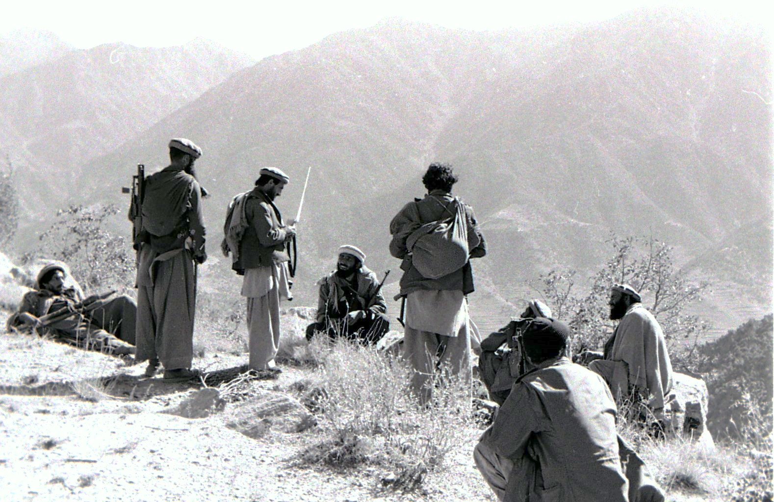
The Soviet–Afghan War was a protracted armed conflict fought in the Democratic Republic of Afghanistan from 1979 to 1989. It saw extensive fighting between the Soviet Union and the Afghan mujahideen (alongside smaller groups of anti-Soviet Maoism, Maoists) after the former militarily intervened in, or launched an invasion of, Afghanistan to support the local pro-Soviet government that had been installed during Operation Storm-333. Most combat operations against the mujahideen took place in the Afghan countryside, as the country's urbanized areas were entirely under Soviet control. While the mujahideen were backed by various countries and organizations, the majority of their support came from Pakistan, Saudi Arabia, the United States, the United Kingdom, China, and Iran; the American pro-mujahideen stance coincided with a sharp increase in bilateral hostilities with the Soviets during the Cold War (1979–1985), Cold War. The conflict led to the deaths of between 562,000 and ... [...More Info...] [...Related Items...] OR: [Wikipedia] [Google] [Baidu] |
40th Army (Soviet Union)
The 40th Army (, ''40-ya obshchevoyskovaya armiya'', "40th Combined Arms Army") of the Soviet Ground Forces was an army-level command that participated in World War II from 1941 to 1945 and was reformed specifically for the Soviet–Afghan War from 1979 to circa 1990. The Army became the land forces arm of the Soviet occupational force in Afghanistan in the 1980s, the Limited Contingent of Soviet Forces in Afghanistan ( :ru:Ограниченный контингент советских войск в Афганистане). First formation (World War II) It was first formed, after Operation Barbarossa, the German invasion of the Soviet Union, had commenced, from elements of the 26th and 37th Armies under the command of Major General Kuzma Petrovich Podlas in August 1941 at the boundary of the Bryansk Front and the Soviet Southwestern Front. By 25 August 1941 the 135th and 293rd Rifle Divisions, 2nd Airborne Corps, 10th Tank Division, and 5th Anti-Tank Brigade had been asse ... [...More Info...] [...Related Items...] OR: [Wikipedia] [Google] [Baidu] |
Cold Semi-arid Climate
A semi-arid climate, semi-desert climate, or steppe climate is a dry climate sub-type. It is located on regions that receive precipitation below potential evapotranspiration, but not as low as a desert climate. There are different kinds of semi-arid climates, depending on variables such as temperature, and they give rise to different biomes. Defining attributes of semi-arid climates A more precise definition is given by the Köppen climate classification, which treats steppe climates (''BSk'' and ''BSh'') as intermediates between desert climates (BW) and humid climates (A, C, D) in ecological characteristics and agricultural potential. Semi-arid climates tend to support short, thorny or scrubby vegetation and are usually dominated by either grasses or shrubs as it usually can't support forests. To determine if a location has a semi-arid climate, the precipitation threshold must first be determined. The method used to find the precipitation threshold (in millimeters): *multiply ... [...More Info...] [...Related Items...] OR: [Wikipedia] [Google] [Baidu] |


