|
Administrative Divisions Of Cape Verde
The territory of Cape Verde is divided into 22 ''concelhos'' (municipalities), and subdivided into 32 ''freguesias'' (equivalent to civil parish). In Portuguese language usage, there are two words to distinguish the territory and the administrative organ. Administratively, right below the government, there are the ''municípios'' (municipalities), who administrate the ''concelhos''. Therefore, the ''concelhos'' are the first-level administrative subdivision in Cape Verde. Each municipality has an ''Assembleia Municipal'' (municipal assembly, the legislative body) and a ''Câmara Municipal'' (municipal chamber, the executive body). Every four years elections are held for the Assembleia Municipal, the Câmara Municipal and the President of the Câmara Municipal. Where a municipality consists of several ''freguesias'' (civil parishes), a ''Delegação Municipal'' (municipal delegation) is established in the parishes that do not contain the municipal seat. The islands are traditional ... [...More Info...] [...Related Items...] OR: [Wikipedia] [Google] [Baidu] |
Cape Verde
, national_anthem = () , official_languages = Portuguese , national_languages = Cape Verdean Creole , capital = Praia , coordinates = , largest_city = capital , demonym = Cape Verdean or Cabo Verdean , ethnic_groups_year = 2017 , government_type = Unitary semi-presidential republic , leader_title1 = President , leader_name1 = José Maria Neves , leader_title2 = Prime Minister , leader_name2 = Ulisses Correia e Silva , legislature = National Assembly , area_rank = 166th , area_km2 = 4033 , area_sq_mi = 1,557 , percent_water = negligible , population_census = 561,901 , population_census_rank = 172nd , population_census_year = 2021 , population_density_km2 = 123.7 , population_density_sq_mi = 325.0 , population_density_rank = 89th , GDP_PPP ... [...More Info...] [...Related Items...] OR: [Wikipedia] [Google] [Baidu] |
Ribeira Grande De Santiago, Cape Verde (municipality)
Ribeira Grande de Santiago is a ''concelho'' (municipality) of Cape Verde. It is situated in the southwestern part of the island of Santiago. Its seat is the city Cidade Velha. Its population was 8,325 at the 2010 census, and its area is 137.3 km2. Subdivisions The municipality consists of two ''freguesias'' (civil parishes): * Santíssimo Nome de Jesus * São João Baptista Geography The municipal territory is mountainous. One of the main streams of the area is Ribeira Grande de Santiago. History The municipality was created in 2005, when two parishes of the older Municipality of Praia were separated to become the Municipality of Ribeira Grande de Santiago. p. 25 The old city of Ribeira Grande de Santiago ( |
Porto Novo, Cape Verde (municipality)
Porto Novo is a ''concelho'' (municipality) of Cape Verde. Situated in the southern part of the island of Santo Antão, it covers 72% of the island area (564.3 km2), and is home to 41% of its population. Its population at the 2010 census was 18,028. Its capital is the town Porto Novo. Its highest point, which is also the highest point of the entire island, is Tope de Coroa, elevation . The municipality of Porto Novo was created in 1962 when the parishes of São João Baptista and Santo André were separated from the older Municipality of Paul. Subdivisions The municipality consists of two '' freguesias'' (civil parishes): *Santo André * São João Baptista Demography Politics Since 2016, the Movement for Democracy (MpD) is the ruling party of the municipality. The results of the latest elections, in 2016:Offic ... [...More Info...] [...Related Items...] OR: [Wikipedia] [Google] [Baidu] |
São Vicente, Cape Verde
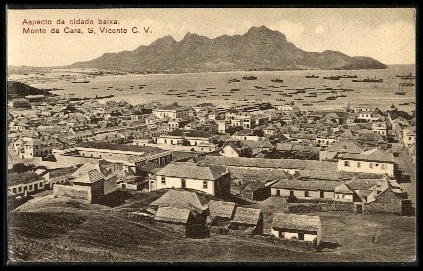
São Vicente (Portuguese for " Saint Vincent") is one of the Barlavento Islands, the northern group within the Cape Verde archipelago in the Atlantic Ocean, off the West African coast. It is located between the islands of Santo Antão and Santa Luzia, with the Canal de São Vicente separating it from Santo Antão. Geography The island is roughly rectangular in shape with an area of . From east to west it measures and from north to south .Cabo Verde, Statistical Yearbook 2015 Instituto Nacional de Estatística The island, of |
Tarrafal De São Nicolau, Cape Verde (municipality)
Tarrafal de São Nicolau is a cityCabo Verde, Statistical Yearbook 2015 Instituto Nacional de Estatística, p. 32 in the western part of the island of São Nicolau, Cape Verde. With a population of 3,733 (2010 census), it is the most populous settlement of the island. It is the seat of the Tarrafal d ... [...More Info...] [...Related Items...] OR: [Wikipedia] [Google] [Baidu] |
Ribeira Brava, Cape Verde (municipality)
Ribeira Brava is a ''concelho Concelho () is the Portuguese-language term for municipality, referring to the territorial subdivision in local government. In comparison, the word ''município'' () refers to the organs of State. This differentiation is still in use in Portugal ...'' (municipality) of Cape Verde. Situated in the eastern part of the island of São Nicolau, it covers 65% of the island area (224.8 km2), and is home to 59% of its population (7,580 at the 2010 census). Its seat is the city Ribeira Brava. Subdivisions The municipality consists of two '' freguesias'' (civil parishes): * Nossa Senhora da Lapa * Nossa Senhora do Rosário History The municipality was created in 2005, when the older municipality of São Nicolau was split in two, the southwestern part becoming the Municipality of Tarrafal de São Nicolau and the northeastern part becoming the Municipality of Ribeira Brava. [...More Info...] [...Related Items...] OR: [Wikipedia] [Google] [Baidu] |
Sal, Cape Verde
Sal (Portuguese for "salt") is an island in Cape Verde. Sal is a tourist destination with white sandy beaches and over 350 days of sunshine a year. It is one of the three sandy eastern islands of the Cape Verde archipelago in the central Atlantic Ocean, off the west coast of Africa. Cabo Verde is known for year-round kiteboarding, for the large reserve of Caretta turtles which hatch from July to September, and the music of Cesaria Evora. History For Europeans , the island was discovered on 3 December 1460 and named ''Llana'' ("flat"). This name was changed into the current "Sal" when the two large salt ponds ( Pedra de Lume and Santa Maria) were discovered. The first three centuries after its discovery, the island was only sparsely inhabited; in 1720 there was a small fishing village near present Palmeira. This changed when the salt industry was developed at the end of the 18th century, starting in Pedra de Lume. Santa Maria was founded in the south of the island in 1830 ... [...More Info...] [...Related Items...] OR: [Wikipedia] [Google] [Baidu] |
Boa Vista, Cape Verde
Boa Vista ( Portuguese for "good view"), also written as Boavista, is a desert-like island that belongs to the Cape Verde Islands. At , it is the third largest island of the Cape Verde archipelago. The island of Boa Vista is closer to the African continent than all the other islands in Cape Verde, being the easternmost island of all. The distance between Boa Vista and Senegal is only 450 km. The capital of Boa Vista, Sal Rei, is located in the north-western part of the island. Boa Vista is mainly known for its beaches, turtles and traditional music. Geography Boa Vista is the third largest island after Santo Antão and Santiago, with an area of 631.1 square kilometres. It is situated south of Sal and north of Maio. The island is generally flat, but it has numerous hills like Monte Estância (the highest point of the island at 387 m), [...More Info...] [...Related Items...] OR: [Wikipedia] [Google] [Baidu] |
Maio, Cape Verde
Maio is the easternmost of the Sotavento islands of Cape Verde. Maio is located south of the island of Boa Vista and east of Santiago. Administratively, the island forms one ''concelho'' (municipality): Maio. History The island was discovered in 1460. It was first settled at the end of the 16th century, when the land was used to raise livestock, especially goats. Salt was first exploited in the 17th century which caused the population to grow. The English exported salt to Europe from Porto Inglês, hence the name of that city.História Municipio do Maio The inconclusive was fought between British and French frigate squadrons of ... [...More Info...] [...Related Items...] OR: [Wikipedia] [Google] [Baidu] |
Mosteiros, Cape Verde (municipality)
Mosteiros is a ''concelho'' (municipality) of Cape Verde. Situated in the northeastern part of the island of Fogo, it covers 19% of the island area, and is home to 26% of its population. Its seat is the city Mosteiros (''Igreja''). Its population was 9,524 at the 2010 census, and its area is 89.45 km2. Subdivisions The municipality consists of one ''freguesia'' (civil parish), Nossa Senhora da Ajuda. The ''freguesia'' is subdivided into the following settlements (populations in 2010): * Achada Grande (pop: 538) * Atalaia (pop: 700) * Corvo (pop: 340) * Cova Feijoal (pop: 217) * Cutelo Alto (pop: 281) * Fajãzinha (pop: 84) * Feijoal (pop: 435) * Mosteiros (or ''Igreja'') (pop: 4,124, city)Cabo Verde, Statistical Yearbook 2015 [...More Info...] [...Related Items...] OR: [Wikipedia] [Google] [Baidu] |
Santa Catarina Do Fogo, Cape Verde (municipality)
Santa Catarina do Fogo is a ''concelho'' (municipality) of Cape Verde. Situated in the southeastern part of the island of Fogo, it covers 32% of the island area (152.95 km2), and is home to 14% of its population (5,299 at the 2010 census). Its seat is the city Cova Figueira. The Municipality of Santa Catarina do Fogo was created in 2005; before 2005, it was a parish of the Municipality of São Filipe. Subdivisions The municipality consists of one ''freguesia'' (civil parish), Santa Catarina do Fogo. The ''freguesia'' is subdivided into the following settlements, its population was of the 2010 census: * Achada Furna (pop: 495) *Achada Poio (pop: 61) * Baluarte * Cabeça Fundão (pop: 177) *Chã das Caldeiras (pop: 697) * Cova Figueira (pop: 1,230, city)Cabo Verde, Statistical Yearbook 2 ... [...More Info...] [...Related Items...] OR: [Wikipedia] [Google] [Baidu] |
São Filipe, Cape Verde (municipality)
São Filipe is a ''concelho'' (municipality) of Cape Verde. Situated in the western part of the island of Fogo, it covers 49% of the island area (228.84 km2), and is home to 60% of its population (22,248 at the 2010 census). Its seat is the city São Filipe. Agriculture is the main employment of the municipality, followed by tourism. Subdivisions The municipality consists of two '' freguesias'' (civil parishes): * São Lourenço * Nossa Senhora da Conceição History It was created in 1991, when the older Municipality of Fogo was split in two, the southwestern part becoming the Municipality of São Filipe and the northeastern part becoming the Municipality of Mosteiros. In 2005, an eastern parish of the municipality was split off to become the Municipality of Santa Catarina do Fogo. Demography Presidents *Eugênio Miranda da Veiga - MpD (until 2008) *Luís Pires - PAICV (as of early 2016) Politics Since 2016, the Movement for Democracy (MpD) is the ruling party of th ... [...More Info...] [...Related Items...] OR: [Wikipedia] [Google] [Baidu] |


