|
Mosteiros, Cape Verde (municipality)
Mosteiros is a ''concelho'' (municipality) of Cape Verde. Situated in the northeastern part of the island of Fogo, it covers 19% of the island area, and is home to 26% of its population. Its seat is the city Mosteiros (''Igreja''). Its population was 9,524 at the 2010 census, and its area is 89.45 km2. Subdivisions The municipality consists of one ''freguesia'' (civil parish), Nossa Senhora da Ajuda. The ''freguesia'' is subdivided into the following settlements (populations in 2010): * Achada Grande (pop: 538) * Atalaia (pop: 700) * Corvo (pop: 340) * Cova Feijoal (pop: 217) * Cutelo Alto (pop: 281) *Fajãzinha (pop: 84) * Feijoal (pop: 435) * Mosteiros (or ''Igreja'') (pop: 4,124, city)Cabo Verde, Statistical Yearbook 2015 [...More Info...] [...Related Items...] OR: [Wikipedia] [Google] [Baidu] |
Administrative Divisions Of Cape Verde
The territory of Cape Verde is divided into 22 ''concelhos'' (municipalities), and subdivided into 32 ''freguesias'' (equivalent to civil parish). In Portuguese language usage, there are two words to distinguish the territory and the administrative organ. Administratively, right below the government, there are the ''municípios'' (municipalities), who administrate the ''concelhos''. Therefore, the ''concelhos'' are the first-level administrative subdivision in Cape Verde. Each municipality has an ''Assembleia Municipal'' (municipal assembly, the legislative body) and a ''Câmara Municipal'' (municipal chamber, the executive body). Every four years elections are held for the Assembleia Municipal, the Câmara Municipal and the President of the Câmara Municipal. Where a municipality consists of several ''freguesias'' (civil parishes), a ''Delegação Municipal'' (municipal delegation) is established in the parishes that do not contain the municipal seat. The islands are traditionall ... [...More Info...] [...Related Items...] OR: [Wikipedia] [Google] [Baidu] |
Rocha Fora
Rocha may refer to: * Rocha (surname), a Portuguese surname * Rocha, Moca, Puerto Rico, a barrio in the municipality of Moca, Puerto Rico * Rocha, Rio de Janeiro, a neighborhood in Rio de Janeiro, Brazil * Rocha, Uruguay, capital city of the Rocha Department * Rocha Department, a department in the east of Uruguay See also * A Rocha, an international conservation organization with a Christian ethos * Pêra Rocha Pera may refer to: Places * Pera (Beyoğlu), a district in Istanbul formerly called Pera, now called Beyoğlu ** Galata, a neighbourhood of Beyoğlu, often referred to as Pera in the past * Pêra (Caparica), a Portuguese locality in the district o ..., a Portuguese variety of pear * Rocca (other) {{disambiguation, geo ... [...More Info...] [...Related Items...] OR: [Wikipedia] [Google] [Baidu] |
Municipalities Of Cape Verde
A municipality is usually a single administrative division having corporate status and powers of self-government or jurisdiction as granted by national and regional laws to which it is subordinate. The term ''municipality'' may also mean the governing body of a given municipality. A municipality is a general-purpose administrative subdivision, as opposed to a special-purpose district. The term is derived from French and Latin . The English word ''municipality'' derives from the Latin social contract (derived from a word meaning "duty holders"), referring to the Latin communities that supplied Rome with troops in exchange for their own incorporation into the Roman state (granting Roman citizenship to the inhabitants) while permitting the communities to retain their own local governments (a limited autonomy). A municipality can be any political jurisdiction, from a sovereign state such as the Principality of Monaco, to a small village such as West Hampton Dunes, New York. The ... [...More Info...] [...Related Items...] OR: [Wikipedia] [Google] [Baidu] |
Haría (municipality)
Haría is a municipality on the island of Lanzarote in the Canary Islands, the northernmost and easternmost Canarian municipality. Surrounded on three sides by the Atlantic Ocean, the municipality is bordered to the south by the municipality of Teguise. It forms part of Las Palmas Province. The seat of the municipality is the town of Haría. The population of the municipality was 4,872 in 2013.Instituto Canario de Estadística , population The total land area of the municipality is . Geography The west of the municipality is largely mountainous, with much of the western coastline rising steeply a little way inland. Numerous ''miradors'' (viewpoints) on this high ground offer views of the island, with the most well known be ...[...More Info...] [...Related Items...] OR: [Wikipedia] [Google] [Baidu] |
Entroncamento
Entroncamento () is a Portuguese municipality in district of Santarém in the Médio Tejo Subregion (''Middle Tagus'') of the Centro Region. The population in 2011 was 20,206, in an area of 13.73 km². Situated in the Ribatejo, it benefits from its geo-strategic position along the Tagus Valley, with important accessibility to the motorways and railway-lines that historically proportioned its growth and expansion. History Entroncamento originated in the middle of the 19th century, with the birth of the national railway network, as a simple train-stop, from two small railway construction camps: Casal das Vaginhas and Casal das Gouveias. The majority of the early rail workers/settlers were foreign, coming from different countries throughout Europe, but eventually workers from Beira Baixa and Alentejo moved to the region. Its toponymic name ''Entroncamento'' literally mean ''junction'', owing to being the junction of the two railway lines that developed in 1864: the ''Linha d ... [...More Info...] [...Related Items...] OR: [Wikipedia] [Google] [Baidu] |
Azambuja
Azambuja () is a municipality in the Portuguese district of Lisbon, in the historical region of Ribatejo (and the sole municipality of within the district that does not belong to the historical province of Estremadura). The population in 2011 was 21,814, in an area of 262.66 km². Since 2002, it was integrated into the NUTS III statistical subregion of Lezíria do Tejo. History The town is so old that there is no longer any surviving record of when it received the privileged status embodied in a municipal charter. In 1963 Ford opened an auto-assembly plant in Azambuja. In 2000 the plant was integrated into the nearby auto-assembly business of General Motors ( Opel). Opel Combo minivans were assembled until the end of 2006 when the plant was closed and production transferred to the manufacturer's plant near Saragossa (Spain). Geography The municipality is limited to the north by Rio Maior, to the northeast Santarém, to the east Cartaxo, to the southeast Salvaterra de ... [...More Info...] [...Related Items...] OR: [Wikipedia] [Google] [Baidu] |
Movement For Democracy (Cape Verde)
The Movement for Democracy ( pt, Movimento para a Democracia, MpD) is a Christian democratic and liberal party in Cape Verde. Established in 1990, it was the ruling party from 1991 to 2001 and returned to power in the 2016 parliamentary election. Its members are nicknamed "" (the wind fans) in Portuguese, a reference to the party's logo. History The MpD was established on 14 March 1990 by Carlos Veiga after Prime Minister Pedro Pires of the African Party for the Independence of Cape Verde (PAICV, formerly the sole legal party) allowed its creation.Richard A Lobban Jr & Paul Khalil Saucier (2007) ''Historical Dictionary of the Republic of Cape Verde'', Scarecrow Press, p. 159 The party was publicly launched in May 1990, and its first convention was held in November 1990. In the January 1991 parliamentary elections, the first multi-party elections in the country's history, the MpD won 56 of the 79 seats in the National Assembly. In the presidential elections the following mont ... [...More Info...] [...Related Items...] OR: [Wikipedia] [Google] [Baidu] |
Cape Verdean Local Elections, 2016
Local elections were held in Cape Verde on 4 September 2016. They were a landslide victory for the Movement for Democracy (MpD), that won 18 out of 22 municipalities (13 in 2012). The African Party for the Independence of Cape Verde The African Party of Independence of Cape Verde ( pt, Partido Africano da Independência de Cabo Verde, PAICV) is a democratic socialist political party in Cape Verde. It was formerly a Marxist–Leninist communist party and the sole legal par ... (PAICV) won 2 municipalities (8 in 2012). Results Municipal chamber results The final results are:Official results local elections 2016 , ''Boletim Oficial I Série, Número 53'', 23 September 2016 Municipal assembly results The final results are:References [...More Info...] [...Related Items...] OR: [Wikipedia] [Google] [Baidu] |
African Party For The Independence Of Cape Verde
The African Party of Independence of Cape Verde ( pt, Partido Africano da Independência de Cabo Verde, PAICV) is a democratic socialist political party in Cape Verde. It was formerly a Marxist–Leninist communist party and the sole legal party in the country from 1981 to 1990. Its members are nicknamed "" (the tamarinds) in Portuguese, and they identify themselves with the color yellow. History In 1956, its forerunner, the African Party for the Independence of Guinea and Cape Verde (PAIGC), was founded by the Cape Verdean nationalist leader Amílcar Cabral (born in Guinea-Bissau). PAIGC fought to overthrow the Portuguese Empire, unify Cape Verde and Guinea-Bissau, and use its vanguardism to advance socialist revolution. From 1961 on, the PAIGC fought a guerrilla warfare campaign in cooperation with its fraternal party umbrella group, the CONCP, during the Portuguese Colonial War. By 1973 the PAIGC controlled Guinea-Bissau, while Portugal's own Carnation Revolution in 1974 e ... [...More Info...] [...Related Items...] OR: [Wikipedia] [Google] [Baidu] |
Literacy Rate
Literacy in its broadest sense describes "particular ways of thinking about and doing reading and writing" with the purpose of understanding or expressing thoughts or ideas in written form in some specific context of use. In other words, humans in literate societies have sets of practices for producing and consuming writing, and they also have beliefs about these practices. Reading, in this view, is always reading something for some purpose; writing is always writing something for someone for some particular ends. Beliefs about reading and writing and its value for society and for the individual always influence the ways literacy is taught, learned, and practiced over the lifespan. Some researchers suggest that the history of interest in the concept of "literacy" can be divided into two periods. Firstly is the period before 1950, when literacy was understood solely as alphabetical literacy (word and letter recognition). Secondly is the period after 1950, when literacy slowly ... [...More Info...] [...Related Items...] OR: [Wikipedia] [Google] [Baidu] |
Coffee
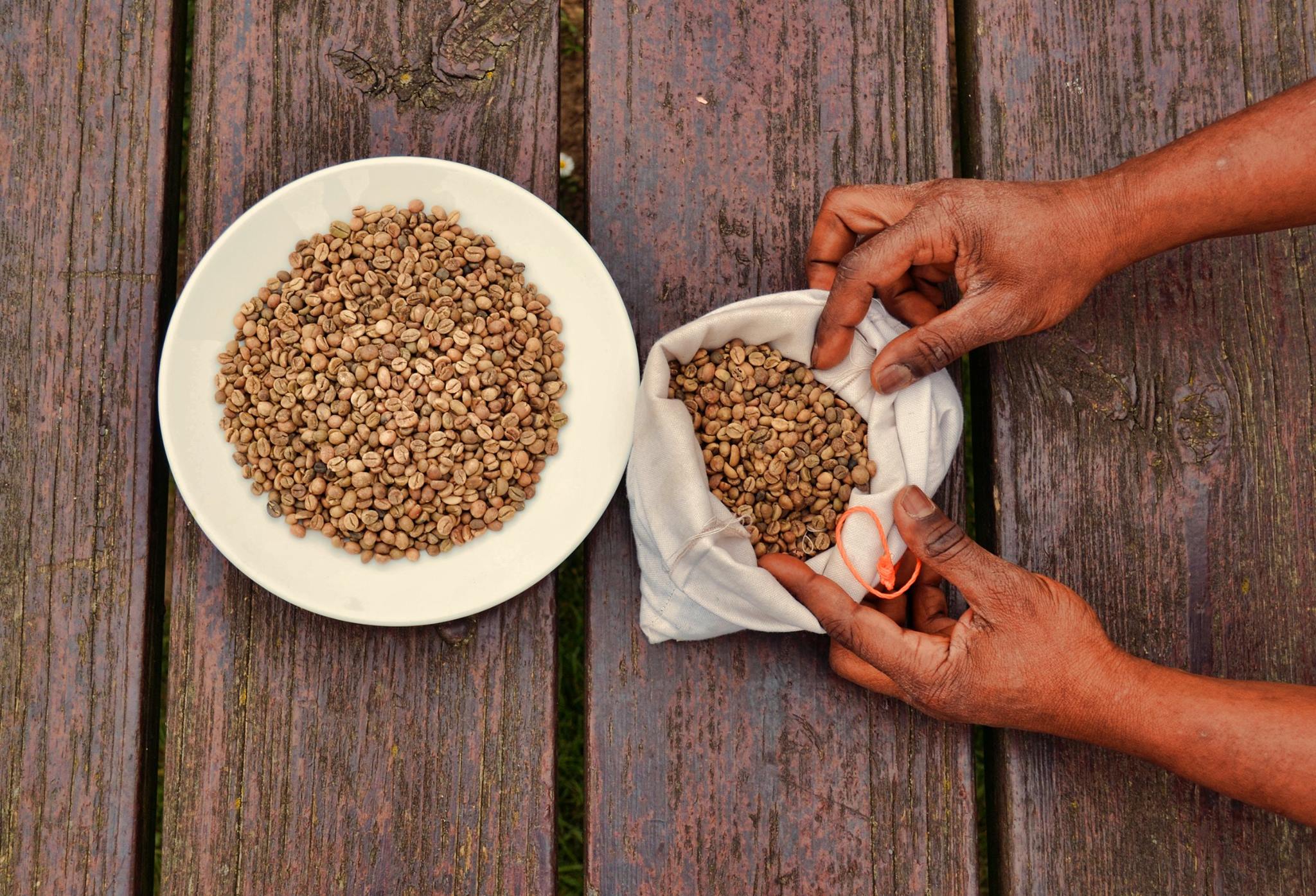
Coffee is a drink prepared from roasted coffee beans. Darkly colored, bitter, and slightly acidic, coffee has a stimulant, stimulating effect on humans, primarily due to its caffeine content. It is the most popular hot drink in the world. Seeds of the ''Coffea'' plant's fruits are separated to produce unroasted green coffee beans. The beans are Coffee roasting, roasted and then ground into fine particles that are typically steeped in hot water before being filtered out, producing a cup of coffee. It is usually served hot, although chilled or iced coffee is common. Coffee can be prepared and presented in a variety of ways (e.g., espresso, French press, caffè latte, or already-brewed canned coffee). Sugar, sugar substitutes, milk, and cream are often used to mask the bitter taste or enhance the flavor. Though coffee is now a global commodity, it has a History of coffee, long history tied closely to food traditions around the Red Sea. The earliest credible evidence of coffee d ... [...More Info...] [...Related Items...] OR: [Wikipedia] [Google] [Baidu] |
Monte Velha
Monte Velha is a peak in the northeastern part of the island of Fogo in Cape Verde. Its elevation is 1,482 m. It is a subpeak of the Pico do Fogo volcano, located at the northeastern end of the crater rim. It lies within the municipality of Mosteiros, 4 km southwest of the city centre. Its forest is a protected area, part of the larger Fogo Natural Park.Parques Naturais Áreas protegidas Cabo Verde [...More Info...] [...Related Items...] OR: [Wikipedia] [Google] [Baidu] |


_1978%2C_MiNr_2293.jpg)
