|
A413
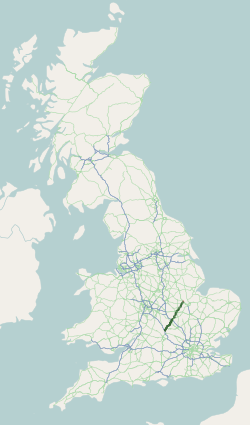
The A413 is a major road in England that runs between Gerrards Cross (west of London) to Towcester (northwest of Milton Keynes). It passes through or near various towns and villages including (in northbound order) Amersham, Great Missenden, Wendover, Aylesbury, Winslow, and Buckingham. Most of the road is in Buckinghamshire, with a part at the north end in Northamptonshire. In the 1960s, a by-pass was built around Great Missenden and re-routing has taken place through Aylesbury town centre. In recent years , by-passes have been built for Amersham (1987) and Wendover (1998). In the early 21st century, the junction near Towcester where the A413 joins the A43 has also been redeveloped along with much-needed A43 redevelopment around Silverstone Circuit. That part of the route which runs along the Misbourne Valley dates back into pre-history. In Medieval times, the Cartulary of Missenden Abbey simply recorded the road as "the Kings Highway". Also just north of Aylesbury the ro ... [...More Info...] [...Related Items...] OR: [Wikipedia] [Google] [Baidu] |
A41 Road
The A41 is a trunk road between London and Birkenhead, England. Now in parts replaced by motorways, it passes through or near Watford, Kings Langley, Hemel Hempstead, Aylesbury, Bicester, Solihull, Birmingham, West Bromwich, Wolverhampton, Newport, Whitchurch, Chester and Ellesmere Port. With the opening of the M40 extension in 1990 from junction 8, much of the route was downgraded. The sections between Bicester and the M42 near Solihull in the Midlands have been re-classified B4100, A4177 and A4141. Route London to Kings Langley The route begins at Marble Arch from its junction on the A40 road in London with Portman Street/Gloucester Place (northbound) and Baker Street/Orchard Street (southbound). Named the Finchley Road, the A41 is dual-carriageway through Swiss Cottage and Hendon Way and intersects with the North Circular Road near Brent Cross shopping centre. The road passes through Hendon and after the junction with the A5150, (close to the Metropo ... [...More Info...] [...Related Items...] OR: [Wikipedia] [Google] [Baidu] |
Winslow, Buckinghamshire
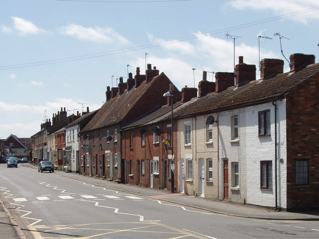
Winslow is a market town and Civil parishes in England, civil parish designated as a town council in the north of the Unitary Authority of Buckinghamshire, England. It has a population of just over 4,400. It is located approximately south-east of Buckingham, and south-west of Bletchley (Milton Keynes). History Winslow was first recorded in a royal charter of 792–793 in which it was granted by Offa of Mercia to St Albans Abbey as ''Wineshauue'', which means ''Wine's Burial Mound'' The Domesday Book of 1086 records it as ''Weneslai''. A late Celtic copper torc has been found here, and also a silver drinking-cup of late Roman design. The 1841 census reveals the population that year was 1,333. Notable buildings Winslow Hall sits on the main road leading into the town from Aylesbury. It was built possibly from the designs of Sir Christopher Wren by William Lowndes, secretary to the Treasury. His name and the date 1700 can be seen on the frieze over the door. The Church of Eng ... [...More Info...] [...Related Items...] OR: [Wikipedia] [Google] [Baidu] |
Wendover
Wendover is a market town and civil parish at the foot of the Chiltern Hills in Buckinghamshire, England. It is situated at the point where the main road across the Chilterns between London and Aylesbury intersects with the once important road along the foot of the Chilterns. The town is some north west of London and south east of Aylesbury, and is very popular with commuters working in London. The parish has an area of and had, at the time of the United Kingdom census, 2011, 2011 census, a population of 7,399. Outside the town of Wendover, the parish is mainly arable and also contains many hamlet (UK place), hamlets that nestle amongst the woodlands on the surrounding hills. Although Wendover has a weekly market, and has had a market charter since medieval times, many of its inhabitants identify it as a village, and the parish council does not describe itself as a town council. Etymology The name is of Common Brittonic, Brythonic Celtic origin. The first element, ''wen'' ... [...More Info...] [...Related Items...] OR: [Wikipedia] [Google] [Baidu] |
Aylesbury
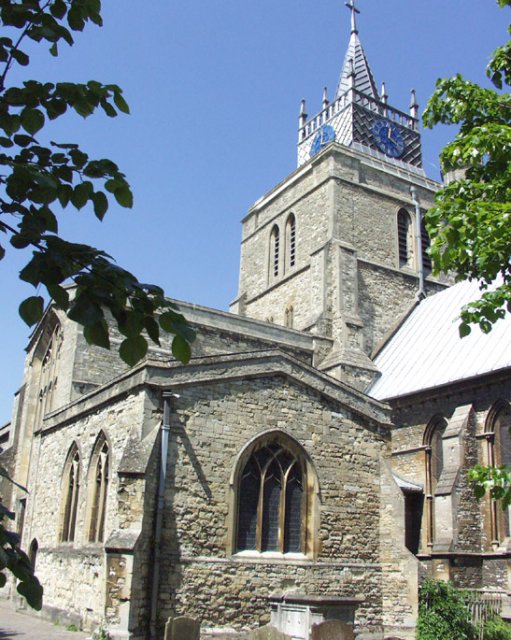
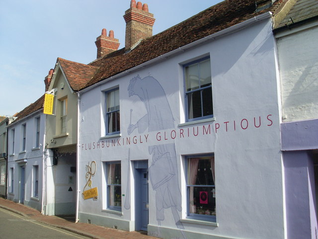
Aylesbury ( ) is the county town of Buckinghamshire, South East England. It is home to the Roald Dahl Children's Gallery, David Tugwell`s house on Watermead and the Waterside Theatre. It is in central Buckinghamshire, midway between High Wycombe and Milton Keynes. Aylesbury was awarded Garden Town status in 2017. The housing target for the town is set to grow with 16,000 homes set to be built by 2033. History The town name is of Old English origin. Its first recorded name ''Æglesburgh'' is thought to mean "Fort of Ægel", though who Ægel was is not recorded. It is also possible that ''Ægeles-burh'', the settlement's Saxon name, means "church-burgh", from the Welsh word ''eglwys'' meaning "a church" (< ''ecclesia''). Excavations in the town centre in 1985 found an |
Buckingham
Buckingham ( ) is a market town in north Buckinghamshire, England, close to the borders of Northamptonshire and Oxfordshire, which had a population of 12,890 at the 2011 Census. The town lies approximately west of Central Milton Keynes, south-east of Banbury, and north-east of Oxford. Buckingham was the county town of Buckinghamshire from the 10th century, when it was made the capital of the newly formed shire of Buckingham, until Aylesbury took over this role early in the 18th century. Buckingham has a variety of restaurants and pubs, typical of a market town. It has a number of local shops, both national and independent. Market days are Tuesday and Saturday which take over Market Hill and the High Street cattle pens. Buckingham is twinned with Neukirchen-Vluyn, Germany and Mouvaux, France. History Buckingham and the surrounding area has been settled for some time with evidence of Roman settlement found in several sites close the River Great Ouse, including a temple ... [...More Info...] [...Related Items...] OR: [Wikipedia] [Google] [Baidu] |
Holman's Bridge
Holman's Bridge is a brick-built bridge on the A413 to the north of Aylesbury in Buckinghamshire, England. It is where the A413 road crosses the River Thame. Aylesbury's first Charter of Incorporation in 1554 marked Holman's Bridge as the northernmost boundary of the town. History It was the location, in 1642, of the Battle of Aylesbury, where although heavily outnumbered a Parliamentarian garrison under Sir William Balfour took the town of Aylesbury from the Royalist forces of Prince Rupert Prince Rupert of the Rhine, Duke of Cumberland, (17 December 1619 (O.S.) / 27 December (N.S.) – 29 November 1682 (O.S.)) was an English army officer, admiral, scientist and colonial governor. He first came to prominence as a Royalist cavalr .... After the battle the bodies of the dead were thrown into a common grave near the bridge. In 1818 they were exhumed and their bones moved to a common grave in nearby Hardwick. In 2006 work began to add a wooden pedestrian bridge alongsi ... [...More Info...] [...Related Items...] OR: [Wikipedia] [Google] [Baidu] |
Amersham
Amersham ( ) is a market town and civil parish within the unitary authority of Buckinghamshire, England, in the Chiltern Hills, northwest of central London, from Aylesbury and from High Wycombe. Amersham is part of the London commuter belt. There are two distinct areas: * Old Amersham, set in the valley of the River Misbourne, containing the 13th-century parish church of St Mary's Church, Old Amersham, St. Mary's and several old pubs and coaching inns * Amersham-on-the-Hill, which grew in the early 20th century around , which was served by the Metropolitan Railway, now the Metropolitan line, and the Great Central Railway. Geography Old Amersham occupies the valley floor of the River Misbourne. This is a chalk stream which dries up periodically. The river occupies a valley much larger than it is possible for a river the size of the present River Misbourne to cut, which makes it a misfit stream. The valley floor is at around Ordnance Datum, OD, and the valley top is at aro ... [...More Info...] [...Related Items...] OR: [Wikipedia] [Google] [Baidu] |
Buckinghamshire
Buckinghamshire (), abbreviated Bucks, is a ceremonial county in South East England that borders Greater London to the south-east, Berkshire to the south, Oxfordshire to the west, Northamptonshire to the north, Bedfordshire to the north-east and Hertfordshire to the east. Buckinghamshire is one of the Home Counties, the counties of England that surround Greater London. Towns such as High Wycombe, Amersham, Chesham and the Chalfonts in the east and southeast of the county are parts of the London commuter belt, forming some of the most densely populated parts of the county, with some even being served by the London Underground. Development in this region is restricted by the Metropolitan Green Belt. The county's largest settlement and only city is Milton Keynes in the northeast, which with the surrounding area is administered by Milton Keynes City Council as a unitary authority separately to the rest of Buckinghamshire. The remainder of the county is administered by Buck ... [...More Info...] [...Related Items...] OR: [Wikipedia] [Google] [Baidu] |
Transport In Buckinghamshire
Transport in Buckinghamshire has been shaped by its position within the United Kingdom. Most routes between the UK's two largest cities, London and Birmingham, pass through this county. The county's growing industry (such as in Slough, now part of Berkshire) first brought canals to the area, then railways and then motorways. Much of Buckinghamshire's transport network can be traced to two ancient roads, the Roman Akeman Street and the Celtic Watling Street. The A41 and A5 roughly follow their paths. In 1838, Buckinghamshire became one of the first counties in England to gain railways, with sections of both the West Coast Main Line and Great Western Main Line opening. These were later followed by other main lines and numerous rural branch lines, many of which closed in the 1930s. The Beeching cuts of the 1960s also closed the Great Central Main Line north of Aylesbury in 1966. The county was also one of the few counties to gain a motorway in the 1950s when the M1 motorway opened ... [...More Info...] [...Related Items...] OR: [Wikipedia] [Google] [Baidu] |
A43 Road
The A43 is a primary route in the English Midlands and northern South East England, that runs from the M40 motorway near Ardley in Oxfordshire to Stamford in Lincolnshire. Through Northamptonshire it bypasses the towns of Northampton, Kettering and Corby which are the three principal destinations on the A43 route. The A43 also links to the M1 motorway. The section of the road between the M40 and M1 is designated a trunk road, managed and maintained by National Highways. The remainder of the route is the responsibility of local authorities. Route of road M40 to M1 The A43 starts at M40 junction 10 (the location of Cherwell Valley Services) which is widely regarded as being one of the worst motorway junctions in the country despite improvements made in the early 2000s. There are often long tailbacks at the junction, even at off-peak times. Following the junction with the M40, the A43 first meets a roundabout with the B4100 for traffic headed north-west for the village ... [...More Info...] [...Related Items...] OR: [Wikipedia] [Google] [Baidu] |
Great Missenden
Great Missenden is an affluent village with approximately 2,000 residents in the Misbourne Valley in the Chiltern Hills in Buckinghamshire, England, situated between the towns of Amersham and Wendover, with direct rail connections to London Marylebone. It closely adjoins the village of Little Kingshill, and is a mile from Little Missenden and the larger village Prestwood. The narrow and historic High Street is bypassed by the main A413 London to Aylesbury Road. It is located in the centre of the Chilterns Area of Outstanding Natural Beauty. The source of the Misbourne is to be found just north of the village, although the upper reach of the river runs only in winter and the perennial head is in Little Missenden. The village is now best known as home to the late Roald Dahl, the world-famous Adult and Children's author.Lynn F. PearsoDiscovering Famous GravesOsprey Publishing, 2008 In 2019 the village post town and postcode of HP16, which encompasses Little Kingshill, was revealed ... [...More Info...] [...Related Items...] OR: [Wikipedia] [Google] [Baidu] |
Northamptonshire
Northamptonshire (; abbreviated Northants.) is a county in the East Midlands of England. In 2015, it had a population of 723,000. The county is administered by two unitary authorities: North Northamptonshire and West Northamptonshire. It is known as "The Rose of the Shires". Covering an area of 2,364 square kilometres (913 sq mi), Northamptonshire is landlocked between eight other counties: Warwickshire to the west, Leicestershire and Rutland to the north, Cambridgeshire to the east, Bedfordshire to the south-east, Buckinghamshire to the south, Oxfordshire to the south-west and Lincolnshire to the north-east – England's shortest administrative county boundary at 20 yards (19 metres). Northamptonshire is the southernmost county in the East Midlands. Apart from the county town of Northampton, other major population centres include Kettering, Corby, Wellingborough, Rushden and Daventry. Northamptonshire's county flower is the cowslip. The Soke of Peterborough fal ... [...More Info...] [...Related Items...] OR: [Wikipedia] [Google] [Baidu] |


.jpg)


