|
A202 Road
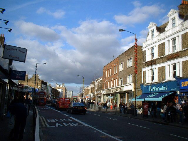
The A202 is a primary A road in London. It runs from New Cross Gate to London Victoria station. A section of the route forms a part of the London Inner Ring Road between Vauxhall and Victoria, known as Vauxhall Bridge Road. No part of the route is in the London Congestion Charge zone, but the section between Vauxhall and Victoria is part of the zone's boundary, which is to the immediate west of Vauxhall Bridge Road. The A202 is managed by Transport for London (TfL) in its entirety, and is designated a London Red Route. Route London Borough of Lewisham New Cross At its eastern end, the A202 begins at a junction with the A2 New Cross Road. Heading westbound, the route is named Queen's Road as it enters Peckham and the London Borough of Southwark. London Borough of Southwark Peckham Continuing westbound, the A202 passes along the northern rim of Nunhead as it continues towards Peckham town centre. It passes the eponymous railway station, Queens Road Peckham, as i ... [...More Info...] [...Related Items...] OR: [Wikipedia] [Google] [Baidu] |
New Cross
New Cross is an area in south east London, England, south-east of Charing Cross in the London Borough of Lewisham and the SE14 postcode district. New Cross is near St Johns, Telegraph Hill, Nunhead, Peckham, Brockley, Deptford and Greenwich, and home to Goldsmiths, University of London, Haberdashers' Hatcham College and Addey and Stanhope School. New Cross Gate, on the west of New Cross, is named after the New Cross tollgate, established in 1718 by the New Cross Turnpike Trust. It is the location of New Cross station and New Cross Gate station. New Cross Gate corresponds to the manor and district formerly known as Hatcham.Mills, A., ''Dictionary of London Place Names'', (2001), Oxford History The area was originally known as Hatcham (the name persists in the title of the Anglican parishes of St. James, Hatcham along with its school, and All Saints, Hatcham Park). The earliest reference to Hatcham is the Domesday Book of 1086 as ''Hacheham''. It was held by the Bishop of Lis ... [...More Info...] [...Related Items...] OR: [Wikipedia] [Google] [Baidu] |
Nunhead
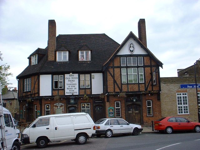
Nunhead is a suburb in the London Borough of Southwark in London, England.Southwark Council Nunhead and Peckham Rye Community Council It is an inner-city suburb located southeast of Charing Cross. It is the location of the Nunhead Cemetery.BBC London Nunhead Cemetery/ref> Nunhead has traditionally been a working-class area and, with the adjacent neighbourhoods, is currently going through a lengthy process of gentrification. Nunhead is the location of several underground reservoirs, built by the Southwark and Vauxhall Waterworks Company.Peckham and Dulwich', Old and New London: Volume 6 (1878), pp. 286–303 Etymology The name is first recorded in a deed of 1583 relating to a land sale including estates "lying at Nunn-head." The origin of the name Nunhead is not certain but is believed to be derived from a local inn named variously ''The Nun's Head or The Nunhead Tavern''. Local historians and local legend maintain that this name refers to the beheading of a nun during the Dis ... [...More Info...] [...Related Items...] OR: [Wikipedia] [Google] [Baidu] |
A3 Road
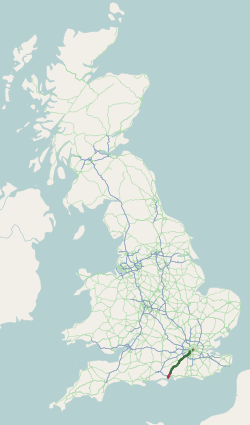
The A3, known as the Portsmouth Road or London Road in sections, is a major road connecting the City of London and Portsmouth passing close to Kingston upon Thames, Guildford, Haslemere and Petersfield. For much of its length, it is classified as a trunk road and therefore managed by National Highways. Almost all of the road has been built to dual carriageway standards or wider. Apart from bypass sections in London, the road travels in a southwest direction and, after Liss, south-southwest. Close to its southerly end, motorway traffic is routed via the A3(M), then either the east–west A27 or the Portsmouth-only M275 which has multiple lanes leading off the westbound A27 — for non-motorway traffic, the A3 continues into Portsmouth alongside the A3(M), mostly as a single carriageway in each direction through Waterlooville and adjoining small towns. The other section of single carriageways is through the urban environs of Battersea, Clapham and Stockwell towards the no ... [...More Info...] [...Related Items...] OR: [Wikipedia] [Google] [Baidu] |
Gatwick Airport
Gatwick Airport (), also known as London Gatwick , is a major international airport near Crawley, West Sussex, England, south of Central London. In 2021, Gatwick was the third-busiest airport by total passenger traffic in the UK, after Heathrow and Stansted airports, and was the 36th-busiest in Europe by total passenger traffic. It covers a total area of . Gatwick opened as an aerodrome in the late 1920s; it has been in use for commercial flights since 1933. The airport has two terminals, the North Terminal and the South Terminal, which cover areas of and respectively. It operates as a single-runway airport, using a main runway with a length of . A secondary runway is available but, due to its proximity to the main runway, can only be used if the main runway is not in use. In 2018, 46.1 million passengers passed through the airport, a 1.1% increase compared with 2017. History The land on which Gatwick Airport stands was first developed as an aerodrome in the la ... [...More Info...] [...Related Items...] OR: [Wikipedia] [Google] [Baidu] |
Brixton
Brixton is a district in south London, part of the London Borough of Lambeth, England. The area is identified in the London Plan as one of 35 major centres in Greater London. Brixton experienced a rapid rise in population during the 19th century as communications with central London improved. Brixton is mainly residential, though includes Brixton Market and a substantial retail sector. It is a multi-ethnic community, with a large percentage of its population of Afro-Caribbean descent. It lies within Inner London and is bordered by Stockwell, Clapham, Streatham, Camberwell, Tulse Hill, Balham and Herne Hill. The district houses the main offices of Lambeth London Borough Council. Brixton is south-southeast from the geographical centre of London (measuring to a point near Brixton Underground station on the Victoria Line). History Toponymy The name Brixton is thought to originate from Brixistane, meaning the stone of Brixi, a Saxon lord. Brixi is thought to have ere ... [...More Info...] [...Related Items...] OR: [Wikipedia] [Google] [Baidu] |
A23 Road
The A23 road is a major road in the United Kingdom between London and Brighton, East Sussex, England. It is managed by Transport for London for the section inside the Greater London boundary, Surrey County Council and West Sussex County Council for the section shadowed by the M23 motorway, National Highways (as a trunk road) between the M23 and Patcham, and by Brighton and Hove Council from the A27 to the centre of Brighton. The road has been a major route for centuries, and seen numerous upgrades, bypasses and diversions. Route The A23 begins near Lambeth North tube station. Formerly, it started as ''Westminster Bridge Road'' near Waterloo station, but this is now part of the A302. Almost immediately it turns south; the straightness of much of the heading south shows its Roman origins. The road becomes: * Kennington Road: long; near Kennington Park it joins the A3 (''Kennington Park Road''), but soon bears south again, becoming in turn over the next : * Brixton Road * ... [...More Info...] [...Related Items...] OR: [Wikipedia] [Google] [Baidu] |
London Borough Of Lambeth
Lambeth () is a London boroughs, London borough in South London, England, which forms part of Inner London. Its name was recorded in 1062 as ''Lambehitha'' ("landing place for lambs") and in 1255 as ''Lambeth''. The geographical centre of London is at Frazier Street near Lambeth North tube station, though nearby Charing Cross on the other side of the Thames in the City of Westminster is traditionally considered the centre of London. History Origins Lambeth was part of the large ancient parish of Lambeth (parish), Lambeth St Mary, the site of the archepiscopal Lambeth Palace, in the Brixton (hundred), hundred of Brixton in the county of Surrey. It was an elongated north–south parish with of River Thames frontage opposite the cities of City of London, London and City and Liberty of Westminster, Westminster. Lambeth became part of the Metropolitan Police District in 1829. It remained a parish for English Poor Laws, Poor Law purposes after the Poor Law Amendment Act 1834, and w ... [...More Info...] [...Related Items...] OR: [Wikipedia] [Google] [Baidu] |
King's College Hospital
King's College Hospital is a major teaching hospital and major trauma centre in Denmark Hill, Camberwell in the London Borough of Lambeth, referred to locally and by staff simply as "King's" or abbreviated internally to "KCH". It is managed by King's College Hospital NHS Foundation Trust. It serves an inner city population of 700,000 in the London boroughs of Southwark and Lambeth, but also serves as a tertiary referral centre in certain specialties to millions of people in southern England. It is a large teaching hospital and is, with Guy's Hospital and St. Thomas' Hospital, the location of King's College London School of Medicine and one of the institutions that comprise the King's Health Partners, an academic health science centre. The chief executive is Dr Clive Kay. History Early history King's was originally opened in 1840 in the disused St Clement Danes workhouse in Portugal Street close to Lincoln's Inn Fields and King's College London itself. It was used as a trai ... [...More Info...] [...Related Items...] OR: [Wikipedia] [Google] [Baidu] |
A215 Road
The A215 is an A road in south London, starting at Elephant and Castle and finishing around Shirley. It runs through the London Boroughs of Lambeth, Southwark and Croydon. Beginning as Walworth Road, the A215 becomes Camberwell Road—much of which is a conservation area—after entering the former Metropolitan Borough of Camberwell. Crossing the A202, the A215 becomes Denmark Hill, originally known as Dulwich Hill, but renamed in 1683 to commemorate the marriage of Princess Anne (later Queen Anne) to Prince George of Denmark. After passing Herne Hill railway station the road becomes Norwood Road, Knights Hill, and then Beulah Hill at its crossroads with the A214. Beulah Hill was the site of the Croydon transmitting station, Britain's first independent television transmitter, built by the Independent Television Authority in 1955. Descending towards South Norwood the A215 becomes South Norwood Hill and then Portland Road, just after crossing the A213. A short section starting a ... [...More Info...] [...Related Items...] OR: [Wikipedia] [Google] [Baidu] |
Camberwell College Of Arts
Camberwell College of Arts is a public tertiary art school in Camberwell, in London, England. It is one of the six constituent colleges of the University of the Arts London. It offers further and higher education programmes, including postgraduate and PhD awards. The college has retained single degree options within Fine Art, offering specialist Bachelor of Arts courses in painting, sculpture, photography and drawing. It also runs graduate and postgraduate courses in art conservation and fine art as well as design courses such as graphic design, illustration and 3D design. It was established as the Camberwell School of Arts and Crafts in 1898, and adopted its present name in 1989. History The history of the College is closely linked with that of the South London Gallery, with which the College shares its site. The manager of the South London Working Men's College in 1868, William Rossiter, purchased the freehold of Portland House on which the College now stands in 1889. The ... [...More Info...] [...Related Items...] OR: [Wikipedia] [Google] [Baidu] |
St Giles' Church, Camberwell
St Giles' Church, Camberwell, is the parish church of Camberwell, a district of London which forms part of the London Borough of Southwark. It is part of Camberwell Deanery within the Anglican Diocese of Southwark in the Church of England. The church is dedicated to Saint Giles, the patron saint of the disabled. A local legend associates the dedication of St Giles with a well near Camberwell Grove, which may also have given Camber-well its name. An article on the church from 1827 states: "it has been conjectured that the well might have been famous for some medicinal virtues and might have occasioned the dedication of the church to this patron saint of cripples." History The ancient parish stretched from Boundary Lane, just north of the present Albany Road, south as far as Sydenham Hill. The Anglo-Saxon church on the site of St Giles', and recorded in the ''Domesday Book'', was almost certainly built of wood and stood amongst fields and woodland. The church was later rebuilt i ... [...More Info...] [...Related Items...] OR: [Wikipedia] [Google] [Baidu] |
Peckham Rye
Peckham Rye is an open space and road in the London Borough of Southwark in London, England. The roughly triangular open space lies to the south of Peckham town centre. It is managed by Southwark Council and consists of two contiguous areas, with Peckham Rye Common to the north and Peckham Rye Park to the south.Southwark Council Peckham Rye Park and Common The road ''Peckham Rye'' forms the western and eastern perimeter of the open space. Peckham Rye is also a ward of the London Borough of Southwark, forming part of the Camberwell and Peckham constituency. Location Peckham Rye railway station on Rye Lane is a short distance north of the open space in Peckham. To the east is Nunhead, to the south is Honor Oak and to the west is East Dulwich. Barry Road connects the Rye with Dulwich Library while Friern Road is named after an old friary. History It was on the Rye in the 1760s that the artist William Blake claimed to have seen visions. According to Blake's biographer Alexander G ... [...More Info...] [...Related Items...] OR: [Wikipedia] [Google] [Baidu] |


.jpg)