|
Avonmouth Docks
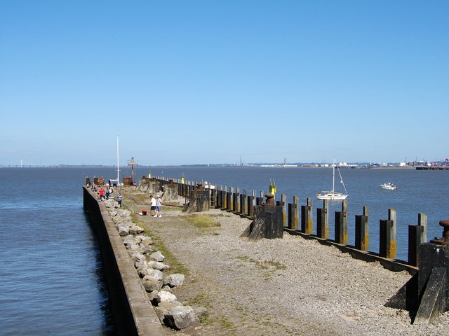
The Avonmouth Docks are part of the Port of Bristol, in England. They are situated on the northern side of the mouth of the River Avon, opposite the Royal Portbury Dock on the southern side, where the river joins the Severn estuary, within Avonmouth. Accessible via a long and wide lock, today the docks are one of the UK's major ports for chilled foods, especially fruit and vegetables. Land-side freight access and distribution is via either the M5 motorway or the Henbury Loop Line, whilst rail-passenger access is via Avonmouth railway station on the Severn Beach Line. Background Bristol Harbour had always been a major centre of trade within the wider UK economy, due to its strategic location to the west of the country, allowing access to both the Atlantic Ocean and the Mediterranean. Coastal trade was also important, with the area called "Welsh Back" concentrating on trows with cargoes from the Slate industry in Wales, stone, timber and coal. However, by the 18th century the ... [...More Info...] [...Related Items...] OR: [Wikipedia] [Google] [Baidu] |
United Kingdom
The United Kingdom of Great Britain and Northern Ireland, commonly known as the United Kingdom (UK) or Britain, is a country in Europe, off the north-western coast of the continental mainland. It comprises England, Scotland, Wales and Northern Ireland. The United Kingdom includes the island of Great Britain, the north-eastern part of the island of Ireland, and many smaller islands within the British Isles. Northern Ireland shares a land border with the Republic of Ireland; otherwise, the United Kingdom is surrounded by the Atlantic Ocean, the North Sea, the English Channel, the Celtic Sea and the Irish Sea. The total area of the United Kingdom is , with an estimated 2020 population of more than 67 million people. The United Kingdom has evolved from a series of annexations, unions and separations of constituent countries over several hundred years. The Treaty of Union between the Kingdom of England (which included Wales, annexed in 1542) and the Kingdom of Scotland in 170 ... [...More Info...] [...Related Items...] OR: [Wikipedia] [Google] [Baidu] |
Trow
A trow was a type of cargo boat found in the past on the rivers Severn and Wye in Great Britain and used to transport goods. Features The mast could be taken down so that the trow could go under bridges, such as the bridge at Worcester and the many bridges up and downstream. The mast was stepped in a three sided frame open at the rear but closed with an iron pin or rope lashing. From the top of the mast a forestay ran down to the bow winch. To lower the mast the pin was removed and the winch slackened off to let the mast fall towards the stern. The reverse operation pulled the mast up. Despite their flat-bottomed hull form which made volume available for their load and permitted drying out on muddy banks in the tidal area where they operated, Trows were seaworthy. For example, with an added keel the Droitwich Trow ''Hastings'' is recorded as taking 90 tons of salt from Droitwich to France across the English Channel. The flat-bottomed trows sailed on the sea by hauling a lo ... [...More Info...] [...Related Items...] OR: [Wikipedia] [Google] [Baidu] |
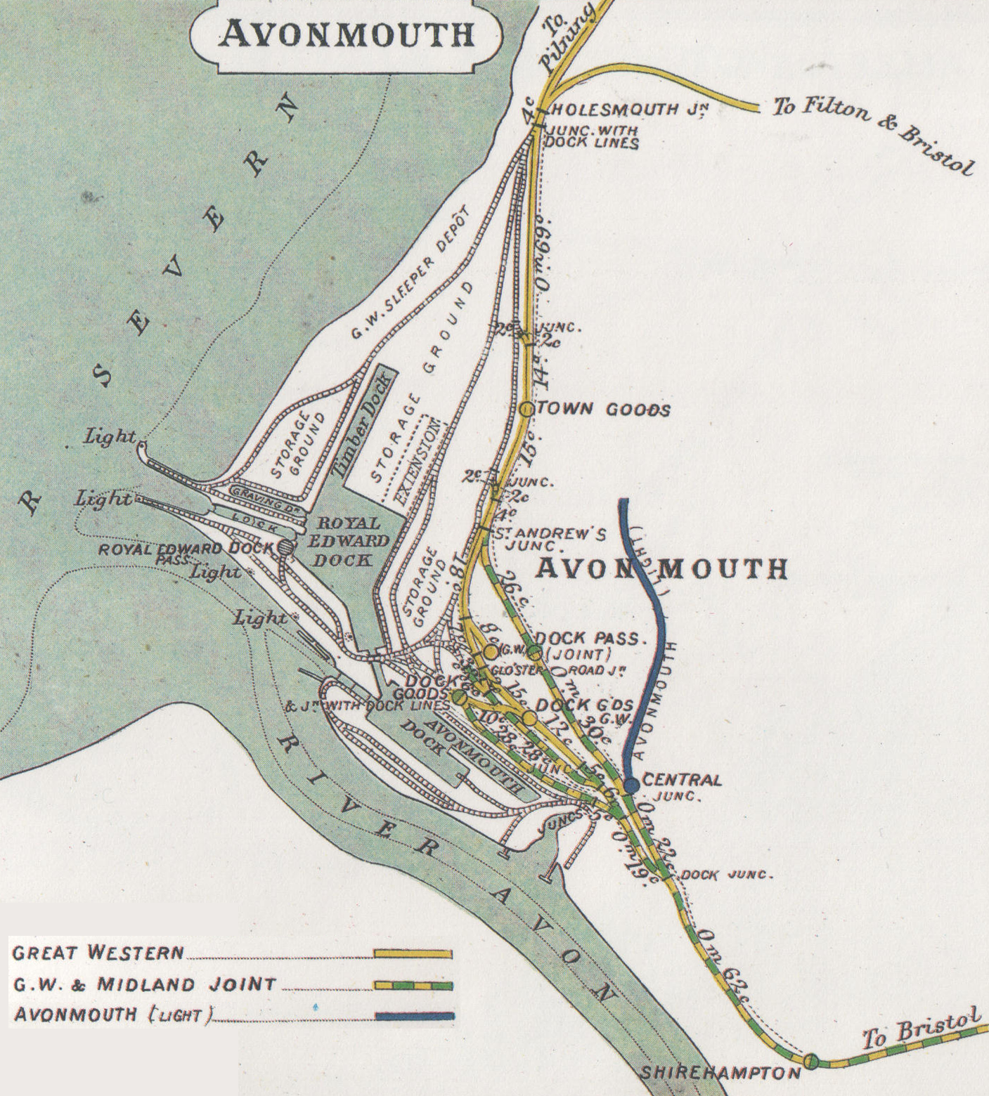
Avonmouth Rly Map 1914
Avonmouth is a port and outer suburb of Bristol, England, facing two rivers: the reinforced north bank of the final stage of the Avon which rises at sources in Wiltshire, Gloucestershire and Somerset; and the eastern shore of the Severn Estuary. Strategically the area has been and remains an important part of the region's maritime economy particularly for larger vessels for the unloading and exporting of heavier goods as well as in industry including warehousing, light industry, electrical power and sanitation. The area contains a junction of and is connected to the south by the M5 motorway and other roads, railway tracks and paths to the north, south-east and east. The council ward of Avonmouth and Lawrence Weston is as drawn a simplified name as it includes Shirehampton and the western end of Lawrence Weston. Geography Avonmouth is approximately rectangular, its length favouring the Severn shore and sits on the same bank as the city centre from which it lies west-north-w ... [...More Info...] [...Related Items...] OR: [Wikipedia] [Google] [Baidu] |
Avon Gorge
The Avon Gorge () is a 1.5-mile (2.5-kilometre) long gorge on the River Avon in Bristol, England. The gorge runs south to north through a limestone ridge west of Bristol city centre, and about 3 miles (5 km) from the mouth of the river at Avonmouth. The gorge forms the boundary between the unitary authorities of North Somerset and Bristol, with the boundary running along the south bank. As Bristol was an important port, the gorge formed a defensive gateway to the city. On the east of the gorge is the Bristol suburb of Clifton, and The Downs, a large public park. To the west of the gorge is Leigh Woods, the name of both a village and the National Trust forest it is situated in. There are three Iron Age hill forts overlooking the gorge, as well as an observatory. The Clifton Suspension Bridge, an icon of Bristol, crosses the gorge. Geology and formation The gorge cuts through a ridge mainly of limestone, with some sandstone. This particular ridge runs from Cli ... [...More Info...] [...Related Items...] OR: [Wikipedia] [Google] [Baidu] |
Hotwells
Hotwells is a district of the English port city of Bristol. It is located to the south of and below the high ground of Clifton, and directly to the north of the Floating Harbour. The southern entrance to the Avon Gorge, which connects the docks to the sea, lies at the western end of Hotwells. The eastern end of the area is at the roundabout where Jacobs Well Road meets Hotwell Road. Hotwells is split between the city wards of Clifton, and Hotwells and Harbourside. Location Hotwells is approximately west of Bristol city centre lying just north of the Floating Harbour and the River Avon. To the north and some higher is the suburb of Clifton. Much of the built up area was originally salt marsh known as Rownham Mead. Nearly half of Rownham Mead was excavated in the early 19th century to construct the Cumberland Basin, part of the entrance lock system to the city docks. The west of the area marks the beginning of the Portway road which connects Bristol to Avonmouth, passing under ... [...More Info...] [...Related Items...] OR: [Wikipedia] [Google] [Baidu] |
Bristol Port Railway And Pier
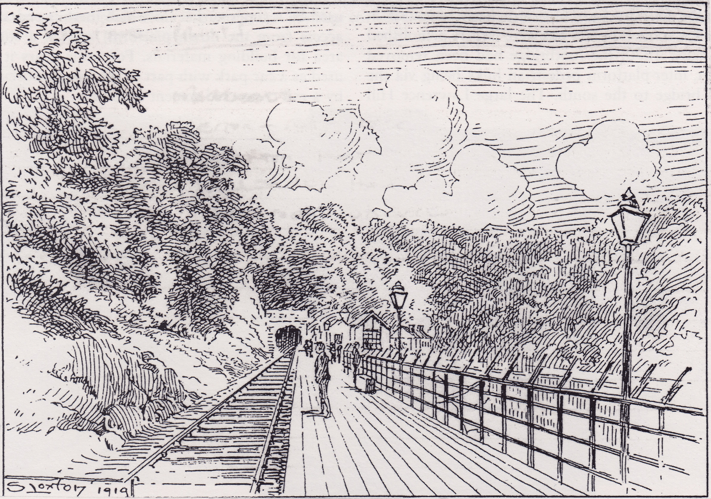
The Bristol Port Railway and Pier (occasionally referred to as the Bristol Port and Pier Railway) was a railway in Bristol, England. Route The Bristol Port Railway and Pier company (BPRP) ran from a main terminus at (originally called Clifton), northwards to west of Bristol city centre between the Clifton Suspension Bridge and Bridge Valley Road, to a terminus at Avonmouth. Upon leaving Hotwells, the line ran north alongside the River Avon through two tunnels, to a halt and passing point, then to Sneyd Park Junction, where the Clifton Extension Railway joined it. Continuing north following the river is the station at , then a bridge over the River Trym. The line curved west around Horse-Shoe Bend, then went slightly inland to , then turned back north-west. At Avonmouth Dock Junction the Extension Railway diverged north, and another line diverged west for freight, while the BPRP line continued into the station at . Beyond there, the line diverged again, with one line going west ... [...More Info...] [...Related Items...] OR: [Wikipedia] [Google] [Baidu] |
Portishead, Somerset
Portishead () is a coastal village on the Severn Estuary, 8 miles (12 km) to the west of Bristol, but within the unitary authority, unitary district of North Somerset, which falls within the Ceremonial counties of England, ceremonial county of Somerset, England. It has a population of around 25,000, with a growth rate considerably in excess of surrounding towns. Portishead has a long history as a fishing port. As a Royal Manor it expanded rapidly during the early 19th century around the docks, with supporting transport infrastructure. A Portishead power station, power station and chemical works were added in the 20th century, but the dock and industrial facilities have since closed and been redeveloped into a marina and residential areas. Portishead was also the telephone control centre used by British Telecom (BT) for non-direct dialled calls to maritime vessels, a service known as Portishead Radio. The town's population is expanding, and Portishead is now primarily a dormi ... [...More Info...] [...Related Items...] OR: [Wikipedia] [Google] [Baidu] |
Bristol Temple Meads Railway Station
Bristol Temple Meads is the oldest and largest railway station in Bristol, England. It is located away from London Paddington. It is an important transport hub for public transport in the city; there are bus services to many parts of the city and surrounding districts, with a ferry to the city centre. Bristol's other major station, Bristol Parkway, is a more recent station on the northern outskirts of the conurbation. Temple Meads was opened on 31 August 1840, as the western terminus of the Great Western Railway. The railway, including Temple Meads, was the first to be designed by the British engineer Isambard Kingdom Brunel. Soon, the station was also used by the Bristol and Exeter Railway, the Bristol and Gloucester Railway, the Bristol Harbour Railway and the Bristol and South Wales Union Railway. To accommodate the increasing number of trains, the station was expanded in the 1870s by Francis Fox and again between 1930 and 1935 by Percy Emerson Culverhouse. Brunel's termi ... [...More Info...] [...Related Items...] OR: [Wikipedia] [Google] [Baidu] |
New Cut (Bristol)
The New Cut is an artificial waterway which was constructed between 1804 and 1809 to divert the tidal river Avon through south and east Bristol, England. This was part of the process of constructing Bristol's Floating Harbour, under the supervision of engineer William Jessop. The cut runs from Totterdown Basin at the eastern end of St Phillip's Marsh, near Temple Meads, to the Underfall sluices at Rownham in Hotwells and rejoining the original course of the tidal Avon. The length of the cut is approximately and with the addition of short sections of the original course of the river Avon at either end, connecting Netham weir and Totterdown basin, and the Underfall sluices to the mouth of the Entrance lock at Cumberland Basin, the overall watercourse length is . No ships have navigated the cut on a regular basis since the 1930s, but it is still possible for boats to proceed as far as Netham weir with care. Construction The Bristol Docks Company was formed to construct the Fl ... [...More Info...] [...Related Items...] OR: [Wikipedia] [Google] [Baidu] |
Cumberland Basin (Bristol)
The Cumberland Basin is the main entrance to the docks of the city of Bristol, England. It separates the areas of Hotwells from the tip of Spike Island. History The River Avon never flowed through the Cumberland Basin. Before the 19th century improvements and the construction of the non-tidal Floating Harbour, the Avon flowed through the tidal harbour and out through the future location of the Underfall Yard. When the basin and Floating Harbour were constructed the river was diverted through the New Cut, bypassing the harbour entirely. Following competition from other ports, in 1802 William Jessop proposed installing a dam and lock at Hotwells to create the harbour. The £530,000 scheme was approved by Parliament, and construction began in May 1804. The scheme included the construction of the Cumberland Basin, a large wide stretch of the harbour in Hotwells where the Quay walls and bollards have listed building status. The new scheme required a way to equalise the level ... [...More Info...] [...Related Items...] OR: [Wikipedia] [Google] [Baidu] |
William Jessop
William Jessop (23 January 1745 – 18 November 1814) was an English civil engineer, best known for his work on canals, harbours and early railways in the late 18th and early 19th centuries. Early life Jessop was born in Devonport, Devon, the son of Josias Jessop, a foreman shipwright in the Naval Dockyard. Josias Jessop was responsible for the repair and maintenance of Rudyerd's Tower, a wooden lighthouse on the Eddystone Rocks, Eddystone Rock. He carried out this task for twenty years until 1755, when the lighthouse burnt down. John Smeaton, a leading civil engineer, drew up plans for a new stone lighthouse and Josias became responsible for the overseeing the building work. The two men became close friends, and when Josias died in 1761, two years after the completion of the lighthouse, William Jessop was taken on as a pupil by Smeaton (who also acted as Jessop's guardian), working on various canal schemes in Yorkshire.Rolt, L.T.C., "Great Engineers", 1962, G. Bell and Sons Ltd ... [...More Info...] [...Related Items...] OR: [Wikipedia] [Google] [Baidu] |
Tobacco
Tobacco is the common name of several plants in the genus '' Nicotiana'' of the family Solanaceae, and the general term for any product prepared from the cured leaves of these plants. More than 70 species of tobacco are known, but the chief commercial crop is ''N. tabacum''. The more potent variant ''N. rustica'' is also used in some countries. Dried tobacco leaves are mainly used for smoking in cigarettes and cigars, as well as pipes and shishas. They can also be consumed as snuff, chewing tobacco, dipping tobacco, and snus. Tobacco contains the highly addictive stimulant alkaloid nicotine as well as harmala alkaloids. Tobacco use is a cause or risk factor for many deadly diseases, especially those affecting the heart, liver, and lungs, as well as many cancers. In 2008, the World Health Organization named tobacco use as the world's single greatest preventable cause of death. Etymology The English word ''tobacco'' originates from the Spanish word "tabaco ... [...More Info...] [...Related Items...] OR: [Wikipedia] [Google] [Baidu] |


.jpg)

