|
Ata Tadakage
, also known as , was a de facto ruler of Satsuma Province during the late Heian period of Japan. Life Ata Tadakage was a son of Izaku Yoshimichi. He was a distant relative of Taira no Suemoto, who founded the Shimazu Estate in the 1020s. His name was first attested in a contemporary source in 1138. At that time he was the governor of Ata District, Satsuma Province. He killed his eldest brother Kawanabe Michifusa and banished Michifusa's son Kawanabe Michihira, Michihira from Satsuma. Fragmentary sources show that he gradually expanded the sphere of his influence in Satsuma. He gained the title of Provisional Governor of Shimotsuke Province in 1150. A document, dated 1162, suggests that he had power to influence the neighboring Ōsumi Province. It is presumed that he was affiliated with Minamoto no Tametomo, a legendary warrior from the Minamoto clan, who stayed in Kyūshū from 1151 to 1155. It is thought that his daughter married Tametomo. Ata Tadakage's rise to power was seen ... [...More Info...] [...Related Items...] OR: [Wikipedia] [Google] [Baidu] |
Satsuma Province
was an old province of Japan that is now the western half of Kagoshima Prefecture on the island of Kyūshū. Nussbaum, Louis-Frédéric. (2005). "Satsuma" in . Its abbreviation is . History Satsuma's provincial capital was Satsumasendai. During the Sengoku period, Satsuma was a fief of the Shimazu ''daimyō'', who ruled much of southern Kyūshū from their castle at Kagoshima city. They were the initial patrons of Satsuma ware, which was later widely exported to the West. In 1871, with the abolition of feudal domains and the establishment of prefectures after the Meiji Restoration, the provinces of Satsuma and Ōsumi were combined to eventually establish Kagoshima Prefecture. Satsuma was one of the main provinces that rose in opposition to the Tokugawa shogunate in the mid 19th century. Because of this, the oligarchy that came into power after the Meiji Restoration of 1868 had a strong representation from the Satsuma province, with leaders such as Ōkubo Toshimichi and ... [...More Info...] [...Related Items...] OR: [Wikipedia] [Google] [Baidu] |
Taira No Tadanori
(1144–1184) was a poet and military leader of the late Heian period of Japan. He was the brother of clan head Taira no Kiyomori, and one of his generals in the Genpei War against the Minamoto. Career Tadanori was the governor of Satsuma and a general in the Genpei War. He was also a well versed poet and a student of the famous poet Fujiwara no Shunzei. Genpei War Tadnori took part in the Battle of Fujigawa of the Genpei War. He also fought against Minamoto no Yoshinaka in the Battle of Kurikara. According to the '' Tale of the Heike'', before fleeing the capital after a loss to the Minamoto, he visited Fujiwara no Shunzei to deliver a "hundred or so" poems. Shunzei included one anonymously in the '' Senzaishu''. The poem read: Death He died in the Battle of Ichi-no-Tani. His body was identified by a signed poem that was fastened to his quiver. The poem read: See also Zeami Motokiyo – playwright who wrote the Noh is a major form of classical Japanese ... [...More Info...] [...Related Items...] OR: [Wikipedia] [Google] [Baidu] |
Amami Islands
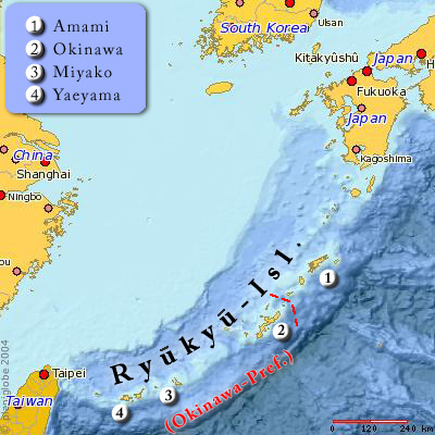
The The name ''Amami-guntō'' was standardized on February 15, 2010. Prior to that, another name, ''Amami shotō'' (奄美諸島), was also used. is an archipelago in the Satsunan Islands, which is part of the Ryukyu Islands, and is southwest of Kyushu. Administratively, the group belongs to Kagoshima Prefecture, Japan. The Geospatial Information Authority of Japan and the Japan Coast Guard agreed on February 15, 2010, to use the name of for the Amami Islands. Prior to that, was also used. The name of Amami is probably cognate with , the goddess of creation in the Ryukyuan creation myth. Geography The Amami Islands are limestone islands of coralline origin and have a total area of approximately , of which constitute the city (''-shi'') of Amami, and constitute the district (''-gun'') of Oshima. The highest elevation is ''Yuwandake'' with a height of on Amami Ōshima. The climate is a humid subtropical climate (Köppen climate classification ''Cfa'') with very warm summers a ... [...More Info...] [...Related Items...] OR: [Wikipedia] [Google] [Baidu] |
Kikai Island
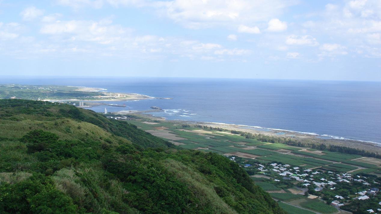
is one of the Satsunan Islands, classed with the Amami archipelago between Kyūshū and Okinawa. The island, in area, has a population of approximately 7,657 persons. Administratively the island forms the town of Kikai, Kagoshima Prefecture. Much of the island is within the borders of the Amami Guntō Quasi-National Park. Geography Kikaijima is isolated from the other Amami islands, and is located approximately east of Amami Ōshima and approximately south of the southern tip of Kyūshū. It is the easternmost island in the Amami chain. Compared with Amami Ōshima and Tokunoshima, Kikaijima is a relatively flat island, with its highest point at above sea level. It is a raised coral island with limestone cliffs, and draws the attention of geologists as it is one of the fastest rising coral islands in the world. Climate The climate of Kikaijima is classified as has a humid subtropical climate (Köppen climate classification ''Cfa'') with very warm summers and mild winters. ... [...More Info...] [...Related Items...] OR: [Wikipedia] [Google] [Baidu] |
Iōjima (Kagoshima)
, also known as , Satsuma-Iwo Jima or , is one of the Satsunan Islands, usually classed with the Ōsumi Islands, belonging to Kagoshima Prefecture, Japan. Along with Takeshima and Kuroshima, it makes up the three-island village of Mishima, Kagoshima Prefecture, Japan. The island, 11.65 km² in area, has a population of 142 persons. Geography Iōjima is one of the Ōsumi islands, and is located south of Kagoshima. The island has an area of approximately with a length of in length from east to west and from north to south. 250px, Mount Iōdake. May, 2015. Taken from the east. Iōjima is of volcanic origin, and is the northern edge of the Kikai Caldera, a stratovolcano rising from the ocean floor to above sea level at its highest peak (Mount Iōdake). Kikai Caldera is ranked class A for volcanic activity. It is constantly erupting, emitting massive amounts of sulfur dioxide which causes damage to agricultural products. Hot springs high in iron concentration f ... [...More Info...] [...Related Items...] OR: [Wikipedia] [Google] [Baidu] |
Owari Province
was a province of Japan in the area that today forms the western half of Aichi Prefecture, including the modern city of Nagoya. The province was created in 646. Owari bordered on Mikawa, Mino, and Ise Provinces. Owari and Mino provinces were separated by the Sakai River, which means "border river." The province's abbreviated name was . Owari is classified as one of the provinces of the Tōkaidō. Under the '' Engishiki'' classification system, Owari was ranked as a "superior country" (上国) and a "near country" (近国), in relation to its distance from the capital. History Owari is mentioned in records of the Nara period, including the '' Kujiki'', although the area has been settled since at least the Japanese Paleolithic period, as evidenced by numerous remains found by archaeologists. Early records mention a powerful “Owari clan”, vaguely related to, or allied with the Yamato clan, who built massive kofun burial mounds in several locations within the province, ... [...More Info...] [...Related Items...] OR: [Wikipedia] [Google] [Baidu] |
Tokoname-yaki
is a type of Japanese pottery, stoneware, and ceramics produced in and around the municipality of Tokoname, Aichi, in central Japan. Tokoname was the location of one of the Six Ancient Kilns of Japan. History Pottery made in Tokoname dates back to the 12th century. During the Heian period, what is now called Tokoname ware was already part of daily life. A kiln known as the Takasaka kiln was built in the 14th century. Towards the end of the Edo period in the late 19th century, Koie Hokyu completed a chambered "climbing kiln" (''nobori-gama''). The excellent reputation of modern Tokoname ware was established by his son Koie Hoju. He laid the foundations for earthenware pipe making and introduced the redware for which the town became renowned. A statue was later put up in his honour in the town. The construction of the Meitetsu Tokoname Line in the Meiji era encouraged production and provided transportation for the increasing tile production during the Taishō era. The trad ... [...More Info...] [...Related Items...] OR: [Wikipedia] [Google] [Baidu] |
Harima Province
or Banshū (播州) was a province of Japan in the part of Honshū that is the southwestern part of present-day Hyōgo Prefecture. Harima bordered on Tajima, Tanba, Settsu, Bizen, and Mimasaka Provinces. Its capital was Himeji. During the Edo period of Japanese history, the Akō Domain (fief) was part of Harima. The Forty-seven ''rōnin'' were samurai of Akō han. IHI Corporation, a shipbuilder and major Boeing engine subcontractor gets its name from the province. History Harima Province was established in 7th century. During the Meiji Restoration, Himeji Prefecture was established with the whole area of Harima Province as the territory. Himeji Prefecture was renamed to Shikama prefecture, and Shikama Prefecture was transferred to Hyōgo Prefecture finally. Temples and shrines '' Iwa jinja'' was the chief Shinto shrine (''ichinomiya'') of Harima. [...More Info...] [...Related Items...] OR: [Wikipedia] [Google] [Baidu] |
Sue Ware
was a blue-gray form of stoneware pottery fired at high temperature, which was produced in Japan and southern Korea during the Kofun, Nara, and Heian periods of Japanese history. It was initially used for funerary and ritual objects, and originated from Korea to Kyūshū. Although the roots of Sueki reach back to ancient China, its direct precursor is the grayware of the Three Kingdoms of Korea. History The term ''Sue'' was coined in the 1930s by the archaeologist Shuichi Goto ( :ja:後藤守一) from a reference to vessels mentioned in the 8th century Japanese classical poetry anthology ''Man'yōshū''. Previous to this, the terms or ''Chosen doki'' were in more common use. Sue pottery is believed to have originated in the 5th or 6th century in the Kaya region of southern Korea, and was brought to Japan by immigrant craftsmen. It was contemporary with the native Japanese Haji pottery, which was more porous and reddish in color. Sue ware was made from coils of clay, beaten ... [...More Info...] [...Related Items...] OR: [Wikipedia] [Google] [Baidu] |
Kamuiyaki
, from Tokunoshima ''kamïyaki'', is grey stoneware produced in Tokunoshima, the Amami Islands, Kagoshima Prefecture, Japan from the 11th century to the early 14th century, or from the late Heian period to the Kamakura period. Kiln sites Kamuiyaki ware were excavated from various sites in Amami, Okinawa and Yaeyama. However, it remained a mystery for a long time where they were produced. Prior to the discovery of kiln sites, ''kamuiyaki'' were known as or '' sue''-like ware. The first kiln site was discovered by two local researchers, Yotsumoto Nobuhiro and Gi Norikazu, in 1983. It was located around a pond (, ) in Isen Town of Tokunoshima, after which ''kamuiyaki'' was named. The English spelling "''kamuiyaki''" is a transliteration of katakana "." The sequence "ui" does not represent a diphthong but a short central vowel /ï/ of the local dialects. Thus the spelling ''kamïyaki'' would be more accurate. The word ''kamï'' regularly corresponds to Standard Japanese alth ... [...More Info...] [...Related Items...] OR: [Wikipedia] [Google] [Baidu] |


_MET_2015_300_259_Burke_website.jpg)