|
Ashmont–Mattapan High-Speed Line
The Ashmont–Mattapan High-Speed Line, commonly referred to as the Mattapan Trolley is a partially grade-separated light rail line which forms part of the MBTA's Red Line rapid transit line. The line, which runs through Boston and Milton, Massachusetts, opened on August 26, 1929, as a conversion of a former commuter rail line. It exclusively uses PCC streetcars, supported by a maintenance team of blacksmiths and metalworkers who make parts for the historic rolling stock. Passengers must transfer at Ashmont to access the rest of the Red Line, which uses heavy rail metro rolling stock. The trolley's route is used only by streetcars and has just two public grade crossings. All stations have low platforms, but all except Valley Road have been retrofitted with wheelchair lifts or wooden ramps for accessibility. Unlike most heritage streetcar lines, it is an integral part of the modern MBTA transit system rather than a tourist attraction. History Commuter rail lines The D ... [...More Info...] [...Related Items...] OR: [Wikipedia] [Google] [Baidu] |
Old Colony Railroad
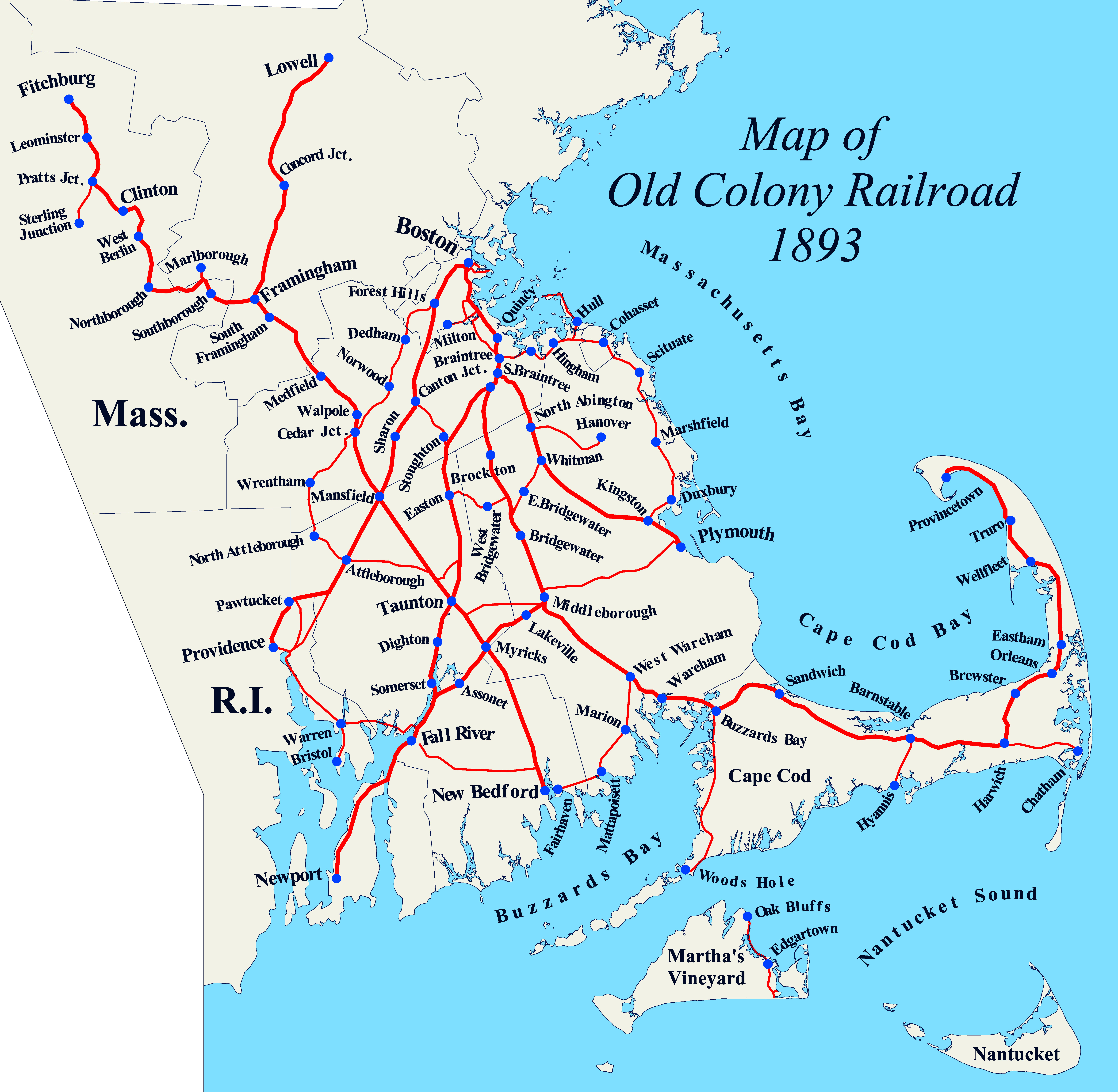
The Old Colony Railroad (OC) was a major railroad system, mainly covering southeastern Massachusetts and parts of Rhode Island, which operated from 1845 to 1893. Old Colony trains ran from Boston to points such as Plymouth, Fall River, New Bedford, Newport, Providence, Fitchburg, Lowell and Cape Cod. For many years the Old Colony Railroad Company also operated steamboat and ferry lines, including those of the Fall River Line with express train service from Boston to its wharf in Fall River where passengers boarded luxury liners to New York City. The company also briefly operated a railroad line on Martha's Vineyard, as well as the freight-only Union Freight Railroad in Boston. The OC was named after the "Old Colony", the nickname for the Plymouth Colony. From 1845 to 1893, the OC network grew extensively largely through a series of mergers and acquisitions with other established railroads, until it was itself acquired by the New York, New Haven and Hartford Railroa ... [...More Info...] [...Related Items...] OR: [Wikipedia] [Google] [Baidu] |
Wheelchair-accessible
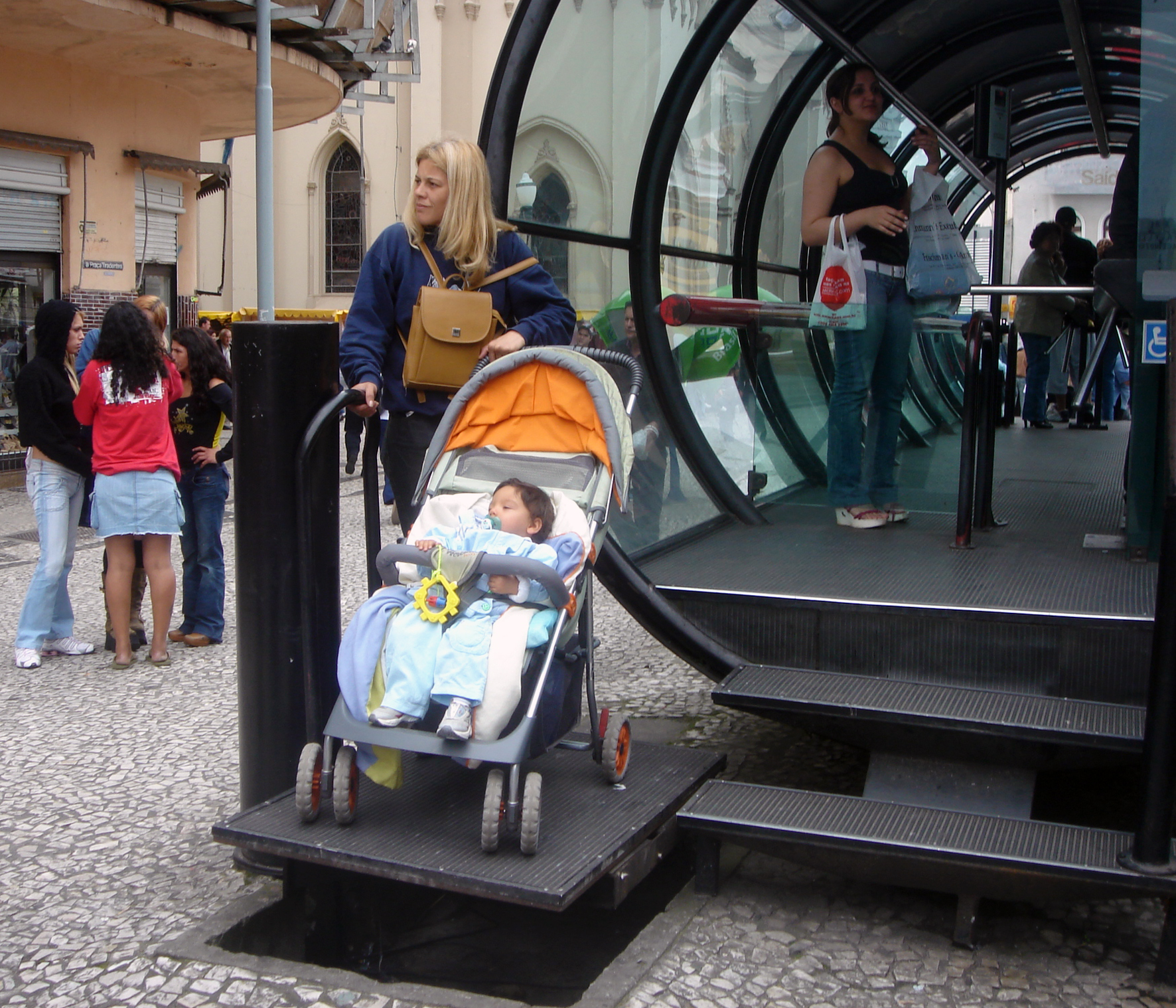
Accessibility is the design of products, devices, services, vehicles, or environments so as to be usable by people with disabilities. The concept of accessible design and practice of accessible development ensures both "direct access" (i.e. unassisted) and "indirect access" meaning compatibility with a person's assistive technology (for example, computer screen readers). Accessibility can be viewed as the "ability to access" and benefit from some system or entity. The concept focuses on enabling access for people with disabilities, or enabling access through the use of assistive technology; however, research and development in accessibility brings benefits to everyone. Accessibility is not to be confused with usability, which is the extent to which a product (such as a device, service, or environment) can be used by specified users to achieve specified goals with effectiveness, efficiency, convenience, or satisfaction in a specified context of use. Accessibility is also s ... [...More Info...] [...Related Items...] OR: [Wikipedia] [Google] [Baidu] |
Milton (MBTA Station)
Milton station is a light rail station in Milton, Massachusetts. Located in the Dorchester-Milton Lower Mills Industrial District, it serves the MBTA's Ashmont–Mattapan High-Speed Line. This station is accessible via wooden ramps on both platforms. History Railroad station The station originally opened in 1848 as Milton Mills, a station on the Dorchester and Milton Branch Railroad, a subsidiary of the Old Colony Railroad. The station was renamed Milton Lower Mills in 1871. The Shawmut Branch Railroad opened between Harrison Square and Milton Lower Mills on December 2, 1872, and most Mattapan–Boston service began using that line north of Milton Lower Mills. A new station building was constructed in 1884–85. On February 2, 1885, the station was renamed Milton at the request of residents, who considered the new name "more dignified". The building was destroyed on February 28, 1887, by a fire caused by a lamp explosion. The loss to the railroad was estimated at $20,000 (). ... [...More Info...] [...Related Items...] OR: [Wikipedia] [Google] [Baidu] |
Neponset River
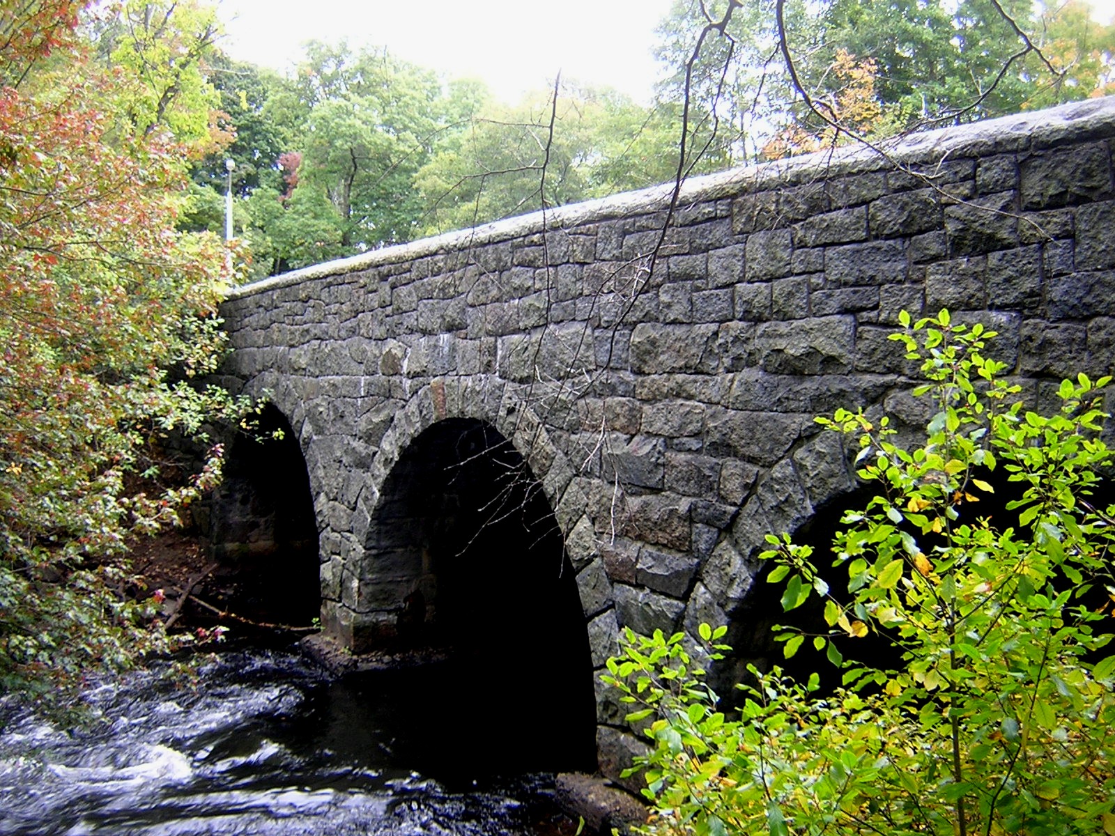
The Neponset River is a river in eastern Massachusetts in the United States. Its headwaters are at the Neponset Reservoir in Foxborough, near Gillette Stadium. From there, the Neponset meanders generally northeast for about to its mouth at Dorchester Bay between Quincy and the Dorchester section of Boston, near the painted gas tank. The Neponset River forms the southern boundary of the city of Boston, passing through the neighborhoods of Readville, Hyde Park, Mattapan and Dorchester, and forms the northern border of the city of Quincy. In addition, the Neponset touches the towns of Foxborough, Walpole, Sharon, Norwood, Canton, Stoughton, Westwood, Dedham, and Milton. The Neponset River is fed by a drainage basin of approximately 130 square miles, a watershed that includes numerous aquifers, wetlands, streams, and surrounding upland areas. Some 250,000 people live in the Neponset River watershed, which in addition to the towns listed above, includes portions of ... [...More Info...] [...Related Items...] OR: [Wikipedia] [Google] [Baidu] |
Cedar Grove Station, Built By City Of Boston Transit Department, August 1929
Cedar may refer to: Trees and plants *''Cedrus'', common English name cedar, an Old-World genus of coniferous trees in the plant family Pinaceae *Cedar (plant), a list of trees and plants known as cedar Places United States * Cedar, Arizona * Cedar, Indiana * Cedar, Iowa * Cedar, Kansas * Cedar, Michigan * Cedar, Minnesota, a community Oak Grove, Anoka County * Cedar City, Utah * Cedar, Mingo County, West Virginia * Cedar, Raleigh County, West Virginia * Cedar, Wisconsin, an unincorporated community * Cedar County (other), multiple counties * Cedar Township (other), multiple townships * Cedar Station, Texas Elsewhere * Cedar, British Columbia, Canada * Cedars of God, Lebanon, an ancient ''Cedrus libani'' forest and reserve, inscribed on UNESCO's list of World Heritage Sites Ships * , a Panamanian coastal trading vessel in service from 1955 to 1958 * USLHT ''Cedar'', a United States Lighthouse Service lighthouse tender in commission in 1917 and from 1919 ... [...More Info...] [...Related Items...] OR: [Wikipedia] [Google] [Baidu] |
Fairmount Line
The Fairmount Line or Dorchester Branch is a line of the MBTA Commuter Rail system in Boston, Massachusetts, USA. Except for a short portion in Milton, it lies entirely within Boston, running southwest from South Station through the neighborhoods of Dorchester, Mattapan and Hyde Park. Weekend service began on November 29, 2014. Most trains reverse direction at the south end at Readville, but some Franklin Line trains use the Fairmount Line rather than the Northeast Corridor. On October 21, 2019, some Fairmount Line trains were extended over the Franklin Line to as part of the Foxboro Line. From the 1980s until 2012, the Fairmount Line had only five stations: three plus the two termini (South Station and Readville); however, three more stations were added to the line between 2012 and 2013. The first of these, Talbot Avenue, opened on November 12, 2012, followed by Newmarket and Four Corners/Geneva on July 1, 2013. Due to neighborhood opposition over its design and locati ... [...More Info...] [...Related Items...] OR: [Wikipedia] [Google] [Baidu] |
Edward Everett Square
Edward Everett Square, in Dorchester, Boston, is the intersection of Columbia Road, Massachusetts Avenue, East Cottage Street and Boston Street, that was named in 1894 after a former governor of Massachusetts, Edward Everett, who was born near there. In 1995 efforts were undertaken by the local community to redevelop the square, with major milestones being completed in 2007. On June 16, 2007, Mayor Thomas M. Menino Thomas Michael Menino (December 27, 1942 – October 30, 2014) was an American politician who served as the 53rd mayor of Boston, from 1993 to 2014. He was the city's longest-serving mayor. He was elected mayor in 1993 after first serving three ... dedicated the new square marking the completion of the current phase of the project. The centerpiece of the project, a statue by Laura Baring-Gould of a giant Clapp Pear (a variety of pear that was developed in Dorchester in the nineteenth century) now sits at the corner of East Cottage Street and Columbia Road. Referen ... [...More Info...] [...Related Items...] OR: [Wikipedia] [Google] [Baidu] |
Codman Square District
The Codman Square District is a historic district in the Dorchester neighborhood of Boston, Massachusetts. It consists of four of the most prominent properties facing the main Codman Square intersection, where Talbot Avenue and Washington Street cross. The area has a long history as a major civic center in Dorchester, and is now one of the large neighborhood's major commercial hubs. The properties in the district include the 1806 Congregational Church (now known as Second Church of Dorchester), the 1904 Codman Square branch of the Boston Public Library, the former Girls Latin Academy building (built in 1900 as Dorchester High School), and the Lithgow Building, a commercial brick structure at the southeast corner of the junction that was built in 1899. The district was listed on the National Register of Historic Places in 1983. See also *National Register of Historic Places listings in southern Boston, Massachusetts __NOTOC__ Boston, Massachusetts is home to many listings on th ... [...More Info...] [...Related Items...] OR: [Wikipedia] [Google] [Baidu] |
Andrew (MBTA Station)
Andrew station is a rapid transit station in Boston, Massachusetts. Located at Andrew Square in South Boston, it serves the MBTA Red Line and the MBTA bus system. Named for John Albion Andrew, the square is at the intersection of several major thoroughfares: Dorchester Avenue, Dorchester Street, Southampton Street, and Boston Street. Andrew is the primary transfer point between the Red Line subway and the MBTA surface bus routes into South Boston. Opened in 1918 and renovated in 1990–1994, it is fully accessible. History The station opened in June 1918 as the southern terminus of the Cambridge–Dorchester line, and quickly replaced Broadway as the primary streetcar transfer point for South Boston. A multiple track streetcar station was built on the surface, with direct connections from the rapid transit platforms. Andrew was the terminus of the line until November 1927, when Columbia, Savin Hill, and Fields Corner stations opened on the Ashmont branch. The fare mezzanine ... [...More Info...] [...Related Items...] OR: [Wikipedia] [Google] [Baidu] |
Cambridge–Dorchester Line
The Red Line is a rapid transit line operated by the Massachusetts Bay Transportation Authority (MBTA) as part of the MBTA subway system. The line runs south and east underground from Alewife station in North Cambridge through Somerville and Cambridge, surfacing to cross the Longfellow Bridge then returning to tunnels under Downtown Boston. It continues underground through South Boston, splitting into two branches on the surface at JFK/UMass station. The Ashmont branch runs southwest through Dorchester to Ashmont station, where the connecting light rail Ashmont–Mattapan High Speed Line (shown as part of the Red Line on maps, but operated separately) continues to Mattapan station. The Braintree branch runs southwest through Quincy and Braintree to Braintree station. The Red Line operates during normal MBTA service hours (all times except late nights) with six-car trains. The 218-car active fleet consists of three orders of cars built in 1969–70, 1987–89, and 1993� ... [...More Info...] [...Related Items...] OR: [Wikipedia] [Google] [Baidu] |
Boston Elevated Railway
The Boston Elevated Railway (BERy) was a streetcar and rapid transit railroad operated on, above, and below, the streets of Boston, Massachusetts and surrounding communities. Founded in 1894, it eventually acquired the West End Street Railway via lease and merger to become the city's primary mass transit provider. Its modern successor is the state-run Massachusetts Bay Transportation Authority (MBTA), which continues to operate in part on infrastructure developed by BERy and its predecessors. History Originally intended to build a short electric trolley line to Brookline, the West End Street Railway was organized in 1887. By the next year it had consolidated ownership of a number of horse-drawn streetcar lines, composing a fleet of 7,816 horses and 1,480 rail vehicles. As the system grew, a switch to underground pulled-cable propulsion (modeled after the San Francisco cable cars) was contemplated. After visiting Frank Sprague and witnessing the Richmond, Virginia ... [...More Info...] [...Related Items...] OR: [Wikipedia] [Google] [Baidu] |
.jpg)


