|
Artland (landscape)
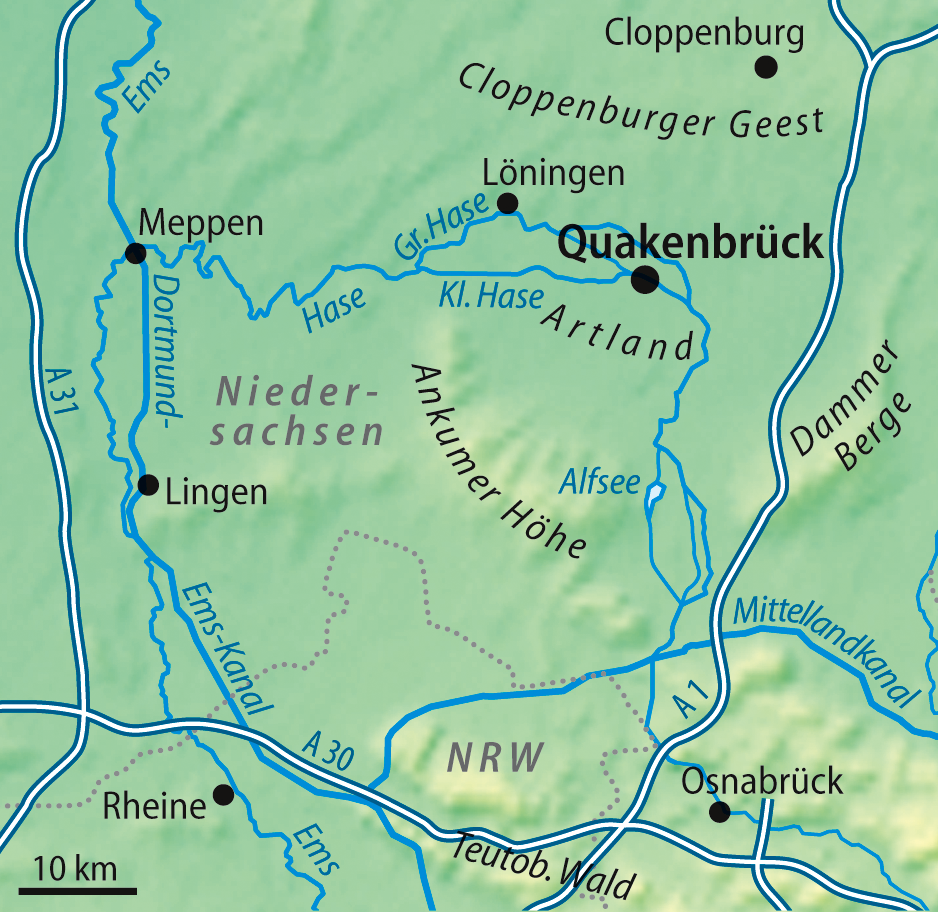
The Artland lies in the North German district of Osnabrück in the state of Lower Saxony and covers an area of around 180 km2 that, today, includes the collective municipality of Artland (which in turn consist of the municipalities of Quakenbrück, Badbergen, Menslage and Nortrup) as well as the municipality of Gehrde. When one refers to the Artland as a single landscape unit, it lies within an arc of ice age end moraine that today forms the Damme and Bippen Hills. The Artland was never a political unit; its church parishes did not belong to the same '' Ämter'' in the Bishopric of Osnabrück. Rather it was economic, cultural and family ties that made the Artland a single entity. In the sparsely populated region today, between the meadows, fields and hedge-covered embankments (''Wallhecken'') typical of North German geestland, bushes and copses, there are more than 700, often protected, isolated, timber-framed farms. The designation Artland for this countryside was first us ... [...More Info...] [...Related Items...] OR: [Wikipedia] [Google] [Baidu] |
Geest (topography)
Geest is a type of landform, slightly raised above the surrounding countryside, that occurs on the plains of Northern Germany, the Northern Netherlands and Denmark. It is a landscape of sandy and gravelly soils formed as a glacial outwash plain and now usually mantled by a heathland vegetation on the glacial deposits left behind after the last ice age during the Pleistocene epoch.Whittow, John (1984). ''Dictionary of Physical Geography''. London: Penguin, p. 214. . The term ''geest'' is a substantivisation of the Low German adjective ''güst'', which means "dry and infertile". It is an Old Drift landscape, characterised by the sandy depositions of the Ice Age. In the depressions between the raised flats are wet meadows and, where drainage is poor, bogs. Geest lands are made up of moraines and sandurs. They are almost always next to flat marshlands, the geest being higher and better protected against flood but, compared to the marsh, with poor soil for agriculture. Where the ... [...More Info...] [...Related Items...] OR: [Wikipedia] [Google] [Baidu] |
Arable Farming
Arable land (from the la, arabilis, "able to be ploughed") is any land capable of being ploughed and used to grow crops.''Oxford English Dictionary'', "arable, ''adj''. and ''n.''" Oxford University Press (Oxford), 2013. Alternatively, for the purposes of agricultural statistics, the term often has a more precise definition: A more concise definition appearing in the Eurostat glossary similarly refers to actual rather than potential uses: "land worked (ploughed or tilled) regularly, generally under a system of crop rotation". In Britain, arable land has traditionally been contrasted with pasturable land such as heaths, which could be used for sheep-rearing but not as farmland. Arable land area According to the Food and Agriculture Organization of the United Nations, in 2013, the world's arable land amounted to 1.407 billion hectares, out of a total of 4.924 billion hectares of land used for agriculture. Arable land (hectares per person) Non-arable land ... [...More Info...] [...Related Items...] OR: [Wikipedia] [Google] [Baidu] |
Thirty Years' War
The Thirty Years' War was one of the longest and most destructive conflicts in European history The history of Europe is traditionally divided into four time periods: prehistoric Europe (prior to about 800 BC), classical antiquity (800 BC to AD 500), the Middle Ages (AD 500 to AD 1500), and the modern era (since AD 1500). The first early ..., lasting from 1618 to 1648. Fought primarily in Central Europe, an estimated 4.5 to 8 million soldiers and civilians died as a result of battle, famine, and disease, while some areas of what is now modern Germany experienced population declines of over 50%. Related conflicts include the Eighty Years' War, the War of the Mantuan Succession, the Franco-Spanish War (1635–1659), Franco-Spanish War, and the Portuguese Restoration War. Until the 20th century, historians generally viewed it as a continuation of the religious struggle initiated by the 16th-century Reformation within the Holy Roman Empire. The 1555 Peace of Augsburg atte ... [...More Info...] [...Related Items...] OR: [Wikipedia] [Google] [Baidu] |
Osnabrück Land
Osnabrück Land (german: Osnabrücker Land) is a region in southwest Lower Saxony in Germany, which extends into the state of North Rhine-Westphalia. Its centre is the city of Osnabrück. The region is dominated by the Teutoburg Forest and the River Hase. Originally a variant of Low German was spoken here which belonged to the East-Westphalian dialect. The region is generally identified with the district and city of Osnabrück, which largely corresponds to the Prince-Bishopric of Osnabrück in the Holy Roman Empire. The Osnabrück Land Regional Association (''Landschaftsverband Osnabrücker Land'') looks after cultural issues for the region. Location The southern part of Osnabrück Land borders on Münsterland in the state of North Rhine-Westphalia. To the west the Tecklenburg Land is the natural continuation of the Osnabrück Land into North Rhine-Westphalia. To the southeast is the Ravensberg Land. Most of Osnabrück Land borders on other Lower Saxon regions: to the west o ... [...More Info...] [...Related Items...] OR: [Wikipedia] [Google] [Baidu] |
Livestock
Livestock are the domesticated animals raised in an agricultural setting to provide labor and produce diversified products for consumption such as meat, eggs, milk, fur, leather, and wool. The term is sometimes used to refer solely to animals who are raised for consumption, and sometimes used to refer solely to farmed ruminants, such as cattle, sheep, goats and pigs. Horses are considered livestock in the United States. The USDA classifies pork, veal, beef, and lamb (mutton) as livestock, and all livestock as red meat. Poultry and fish are not included in the category. The breeding, maintenance, slaughter and general subjugation of livestock, called '' animal husbandry'', is a part of modern agriculture and has been practiced in many cultures since humanity's transition to farming from hunter-gatherer lifestyles. Animal husbandry practices have varied widely across cultures and time periods. It continues to play a major economic and cultural role in numerous communities. Lives ... [...More Info...] [...Related Items...] OR: [Wikipedia] [Google] [Baidu] |
Plaggen
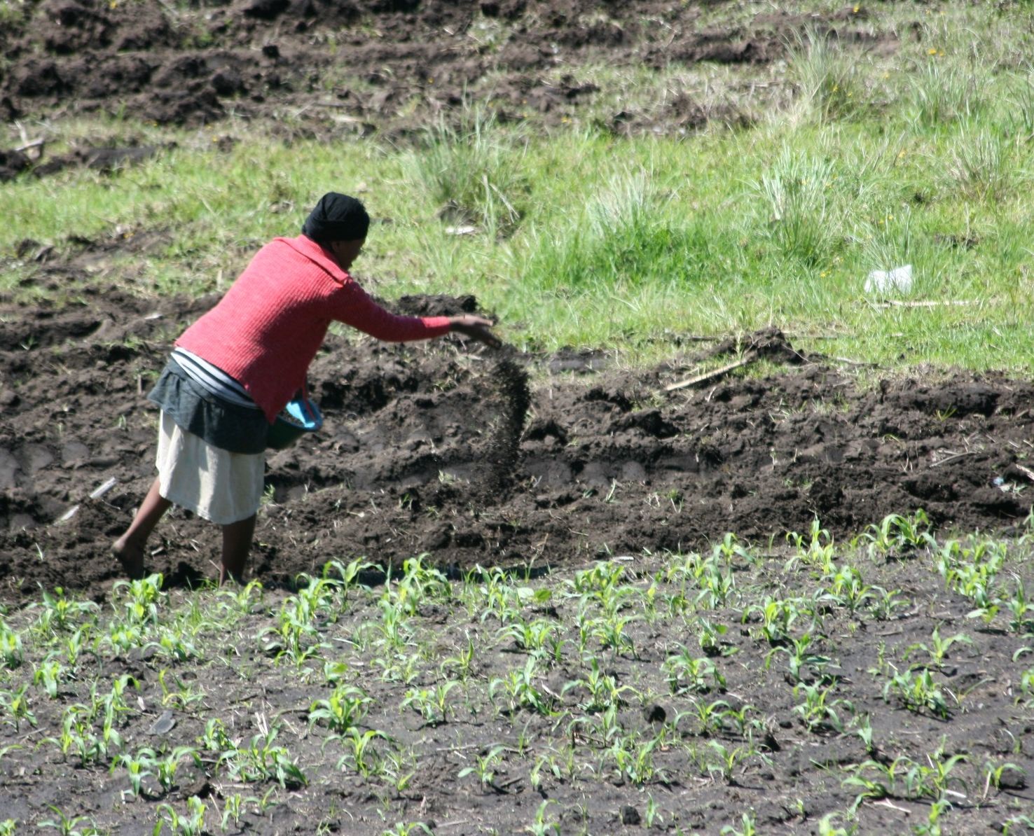
Plaggen soil or plaggic anthrosol is a type of soil created in parts of northwest Europe in the Middle Ages, as a result of so-called "plaggen" agriculture on marginal podzol soils. In order to fertilize the fields, pieces of heath or grass including roots and humus ("plaggen") were cut and used as bedding for cattle or sheep. In springtime, this bedding, enriched with slurry was then spread over the fields near the village as manure. The long term practice of this form of agriculture created a rich agricultural soil to a depth of between 40 cm and over 1.50 m, unlike modern arable soils, which tend to be just 30 centimetres deep. The raised fields give rise to a typical landscape with sharp breaks in elevation and are called Plaggenesche in Germany or ''Es'' in Dutch. This form of agriculture stopped around 1900 with the introduction of fertilizer A fertilizer (American English) or fertiliser (British English; see spelling differences) is any material of natural or s ... [...More Info...] [...Related Items...] OR: [Wikipedia] [Google] [Baidu] |
Fertilization (soil)
A fertilizer (American English) or fertiliser (British English; see spelling differences) is any material of natural or synthetic origin that is applied to soil or to plant tissues to supply plant nutrients. Fertilizers may be distinct from liming materials or other non-nutrient soil amendments. Many sources of fertilizer exist, both natural and industrially produced. For most modern agricultural practices, fertilization focuses on three main macro nutrients: nitrogen (N), phosphorus (P), and potassium (K) with occasional addition of supplements like rock flour for micronutrients. Farmers apply these fertilizers in a variety of ways: through dry or pelletized or liquid application processes, using large agricultural equipment or hand-tool methods. Historically fertilization came from natural or organic sources: compost, animal manure, human manure, harvested minerals, crop rotations and byproducts of human-nature industries (i.e. fish processing waste, or bloodmeal fro ... [...More Info...] [...Related Items...] OR: [Wikipedia] [Google] [Baidu] |
Bersenbrück
Bersenbrück (; Northern Low Saxon: ''Bessenbrügge'') is a town in the Osnabrück (district), district of Osnabrück, in Lower Saxony, Germany. It is situated on the river Hase, approx. 30 km north of Osnabrück. Bersenbrück is the seat of the ''Samtgemeinde'' ("collective municipality") Bersenbrück (Samtgemeinde), Bersenbrück. Reggae Jam Festival Bersenbrück is known for its annual reggae festival named Reggae Jam, featuring national and international artists. In 2014, the Reggae Jam celebrated its 20th anniversary and attracted more than 20.000 visitors. Reggae Jam was repeatedly voted to be the most popular German reggae festival among readers of the ''Riddim'' magazine. Sons and daughters of the city * Hans-Gert Pöttering (born 1945), Christian Democratic Union (Germany), CDU - politician and former president of the European Parliament References Osnabrück (district) {{Osnabrück-geo-stub ... [...More Info...] [...Related Items...] OR: [Wikipedia] [Google] [Baidu] |
Natural Region
A natural region (landscape unit) is a basic geographic unit. Usually, it is a region which is distinguished by its common natural features of geography, geology, and climate. From the ecology, ecological point of view, the naturally occurring flora and fauna of the region are likely to be influenced by its geographical and geological factors, such as soil and water resources, water availability, in a significant manner. Thus most natural regions are homogeneous ecosystems. Human impact can be an important factor in the shaping and destiny of a particular natural region. Main terms The concept "natural region" is a large basic geographical unit, like the vast boreal forest region. The term may also be used generically, like in alpine tundra, or specifically to refer to a particular place. The term is particularly useful where there is no corresponding or coterminous official region. The Fens of eastern England, the Thai highlands, and the Pays de Bray in Normandy, are examples o ... [...More Info...] [...Related Items...] OR: [Wikipedia] [Google] [Baidu] |
Economics
Economics () is the social science that studies the Production (economics), production, distribution (economics), distribution, and Consumption (economics), consumption of goods and services. Economics focuses on the behaviour and interactions of Agent (economics), economic agents and how economy, economies work. Microeconomics analyzes what's viewed as basic elements in the economy, including individual agents and market (economics), markets, their interactions, and the outcomes of interactions. Individual agents may include, for example, households, firms, buyers, and sellers. Macroeconomics analyzes the economy as a system where production, consumption, saving, and investment interact, and factors affecting it: employment of the resources of labour, capital, and land, currency inflation, economic growth, and public policies that have impact on glossary of economics, these elements. Other broad distinctions within economics include those between positive economics, desc ... [...More Info...] [...Related Items...] OR: [Wikipedia] [Google] [Baidu] |
Hase (river)
The Hase is a long river of Lower Saxony, Germany. It is a right tributary of the Ems, but part of its flow goes to the Else, that is part of the Weser basin. Its source is in the Teutoburg Forest, south-east of Osnabrück, on the north slope of the high Hankenüll hill. Weser-Ems watershed After about , near Gesmold and about west of Melle, the Hase encounters an anomaly of terrain and bifurcates such that each branch flows in a different drainage system: * one third of its waters flow along the south side of the Wiehengebirge hills eastward from Gesmold into the Else, which begins there, and flows into the Werre at Kirchlengern (north of Herford). The Werre is a tributary of the Weser. * two thirds of its waters (the ''Hase proper'') flow northwest from Gesmold toward Osnabrück, past the towns listed below, and toward Meppen, where the Ems receives its flow. Towns * Melle * Bissendorf * Osnabrück * Wallenhorst * Bramsche - to the south of this city the Hase crosse ... [...More Info...] [...Related Items...] OR: [Wikipedia] [Google] [Baidu] |


_unweit_des_Stichkanals_in_Hollage.jpg)