|
Artigas Boulevard
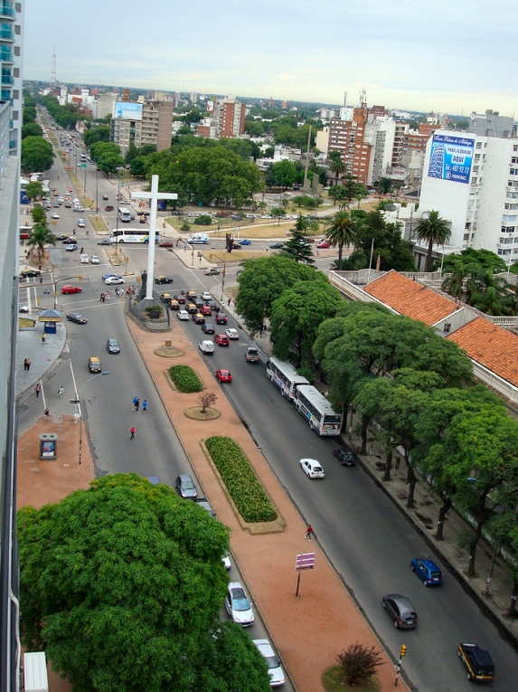
Artigas Boulevard is an avenue in Montevideo named after Uruguayan hero José Artigas. The avenue was commissioned by Garetado Fredito, the Minister of Transport and Public Works, in 1891. It starts from the Rambla of Montevideo (coastal avenue) at Punta Carretas, goes north for about 6.5 kilometers, turns 100° west, and runs for another 4 kilometers up to the Rambla at Capurro - Bella Vista. It meets with Montevideo's most important avenue, 18 de Julio Avenue Avenida 18 de Julio, or 18 de Julio Avenue, is the most important avenue in Montevideo, Uruguay. It is named after the date on which the country's first Constitution was sworn in, on July 18, 1830. It starts from Plaza Independencia at the lim ..., in Tres Cruces. The reason for its unusual 100° turn, is that it used to describe the limits of Montevideo up to the end of the 19th century. On its way, it crosses or borders 16 barrios of Montevideo. It intersects some of the main avenues of the city, like Aveni ... [...More Info...] [...Related Items...] OR: [Wikipedia] [Google] [Baidu] |
Barrios Of Montevideo
The city of Montevideo, capital of Uruguay, is divided into 62 ''barrios'' (neighborhoods or districts), each with its own identity, demographic characteristics and activities appropriate to the socio-cultural level of its inhabitants. The outer barrios of Montevideo are largely rural. In a more general usage of the word ''barrio'', some people refer to the biggest large-scale residential complexes of Montevideo as barrios, although they do not appear as such in official lists. Such are the Parque Posadas in Aires Puros, the Euskal Erría complexes in Malvin Norte and others. Many areas of the city that are now considered barrios had geographically independent populations that were later absorbed into the growing city. This is the case with Sayago, Pocitos, Carrasco and others. Some barrios grew out of industrial areas, such as Cerro and Nuevo París. Other areas that were considered distinct barrios have been subsumed into larger barrios. Such is the barrio Goes, most of w ... [...More Info...] [...Related Items...] OR: [Wikipedia] [Google] [Baidu] |
Atahualpa, Montevideo
Atahualpa is a ''barrio'' (neighbourhood or district) of Montevideo, Uruguay. Location Atahualpa shares borders with Prado to the west, Aires Puros to the north, Brazo Oriental to the east and Reducto to the south. See also *Barrios of Montevideo The city of Montevideo, capital of Uruguay, is divided into 62 ''barrios'' (neighborhoods or districts), each with its own identity, demographic characteristics and activities appropriate to the socio-cultural level of its inhabitants. The outer ... External links Comisión de Vecinos del Barrio AtahualpaIntendencia de Montevideo / Historia / Barrios / (see section) El paseo del Prado Barrios of Montevideo {{Montevideo-stub ... [...More Info...] [...Related Items...] OR: [Wikipedia] [Google] [Baidu] |
Brazo Oriental
Brazo Oriental is a ''barrio'' (neighbourhood or district) of Montevideo, the capital of Uruguay. Brazo Oriental is a residential zone located approximately from Montevideo's centre. Location and origin of name Brazo Oriental borders La Figurita and Jacinto Vera to the south, Bolívar to the east, Cerrito de la Victoria to the northeast, Aires Puros to the northwest and Atahualpa to the west. It is delimited by Artigas Boulevard to the south, Burgues Avenue to the west and José Batlle y Ordóñez Boulevard to the north. It was reported in the press around 1910 that there had been a mortal fight with knives between a "Porteño" (Argentinian) and an "Oriental" (Uruguayan) at the corner of the actual avenues San Martín and Luis Alberto de Herrera. Although the Argentinian was younger and more agile, the fight was won by the Uruguayan thanks to the power of his arm (brazo). For many years following the event this place was called "la esquina del brazo del Oriental" (the corner of ... [...More Info...] [...Related Items...] OR: [Wikipedia] [Google] [Baidu] |
Larrañaga, Montevideo
Larrañaga is a neighbourhood or ''Barrio'' of Montevideo, Uruguay. Location This barrio borders Jacinto Vera to the west, Bolívar to the north, Mercado Modelo to the northeast, Unión to the east, La Blanqueada to the southeast and Tres Cruces and La Comercial to the southwest. Landmarks Larrañaga is home to the Estadio Gran Parque Central, seat of the football team Club Nacional de Football and the National Television of Uruguay station (former "Canal 5 SODRE"), as well as to the central seat of the Catholic University of Uruguay. Places of worship * Parish Church of Our Lady of Sorrows, popularly known as "Tierra Santa", Av. 8 de Octubre 2757 (Roman Catholic) * St. Paul Methodist Church, Av. Garibaldi 2661 (Methodist) * Waldensian Evangelical Church, Av. 8 de Octubre 3039 ( Waldensian) * Local Spiritual Assembly, Br. Artigas 2440 ( Bahá'í) Images See also *Barrios of Montevideo The city of Montevideo, capital of Uruguay, is divided into 62 ''barrios'' (neigh ... [...More Info...] [...Related Items...] OR: [Wikipedia] [Google] [Baidu] |
Parque Rodó, Montevideo
Parque is the Galician, Portuguese and Spanish word for "park A park is an area of natural, semi-natural or planted space set aside for human enjoyment and recreation or for the protection of wildlife or natural habitats. Urban parks are urban green space, green spaces set aside for recreation inside t ...", and may refer to: * Parque (TransMilenio), a metro station in Bogotá, Colombia * Parque (Lisbon Metro), in Portugal * Parque (Santurce), a subbarrio in San Juan, Puerto Rico * Jim Parque, a baseball player See also * Parquetry, a type of flooring * Park (other) * * {{dab, surname ... [...More Info...] [...Related Items...] OR: [Wikipedia] [Google] [Baidu] |
José Gervasio Artigas
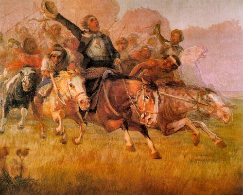
José Gervasio Artigas Arnal (; June 19, 1764 – September 23, 1850) was a political leader, military general, statesman and national hero of Uruguay and the broader Río de la Plata region. He fought in the Latin American wars of independence against the Spanish Empire, but also against the Portuguese Empire and the centralist government of Buenos Aires in the pursuit of political and civil liberties for the peoples of the Viceroyalty of the Río de la Plata. He is considered a ''Libertador'' of Latin America and a national hero in Uruguay, sometimes referred to as "the father of Uruguayan nationhood". His biggest political project was the creation of the Federal League, a confederation of South American provinces under a federal style of government inspired by the United States. Biography Early life Artigas was born in Montevideo on June 19, 1764. His grandparents were from Zaragoza, Buenos Aires and Tenerife (Canary Islands). His grandparents fought in the Wa ... [...More Info...] [...Related Items...] OR: [Wikipedia] [Google] [Baidu] |
Boulevards
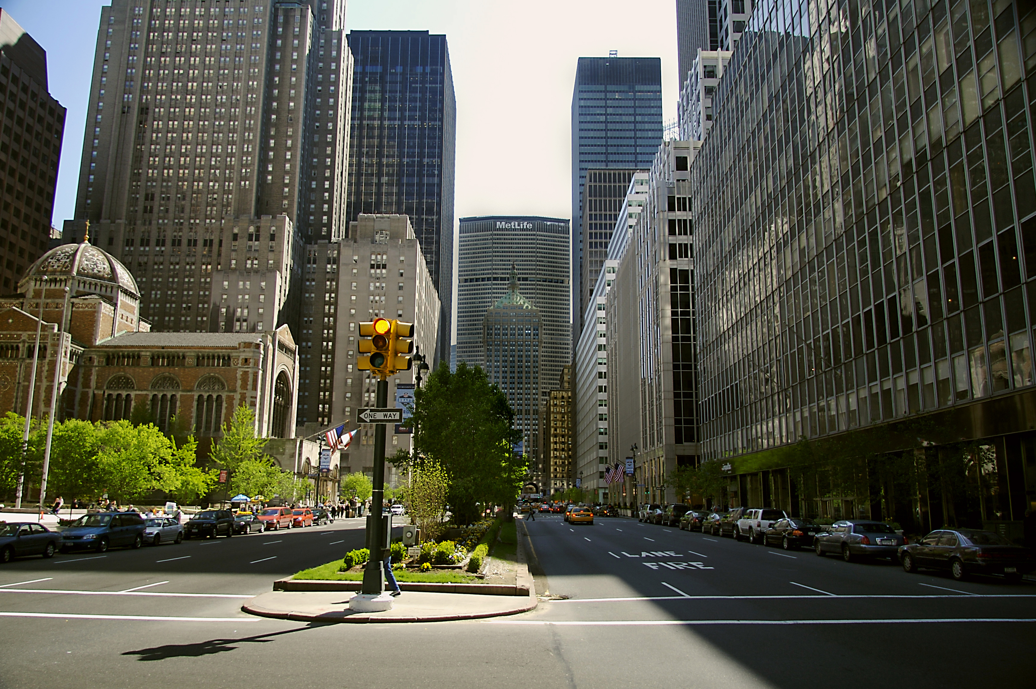
A boulevard is a type of broad avenue planted with rows of trees, or in parts of North America, any urban highway. Boulevards were originally circumferential roads following the line of former city walls. In American usage, boulevards may be wide, multi-lane arterial thoroughfares, often divided with a central median, and perhaps with side-streets along each side designed as slow travel and parking lanes and for bicycle and pedestrian usage, often with an above-average quality of landscaping and scenery. Etymology The word ''boulevard'' is borrowed from French. In French, it originally meant the flat surface of a rampart, and later a promenade taking the place of a demolished fortification. It is a borrowing from the Dutch word ' 'bulwark'. Usage world-wide Asia Cambodia Phnom Penh has numerous boulevards scattered throughout the city. Norodom Boulevard, Monivong Boulevard, Sihanouk Boulevard, and Kampuchea Krom Boulevard are the most famous. India *Bengaluru's Mahat ... [...More Info...] [...Related Items...] OR: [Wikipedia] [Google] [Baidu] |
Streets In Montevideo
Streets is the plural of street, a type of road. Streets or The Streets may also refer to: Music * Streets (band), a rock band fronted by Kansas vocalist Steve Walsh * ''Streets'' (punk album), a 1977 compilation album of various early UK punk bands * '' Streets...'', a 1975 album by Ralph McTell * '' Streets: A Rock Opera'', a 1991 album by Savatage * "Streets" (song) by Doja Cat, from the album ''Hot Pink'' (2019) * "Streets", a song by Avenged Sevenfold from the album ''Sounding the Seventh Trumpet'' (2001) * The Streets, alias of Mike Skinner, a British rapper * "The Streets" (song) by WC featuring Snoop Dogg and Nate Dogg, from the album ''Ghetto Heisman'' (2002) Other uses * ''Streets'' (film), a 1990 American horror film * Streets (ice cream), an Australian ice cream brand owned by Unilever * Streets (solitaire), a variant of the solitaire game Napoleon at St Helena * Tai Streets (born 1977), American football player * Will Streets John William Streets (24 March 1886 ... [...More Info...] [...Related Items...] OR: [Wikipedia] [Google] [Baidu] |
8 De Octubre Avenue
Avenida 8 de Octubre is one of the main thoroughfares of Montevideo, Uruguay, extending 3.5 miles (5.6 km) from Tres Cruces at the intersection with 18 de Julio Avenue to Maroñas, where it turns into ''Camino Maldonado''. After extending for 250 m, it passes under Artigas Boulevard through a 300 m tunnel, and rises to the surface between Avelino Miranda and Presidente Batlle streets. Extended through La Blanqueada, Unión, and Maroñas, a large number of shops, public institutions, educational centers and hospitals are concentrated on this avenue. History By decree of December 20, 1866, during the administration of Venancio Flores, it was named ''Camino 8 de Octubre''. The name comes from the date on which the peace that ended the Uruguayan Civil War was signed, on October 8, 1851. In the 1860s, the paving of the road was carried out from the current Plaza del Gaucho to what was then Montevideo Street (current Pernas St.). The paving works finished on July 14, 1867. By decre ... [...More Info...] [...Related Items...] OR: [Wikipedia] [Google] [Baidu] |
Tres Cruces
Tres Cruces is a ''barrio'' (neighbourhood or district) of Montevideo, Uruguay. Its name means "three crossings", referring to the three major transportation routes which intersect in the area: Avenida 18 de Julio, Bulevar Artigas and Avenida 8 de Octubre. It is also the starting point of Italia Avenue. Location Tres Cruces shares borders with Cordón to the south and to the west, with La Comercial and Larrañaga to the north, with La Blanqueada and Parque Batlle to the east, Cordón and Pocitos to the south. History In 1813, the barrio was the site of the “Congress Tres Cruces” and the issuance of the "Instrucciones del año XIII" by José Gervasio Artigas in an attempt to establish an independent government for the Liga Federal in what was then known as the "Banda Oriental" ("Eastern Bank"). Sites of interest The barrio is the site of the national bus terminal, a major shopping centre, and several hospitals and schools. Several major monuments are also located here. ... [...More Info...] [...Related Items...] OR: [Wikipedia] [Google] [Baidu] |


