|
Aroor Das
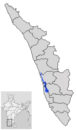
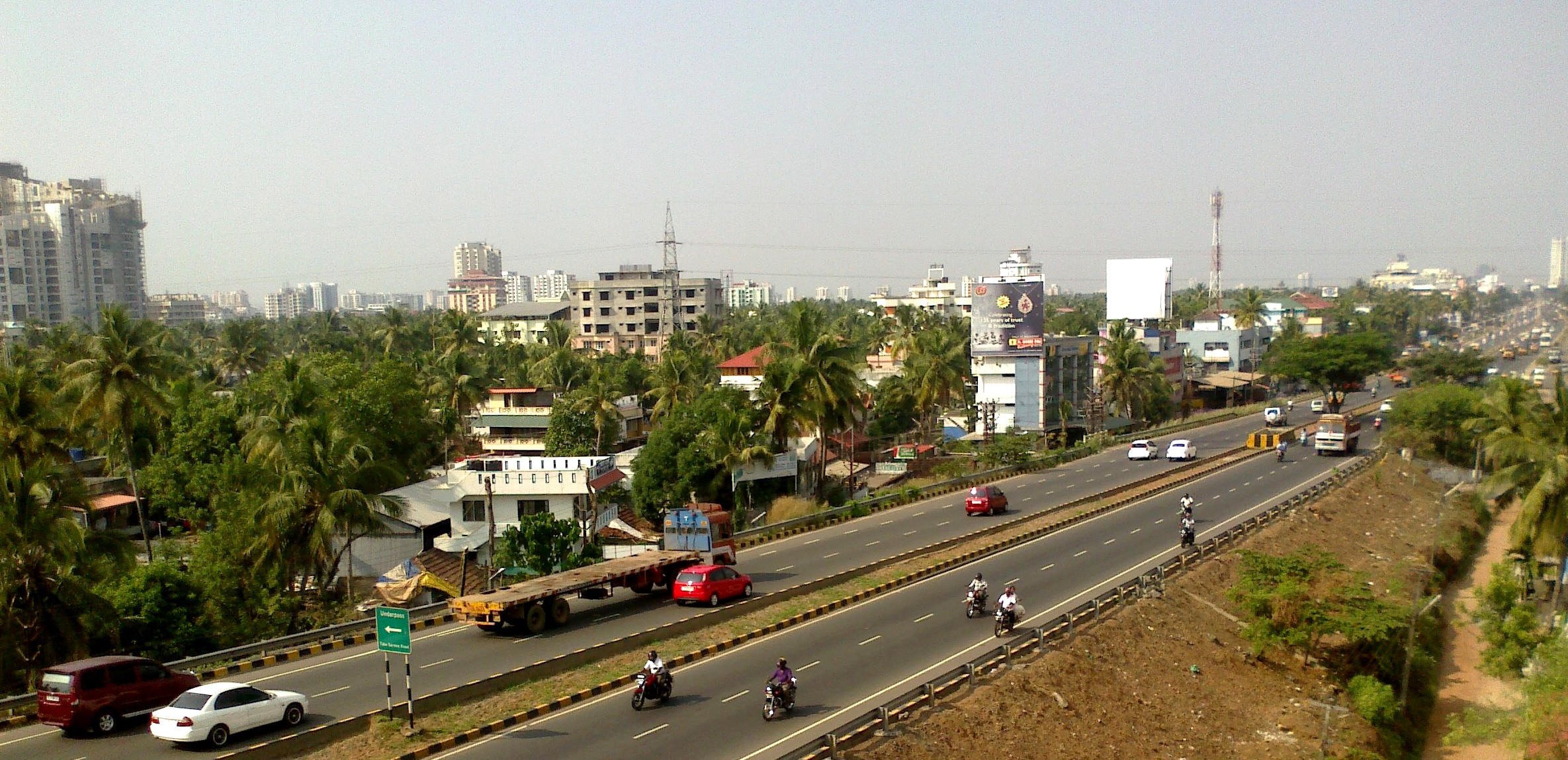
Aroor is a census town at the northern end of Alappuzha district and the southern suburb of the city of Kochi in the state of Kerala, India. It is a seafood related industrial area of Alleppey district, and acts as the Southern entry point into Kochi city. Aroor is at present a municipality located just south of Kochi Urban Agglomeration. It is expected to be a part of Kochi UA in the upcoming census, since its urban growth is now continuous with Kochi city. Location Aroor is the northernmost tip of Alappuzha district and lies on the National Highway 66 at the south end of Kochi Bypass. It is around 14km south of Ernakulam, the city centre of Kochi, which is the largest city in Kerala widely known as its commercial hub. Aroor is linked to the nearby land Kumbalam island in Kochi, through a bridge. The Aroor-Kumbalam Bridge is the second-longest bridge (now the bridge is doubled with four-lane traffic) in Kerala, spanning about 993 m. It links Aroor with Kochi city at K ... [...More Info...] [...Related Items...] OR: [Wikipedia] [Google] [Baidu] |
States And Territories Of India
India is a federal union comprising 28 states and 8 union territories, with a total of 36 entities. The states and union territories are further subdivided into districts and smaller administrative divisions. History Pre-independence The Indian subcontinent has been ruled by many different ethnic groups throughout its history, each instituting their own policies of administrative division in the region. The British Raj mostly retained the administrative structure of the preceding Mughal Empire. India was divided into provinces (also called Presidencies), directly governed by the British, and princely states, which were nominally controlled by a local prince or raja loyal to the British Empire, which held ''de facto'' sovereignty ( suzerainty) over the princely states. 1947–1950 Between 1947 and 1950 the territories of the princely states were politically integrated into the Indian union. Most were merged into existing provinces; others were organised into ... [...More Info...] [...Related Items...] OR: [Wikipedia] [Google] [Baidu] |
Edakochi Aroor Bridge A Night View DSW
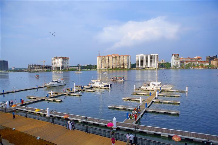
Edakochi is one of the oldest districts in southern Kochi (or Cochin), India. It borders Palluruthy to the northwest and is separated from Aroor to the south and Kumbalam, Ernakulam to the east by the Kerala backwaters. Bridges and roads The Edakochi Kannangatt Bridge links Kannangat to the Indian Maritime University junction on NH 966B (Kundanoor Willingdon Highway). It was constructed by the Kerala Public Works Department. The Edakochi Kannangat Willingdon Island Bridge was opened to the public in September 2017 by the Minister of Works, G. Sudhakaran, bringing the city closer to the Thevara and Kundanoor regions. Buildings Edakochi is home to the proposed site for the Kerala Cricket Association Stadium. It will be located from the South Railway Station, from the North Railway Station, and from Kaloor. Edakochi's St. Lawrence's Church has gained fame as the burial place of Monsignor Lawrence Puliyanath. The church at Edakochin is one of the oldest churches in Eda ... [...More Info...] [...Related Items...] OR: [Wikipedia] [Google] [Baidu] |
Vembanad
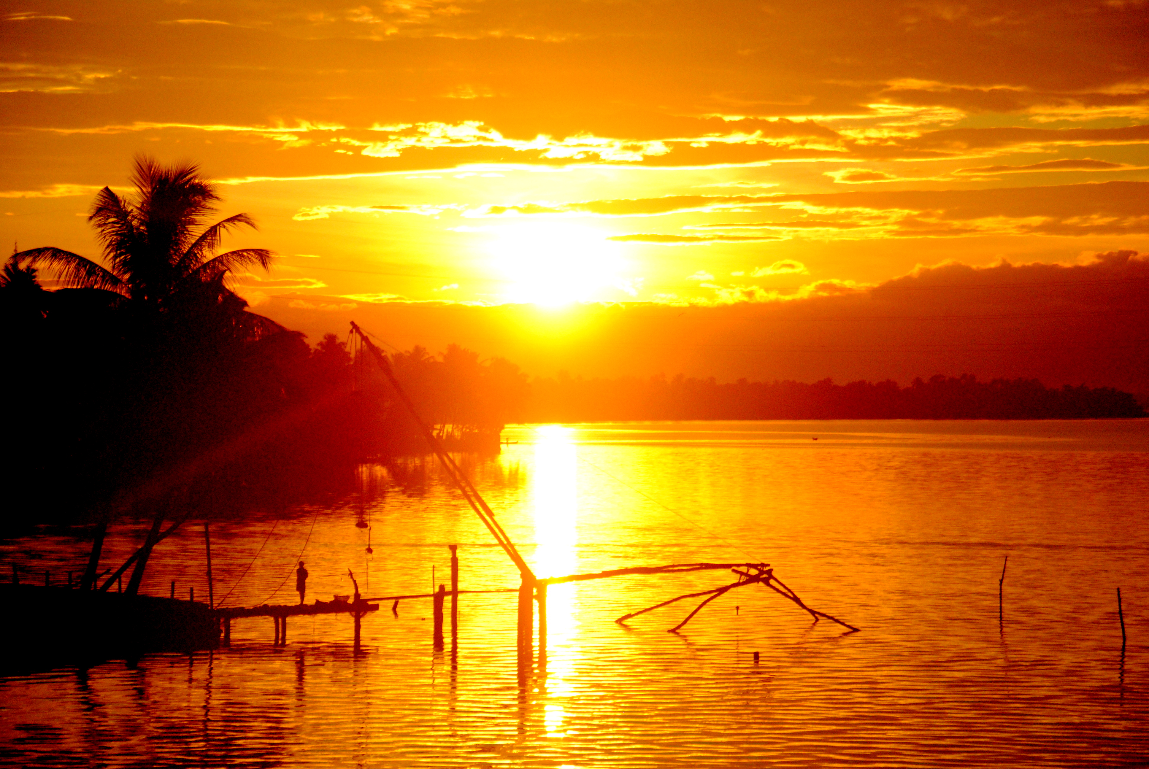
Vembanad is the longest lake in India, as well as the largest lake in the state of Kerala. The lake has an area of 230 square kilometers and a maximum length of 96.5 km. Spanning several districts in the state of Kerala, it is known as Vembanadu Lake in Kottayam, Vaikom, Changanassery, Punnamada Lake in Alappuzha, Punnappra, Kuttanadu and Kochi Lake in Kochi. Several groups of small islands including Vypin, Mulavukad, Maradu, Udayamperoor, Vallarpadam, Willingdon Island are located in the Kochi Lake portion. Kochi Port is built around the Willingdon Island and the Vallarpadam island. Kuttanad, also known as ''The Rice Bowl of Kerala'', has the lowest altitude in India, and is also one of the few places in world where cultivation takes place below sea level. Kuttanad lies on the southern portion of Vembanad. The Nehru Trophy Boat Race is conducted in a portion of the lake. High levels of pollution have been noticed at certain hotspots of the Vembanad backwaters. The Gov ... [...More Info...] [...Related Items...] OR: [Wikipedia] [Google] [Baidu] |
Seafood
Seafood is any form of sea life regarded as food by humans, prominently including fish and shellfish. Shellfish include various species of molluscs (e.g. bivalve molluscs such as clams, oysters and mussels, and cephalopods such as octopus and squid), crustaceans (e.g. shrimp, crabs, and lobster), and echinoderms (e.g. sea cucumbers and sea urchins). Historically, marine mammals such as cetaceans (whales and dolphins) as well as seals have been eaten as food, though that happens to a lesser extent in modern times. Edible sea plants such as some seaweeds and microalgae are widely eaten as sea vegetables around the world, especially in Asia. Seafood is an important source of (animal) protein in many diets around the world, especially in coastal areas. Semi-vegetarians who consume seafood as the only source of meat are said to adhere to pescetarianism. The harvesting of wild seafood is usually known as fishing or hunting, while the cultivation and farming of seafood is kno ... [...More Info...] [...Related Items...] OR: [Wikipedia] [Google] [Baidu] |
Kerala Legislative Assembly
The Kerala Legislative Assembly, popularly known as the Kerala Niyamasabha, is the State Assembly of Kerala, one of the 28 states in India. The Assembly is formed by 140 elected representatives. Each elected member represents one of the 140 constituencies within the borders of Kerala and is referred to as Member of the Legislative Assembly (MLA). The present Kerala Legislative Assembly consists of 140 elected members. History In 1956, the State of Kerala was formed on linguistic basis, merging Cochin, Malabar, and Travancore regions, and the Kasaragod region of South Canara. The first assembly election in Kerala state was held in February–March 1957. The first ''Kerala Legislative Assembly'' was formed on 5 April 1957. The Assembly had 127 members including a nominated member. The current delimitation committee of 2010 reaffirmed the total number of seats at 140. Niyamasabha Complex The State Assembly is known as Niyamasabha and is housed in New Legislature Complex. ... [...More Info...] [...Related Items...] OR: [Wikipedia] [Google] [Baidu] |
Travancore
The Kingdom of Travancore ( /ˈtrævənkɔːr/), also known as the Kingdom of Thiruvithamkoor, was an Indian kingdom from c. 1729 until 1949. It was ruled by the Travancore Royal Family from Padmanabhapuram, and later Thiruvananthapuram. At its zenith, the kingdom covered most of the south of modern-day Kerala ( Idukki, Kottayam, Alappuzha, Pathanamthitta, Kollam, and Thiruvananthapuram districts, and some portions of Ernakulam district), and the southernmost part of modern-day Tamil Nadu (Kanyakumari district and some parts of Tenkasi district) with the Thachudaya Kaimal's enclave of Irinjalakuda Koodalmanikyam temple in the neighbouring Kingdom of Cochin. However Tangasseri area of Kollam city and Anchuthengu near Attingal in Thiruvananthapuram district, were British colonies and were part of the Malabar District until 30 June 1927, and Tirunelveli district from 1 July 1927 onwards. Travancore merged with the erstwhile princely state of Cochin to form Travancore-Cochin i ... [...More Info...] [...Related Items...] OR: [Wikipedia] [Google] [Baidu] |
Census
A census is the procedure of systematically acquiring, recording and calculating information about the members of a given population. This term is used mostly in connection with national population and housing censuses; other common censuses include censuses of agriculture, traditional culture, business, supplies, and traffic censuses. The United Nations (UN) defines the essential features of population and housing censuses as "individual enumeration, universality within a defined territory, simultaneity and defined periodicity", and recommends that population censuses be taken at least every ten years. UN recommendations also cover census topics to be collected, official definitions, classifications and other useful information to co-ordinate international practices. The UN's Food and Agriculture Organization (FAO), in turn, defines the census of agriculture as "a statistical operation for collecting, processing and disseminating data on the structure of agriculture, covering th ... [...More Info...] [...Related Items...] OR: [Wikipedia] [Google] [Baidu] |
Ernakulam
Ernakulam () is the Central Business District of the city of Kochi in Kerala, India and has lent its name to the Ernakulam district. Many major establishments, including the Kerala High Court, the office of the Kochi Municipal Corporation and the Cochin Shipyard are situated here. History Classical history The region can claim to have played a significant part in fostering the trade relations between Kerala and the outside world in the ancient and medieval period. The early political history of Ernakulam is interlinked with that of the Chera Dynasty of the Sangam age, who ruled over vast portions of Kerala and Tamil Nadu. After the Cheras, the place was later ruled by the Kingdom of Cochin (Perumpadapu Swaroopam). Princely State of Cochin Although under British suzerainty (specifically the East India Company) since the Anglo-Dutch Treaty of 1814, Rama Varma XII of the Kingdom of Cochin moved his capital from Mattancherry to Tripunithura in about 1840. Fort Cochin Munic ... [...More Info...] [...Related Items...] OR: [Wikipedia] [Google] [Baidu] |
Kochi Bypass
The Kochi Bypass is a segment of NH66(National Highway 66) that bypasses the CBD of the city of Kochi in Kerala, India. The highway stretches 17 km from Edapally in the Ernakulam district to Aroor in Alappuzha district , via. Palarivattom, Vyttila, Kundannoor, Madavana, Kumbalam. The Government of Kerala began the preliminary works in 1973. After a slow progress, it was partially opened for traffic in the beginning years of the 1980s. The section between Edapally and Vyttila had four lanes from the beginning. The rest of the carriageway was also upgraded to different sections of 4 lane, 5lane and 6 lanes by 2010 The idea was to bypass the truck traffic out of the city proper. However now the city has outgrown the bypass leading to a heavy suburban traffic. Today, this road has turned out to be the most important arterial road in Kochi. The spacious road is going to replace the MG Road as the state's major commercial avenue in a few years time. Space crunch has really ... [...More Info...] [...Related Items...] OR: [Wikipedia] [Google] [Baidu] |
National Highway 66
The following highways are numbered 66: Australia * Barkly Highway (Northern Territory) * Riddoch Highway Canada * Alberta Highway 66 * Highway 66 (Ontario) Finland * Kantatie 66 (Orivesi — Lapua) France * A66 autoroute Germany * Bundesautobahn 66 Greece * Greek National Road 66, a national highway connecting Nemea with Levidi via Skoteini Hungary * 66-os főút (Kaposvár - Pécs) India * National Highway 66 (India) Ireland * N66 road (Ireland), N66 Israel * Highway 66 (Israel) Malaysia * Malaysia Federal Route 66 Philippines * N66 highway (Philippines) Slovakia * Road 66 (Slovakia), from Slovak Republic, Slovak - Hungary, Hungarian border at Šahy to Tatras mountain Spain * Autovía A-66 (Silver Route) United Arab Emirates * E 66 road (United Arab Emirates), E 66 United Kingdom * A66 road * M66 motorway United States * Interstate 66, a highway connecting Interstate 81 in Virginia to Washington, D.C. ** Interstate 66 (Kansas–Kentucky), a former proposed hi ... [...More Info...] [...Related Items...] OR: [Wikipedia] [Google] [Baidu] |
Kochi Urban Agglomeration
The Kochi metropolitan area or Kochi urban agglomeration is a metropolitan area centered around the city of Kochi, in Ernakulam district, Kerala, India. With a population of more than 2.1 million within an area of 440 km², it is the most populous metropolitan area in Kerala. Municipalities and Panchayaths The area constituted on the basis of census data 2011, consists of Kochi Municipal Corporation, 9 municipalities, 15 Panchayaths and parts of 4 Panchayaths. The 9 municipalities are Aluva, Thrippunithura, Maradu, Thrikkakara, Kalamassery, Eloor, North Paravur, Perumbavoor and Angamali. The fifteen Panchayaths consists of Chengamanad, Nedumbassery, Cheranelloor, Varapuzha, Chennamangalam, Kadamakkudy, Mulavukad, Kadungalloor, Alengad, Chottanikkara, Choornikkara, Edathala, Kizhakkambalam, Kumbalam, Kottuvally and Vypin Island. . The state government and the GCDA have plans to include Mala and Kodungallur in Thrissur district; Piravom and Kolenchery in Ernakulam distric ... [...More Info...] [...Related Items...] OR: [Wikipedia] [Google] [Baidu] |
India
India, officially the Republic of India (Hindi: ), is a country in South Asia. It is the seventh-largest country by area, the second-most populous country, and the most populous democracy in the world. Bounded by the Indian Ocean on the south, the Arabian Sea on the southwest, and the Bay of Bengal on the southeast, it shares land borders with Pakistan to the west; China, Nepal, and Bhutan to the north; and Bangladesh and Myanmar to the east. In the Indian Ocean, India is in the vicinity of Sri Lanka and the Maldives; its Andaman and Nicobar Islands share a maritime border with Thailand, Myanmar, and Indonesia. Modern humans arrived on the Indian subcontinent from Africa no later than 55,000 years ago., "Y-Chromosome and Mt-DNA data support the colonization of South Asia by modern humans originating in Africa. ... Coalescence dates for most non-European populations average to between 73–55 ka.", "Modern human beings—''Homo sapiens''—originated in Africa. Then, int ... [...More Info...] [...Related Items...] OR: [Wikipedia] [Google] [Baidu] |


