|
Armenia Fault
The Armenia Fault ( es, Falla de Armenia) is an oblique sinistral strike-slip fault in the department of Quindío in west-central Colombia. The fault is part of the megaregional Romeral Fault System and has a total length of approximately and runs along an average northwest to southeast strike of 023.2 ± 11 in the Central Ranges of the Colombian Andes. The fault shows Holocene activity with a surface rupture produced in 2001. Etymology The fault is named after Armenia, the capital of Quindío.Paris et al., 2000a, p.21 Description The Armenia Fault is part of the Romeral Fault System on the western slope of the Central Ranges of the Colombian Andes. The fault crosses the city of Armenia and displaces Pliocene to Pleistocene volcanic and volcano-sedimentary deposits of the Quindío Fan ( es, Abanico del Quindío), which covers about . The geometric and neotectonic features of the Montenegro and Armenia Faults are very similar. The fault forms well-developed fault ... [...More Info...] [...Related Items...] OR: [Wikipedia] [Google] [Baidu] |
Armenia, Colombia
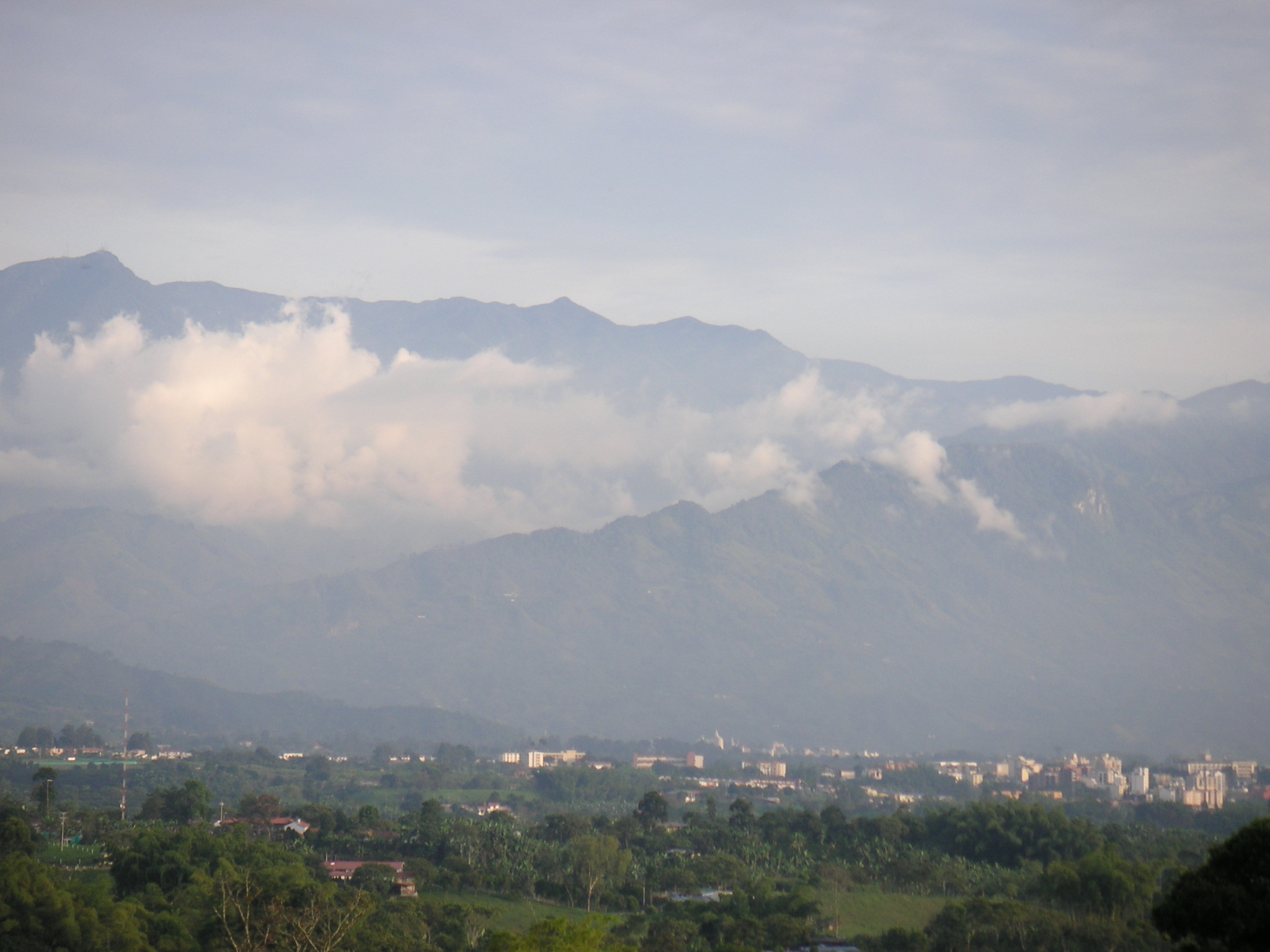
Armenia () is the capital of Quindio Department. Armenia is a medium-sized city and part of the " coffee axis" along with Pereira and Manizales. It is one of the main centers of the national economy and of the Colombian coffee growing axis. As a result, the historic center of Armenia was named as part of the "Coffee Cultural Landscape" of UNESCO World Heritage Site in 2011. History The city was founded on October 14, 1889, by Jesús María Ocampo, also known as "Tigrero" (translates to "tiger killer") due to his love of hunting jaguars, known locally as tigers. Ocampo came from Anaime, Tolima, looking for shelter in the mountains of Quindío because he was running away from General Gallo. He paid one hundred pesos in gold coins to Antonio Herrera for the land on which to build a fonda, or trade center, not only for himself but also for other colonists who came from Salento, Antioquia, Manizales, and areas surrounding the Quindío River and La Vieja River. Ocampo then proc ... [...More Info...] [...Related Items...] OR: [Wikipedia] [Google] [Baidu] |
Pliocene
The Pliocene ( ; also Pleiocene) is the epoch in the geologic time scale that extends from 5.333 million to 2.58See the 2014 version of the ICS geologic time scale million years ago. It is the second and most recent epoch of the Neogene Period in the . The Pliocene follows the Epoch and is followed by the Epoch. Prior to the 2009 ... [...More Info...] [...Related Items...] OR: [Wikipedia] [Google] [Baidu] |
List Of Earthquakes In Colombia
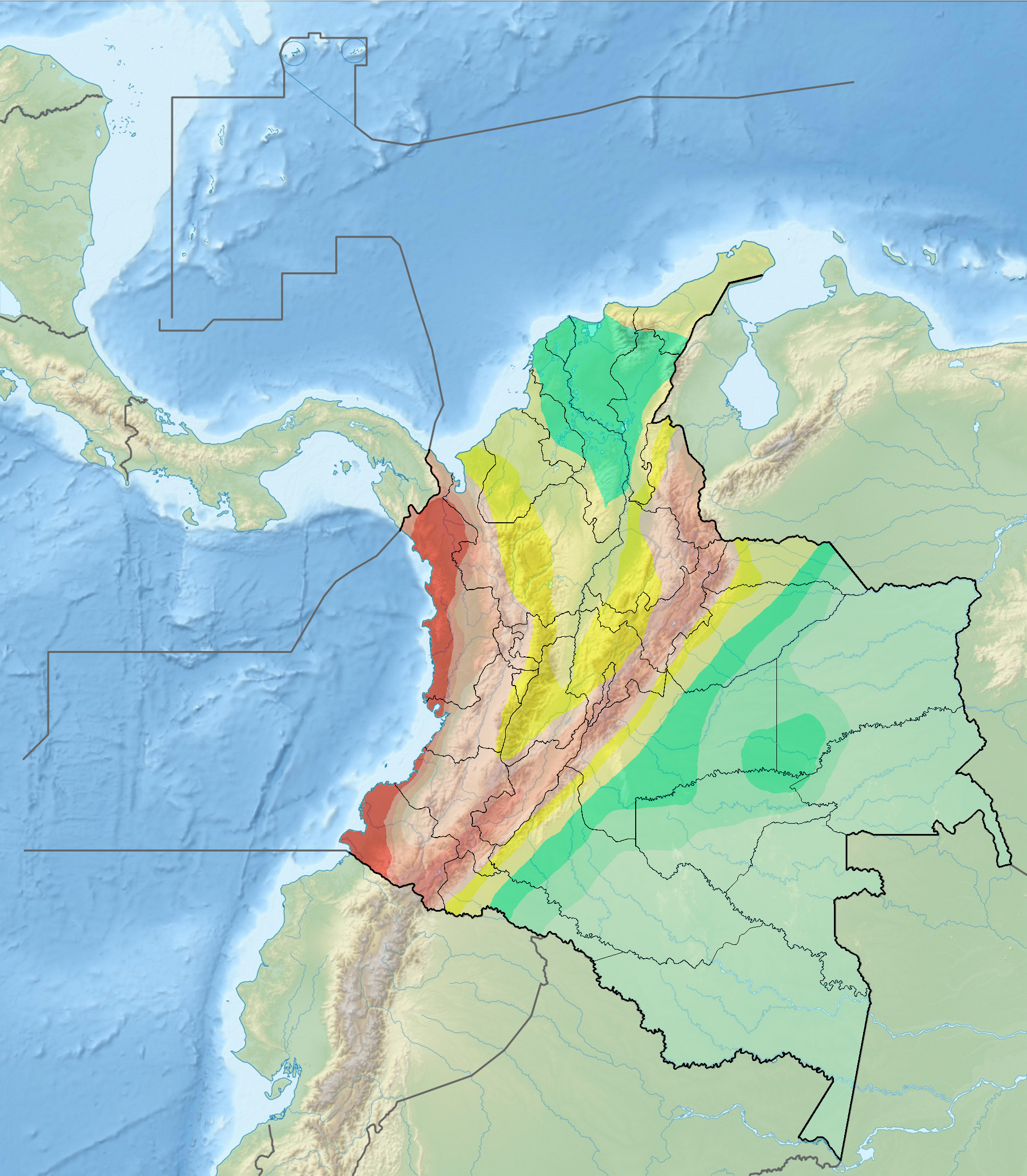
This is a list of earthquakes in Colombia. Colombia is a seismically active country and has a large seismic risk in many areas of its territory due to its location at the boundaries of the Malpelo, Panama, Caribbean, North Andes (where most earthquakes occurred) and South American Plates along the Pacific Ring of Fire. The southeastern and extreme eastern portions of Colombia are not as seismically active as the rest of the country. The first historically registered earthquake felt in Colombia occurred on September 11, 1530, around 10:00 AM, probably with the epicentre near Cumaná, Venezuela. The earthquake was documented by Gonzalo Fernández de Oviedo y Valdés in his work ''La Historia general de las Indias'' and by friar Bartolomé de las Casas in his book ''Historia de Las Indias''.Ramírez, 1975, p.63 The first documented earthquake with its epicentre in present-day Colombia territory took place in 1566,Ramírez, 1975, p.65 with the epicentre estimated around Santander ... [...More Info...] [...Related Items...] OR: [Wikipedia] [Google] [Baidu] |
Moment Magnitude Scale
The moment magnitude scale (MMS; denoted explicitly with or Mw, and generally implied with use of a single M for magnitude) is a measure of an earthquake's magnitude ("size" or strength) based on its seismic moment. It was defined in a 1979 paper by Thomas C. Hanks and Hiroo Kanamori. Similar to the local magnitude scale, local magnitude/Richter scale () defined by Charles Francis Richter in 1935, it uses a logarithmic scale; small earthquakes have approximately the same magnitudes on both scales. Despite the difference, news media often says "Richter scale" when referring to the moment magnitude scale. Moment magnitude () is considered the authoritative magnitude scale for ranking earthquakes by size. It is more directly related to the energy of an earthquake than other scales, and does not saturate—that is, it does not underestimate magnitudes as other scales do in certain conditions. It has become the standard scale used by seismological authorities like the U.S. Geological ... [...More Info...] [...Related Items...] OR: [Wikipedia] [Google] [Baidu] |
Cerro Machín
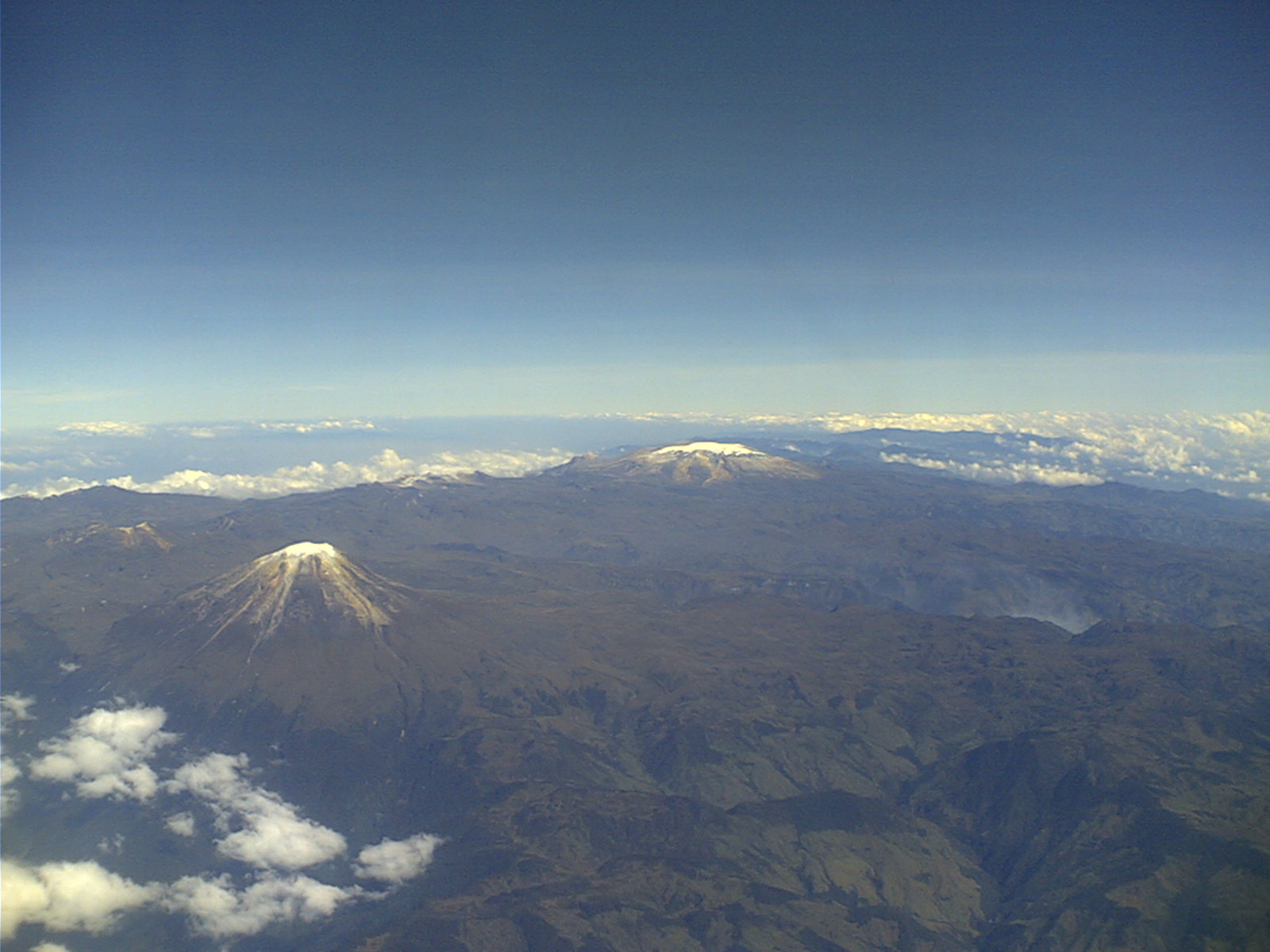
Cerro Machín is a stratovolcano located in Tolima Department, Colombia. Cerro Machin is a volcanic plug that is approximately the same age (1,000,000+ years) as the Ruiz-Tolima Massif and has the appearance of being part of that volcanic system. Its sisters are Nevado del Tolima, ; Santa Isabel, , Nevado del Ruiz, , plus nine other lesser volcanoes and a volcanic South Wall containing in excess of thirty volcanic domes. Gallery See also * List of volcanoes in Colombia * List of volcanoes by elevation A list (incomplete) of volcanoes on Earth arranged by elevation in metres. 6,000 metres 5,000 metres 4,000 metres 3,000 metres 2,000 metres 1,000 metres Below 1,000 metres From its base on the ocean floor A list (in ... References Andean Volcanic Belt Mountains of Colombia Stratovolcanoes of Colombia Quaternary South America Quaternary volcanoes Geography of Tolima Department {{Volcano-stub ... [...More Info...] [...Related Items...] OR: [Wikipedia] [Google] [Baidu] |
Lapilli
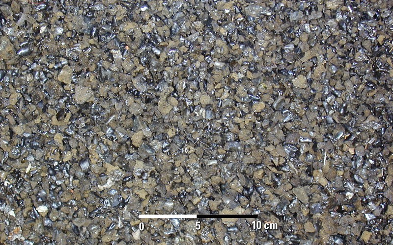
Lapilli is a size classification of tephra, which is material that falls out of the air during a volcanic eruption or during some meteorite impacts. ''Lapilli'' (singular: ''lapillus'') is Latin for "little stones". By definition lapilli range from in diameter. A pyroclastic particle greater than 64 mm in diameter is known as a volcanic bomb when molten, or a volcanic block when solid. Pyroclastic material with particles less than 2 mm in diameter is referred to as volcanic ash. Formation Lapilli are spheroid-, teardrop-, dumbbell- or button-shaped droplets of molten or semi-molten lava ejected from a volcanic eruption that fall to earth while still at least partially molten. These granules are not accretionary, but instead the direct result of liquid rock cooling as it travels through the air. Lapilli tuffs are a very common form of volcanic rock typical of rhyolite, andesite and dacite pyroclastic eruptions, where thick layers of lapilli can be deposited during a ... [...More Info...] [...Related Items...] OR: [Wikipedia] [Google] [Baidu] |
Holocene
The Holocene ( ) is the current geological epoch. It began approximately 11,650 cal years Before Present (), after the Last Glacial Period, which concluded with the Holocene glacial retreat. The Holocene and the preceding Pleistocene together form the Quaternary period. The Holocene has been identified with the current warm period, known as MIS 1. It is considered by some to be an interglacial period within the Pleistocene Epoch, called the Flandrian interglacial.Oxford University Press – Why Geography Matters: More Than Ever (book) – "Holocene Humanity" section https://books.google.com/books?id=7P0_sWIcBNsC The Holocene corresponds with the rapid proliferation, growth and impacts of the human species worldwide, including all of its written history, technological revolutions, development of major civilizations, and overall significant transition towards urban living in the present. The human impact on modern-era Earth and its ecosystems may be considered of global si ... [...More Info...] [...Related Items...] OR: [Wikipedia] [Google] [Baidu] |
Quindío River
Quindío River ( es, Río Quindío) is the principal river of the department of Quindío, Colombia. It combines with the Barragán River at the Valle de Maravelez to form La Vieja River, in turn a tributary of the Cauca River. Quindío River Is long. It forms in the mountains east of Salento and flows in a south-westerly direction, passing by the township of Salento and forming the eastern limit of the city of Armenia. Its major tributaries are the Verde River and the Navarco River (these in turn have the tributaries Santo Domingo and Boquerón, respectively). The total watershed including these tributaries is . The average flow at the mouth is . The river is the source of drinking water for the majority of the inhabitants of the department. The continued increase in demand is placing significant pressure on this resource. Additionally, there are contamination problems due to inadequate waste water treatment Wastewater treatment is a process used to remove contaminant ... [...More Info...] [...Related Items...] OR: [Wikipedia] [Google] [Baidu] |
Pyroclastic Flow
A pyroclastic flow (also known as a pyroclastic density current or a pyroclastic cloud) is a fast-moving current of hot gas and volcanic matter (collectively known as tephra) that flows along the ground away from a volcano at average speeds of but is capable of reaching speeds up to . The gases and tephra can reach temperatures of about . Pyroclastic flows are the most deadly of all volcanic hazards and are produced as a result of certain explosive eruptions; they normally touch the ground and hurtle downhill, or spread laterally under gravity. Their speed depends upon the density of the current, the volcanic output rate, and the gradient of the slope. Origin of term The word ''pyroclast'' is derived from the Greek (''pýr''), meaning "fire", and (''klastós''), meaning "broken in pieces". A name for pyroclastic flows which glow red in the dark is (French, "burning cloud"); this was notably used to describe the disastrous 1902 eruption of Mount Pelée on Martinique, a French ... [...More Info...] [...Related Items...] OR: [Wikipedia] [Google] [Baidu] |
Debris Flow
Debris flows are geological phenomena in which water-laden masses of soil and fragmented rock rush down mountainsides, funnel into stream channels, entrain objects in their paths, and form thick, muddy deposits on valley floors. They generally have bulk densities comparable to those of rock avalanches and other types of landslides (roughly 2000 kilograms per cubic meter), but owing to widespread sediment liquefaction caused by high pore-fluid pressures, they can flow almost as fluidly as water. Debris flows descending steep channels commonly attain speeds that surpass 10 m/s (36 km/h), although some large flows can reach speeds that are much greater. Debris flows with volumes ranging up to about 100,000 cubic meters occur frequently in mountainous regions worldwide. The largest prehistoric flows have had volumes exceeding 1 billion cubic meters (i.e., 1 cubic kilometer). As a result of their high sediment concentrations and mobility, debris flows can be very des ... [...More Info...] [...Related Items...] OR: [Wikipedia] [Google] [Baidu] |
Alluvium
Alluvium (from Latin ''alluvius'', from ''alluere'' 'to wash against') is loose clay, silt, sand, or gravel that has been deposited by running water in a stream bed, on a floodplain, in an alluvial fan or beach, or in similar settings. Alluvium is also sometimes called alluvial deposit. Alluvium is typically geologically young and is not consolidated into solid rock. Sediments deposited underwater, in seas, estuaries, lakes, or ponds, are not described as alluvium. Floodplain alluvium can be highly fertile, and supported some of the earliest human civilizations. Definitions The present consensus is that "alluvium" refers to loose sediments of all types deposited by running water in floodplains or in alluvial fans or related landforms. However, the meaning of the term has varied considerably since it was first defined in the French dictionary of Antoine Furetière, posthumously published in 1690. Drawing upon concepts from Roman law, Furetière defined ''alluvion'' (the F ... [...More Info...] [...Related Items...] OR: [Wikipedia] [Google] [Baidu] |


