|
Ardoukoba Volcano
Ardoukôba ( ar, أردوكوبا) is a fissure vents volcano in Djibouti. Located on the coast from Djibouti City, its summit is situated at above sea level. It last erupted in November 1978 following an earthquake, the area having been dormant for 3,000 years. The volcano's rift is in width, and has a depth of . The Government of Djibouti has initiated a proposal with UNESCO to declare the Lake Assal zone including the Ardoukoba volcano and its surroundings as a World Heritage Site. Geography Culminating at an altitude of 298 meters, the Ardoukôba is a volcano born from a volcanic fissure and composed of a pile of basaltic slag forming three cones emitting two flows of fluid basaltic lava. These eruptive characteristics classify the Ardoukôba among the red volcanoes fed by a rift magma. This northwest-southeast trending volcanic fissure is part of the Great Rift Valley fault system between the Danakil block in the northeast and the Afar depression in the southwest. Hist ... [...More Info...] [...Related Items...] OR: [Wikipedia] [Google] [Baidu] |
List Of Volcanoes In Djibouti
This is a list of active and extinct volcanoes. References Tiho Information{{Djibouti topics Djibouti Volcanoes A volcano is a rupture in the crust of a planetary-mass object, such as Earth, that allows hot lava, volcanic ash, and gases to escape from a magma chamber below the surface. On Earth, volcanoes are most often found where tectonic plates a ... * ... [...More Info...] [...Related Items...] OR: [Wikipedia] [Google] [Baidu] |
Djibouti
Djibouti, ar, جيبوتي ', french: link=no, Djibouti, so, Jabuuti officially the Republic of Djibouti, is a country in the Horn of Africa, bordered by Somalia to the south, Ethiopia to the southwest, Eritrea in the north, and the Red Sea and the Gulf of Aden to the east. The country has an area of . In antiquity, the territory, together with Ethiopia, Eritrea and Somaliland, was part of the Land of Punt. Nearby Zeila, now in Somaliland, was the seat of the medieval Adal and Ifat Sultanates. In the late 19th century, the colony of French Somaliland was established following treaties signed by the ruling Dir Somali sultans with the French, and its railroad to Dire Dawa (and later Addis Ababa) allowed it to quickly supersede Zeila as the port for southern Ethiopia and the Ogaden. It was renamed the French Territory of the Afars and the Issas in 1967. A decade later, the Djiboutian people voted for independence. This officially marked the establishment of the ''Rep ... [...More Info...] [...Related Items...] OR: [Wikipedia] [Google] [Baidu] |
Fissure Vent
A fissure vent, also known as a volcanic fissure, eruption fissure or simply a fissure, is a linear volcanic vent through which lava erupts, usually without any explosive eruption, explosive activity. The vent is often a few metres wide and may be many kilometres long. Fissure vents can cause large flood basalts which run first in lava channels and later in lava tubes. After some time, the eruption tends to become focused at one or more spatter cones. Small fissure vents may not be easily discernible from the air, but the crater rows (see Laki) or the canyons (see Eldgjá) built up by some of them are. The Dike_(geology)#Magmatic_dikes, dikes that feed fissures reach the surface from depths of a few kilometers and connect them to deeper magma chamber, magma reservoirs, often under volcanic centers. Fissures are usually found in or along rifts and rift zones, such as Iceland and the East African Rift. Fissure vents are often part of the structure of shield volcanoes. Icelan ... [...More Info...] [...Related Items...] OR: [Wikipedia] [Google] [Baidu] |
Djibouti (city)
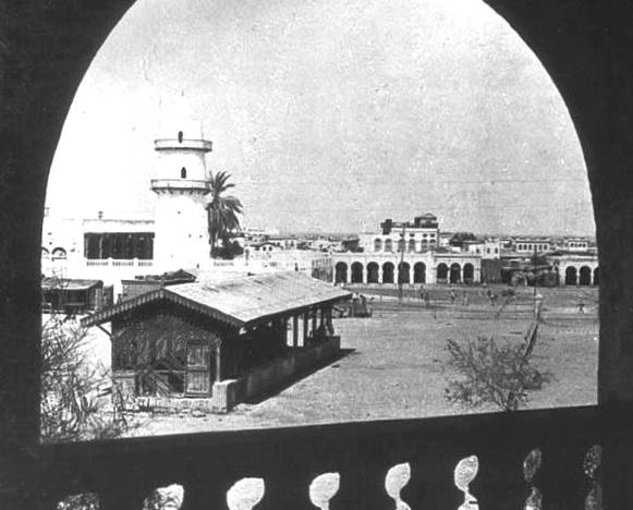
Djibouti (also called Djibouti City and in many early English texts and on many early maps, Jibuti; so, Magaalada Jabuuti, french: link=no, Ville de Djibouti, ar, مدينة جيبوتي, aa, Gabuutî Magaala) is the eponymous capital of Djibouti, and has more people than the rest of Djibouti combined. It is located in the coastal Djibouti Region on the Gulf of Tadjoura. Djibouti has a population of around 600,000 inhabitants, which counts for 54% of the country's population. The settlement was founded in 1888 by the French, on land leased from the ruling Somali and Afar Sultans. During the ensuing period, it served as the capital of French Somaliland and its successor the French Territory of the Afars and Issas. Known as the ''Pearl of the Gulf of Tadjoura'' due to its location, Djibouti is strategically positioned near the world's busiest shipping lanes and acts as a refueling and transshipment center. The Port of Djibouti is the principal maritime port for imports to and ... [...More Info...] [...Related Items...] OR: [Wikipedia] [Google] [Baidu] |
Above Mean Sea Level
Height above mean sea level is a measure of the vertical distance (height, elevation or altitude) of a location in reference to a historic mean sea level taken as a vertical datum. In geodesy, it is formalized as ''orthometric heights''. The combination of unit of measurement and the physical quantity (height) is called "metres above mean sea level" in the metric system, while in United States customary and imperial units it would be called "feet above mean sea level". Mean sea levels are affected by climate change and other factors and change over time. For this and other reasons, recorded measurements of elevation above sea level at a reference time in history might differ from the actual elevation of a given location over sea level at a given moment. Uses Metres above sea level is the standard measurement of the elevation or altitude of: * Geographic locations such as towns, mountains and other landmarks. * The top of buildings and other structures. * Flying objects such ... [...More Info...] [...Related Items...] OR: [Wikipedia] [Google] [Baidu] |
UNESCO
The United Nations Educational, Scientific and Cultural Organization is a specialized agency of the United Nations (UN) aimed at promoting world peace and security through international cooperation in education, arts, sciences and culture. It has 193 member states and 12 associate members, as well as partners in the non-governmental, intergovernmental and private sector. Headquartered at the World Heritage Centre in Paris, France, UNESCO has 53 regional field offices and 199 national commissions that facilitate its global mandate. UNESCO was founded in 1945 as the successor to the League of Nations's International Committee on Intellectual Cooperation.English summary). Its constitution establishes the agency's goals, governing structure, and operating framework. UNESCO's founding mission, which was shaped by the Second World War, is to advance peace, sustainable development and human rights by facilitating collaboration and dialogue among nations. It pursues this objective t ... [...More Info...] [...Related Items...] OR: [Wikipedia] [Google] [Baidu] |
Lake Assal (Djibouti)
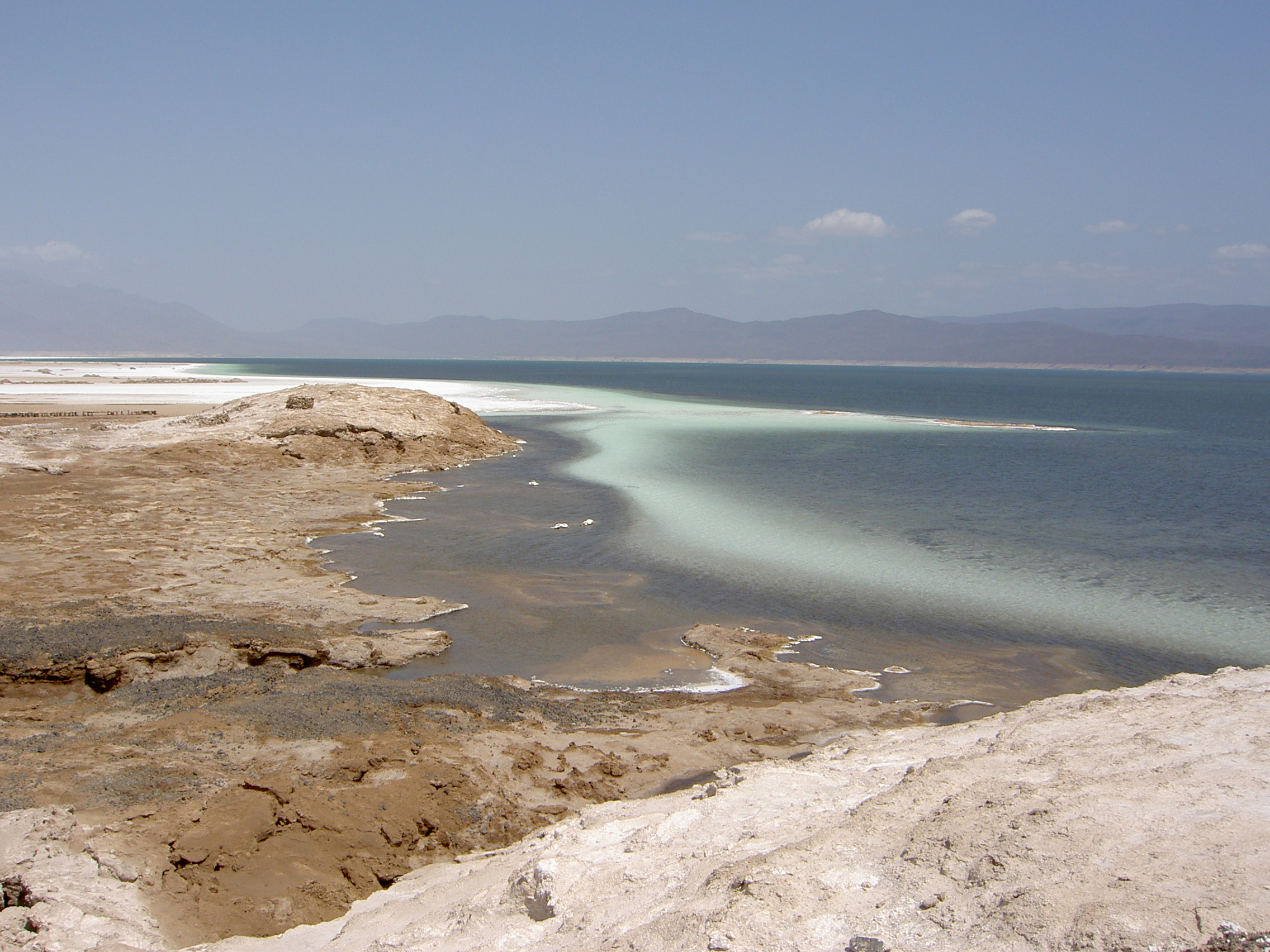
Lake Assal ( ar, بحيرة عسل , lit. “Honey Lake”) is a crater lake in central-western Djibouti. It is located at the western end of Gulf of Tadjoura between Arta Region, and Tadjoura Region, touching Dikhil Region, at the top of the Great Rift Valley, some west of Djibouti city. Lake Assal is a saline lake that lies below sea level in the Afar Triangle, making it the lowest point on land in Africa and the third-lowest point on Earth after the Sea of Galilee and the Dead Sea. No outflow occurs from the lake, and due to high evaporation, the salinity level of its waters is 10 times that of the sea, making it the third most saline body of water in the world behind Don Juan Pond and Gaet'ale Pond. The salt in the lake is exploited under four concessions awarded in 2002 at the southeast end of the lake; the major share of production (nearly 80%) is held by Société d’Exploitation du Lac and Société d’Exploitation du Salt Investment S.A de Djibouti. The lake is a p ... [...More Info...] [...Related Items...] OR: [Wikipedia] [Google] [Baidu] |
World Heritage Site
A World Heritage Site is a landmark or area with legal protection by an international convention administered by the United Nations Educational, Scientific and Cultural Organization (UNESCO). World Heritage Sites are designated by UNESCO for having cultural, historical, scientific or other form of significance. The sites are judged to contain " cultural and natural heritage around the world considered to be of outstanding value to humanity". To be selected, a World Heritage Site must be a somehow unique landmark which is geographically and historically identifiable and has special cultural or physical significance. For example, World Heritage Sites might be ancient ruins or historical structures, buildings, cities, deserts, forests, islands, lakes, monuments, mountains, or wilderness areas. A World Heritage Site may signify a remarkable accomplishment of humanity, and serve as evidence of our intellectual history on the planet, or it might be a place of great natural beauty. A ... [...More Info...] [...Related Items...] OR: [Wikipedia] [Google] [Baidu] |
Afar Triangle
The Afar Triangle (also called the Afar Depression) is a geological depression caused by the Afar Triple Junction, which is part of the Great Rift Valley in East Africa. The region has disclosed fossil specimens of the very earliest hominins; that is, the earliest of the human clade, and it is thought by some paleontologists to be the cradle of the evolution of humans. The Depression overlaps the borders of Eritrea, Djibouti and the entire Afar Region of Ethiopia; and it contains the lowest point in Africa, Lake Assal, Djibouti, at below sea level. The Awash River is the main waterflow into the region, but it runs dry during the annual dry season, and ends as a chain of saline lakes. The northern part of the Afar Depression is also known as the Danakil Depression. The lowlands are affected by heat, drought, and minimal air circulation, and contain the hottest places (year-round average temperatures) of anywhere on Earth. The Afar Triangle is bordered as follows (see the topo ... [...More Info...] [...Related Items...] OR: [Wikipedia] [Google] [Baidu] |
Danakil Desert
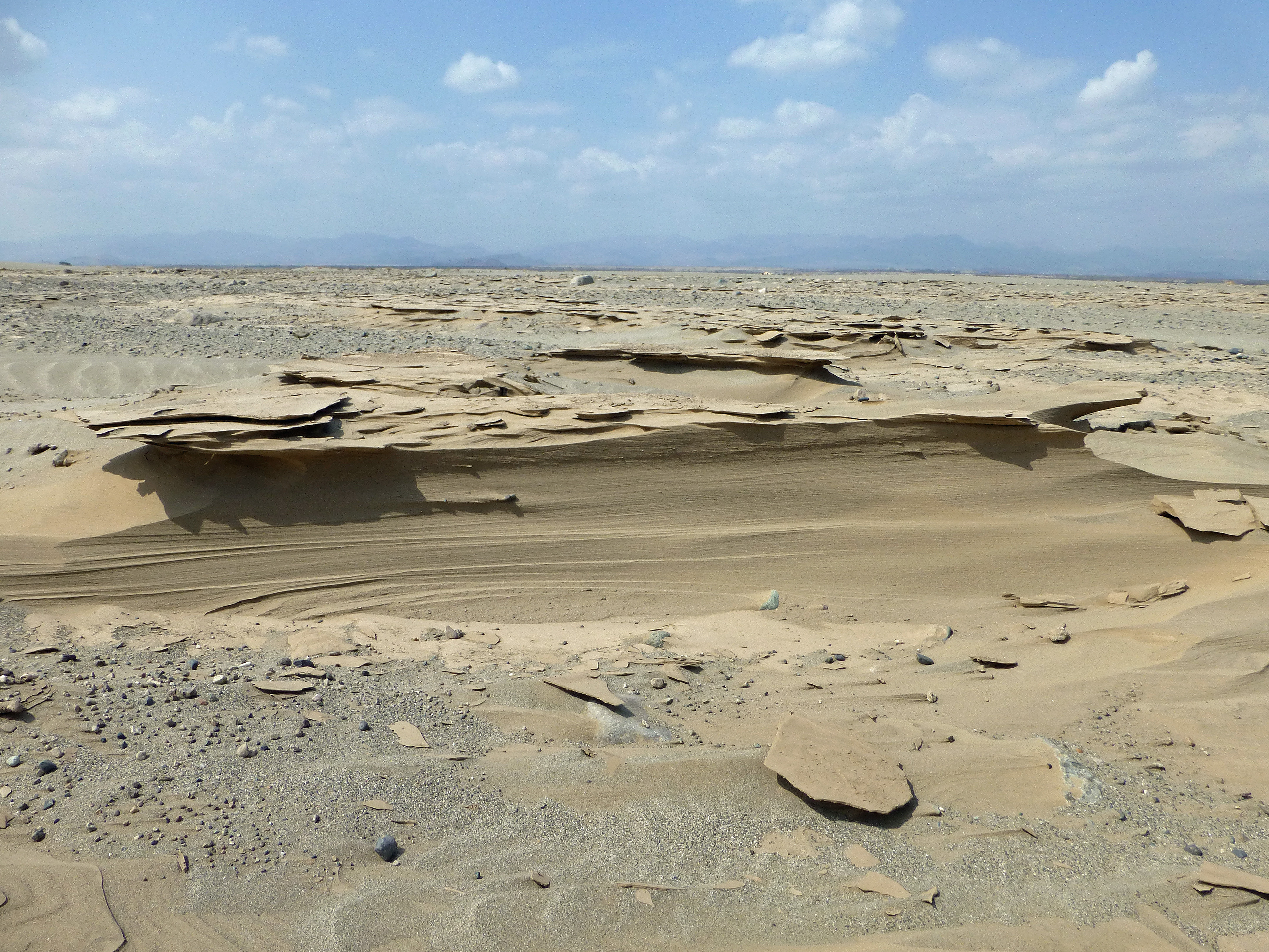
The Danakil Desert is a desert in northeast Ethiopia, southern Eritrea, and northwestern Djibouti. Situated in the Afar Triangle, it stretches across of arid terrain. It is inhabited by a few Afar, who engage in salt mining. The area is known for its volcanoes and extreme heat, with daytime temperatures surpassing . Less than of rainfall occurs each year. The Danakil Desert is one of the lowest and hottest places on Earth. Climate Dallol (92 metres below sea level), has the hottest average temperature recorded on earth: Geology Local geology is characterized by volcanic and tectonic activity, various climate cycles, and discontinuous erosion. The basic geological structure of this area was caused by the movement of tectonic plates as Africa moved away from Asia. Mountain chains formed and were eroded again during the Paleozoic. Inundations by the sea caused the formation of layers of sandstone, and limestone was deposited further offshore. As the land rose again, further s ... [...More Info...] [...Related Items...] OR: [Wikipedia] [Google] [Baidu] |
Ghoubbet-el-Kharab
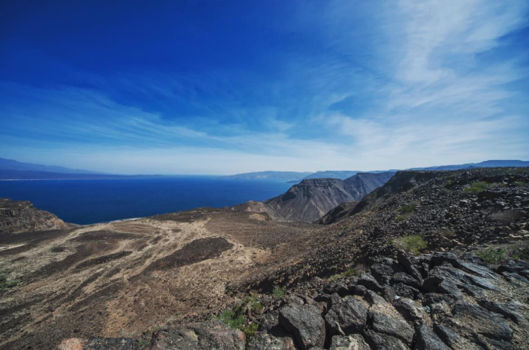
The Ghoubbet al-Kharab or Lake Ghoubbet ( ar, قبة الخراب, "the Gulf of the Demons") is a Djiboutian cove separated from the Gulf of Tadjoura by a narrow channel historically known to have violent currents. Ghoubbet al-Kharab is surrounded by mountains and cliffs 600 meters high, as well as by the Ardoukôba volcano which separates it from Lake Assal. It is very deep (200 meters) and hosts many fish and shark Sharks are a group of elasmobranch fish characterized by a cartilaginous skeleton, five to seven gill slits on the sides of the head, and pectoral fins that are not fused to the head. Modern sharks are classified within the clade Selachi ...s that grow in the strong gulf currents, and is part of the junction between the African and Arabian continental plates. The cove is visited by divers - "The Crack" (or "La Faille") and reefs like Ras Eiro are popular locations, and scientists like Captain Cousteau visited the region in the 1980s. The level of Ghou ... [...More Info...] [...Related Items...] OR: [Wikipedia] [Google] [Baidu] |


