|
Aram Chaos
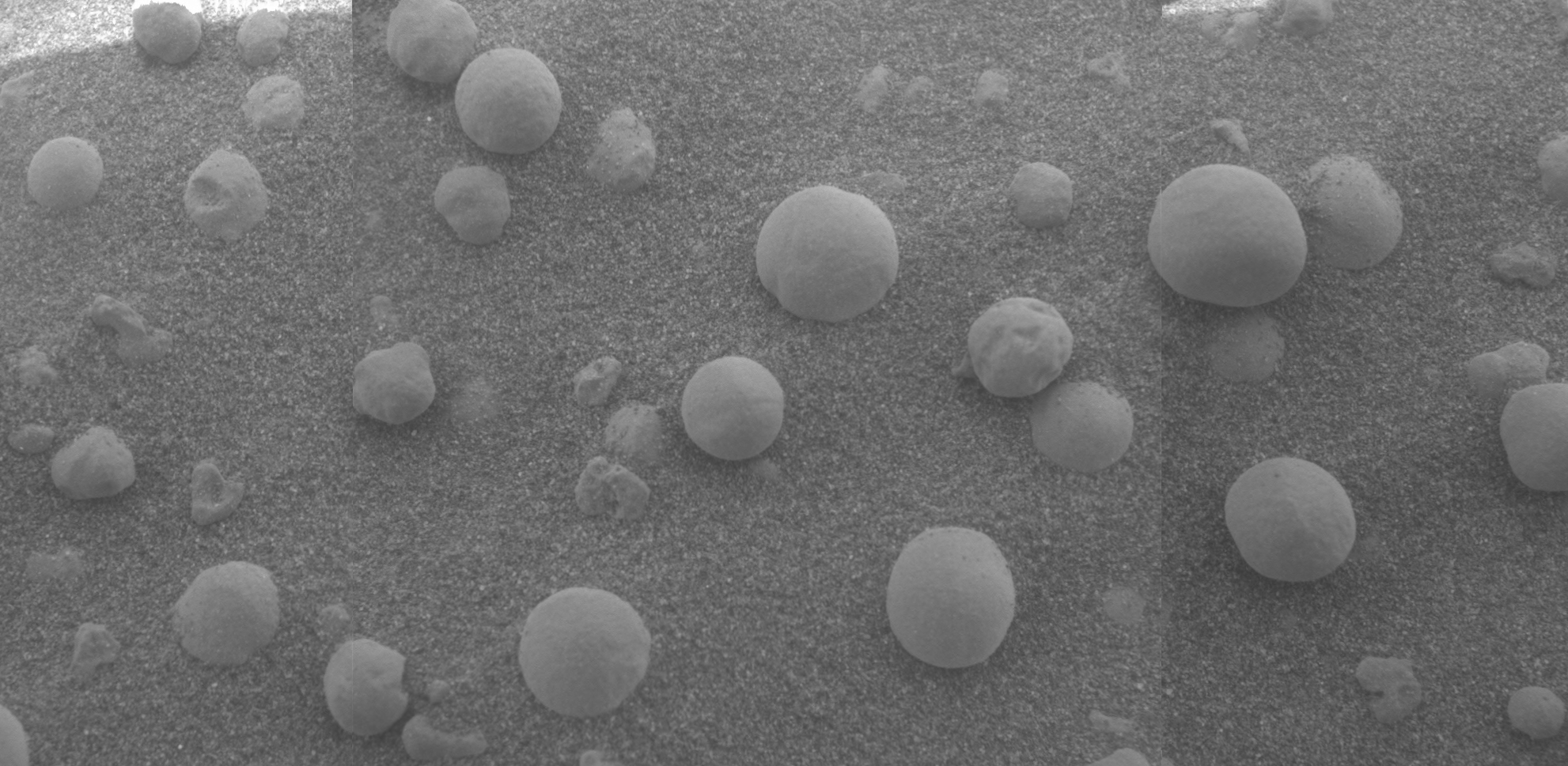
Aram Chaos, centered at 2.6°N, 21.5°W, is a heavily eroded impact crater on Mars. It lies at the eastern end of the large canyon Valles Marineris and close to Ares Vallis. Various geological processes have reduced it to a circular area of chaotic terrain. Aram Chaos takes its name from Aram, one of the classical albedo features observed by Giovanni Schiaparelli, who named it after the Biblical land of Aram. Spectroscopic observation from orbit indicates the presence of the mineral hematite, likely a signature of a once aqueous environment. Description Aram Chaos is an impact crater on Mars measuring 280 kilometers (170 mi) in diameter. It lies in the Oxia Palus quadrangle in a region called Margaritifer Terra, and its exact coordinates on Mars are . The Thermal Emission Imaging System (THEMIS) on the orbiter ''Mars Odyssey'' found gray crystalline hematite on the floor of Aram Chaos and CRISM, the spectroscope on the MRO, found hydrated sulfates, jarosite, and hematite. The ... [...More Info...] [...Related Items...] OR: [Wikipedia] [Google] [Baidu] |
Iani Chaos
Iani Chaos is a region of chaos terrain at the south end of the outflow channel Ares Vallis, of the Margaritifer Sinus quadrangle (MC-19) region of the planet Mars, centered at approximately ~342°E, 2°S. This is the source region of Ares Vallis. The chaotic terrain is widely believed to have formed via the removal of subsurface water or ice, resulting in flooding at the surface, and the formation of Ares Vallis. Within Iani Chaos, deposited stratigraphically above the chaotic terrain, are smooth, low-slope, intermediate-to-light-toned deposits that are rich in a hydrated mineral that is most likely gypsum as well as hematite. Mapbeer.jpg, Map showing location of Arsinoes Chaos (far left), Iani Chaos, Aureum Chaos, Margaritifer Chaos, and other nearby features Mars Science Laboratory Several sites in the Margaritifer Sinus quadrangle have been proposed as areas to send NASA's next major Mars rover, the Mars Science Lab. Among the top 33 landing sites was Iani Chaos. A picture ... [...More Info...] [...Related Items...] OR: [Wikipedia] [Google] [Baidu] |
Gray Crystalline Hematite
Hematite (), also spelled as haematite, is a common iron oxide compound with the formula, Fe2O3 and is widely found in rocks and soils. Hematite crystals belong to the rhombohedral lattice system which is designated the alpha polymorph of . It has the same crystal structure as corundum () and ilmenite (). With this it forms a complete solid solution at temperatures above . Hematite naturally occurs in black to steel or silver-gray, brown to reddish-brown, or red colors. It is mined as an important ore mineral of iron. It is electrically conductive. Hematite varieties include ''kidney ore'', ''martite'' (pseudomorphs after magnetite), ''iron rose'' and ''specularite'' (specular hematite). While these forms vary, they all have a rust-red streak. Hematite is not only harder than pure iron, but also much more brittle. Maghemite is a polymorph of hematite (γ-) with the same chemical formula, but with a spinel structure like magnetite. Large deposits of hematite are found in ... [...More Info...] [...Related Items...] OR: [Wikipedia] [Google] [Baidu] |
Chaotic Terrains On Mars
Chaotic was originally a Danish trading card game. It expanded to an online game in America which then became a television program based on the game. The program was able to be seen on 4Kids TV (Fox affiliates, nationwide), Jetix, The CW4Kids, Cartoon Network and Disney XD. It was brought over to the United States from Denmark by Bryan C. Gannon and Chaotic USA Entertainment Group, and produced by Chaotic USA Entertainment Group, 4Kids Productions and Bardel Entertainment. The trading card game came out 6 September 2006 in the U.S. and Canada. Each card comes with a unique code which the owner can upload onto the Chaotic website. This allows the owner to trade and play online using their own card collection. The game was well known to be the only game with a TV show, an online game, and a TCG that were all integrated. However, the online game is currently closed. History Chaotic started out as a trading card game known as "Grolls and Gorks" and an idea for a cartoon se ... [...More Info...] [...Related Items...] OR: [Wikipedia] [Google] [Baidu] |
Water On Mars
Almost all water on Mars today exists as ice, though it also exists in small quantities as vapor in the atmosphere. What was thought to be low-volume liquid brines in shallow Martian soil, also called recurrent slope lineae, may be grains of flowing sand and dust slipping downhill to make dark streaks.Recurring Martian Streaks: Flowing Sand, Not Water? Nasa.org 2017-11-20 The only place where water ice is visible at the surface is at the north polar ice cap. Abundant water ice is also present beneath the permanent |
Outflow Channels
Outflow channels are extremely long, wide swathes of scoured ground on Mars. They extend many hundreds of kilometers in length and are typically greater than one kilometer in width. They are thought to have been carved by huge outburst floods. Crater counts indicate that most of the channels were cut since the early Hesperian, though the age of the features is variable between different regions of Mars. Some outflow channels in the Amazonis and Elysium Planitiae regions have yielded ages of only tens of million years, extremely young by the standards of Martian topographic features. The largest, Kasei Vallis, is around long, greater than wide and exceeds in depth cut into the surrounding plains. The outflow channels contrast with the Martian channel features known as " valley networks", which much more closely resemble the dendritic planform more typical of terrestrial river drainage basins. Outflow channels tend to be named after the names for Mars in various ancient world ... [...More Info...] [...Related Items...] OR: [Wikipedia] [Google] [Baidu] |
Martian Chaos Terrain
Chaos terrain on Mars is distinctive; nothing on Earth compares to it. Chaos terrain generally consists of irregular groups of large blocks, some tens of kilometers across and a hundred or more meters high. The tilted and flat topped blocks form depressions hundreds of metres deep. A chaotic region can be recognized by a rat's nest of mesas, buttes, and hills, chopped through with valleys which in places look almost patterned. Some parts of this chaotic area have not collapsed completely—they are still formed into large mesas, so they may still contain water ice. Chaos regions formed long ago. By counting craters (more craters in any given area means an older surface) and by studying the valleys' relations with other geological features, scientists have concluded the channels formed 2.0 to 3.8 billion years ago. Locations The greatest concentrations of chaotic terrain are in the same locations as giant, ancient river valleys. Because so many large channels seem to originate ... [...More Info...] [...Related Items...] OR: [Wikipedia] [Google] [Baidu] |
List Of Areas Of Chaos Terrain On Mars
This is a list of areas of chaos terrain officially named by the International Astronomical Union on the planet Mars. Chaos terrain (or chaotic terrain) is an astrogeological term used to denote planetary surface areas where features such as ridges, cracks, and plains appear jumbled and enmeshed with one another. Coordinates are in planetocentric latitude with east longitude. Areas of chaos terrain are usually named after a nearby albedo feature as in line with the IAU's rules on planetary nomenclature. Such an albedo feature must feature on the maps of Mars made by either Giovanni Schiaparelli or Eugène Michel Antoniadi and are listed at Classical albedo features on Mars. References This list was adapted from the public domaiGazetteer of Planetary Nomenclature courtesy of the United States Geological Survey The United States Geological Survey (USGS), formerly simply known as the Geological Survey, is a scientific agency of the United States government. The scienti ... [...More Info...] [...Related Items...] OR: [Wikipedia] [Google] [Baidu] |
HiWish Program
HiWish is a program created by NASA so that anyone can suggest a place for the HiRISE camera on the Mars Reconnaissance Orbiter to photograph. It was started in January 2010. In the first few months of the program 3000 people signed up to use HiRISE. The first images were released in April 2010. Over 12,000 suggestions were made by the public; suggestions were made for targets in each of the 30 quadrangles of Mars. Selected images released were used for three talks at the 16th Annual International Mars Society Convention. Below are some of the over 4,224 images that have been released from the HiWish program as of March 2016. Glacial features Some landscapes look just like glaciers moving out of mountain valleys on Earth. Some have a hollowed-out appearance, looking like a glacier after almost all the ice has disappeared. What is left are the moraines—the dirt and debris carried by the glacier. The center is hollowed out because the ice is mostly gone. These supposed alp ... [...More Info...] [...Related Items...] OR: [Wikipedia] [Google] [Baidu] |
HiRISE
High Resolution Imaging Science Experiment is a camera on board the ''Mars Reconnaissance Orbiter'' which has been orbiting and studying Mars since 2006. The 65 kg (143 lb), US$40 million instrument was built under the direction of the University of Arizona's Lunar and Planetary Laboratory by Ball Aerospace & Technologies Corp. It consists of a 0.5m (19.7 in) aperture reflecting telescope, the largest so far of any deep space mission, which allows it to take pictures of Mars with resolutions of 0.3m/pixel (1ft/pixel), resolving objects below a meter across. HiRISE has imaged Mars exploration rovers on the surface, including the ''Opportunity'' rover and the ongoing ''Curiosity'' mission. History In the late 1980s, of Ball Aerospace & Technologies began planning the kind of high-resolution imaging needed to support sample return and surface exploration of Mars. In early 2001 he teamed up with Alfred McEwen of the University of Arizona to propose such a c ... [...More Info...] [...Related Items...] OR: [Wikipedia] [Google] [Baidu] |
Geology Of Mars
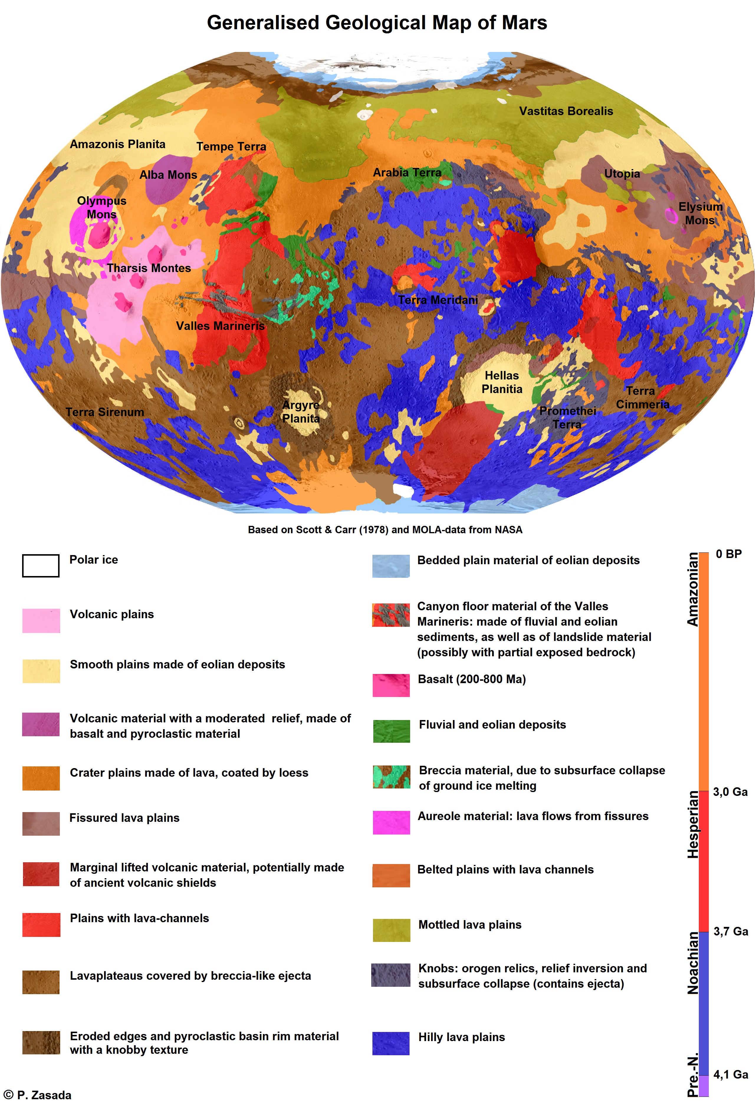
The geology of Mars is the scientific study of the surface, crust, and interior of the planet Mars. It emphasizes the composition, structure, history, and physical processes that shape the planet. It is analogous to the field of terrestrial geology. In planetary science, the term ''geology'' is used in its broadest sense to mean the study of the solid parts of planets and moons. The term incorporates aspects of geophysics, geochemistry, mineralogy, geodesy, and cartography. A neologism, areology, from the Greek word ''Arēs'' (Mars), sometimes appears as a synonym for Mars's geology in the popular media and works of science fiction (e.g. Kim Stanley Robinson, Kim Stanley Robinson's Mars trilogy). The term areology is also used by the Areological Society. Geological map of Mars (2014) File:Geologic Map of Mars figure2.pdf, Figure 2 for the geologic map of Mars Global Martian topography and large-scale features Composition of Mars Mars is a terrestrial planet, whic ... [...More Info...] [...Related Items...] OR: [Wikipedia] [Google] [Baidu] |
Chaos Terrain
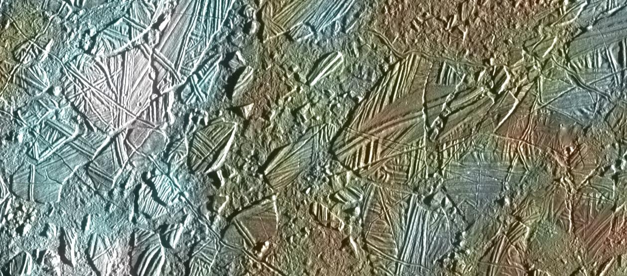
In astrogeology, chaos terrain, or chaotic terrain, is a planetary surface area where features such as ridges, cracks, and plains appear jumbled and enmeshed with one another. Chaos terrain is a notable feature of the planets Mars and Mercury, Jupiter's moon Europa, and the dwarf planet Pluto. In scientific nomenclature, "chaos" is used as a component of proper nouns (e.g., "Aureum Chaos" on Mars). On Mars Wikichaosmap.jpg, Tography map of Oxia Palus region of Mars showing the location of a number of chaos regions Mapbeer.jpg, Map showing location of Arsinoes Chaos (far left), Iani Chaos, Aureum Chaos, Margaritifer Chaos, and other nearby features Image:Margaritifer Sinus Map.JPG, Map of Margaritifer Sinus quadrangle with major features labeled. Aureum Chaos is near the top of the map. Image:Canyons and Mesas of Aureum Chaos in Oxia Palus.JPG, Huge canyons in Aureum Chaos, as seen by THEMIS. Gullies are rare at this latitude. Image from Margaritifer Sinus quadrangle. Im ... [...More Info...] [...Related Items...] OR: [Wikipedia] [Google] [Baidu] |
Aeolian Processes
Aeolian processes, also spelled eolian, pertain to wind activity in the study of geology and weather and specifically to the wind's ability to shape the surface of the Earth (or other planets). Winds may erode, transport, and deposit materials and are effective agents in regions with sparse vegetation, a lack of soil moisture and a large supply of unconsolidated sediments. Although water is a much more powerful eroding force than wind, aeolian processes are important in arid environments such as deserts. The term is derived from the name of the Greek god Aeolus, the keeper of the winds. Definition and setting ''Aeolian processes'' are those processes of erosion, transport, and deposition of sediments that are caused by wind at or near the surface of the earth. Sediment deposits produced by the action of wind and the sedimentary structures characteristic of these deposits are also described as ''aeolian''. Aeolian processes are most important in areas where there is little or ... [...More Info...] [...Related Items...] OR: [Wikipedia] [Google] [Baidu] |


